Mountains refresh our perspective. When your vista is dominated by an ocean of dissolving summits, when sky and peak perform a cloud and rock concerto, human endeavour seems delightfully insignificant.
Cadair Idris in Eryri (Snowdonia) is no exception, though at 893 metres it is not so high you cannot also see settlements. But only a few and they are dwarfed by landscape – Barmouth (Y Bermo) is tiny at the mouth of Afon Mawddach, itself a shining wondrous shawl.
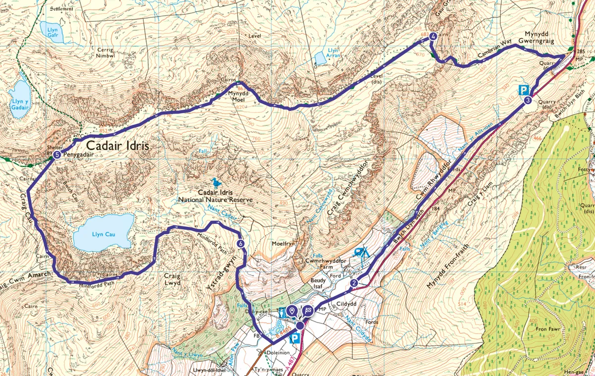
This 8.3-mile circular walk – one of several routes up Cadair Idris – skirts the south of the mountain, ascending to the summit from the east before returning via the Minffordd Path.

Cadair Idris walk
8.3 miles / 13.4km | 6–7 hours | challenging | 981m ascent
1. Cwmrhyddfor Farm
From the Minffordd car park turn left onto the A487 taking extreme care on the short distance to Cwmrhyddfor Farm – the traffic is fast. (If travelling by bus you can skip sections 1 and 2 and begin at the bwlch.)
2. Cwm Rhyddfor
At the farm follow the path along the bottom of Cwm Rhyddfor between Cadair Idris and the road which is so far above, you barely notice it.
Eryri (Snowdonia) walks
Packed with great mountain climbs, idyllic river walks, lakeside rambles and coastal hikes, Eryri (Snowdonia) National Park is the perfect getaway location for hiking – check out our pick of the best walks in Snowdonia
3. Mynydd Gwerngraig
At the bwlch bus stop and car park, climb the stile and start climbing. The path keeps largely to the fence-line weaving either side of it as the views unfold. It becomes very steep and some hand use is required.
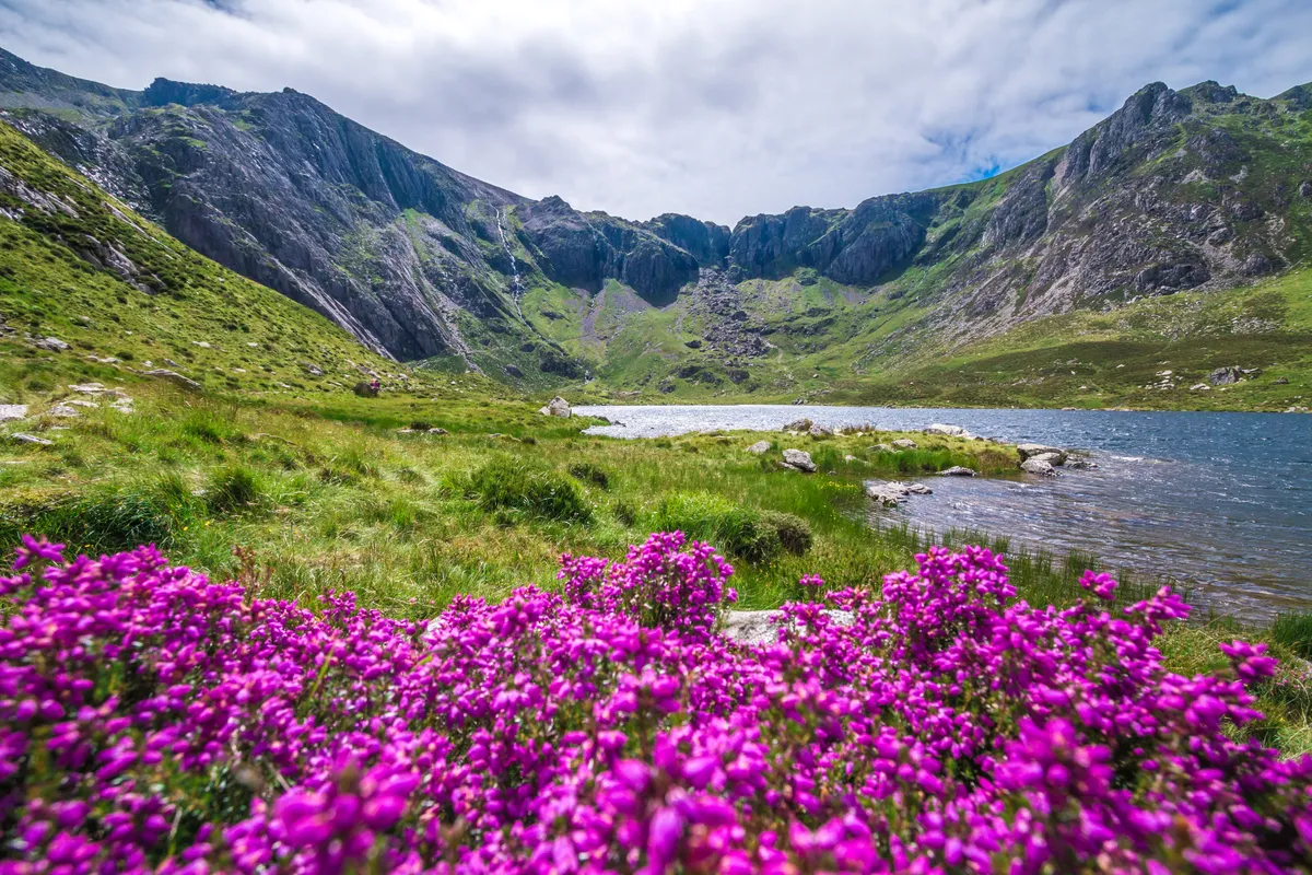
4. Llyn y Gader
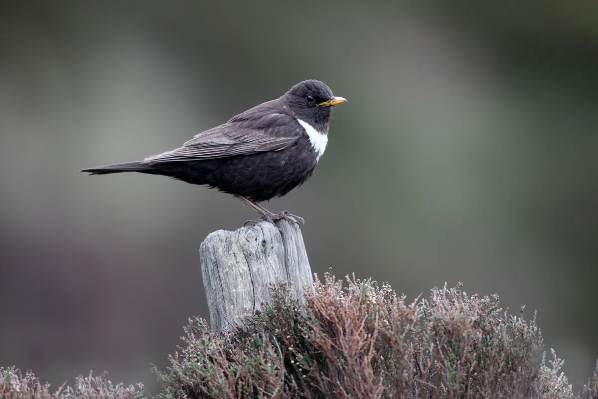
At the cairn, continue left along the path. Although still climbing, the path levels out a little, allowing you to relax and enjoy the rugged terrain and views down the ridge right to the lakes – Llyn Arran, Llyn Gafr and Llyn y Gader. Look out for ring ouzels.
5. Cadair Idris summit
It gets busier as the paths combine at the summit. Cadair Idris is a popular mountain due to its varied habitats and spectacular vistas. From here you can see Eryri's summits, gentler peaks rolling south and east, and the sea.
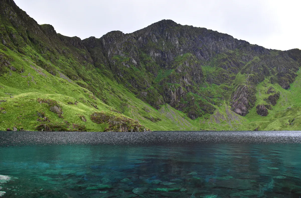
Descend by the busier Minffordd Path, paying due care and attention – the path is for the most part steep rocky steps which can be slippery, with potentially treacherous drops into the hanging valley of Cwm Cau. Llyn Cau sits within the valley. Scoured by glaciers, this conical lake is 50 metres deep at its centre, harbouring brown trout while lakeside vegetation includes quillwort and shoreweed, liverworts and mosses.
6. Dôl Idris
The steps are as gruelling in descent as ascent. But this alluring path dropping from montane terrain into broadleaf woodland, delivers you finally into the relaxing glades and wooded park around the lake of Dôl Idris.
Cadair Idris map
Cadair Idris – OS Maps walking route
Useful Information
Starting point
This route is served by the T2 bus between Aberystwyth and Bangor with stops at Minffordd and the bwlch. Drivers head for the car park at LL36 9AJ.
Terrain
There are several routes up Cadair Idris. The Pony Path for example, ascends from Dolgellau. None are way-marked and all are potentially hazardous, especially in inclement weather.
Map
OS Explorer OL23
Eat and drink
Cadair Idris visitor centre and tearoom is situated at the bottom of the Minffordd Path.
Stay
Dolgellau has plenty of accommodation, places to eat, and buses from north, south and east Wales.