Arguably the most beautiful – and peaceful – canal in Britain, the Monmouthshire and Brecon Canal runs only for about 35 miles (55km) between Brecon and Newport. Built in the late 18th century to carry iron and other goods from the Valleys to the River Usk, it appears to defy gravity, clinging to hillsides and giving boat users and towpath walkers extraordinary views.
This walk takes in one of the loveliest stretches – and offers a more challenging route back to the start following a tram road over the mountain.
Llanellen and the Punchbowl walk
7.4 miles/11.9km | 5 hours | moderate
1. Terraced canal
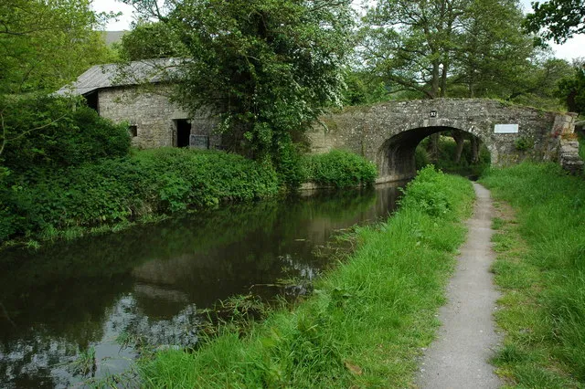
Begin in Llanellen car park and follow the dead-end sign up St Helen’s Close and through the village until you find a narrow alley and a footpath sign. This takes you into a field. After a climb of about 400m, you reach the canal. Turn right and follow the towpath – the going is very easy.
The waterway feels terraced into the hill and to the right you’ll see the Usk Valley below and the outskirts of Abergavenny. The left bank comprises a few sheep fields then forested hillside.
2. Pit stops
The first village you reach, after about 2½ miles, is Llanfoist. There’s a wharf here and a boat-hire company that occasionally opens its doors for cream teas in the summer. If you cross the canal (by going through a spooky tunnel), you can climb up onto the Blorenge Mountain – but be warned, it’s very steep going.
About a mile further on, you have to cross the canal to enter Govilon – which is as busy as it gets boatwise. Govilon has a pub and a shop for refreshments and then you can either call a taxi to take you back to Llanellen – or retrace your steps.
However, if you want more of an adventure, you can return to Llanellen by one of the tramroads that used to bring materials from the Valleys’ mines and furnaces down to the canal.
3. Onto the hill
Take the left fork from the towpath just after you cross the canal before Govilon. This leads up into Coed-y-Person woods. When it emerges onto the road bend, take the path straight ahead, leading up into more woods. After about 250m, this meets a track and open land.
Turn left and follow the track for about 600m until you reach Pen-y-Graig farm. Go carefully through the farmyard, leaving by the gate in the south-west corner. Follow the hedge uphill for about 70m, go through the gate then turn left. After 250m, cross the stile and turn right, uphill through Cwn Craf.
4. Making tracks
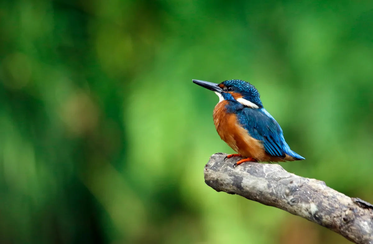
It’s a stiff climb of about 150m and then you’re on the tramway. Follow this broad path left – buzzards, skylarks, meadow pipits and ravens will keep you company.
After about a mile of gently undulating walking, you’ll enter the Punchbowl with its magical pool. On a misty morning, expect a hand to emerge from the water clutching Excalibur. This enchanted wildlife haven is an ideal spot for a break.
From the Punchbowl, follow the path steeply up into beech woods then left and down a sunken lane for about 400m until you reach a road. Cross the road and follow the very muddy path down into the Forestry Commission wood opposite.
After about 60m, you’ll arrive on a broad forest path bend. Go straight ahead (not right and upwards) and follow this for about mile until you reach another lane. Follow the lane for 50m and keep going through the gate at the bend ahead onto another broad forest path. After about 500m, take the left footpath downhill into a field with a barn in it. Cross the field and then the footbridge over the canal and it’s a downhill path back to Llanellen.
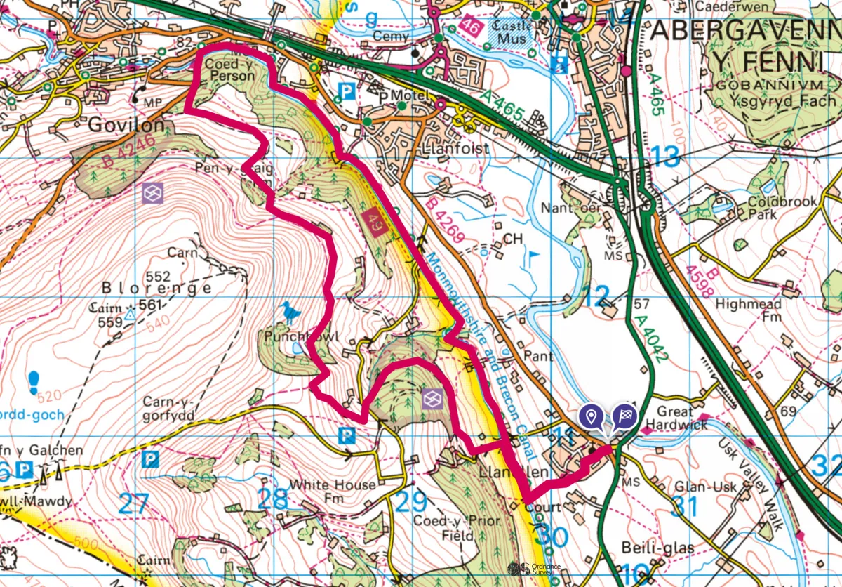
Llanellen and the Punchbowl map
Llanellen and the Punchbowl walking route and map