Settle Up’ and ‘Settle Down’ proclaim the platform benches as you step off the train at Settle’s lovingly restored station, gateway to the pretty little market town and a landscape rich in gleaming limestone scars, caves and potholes.
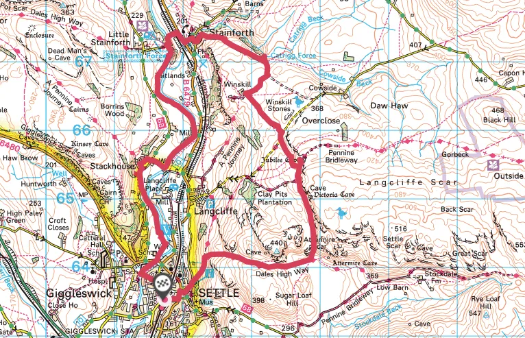
This 8.5-mile circular walking route starts in Settle, venturing beneath Attermire Scar and beyond Catrigg Force to Stainforth, before returning to Settle via Stainforth Force.
Yorkshire Dales walks
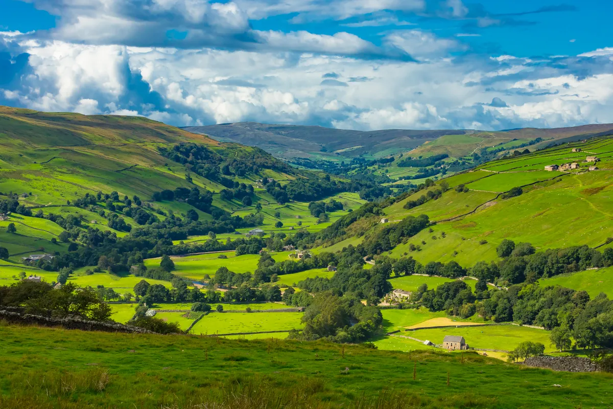
The valleys, moors, hills and caverns of the Yorkshire Dales are etched with miles and miles of rolling footpaths – explore this atmospheric limestone landscape with our guide to the Yorkshire Dales best walks.
Settle walk
8.5 miles | 6 hours | moderate-challenging
1. Settle
Every stride of this route is a textbook geology lesson. The first objective as you cross the market square, with its 17th-century Shambles, is to seek out Castlebergh Hill.
A permissive path climbs to the top of the hill to offer a bird’s-eye view across Settle’s rooftops to the brooding moorland of Bowland and glimmering Giggleswick Scar.
Drop down the other side and follow the Dales High Way between pale drystone walls before ascending a steep grassy slope to reveal stunning Warrendale Knotts and Attermire Scar. Look for the entrances to Attermire and Horseshoe Caves.

2. Catrigg Force
Turn left below Attermire Scar, passing scree slopes to reach Victoria Cave and then Jubilee Cave. Turn right at the road then left along a sealed track below Winskill Stones where islands of limestone pavement and twisted hawthorns distract from longer views to the iconic Three Peaks of Ribblesdale. Listen for the burbling call of curlews and look for northern wheatears along the wall tops.
Head across to Catrigg Force where the cool waters of Stainforth Beck tumble dramatically into a deep gorge.

3. Goat Scar Lane
Join Goat Scar Lane, a classic Dales green lane flanked by drystone walls, as it descends to Stainforth and the Craven Heifer pub. The leading lines of the walls draw the eye to the dramatic hills of Pot Scar and Smearsett Scar, limestone waves frozen in time.
Head across the main road to the graceful arch of a packhorse bridge at Stainforth Force where the Ribble squeezes between limestone walls. The Ribble Way back to Settle meanders infallibly through riverside meadows dotted with cuckoo flowers, primroses, dog violets and lesser celandine.
Settle to Stainforth Map
Settle to Stainforth walking route and map