Remote and serene, Kielder Water is, according to the Campaign to Protect Rural England, officially England’s most tranquil spot.
By day, the water of England’s largest man-made lake laps listlessly on a tranquil shore covered by England’s largest forest, where red squirrels thrive. By night, stargazers gather to experience the country’s darkest and clearest skies.
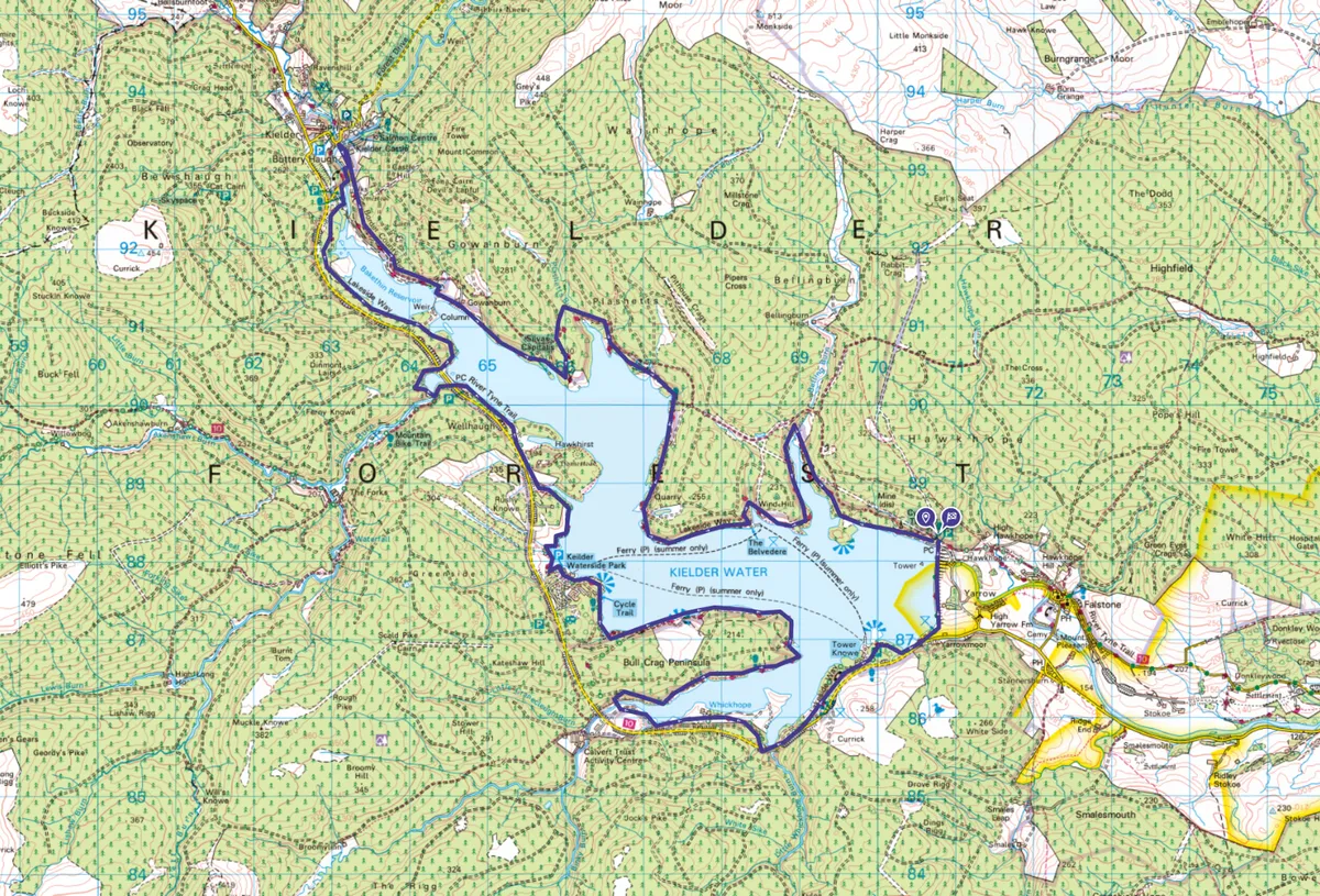
The Lakeside Way, a 27-mile long multi-access trail that circumnavigates the lake gives visitor access to the most scenic parts of the lakeshore. You can cycle or walk the entire route or stroll a shorter section and return by ferry. The trail is also designed to be wheelchair and pushchair friendly.
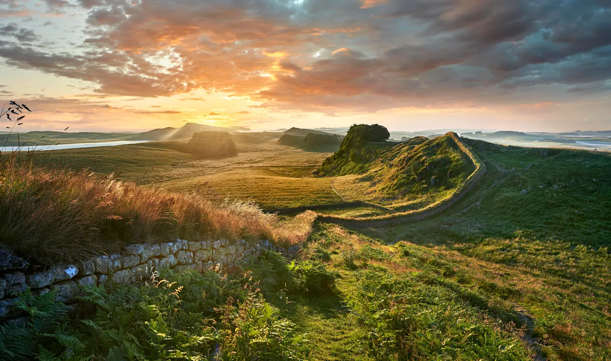
Northumberland National Park walks
The darks skies, open moorland, wild woodland and splashing waterfalls of Northumberland National Park hug the border between England and Scotland – explore the park on foot with our favourite walks.
Kielder Forest and Kielder Water walk
23.3 miles/37.5km | 10 hours | moderate–challenging | 518m ascent
1. Hawkhope
From Hawkhope car park cross the dam, then follow the trail to Tower Knowe, venturing briefly into the western fringes of Northumberland National Park. The track continues parallel to the road, dipping to cross the bridge over Little Whickhope Burn, before rising again towards Whickhope.
Continue to the next inlet, cross the bridge and follow the zigzags uphill on to the Bull Crag Peninsula. Turn right at the junction and continue to a clearing. The trail now leads to the eastern end of the peninsula. At various points you’ll find small brass plaques fixed into stone, pieces of a commissioned artwork known as Keepsake.

Around the eastern shore, a wonderful view opens out across the reservoir and continues around the peninsula. Along the north shore, the route briefly follows the original valley road that elsewhere disappeared under the lake. It then swings around the bay to Leaplish Waterside Park.
2. Bakethin Reservoir
The trail now follows the open shoreline, crosses the neck of Hawkhirst Peninsula and continues to Matthews Linn. It runs under the road bridge to the Lewisburn suspension bridge, over this and back above the west bank. Around the next headland, the track zigzags past Mirage artwork, and continues, with a short detour, to Bakethin Weir and another artwork, the Kielder Column.
Continue through woods on the southern shore of Bakethin Reservoir, through a conservation area to join a road. Look out for red squirrels, as Kielder is one of its last strongholds. Turn right and follow this into Kielder village.

3. Plashetts Quarry
Follow the route south out of Kielder, along the north shore of Bakethin Reservoir. From Gowanburn, continue along the shore to the southern tip of the promontory, which looks across the lake toward Hawkhirst. The track now turns north and swings east over the mouth of Plashetts Burn. On a small spit of land is the Janus Chairs artwork, which can rotate to give you views of the lake.
Continue along the shoreline to the southern end of the next peninsula, past Plashetts Quarry, and continue east again to Belvedere stainless steel shelter. Head back around the inlet and on to the shelter of Cock Stoor.

4. Belling Burn
The trail leads north again to a bridge over the mouth of Belling Burn, then runs south to an isthmus where you can leave you bike for the short walk to the Belling. This is the summit of a once popular rock climbing venue, before the valley was flooded.
On the shore is a beehive-shaped building that, on a sunny day, acts as a camera obscura, reflecting an image of waves on to its floor. Resume the Lakeside Way, which leads along the shore to Hawkhope car park.
Kielder Forest map
Kielder Forest walking route and map