When it comes to summiting mountains, it’s all about perspective. Some are merely rounded bulges, making it easy to pick out an ascent route, even from the bottom. But then there are others – those pesky, pointy numbers – that present a perplexing problem and get us asking, how on earth can we, mere mortals, make it to the top?
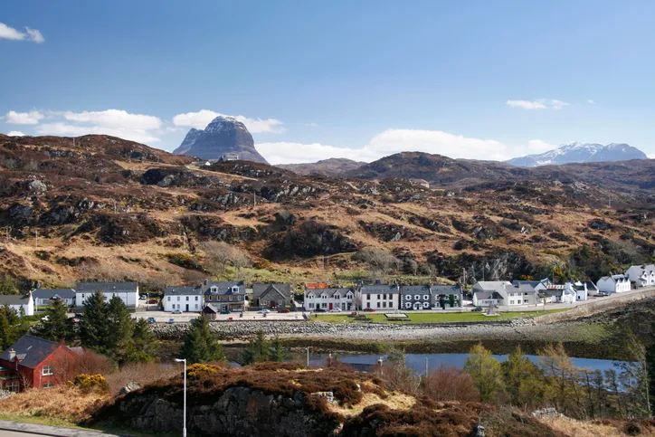
Case in point is the Scottish peak of Suilven. At 731m, some 200m shy of the coveted Munro status, it’s small by mountain standards north of the border. Yet, certainly from most vantage points, it looks impossibly steep – Suilven means ‘pillar’ in Old Norse, a name bestowed to the peak by the sea-fearing Vikings.
Suilven’s highest point –
, meaning ‘The Grey Castle’ in Scottish Gaelic – is fittingly ringed by a barrier of purple-tinted Torridonian sandstone, like a fortress wall. Its rocky summit somehow escaped the calving of the last Ice Age and it now sits, pimple-like, amid the glaciated flatlands of
– an area of Lewisian gneiss, pockmarked by hundreds of little lochans and rough tussock grass. It’s a commanding and seemingly insurmountable peak.
Looks can be deceiving – a route to the top
But Suilven is something of a visual trick. View it from its western end at Glencanisp Lodge near Lochinver, and it appears unconquerable – yet this is the starting point of the easiest route to the top.
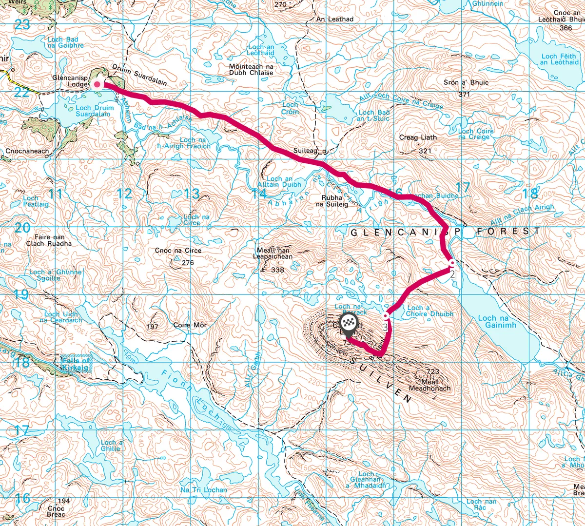
1
Stalking
Follow the stalker’s path for about five miles, keeping a lookout for native red deer, wildcats and mountain hares.
2
Loch to ridge
Once on the rocky flanks of its northern side, you’ll be offered a new perspective as the gnarly slopes transform to a broad, sprawling ridge, a little over a mile in length.
Leave the path 0.5km before Loch na Gainimh and walk south-south-west between a series of lochs.
3
Grassy summit
A handy gully grants walkers access to a cleft in the ridgeline – rugged Bealach Mor. From here, you will need to use your hands a little to climb up to the fairly broad, grass-covered summit.
Amid the watery wilderness of Assynt rises Suilven, here viewed from the south. Its highest point, Caisteal Liath, stands at 731m. Its second highest point, the flat-summited Meall Meadhonach, lies east of the ridge ©Getty
4
Camping out
Depending on your viewpoint, Suilven shape-shifts from unclimbable to conquerable. But be warned, this is not a stroll in the park. Covering a minimum of 15 miles, this long, round trip is a full day’s walk.
Fortunately, thanks to Scotland’s Land Reform Act of 2003, you have the wonderful option to indulge in a little wild camping en route. Stop beside a secluded loch in this roadless hinterland and pitch your tent for a night beneath the stars.
Whichever way you look at it – from the sea, the lodge at Glencanisp or your own tent porch – Suilven is a stunner.
Note: The map and route described are from Glencansip Lodge to the summit of Suilven. To complete the circuit, walkers should at least double the distance and time suggested. This is a hard route for experience mountain walkers.
Map
Click on the map below for an interactive version of the route.