It was the coming of the railway in 1865 that allowed the Alresfords’ watercress industry to flourish: the peppery, perishable crop was packed into wicker ‘flats’ and sent speedily to market in London.
Today, a popular steam train service still runs on the Watercress Line from Alton – the best way to arrive in New Alresford – and this charming town even hosts an annual watercress festival.
Looking for more walks in Hampshire? Check out our routes in Rhinefield, Denny Wood and the Meon Valley.
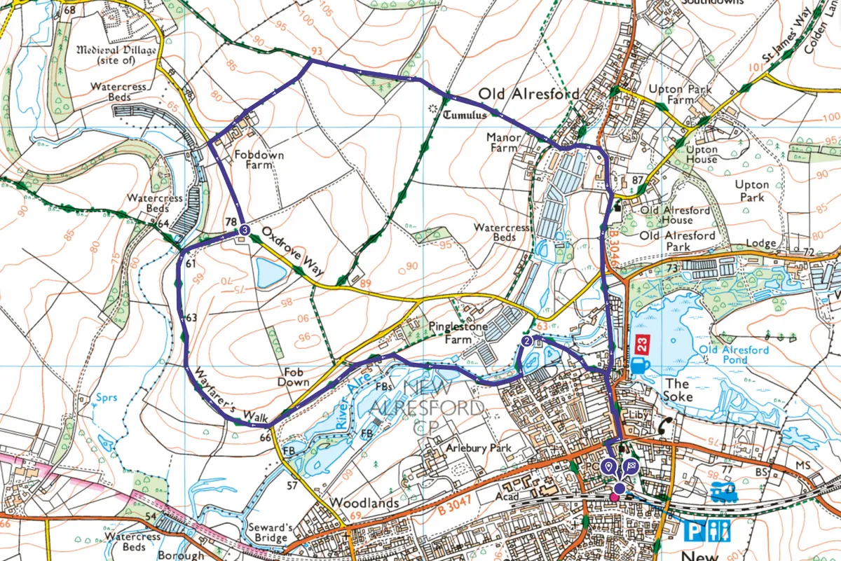
Alresford walk
4.5 miles/7.3km | accent 100m | 3 hours | moderate
1. New Alresford
Leave the station car park along Station Road, turning right at the junction with West Street then left down aptly named Broad Street, a delightful Georgian thoroughfare. At the bottom, keep left down Mill Hill.
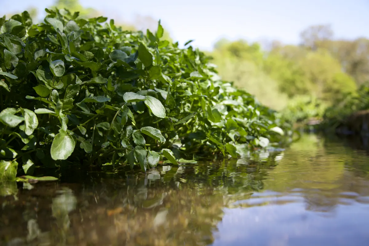
Halfway down, turn left along Ladywell Lane (signposted ‘the Wayfarer’s Walk’). The path joins the River Alre, leading to the timber-framed Fulling Mill. Swathes of wild watercress grow in the crystal-clear water here, while in the distance you can see commercial beds. It was Alresford’s mineral-rich springs and pure, fast-flowing streams that made this a watercress hotspot, but today beds are fed from deep boreholes to avoid contamination. The water they provide is always 10°C, keeping the beds frost-free on winter days.
Discover more walks in Hampshire
Explore Hampshire's countryside, coast and its two National Parks – the New Forest and South Downs – with our pick of the best hikes in the county.
2. Alresford Eel House
Continue along the track, turning right to keep beside the river. The alders that have always grown along this river ford gave the town its name.
Further on is the restored Alresford Eel House, built in the 1820s to trap sea-bound eels. Just beyond it, cross a brick bridge then ascend up past cottages to a private drive. The path runs to the left of the drive for a short distance before forking away beside a field. You’ll emerge on to a road: follow it round to your left and, at the bend, turn right into Wayfarer’s Walk. When you come to a junction of paths, turn right, then left on to an uphill track.
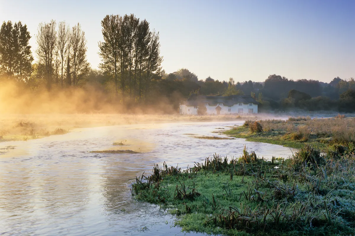
3. Old Alresford
At the top of the track is a road: turn left and descend with it to Fobdown Farm. Now turn right, up the hill. At the top, take the right-hand path, and descend into Old Alresford. The footpath leads into a lane with watercress beds on the right; turn right at the green to cross the B3046. Join the path opposite, turn right, and head to St Mary’s church.
Now cross the road and turn left. At the grass triangle, bear right and follow the footpath immediately ahead. This path, beside a stream and more watercress beds, leads back to Mill Hill.
Alresford map
Alresford walking route and map
Useful Information
HOW TO GET THERE
Trains run from London Waterloo to Alton, where you can travel by steam train to New Alresford on the Watercress Line. By car, follow the A3 from London to Guildford, then A31 to Alton (for the Watercress Line) or New Alresford.
EAT
The Courtyard Tea Rooms
Stop in these tea rooms for watercress soup or even a watercress scone.
19 Broad Street, Alresford PO16 8QS, 01962 733303
STAY
Cosy farmhouse B&B.
Kilmeston, Alresford SO24 0NL, 01962 771286
