The lightning-bolt moments that ignite a passion for weather often come from the completely unexpected, yet grand, displays that our atmosphere can provide in unique circumstances. We often describe such heart-stopping moments as weird weather, and they can grab headlines when accompanied by beautiful and unusual photographs.
The good news is that you don’t have to travel the world to see them. There are plenty of awe-inspiring weather phenomena to see right here in the UK. If the conditions are right, just take a closer look at the skies and the air around you next time you’re in the great outdoors: you might be surprised at what you’ve been missing.
Meteorologists and journalists John Hammond and Sara Thornton highlight 12 of the weirdest weather phenomena to look out for in the UK.
- The Great Storm of 1987: what happened and how did it change weather forecasting?
- Britain’s worst storms
- How to predict the weather using clouds
12 types of strange weather phenomena
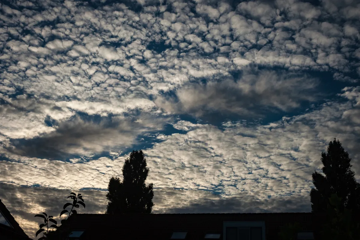
Mammatus clouds

Take a look at these looming, upside-down bubbles of cloud hanging from a dark sky. These are mammatus clouds – protruding lobes often found suspended from thunderclouds.
Thunderstorms occur when air rises rapidly up through the atmosphere, forming the familiar cumulonimbus, from which heavy rain and hail often form.
But all that rising air has to go somewhere, and as it spreads out at the top of the storm, it begins to descend on either side. Each bulge of mammatus forms as this cold, dense air falls earthwards, dragging the moisture it holds with it. As it does so, the air warms and the moisture evaporates, marking the bottom of the cloud.
Diamond Dust
Guaranteed to take your breath away, as will the intense cold that accompanies it, diamond dust can only be seen on the very coldest days; pictures of it occuring in the UK are rare, so here’s a shot of the same phenomenon in Norway.
When temperatures are just below freezing, the air can still hold super-cooled water droplets. Snow crystals ‘feed’ on these drops of moisture and snowflakes eventually form and fall. However, when the air is extremely cold, there’s not enough moisture in the air, so, instead, crystals of ice form out of an otherwise clear, blue sky. The ice slowly floats towards the ground and is lit up by the sun’s rays, giving a colourful twinkling effect like diamonds hanging in the air.
- Britain’s snowiest places: where to see snow and how to stay safe
- April showers: what are they and why is it so rainy in April?
Snow rollers
On a cold winter’s day, you might encounter large rolls of snow lying across a field. They seem to have been rolled up by a person – maybe to make the head for a snowman? But think again! These snow rollers have formed without any human help at all.
They’re rare because the natural conditions have to be just right. First, they need a thin layer of snow which is slightly sticky – not too dry and powdery, not too wet and heavy. Underneath, they need a harder, smoother base of snow or ice, on which the snow can roll. Then, the crucial ingredient is wind at just the right speed. The wind pushes a small lump of snow and starts it rolling along, preferably down a slope. The further it rolls, the more snow each cylinder picks up, with layers as high as a metre.
Dust Devil
Walk through the countryside on a sunny summer’s day and you might suddenly hear a gathering roar. In the distance, a rotating swirl of leaves, grass or hay is being lifted high into the clear blue sky. This whirlwind of energy is a dust devil, barely a few metres across, but possibly hundreds of metres high. It spins across fields and hedgerows, before disappearing.
Dust devils tend to occur when the sunshine is intense but the air above is relatively cool. Triggered by a particular hotspot on the ground, causing a bubble of warm air to rise, the vacuum of low pressure it produces is enough to suck in air from the surroundings. This then spins rapidly skywards, taking debris with it but only lasting seconds.
Noctilucent clouds
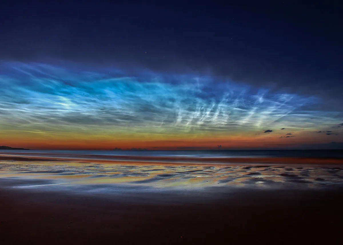
On a clear summer’s evening, long after sunset, you might see a mysterious glow when you look into the northern sky. These rare noctilucent clouds are seen at this odd time because, while the sun may have disappeared at ground level, at a height of around 200,000 feet, it’s still shining brightly. Glowing from the outer reaches of the atmosphere, these clouds are higher than any other. They appear as thin streaky clouds with a sometimes silvery luminescence and tend to only be seen at high latitudes, which means the UK is well placed to see them.
Lenticular clouds
We all know that flying saucers are the stuff of science fiction – don’t we? But you can see why UFO reports arise from the ‘out of this world’ weather phenomena of lenticular clouds. The formation of these giant, smooth, lens-shaped clouds is all down to waves of wind flowing over mountain ranges. The high ground sets up air ripples that can propagate hundreds of miles downstream. With each ascending peak in the ripple, the air rises high enough to cool and condense, before it descends and evaporates. Because the clouds are triggered by unmoving mountains, they can last for hours in the same place.
Fogbow
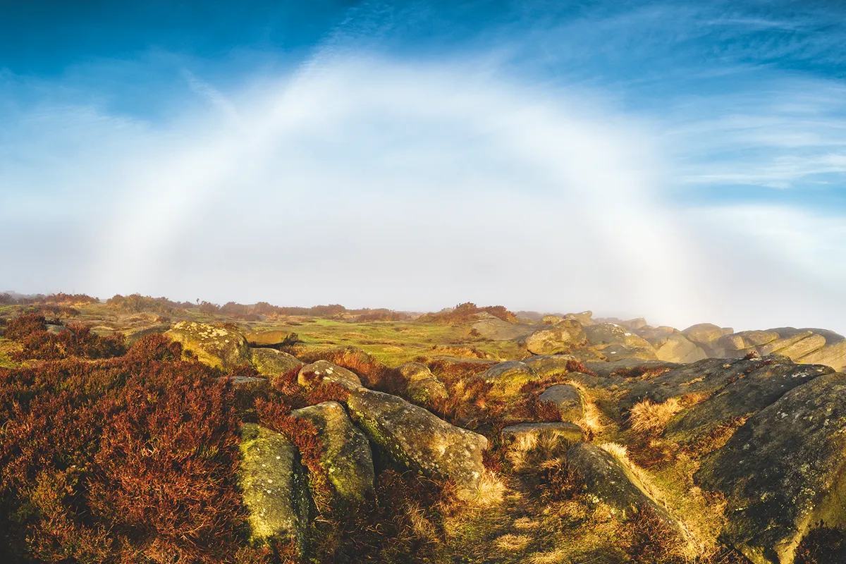
A monochrome rainbow? Surely that’s impossible. But a fogbow is another way nature can trick us. Crucially, this ghostly arc of white light appears out of a backdrop of fog, rather than rain. Like its more colourful counterpart, a fogbow appears opposite the sun, but the difference is that fog droplets are hundreds of times smaller than raindrops. Because of this, the spectrum of light that is bounced and bent back from the inside of fog droplets isn’t split into the discrete bands of colour that you see in a rainbow. Instead, it gets ‘smudged’ into one collective white band, forming a broad arc, with a radius of 30–45°, centred on a point opposite the sun.
Rainbow with anticrepuscular rays
Two light shows for the price of one. Magnificent multi-coloured rainbows occur when light coming from the sun enters a raindrop and is refracted, or bent. The light is refracted once more when it exits the raindrop and heads towards our eyes. The different colours of light reach our eyes at slightly different angles, creating the spectrum we see. The fan-shaped beams of whiter light within the rainbow are called anticrepuscular rays, caused by the sun bouncing off clouds and back to your eyes. Some of the rays appear darker because they are moving through parts of the sky shaded by other clouds.
Superior Mirage
When photos of a container ship appearing to float in the sky off the Cornish coast went viral in March 2021, many people assumed a digital hoax was at play. But the only trick was the way the light was bending as it passed through different layers of air.
A superior mirage is often seen in spring or early summer when the cold sea cools the lowest layers of the air above it. The cooling causes the air to have a much higher density than warmer air higher up. The light from a distant ship becomes refracted as it reaches the warmer air above, and is bent back down to Earth to reach observers on the shoreline. The bizarre effect is to make the ship appear as if it’s hovering in mid-air. It’s the opposite of a traditional mirage, often seen shimmering on black roads in summer.
Kelvin-Helmholtz Clouds
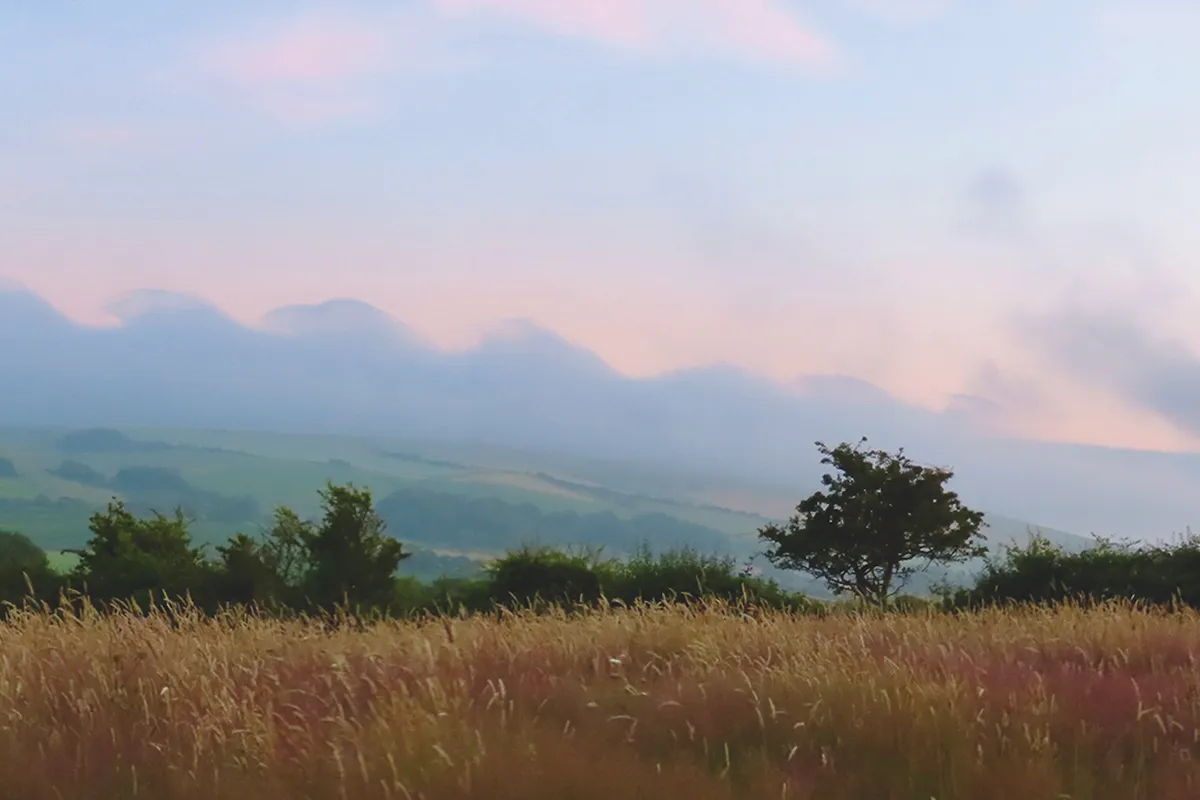
The atmosphere is a fluid – a meteorological truth writ large by these relatively rare Kelvin-Helmholtz clouds. Resembling evenly spaced rolling ocean waves, they occur when a faster moving, drier wind at higher levels scoops up the cloud within the moister layer below, which then breaks forward, like a wave at sea.
So why don’t we see these ‘surfer clouds’ more often? Well, they depend on the layer above having precisely the right difference in wind speed, temperature and humidity compared with the layer below. Quite literally the perfect wave.
Fallstreak
Sometimes, out of a cloudy sky, an odd ‘hole’ appears. This is a fallstreak. Clouds are often formed of liquid water. In order to turn to ice, these super-cooled water droplets require some disturbance in the atmosphere. For instance, a passing plane forces the air to expand and cool, and can create an ice-crystal trigger. Surrounding water then freezes on to these crystals, which in turn grow heavier and begin to fall to Earth as a wispy trail of ice cloud. With the liquid water removed from the air, we see an expanding circle of blue sky around the icy fallstreak.
Roll cloud
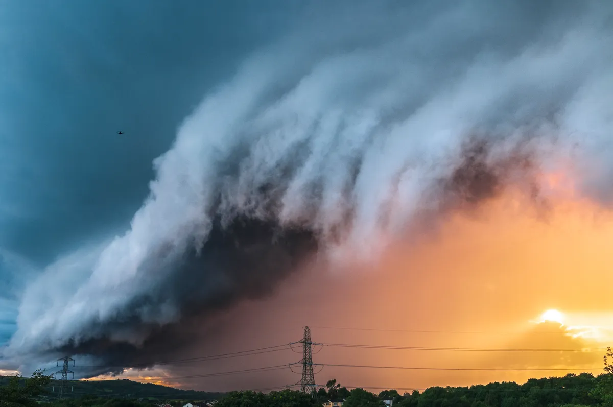
One of the most awe-inspiring clouds you can encounter is the roll cloud. This long, horizontal, rotating wall of darkness marks a boundary of dense and lighter air. As the air rises, it condenses into a rapidly rotating cylinder of thick, dark cloud.
From a distance, the roll cloud appears to be moving at walking pace, but as it gets closer to you, the sky rapidly descends into darkness, sometimes accompanied by gusty winds,
heavy rain and hail.