The hillside is yawning. Its breath is dank. The cave is a moist mouth with crumbling teeth, whose trachea lead deep into the hillside. Look again! Now it is a glittering grotto, resplendent in sparkling ferns, moss and maidenhair spleenwort.
Chartist Cave (Ogof Fawr – Big Cave) is history-thick. Chartists – demanding better democracy and voting rights for all men rather than only the rich – had already in 1838 had their first petition rejected by parliament. Dejected, they planned a march on Newport (Casnewydd). Among them were rebels who stored pikes and other ammunition in this cave. The march became an uprising and several Chartists were shot dead by troops.
Imagine the men, as you walk across the moor today in search of Chartist Cave, their fear, doubt and resolve, their sights fixed on the moors across which they will march.
Looking for more routes in the area? Check out our walking guides to Fan y Big, Sugar Loaf and Pen y Fan.
Bannau Brycheiniog (Brecon Beacons) walks
From spectacular hills and mountains to glistening waterfalls, rivers and lakes, the Bannau Brycheiniog National Park in South Wales has something for everyone. Our guide reveals the best walks in the national park – all with an OS Map and route description.
Chartist Cave walk
7.8 miles/12.5km | 5 hours | challenging |482m ascent
1. Start
From the village hall bus stop, head through Llangynidr passing the Red Lion, up Duffryn Road proceeding to Mill Road and cross the B4560. Keep to the footpaths till meeting the B4560 again, and continue along it to Llangynidr Moors car park.

2. Trig point
Bear west on the obvious track beneath the escarpment, enjoying views north to Llangynidr, Llyn Llangorse, and the northern Bannau Brycheiniog peaks.
As you approach the corner of the conifer plantation bear south-east away from its mistle-thrush-frequented old spruce, and climb the escarpment to pick up a path to the trig point.
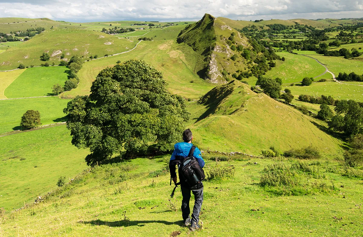
3. Chartist Cave
At the trig point turn right onto the well-trodden Cambrian Way, and, noting where a smaller path intersects it, follow it to the cave.
The inverted cones of shakeholes either side of the path indicate where the underlying rock has collapsed, and hint at the limestone caverns beneath.
4. Valley head
After visiting the cave (formed by limestone eroding beneath a sandstone cap) you have options. You could, for example, retrace your steps, or climb to the stone on the rise above the cave and trace a high horseshoe around the valley before descending to Llangynidr. Otherwise return to the lesser footpath, turn northwards and follow it to the valley head.
Best hill walks in Britain
Our guide to hill walking explores the most beautiful ridges, tors, pikes and crags in the UK.
5. Cwm Cleisfer
On reaching the bed of the valley, turn right to trace the south side of the stream. The path is not always obvious, is challenging underfoot, especially when the bracken is high, and requires initiative, to circumnavigate the filter station for example. But Cwm Cleisfer has waterfalls, ancient hawthorns, and an air of secret intrigue.

6. Nant Cleisfer
Crossing the farm bridge over Nant Cleisfer, turn immediately right over a broken stile to find the path between wall and oak tree. Although neglected, this is a waymarked path.
7. Llangynidr
On reaching the road, appreciate the curvilinear bridge before returning to Llangynidr, and its church built on medieval foundations.
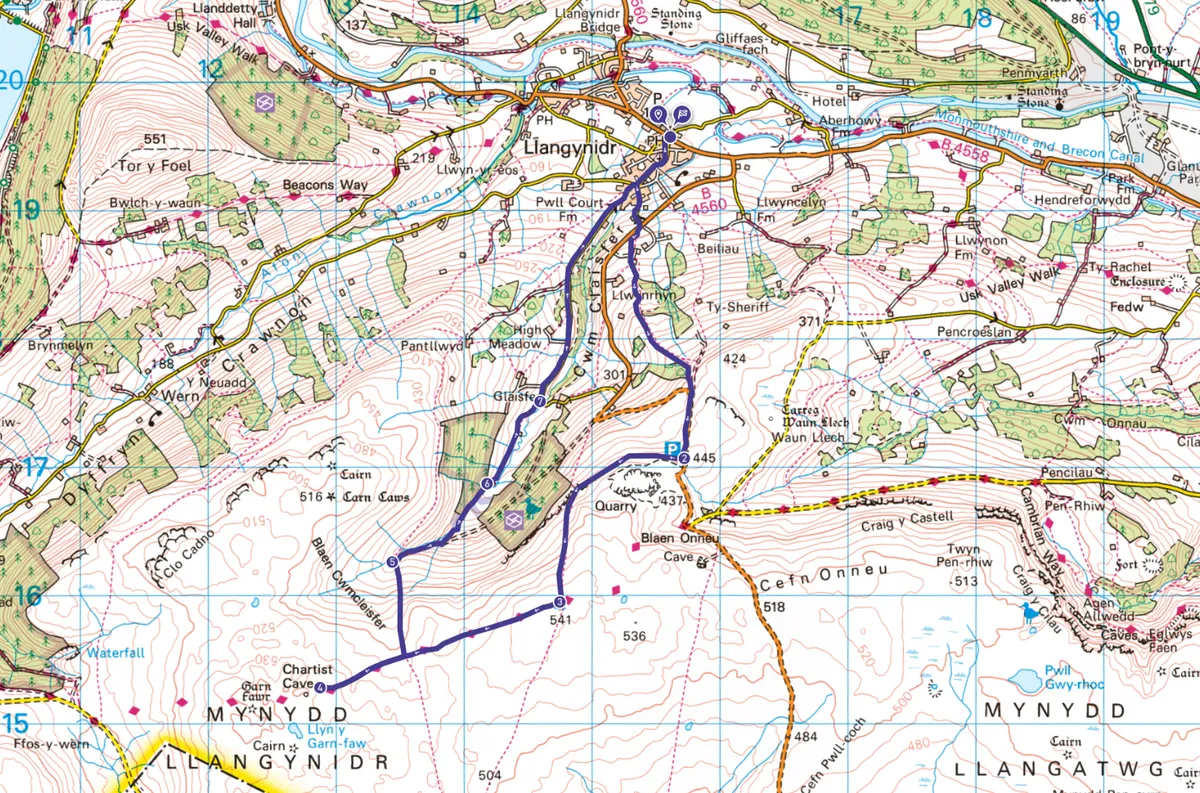
Chartist Cave map
Chartist Cave walking route and map
Useful information
Starting Point
The 43 bus Y Fenni (Abergavenny) and Aberhonddu (Brecon) stops at Llangynidr Village Hall, NP8 ILS. Drivers prefer Llangynidr Moors Car Park, SO/157165
Terrain
Slippery when wet, and moderately challenging with lumpy terrain, this route is not waymarked and is badly maintained in parts. It can be difficult to navigate, especially in poor weather.
Map
OS Explorer OL13
Cave Access
The main cave is accessible to walkers while the passages at the back possibly extend beneath the moors – for experienced cavers only.
Eat/drink
The Red Lion serves real ales and bar food. Dog friendly, closed Mondays. 01874 730223