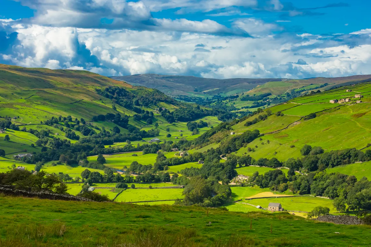
To the north of Ingleton, in the Yorkshire Dales, is a strange and fascinating landscape.
The grassland at the foot of the region’s highest peaks is dotted with limestone pavement and boulders carved into weird shapes. But it is the subterranean world that is the most alluring – a world into which visitors get tantalising glimpses on this walk.
While streams disappear into holes in the ground, massive chasms suddenly open out at your feet. After exploring these surface features, this walk culminates in a visit underground – into a massive chamber, once a show cave, now requiring torches, surefootedness and a sense of adventure.
Looking for more walks in the area? Check out our walking guides to Ingleton Falls, Dentdale and Leighton Moss.
Yorkshire Dales walks
The valleys, moors, hills and caverns of the Yorkshire Dales National Park are etched with miles of rolling footpaths – explore this atmospheric limestone landscape with our guide to the Yorkshire Dales' best walks.
Yordas Cave walk
5.9 miles/9.5km | 3 hours | easy | 194m ascent
1. Start
Go through the gate beside the layby and walk towards the transmitter. When the gravel ends, swing left on a path heading uphill. After a wall gap, the route heads towards a dip on the skyline ahead. From this saddle, a detour can be made to the Cheese Press Stone, an unusual boulder, by clambering up the rocks to the right. Otherwise, continue straight on, later swinging east and then north to a stony track.
Great British hill walks
Discover the most beautiful ridges, tors, pikes and crags in the UK with your guide to the great hill walks.

2. Turbary Road
Turn right along the track – the Turbary Road, once used by dales people to access turf for fuel. Follow this for 1.75 miles, passing through several large, walled enclosures, each containing numerous potholes. Hold on to children and dogs because not all the holes are fenced.

3. Rowten Pot
One of the most dramatic is Rowten Pot, on the far side of the fourth enclosure. Rowan trees cling to the sheer sides of this massive rip in the ground while the roar of water reveals the presence of a stream, unseen far below. The sinkhole into which this stream disappears can be seen 100m to the west.
4. Yordas Cave
After climbing gently to a gate and stile, a fainter path continues beside a wall on the right for 200 yards and then crosses via a ladder stile. Descend on grass. As the path draws level with the bottom of walled woodland, turn left along a trail and then go through a gate in this wall.
A few steps lead into the mouth of Yordas Cave. After a slight drop just back from the entrance, the dark chamber opens out, complete with underground stream. To the right is a high, domed ceiling, while a nearby ‘window’ allows a peep into a side chamber containing an impressive waterfall.

5. Lane walk
Having explored, head back through the gate and descend to the bottom wall. Go through a gate in it and turn right along the lane. It’s now 2.3 miles back to the layby.

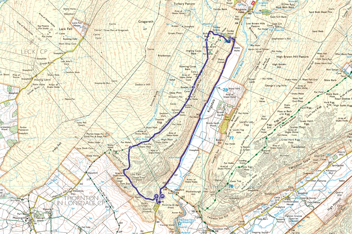
Yordas Cave map
Yordas Cave walking route and map
Useful information
Starting point
Small layby close to radio transmitter on Thornton Lane, 1.4 miles north of Thornton in Lonsdale (SD691756). No public transport.
Terrain
Mostly good tracks and paths across limestone grassland; wet and slippery in cave; return via quiet lane
Map
OS Explorer OL2
Eat/drink
There’s a great chip shop in nearby Ingleton. The Ingleton Chippy on The Square has indoor seating.
Cave access
Free to enter; on access land. Entrance is straightforward, but exploration of the main chamber requires a torch and waterproof footwear with good grip.