This walk can be done in one go or spread over two days with a wild camp overlooking the beautiful and dramatic Glen Tilt.
About half of the route uses footpaths and lanes but the other half in trackless, requiring a level of map reading and compass skills.
Loch Moraig and Glen Tilt walk
12.5 miles/20km | 535m accent | 8 hours | moderate
1. Glen Tilt Car Park to Loch Moraig
Start at the Glen Tilt Car Park just north of Blair Atholl, leaving it to the east on a narrow road. Cross the River Tilt then ascend gradually to the meeting point of three roads. Ignore the first one on the left, instead taking the second left, rising once more past a succession of large houses.
Stay with the primary road, ignoring any turn-offs until you reach a right-hand turn, signed 'Mole 2 miles'. Join this side road, continuing east. After 0.5km, the road crosses a cattle grid then turns to gravel. Continue on, turning left at a junction to run alongside a small patch of forest.
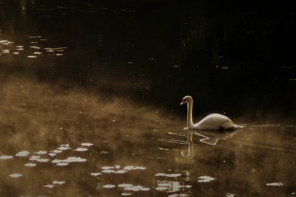
Proceed along the track for another 2km to reach a rough parking area beside Loch Moraig. In spring and summer, look for swallows whirling above a placid loch, its shores banked with bulrush and small gatherings of lilypads. A roe deer can also been seen wading lazily through the water, as raptors cruise in the skies above.
2. Carn Liath
Keep the loch right and, on reaching the edge of the trees, continue straight ahead (north-east), rising slowly on a track beside a fence.
After about 1.5km the track splits multiple ways. At this point you'll need to start using your compass. Set it north-east-east and take the path heading straight towards the imposing bulk of Carn Liath. The ground can quite rough – a blend of tussock and mire.
Just under 1km later, the ground suddenly steepens to a series of quartz and limestone crags. If you're feeling up to it, continue to the summit. Otherwise, follow the fence line to the left (north-west) for about 400m.
3. Aldandulish
For the next 6-7km the route is trackless and will require a map and compass. From the fence corner, set you needle west. The way can be tough going, especially after wet weather, so take care with your footing, keeping true to your westerly orientation.
Deer antlers can often be seen jutting from the uneven ground like bleached tree roots, and black grouse graze the shrub, their white rumps a vivid contrast to the glossy black of their backs.
You'll soon reach a rise and, if the weather is kind, you'll be able to see a conifer plantation directly ahead. Aim for a small building on the right of this, labelled Aldandulish on the map.
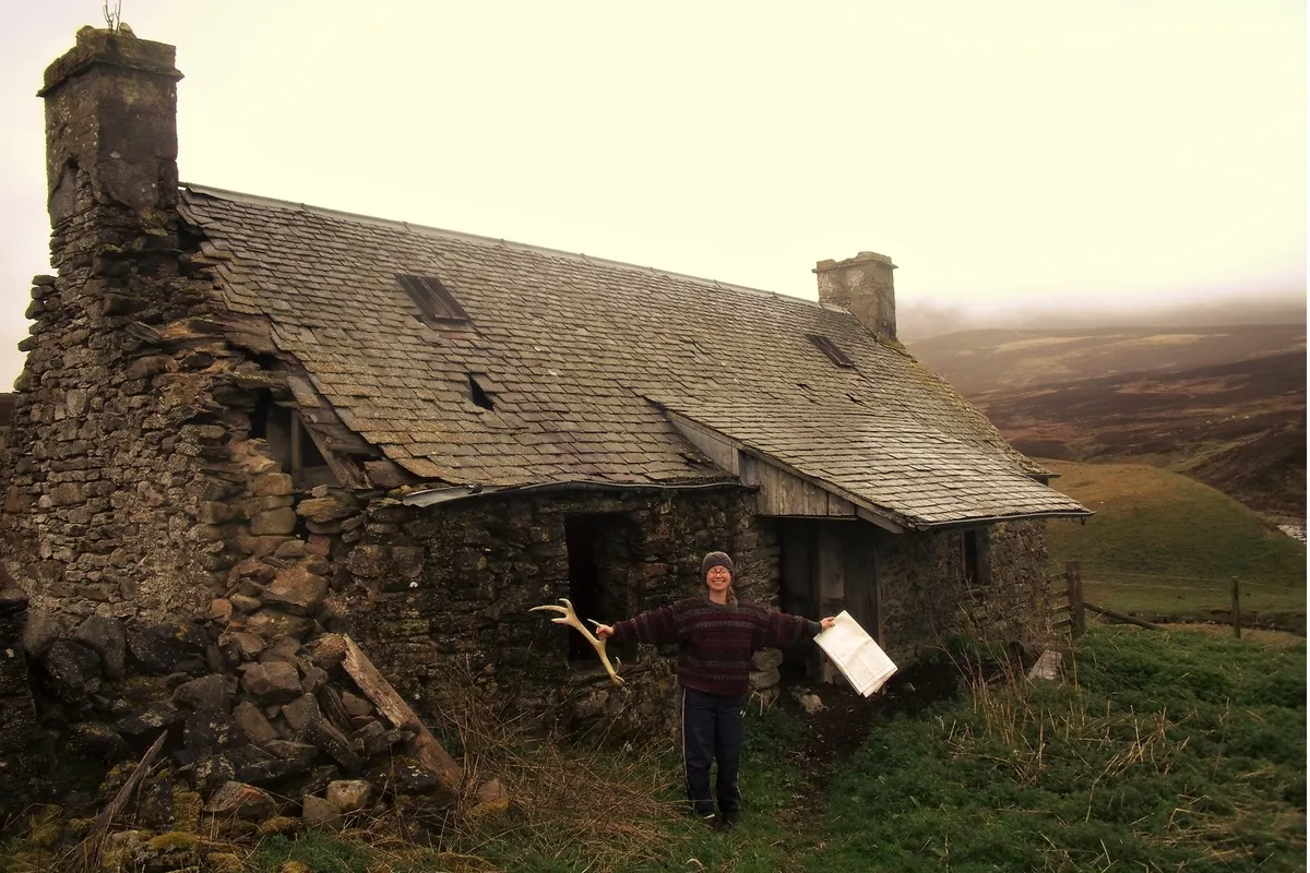
4. Allt Glac Shielich
You'll need to cross the Fender Burn and a fence to reach the building, which, despite is poor condition, can offer some welcome shelter on a wet day.
Track the Allt Glac Shielich watercourse north-west, skipping from bank to bank for about 1km. At a fence line, turn right and follow it north-east to the meeting point of three fences.
Scale the boundary and set your compass north-north-east, aiming for Caisteal Dubh.
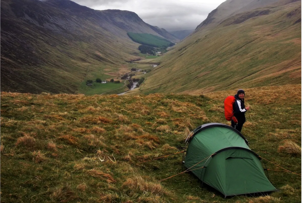
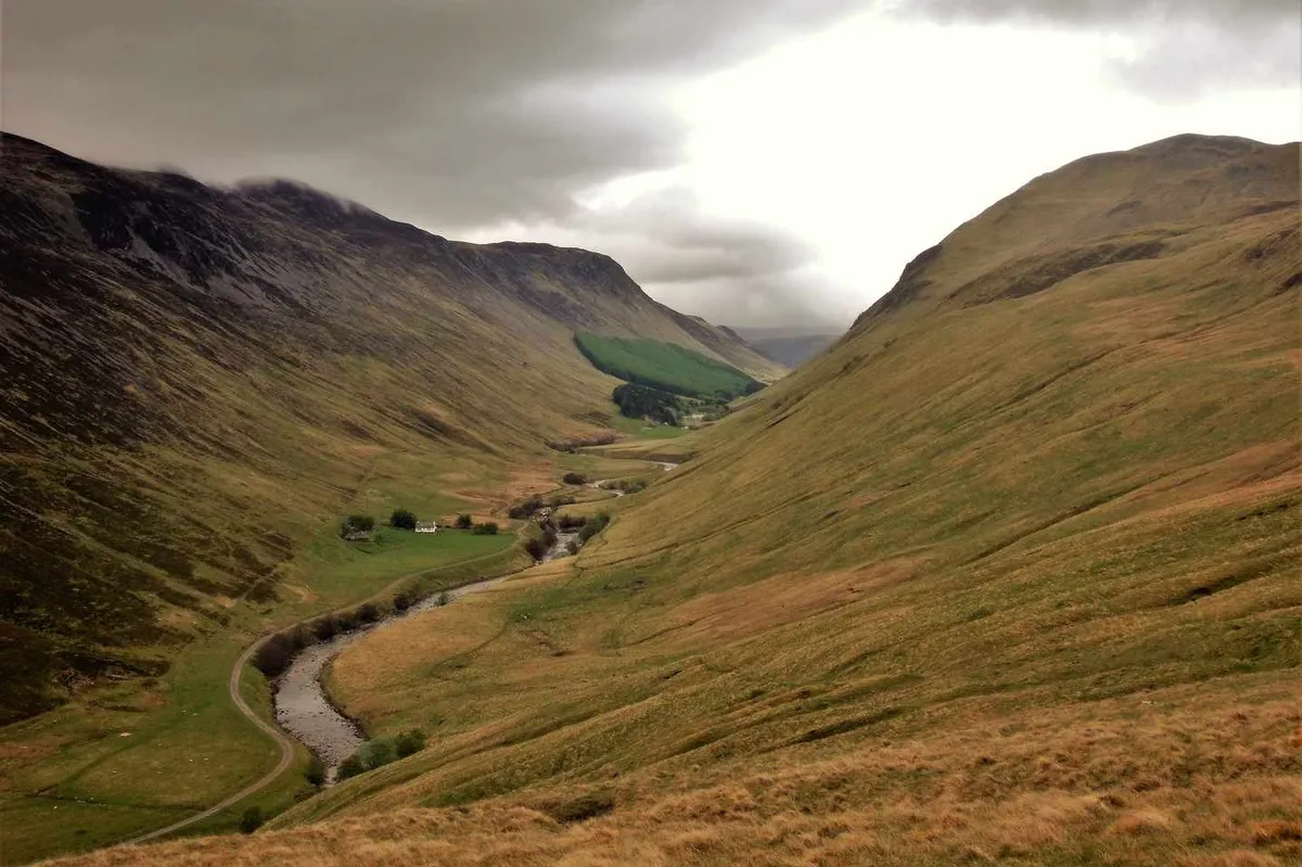
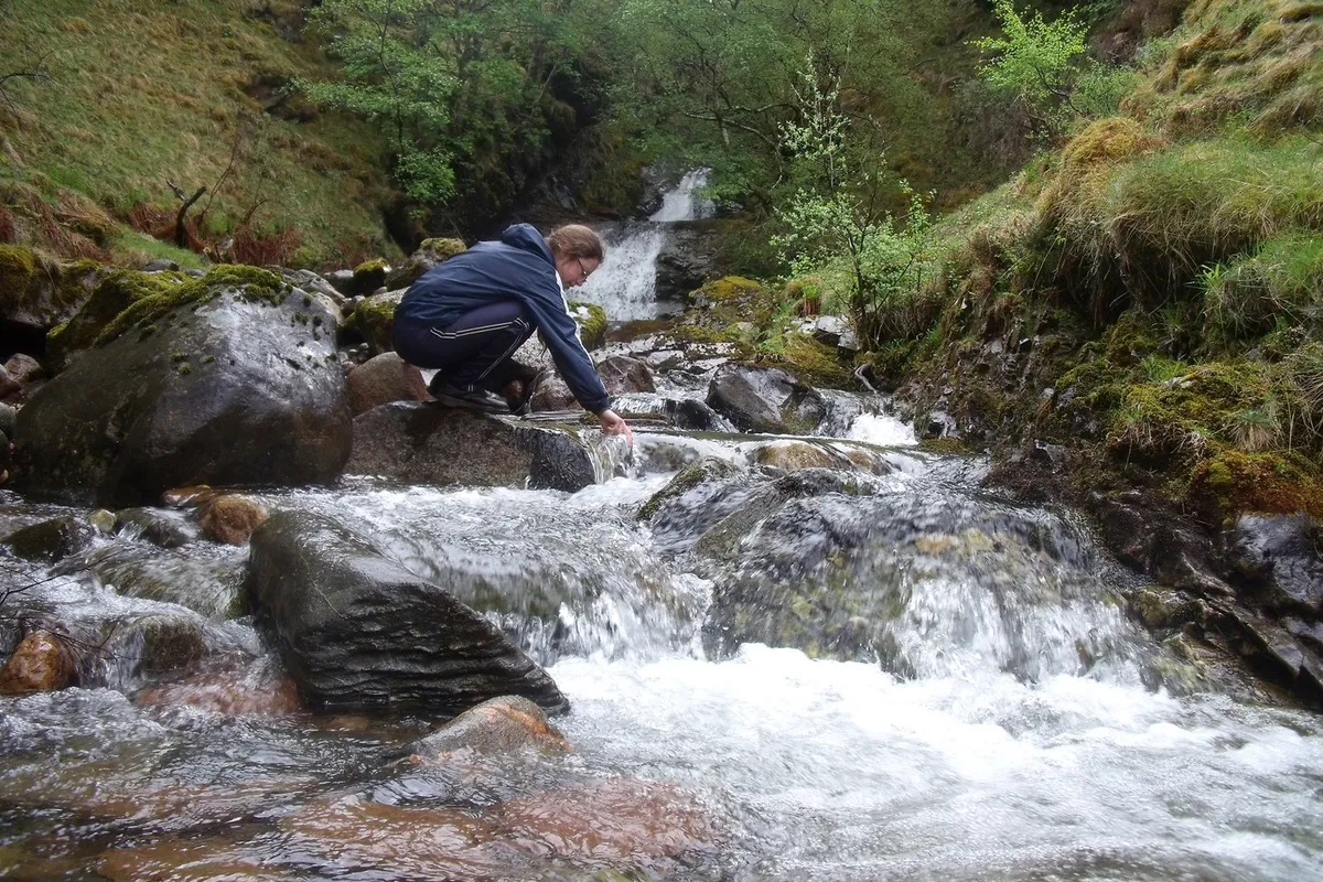
If your plan is to camp, there are one or two good spots half-sheltered on the southern side of the mount with splendid views into the vast throat of Glen Tilt. Just east of the hill is a small river that can be used to cooking and drinking (note: check upstream to dead livestock and purify all water).
5. Caisteal Dubh to Glen Tilt
There are no obvious paths off Caisteal Dubh but you general aim now is to descend into Glen Tilt. Needless to say, care should be taken.
At the bottom of the valley there is a vague path. If you can't find it, stick to the river, tracing it west alongside Buailagan Wood to a bridge.
With the toughest section of the walk now behind you, it's simply a case of following the clear track alongside the River Tilt for about 7–8km back to the car park.
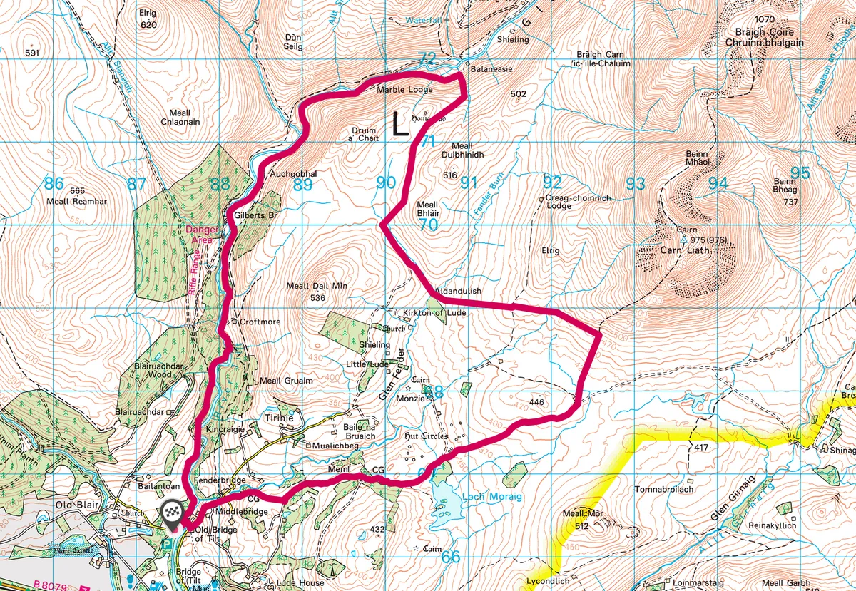
Loch Moraig and Glen Tilt map
Loch Moraig and Glen Tilt walking route and map