A 4.4-mile circular walk through Mabie Forest in south-west Scotland.
Forestry and Land Scotland’s Mabie Forest lies just outside the town of Dumfries in south-west Scotland and is managed in association with Butterfly Conservation Scotland, whose reserve – their largest – occupies 100 hectares in the middle of the forest. Ancient oak woodland, wetlands and grassland are all here, offering ideal conditions not just for butterflies, but also bats, red squirrels, roe deer and dragonflies.
Fruitful forest
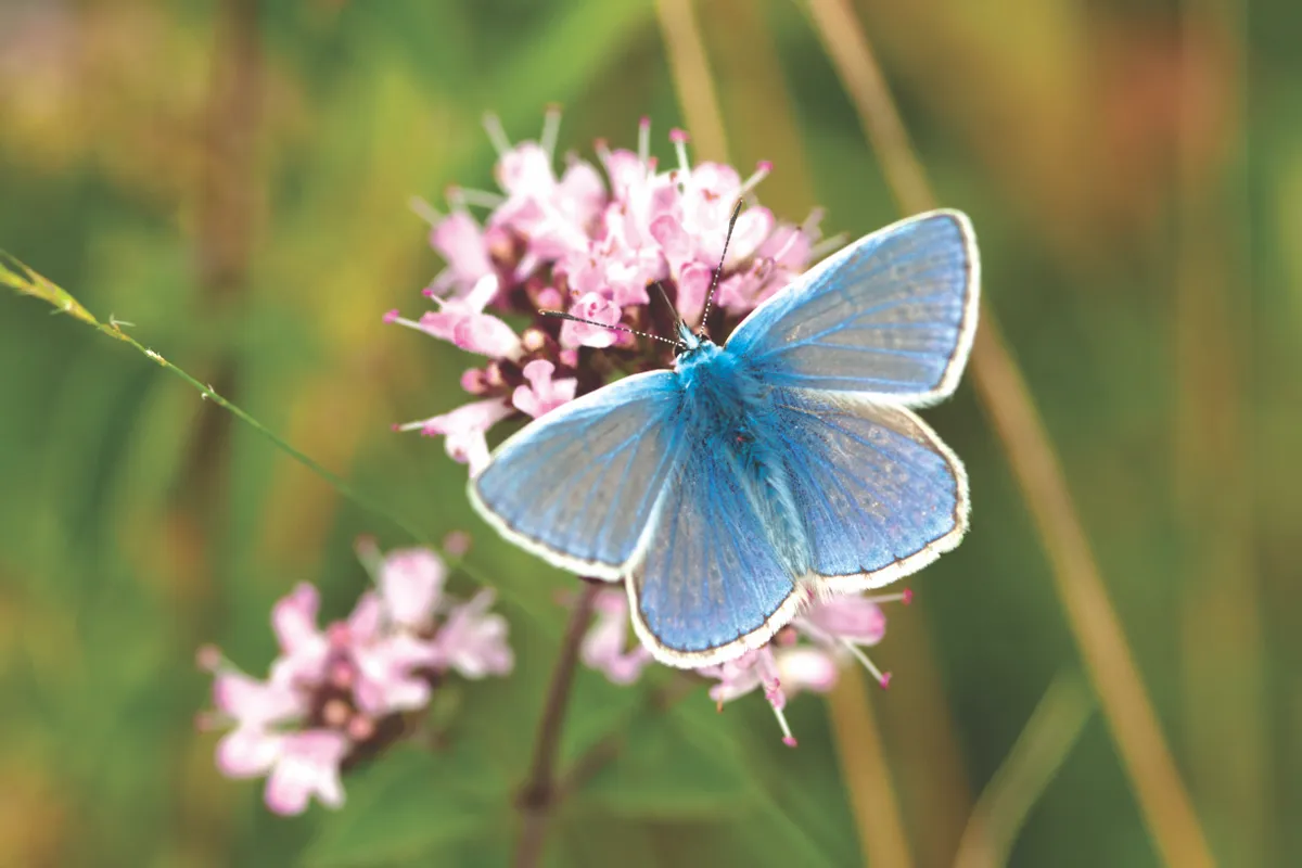
Scotland accounts for a third of the UK in terms of land area but has less than one tenth of the population, which means recording butterflies and moths can be more of a challenge than in more populated areas. Mabie Forest is a particularly good place to come for sightings; in 2018, 23 of Scotland’s 32 resident species were recorded here.
The list includes three of the UK’s most endangered butterflies and moths: the pearl-bordered fritillary, with its distinctive silver ‘pearls’ and row of seven outer ‘pearls’ on the underside wing; wall brown, so-called because its delicately patterned light-brown underside provides good camouflage against the stony or sandy walls on which it can be found, and the green, spot-less forester moth. Other species found here include the large skipper, small copper, small pearl-bordered and dark green fritillary, purple hairstreak (increasingly rare) and the speckled wood, which is now spreading rapidly through Dumfries and Galloway.
Mabie Forest is also managed for leisure activities and has a world-class 7stanes mountain-biking centre, as well as a number of waymarked walks, including the Nith View Trail.
1. Over the burn
From the car park (accessed from the A710 up the drive for Mabie House Hotel), take the signposted path downhill and cross the bridge over the Mabie Burn. Chinney Field on the other side is full of wildflowers in summer; look out for the meadow brown, ringlet, peacock and red admiral butterflies.
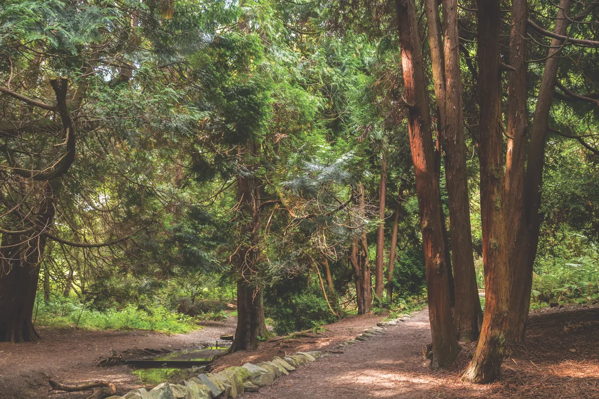
Continue to pass the old sawmill, a remnant of industry past; the Forestry Commission acquired Mabie in 1943 as part of a wartime tree-planting scheme to rebuild timber reserves. At the bottom of the hill, go left through the woods, soon passing some enormous sequoia trees. Ascend on the path, cross a burn and climb the steps up the hillside. At a T-junction of paths, turn right to continue gently uphill.
Follow the path through woodland then take a sharp turn right up a steeper hill, emerging on a broader track. On calm summer days, these south-facing slopes are a good spot to look out for the scarce pearl-bordered fritillary.
2. Hilltop vista
Go right here and follow this track around Larch Hill for roughly 1.5km, enjoying the impressive views to Dumfries and the village of Glencaple on the River Nith, and beyond to the Solway Firth. In recent years there has been a programme of larch clearance here due to the Phytophthora ramorum fungus, which means hillsides that were once cloaked in trees are now bare.
As you head northwards along the track, the Galloway hills become clearer. Then, on rounding the far side of the slope, the impressive Goldielea railway viaduct comes into view, its 18 semicircular arches marching across the valley below. Along here you might spot small tortoiseshell, orange-tip and green-veined white butterflies.
Shortly after this, just before meeting another track, go right down the waymarked steps, soon passing a line of beech trees. About halfway along, just off to the right, is a small covered seating area with a view of the hills – an ideal spot to pause for sandwiches.
3. Hill hopping
Continue along the beech trees to rejoin the main track, and turn right. At the next junction, follow the waymarker gently uphill to the left, then go right once more and then left again along a gravel track. Views of the Solway Firth open up ahead and over to the left you might catch a glimpse of a reconstructed Iron Age roundhouse, the floor of which is made from trees felled to try and stop the spread of Phytophthora. Along with yurts, a tipi and a bunkhouse, the roundhouse can be rented for forest escapes.
Keep ahead on the track and, after passing two cycle trails on the left, take the waymarked path, also on the left, down the hill.
Towards the bottom of the hill, cross straight over a path and, at the very bottom, take a hard left to join the trail running beside Mabie Burn. Follow this through the woods, looking out for waymarkers, all the way back to the car park.
There’s no tearoom at Mabie but, time permitting, pop along to New Abbey, around 20 minutes drive south. The 13th-century ruin is better – and more romantically – known as Sweetheart Abbey. So bereft was the good Lady Devorgilla at the death of her husband, John Balliol (of Balliol College, Oxford renown), that she carried his heart with her, eventually being buried with it here in the abbey that she founded. The tearoom next to the abbey makes a good spot to round off the day.
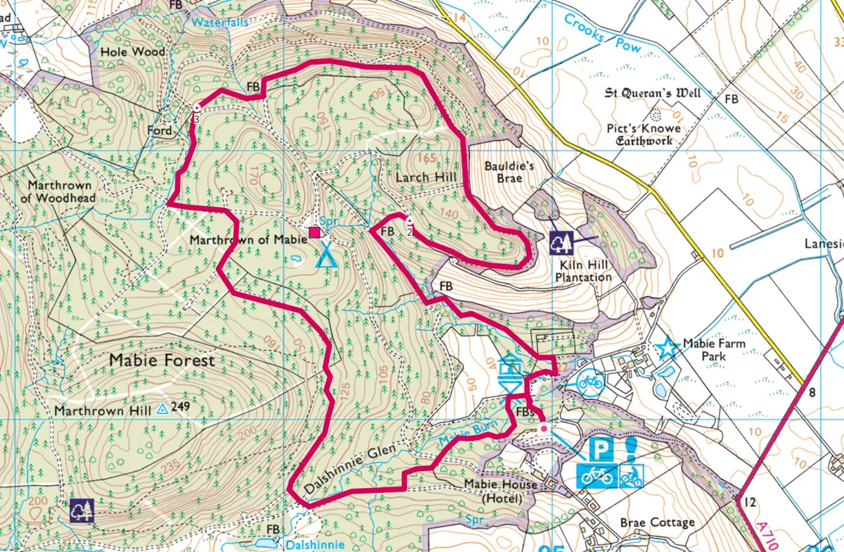
Map
Click on the map below for an interactive version of the route.