It can sometimes be challenging, with a young family, to find walking trails manageable for little legs. Thankfully there is an ideal place in the Radnor Forest in Mid Wales.
Once the royal hunting ground of Norman kings, the forest is now a landscape of hill farms, moorlands and steep, narrow valleys, patrolled by red kites.
Warren Wood is just under a mile from the village of New Radnor, so named for the labyrinth of rabbit warrens that kept the locals fed for centuries, now dwarfed by towering beeches, oaks and conifers planted in the 1800s to provide a bit of scenic beauty for the picturesque-loving Victorians.
There are three short trails in the wood, each waymarked with coloured signs. All three routes are worth walking – here we follow the Water-break-its-neck Trail (blue waymarkers).
This short walk to Water-break-its-neck waterfall is perfect for families.

Water-break-its-neck walk
0.75 miles/1.2km | 1 hour | easy
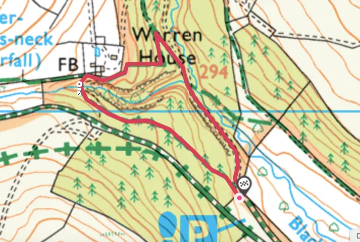
1. Warren Wood car park
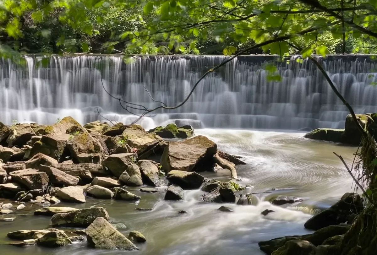
Starting from the Warren Wood car park, the Water-break-its-neck Trail (¾ of a mile) climbs gently south of the river for 500m to a spectacular viewpoint over the top of the puzzlingly named Water-break-its-neck falls. The small but gorgeous cascade has created its own microclimate.
The fine rainbow mist in the air and green lushness of the gorge make for a perfect fairyland setting, and if it’s a hot day, there’s nothing more refreshing than pulling your boots and socks off for a cooling paddle.
Looking for more outdoor inspiration?
2. Arboreal valley
Continue to follow the blue markers, first climbing to the other side of the valley, then descending through more woodland back to the car park.
The slightly shorter Waterfall Walk (⅓ of a mile, follow the red waymarkers) leads you along a stream past curtains of ferns, moss-covered boulders and oaks dripping with lichens to the bottom of the falls.
The Warren Trail (1½ miles, follow the green waymarkers) is an energetic loop away from the waterfall, taking in the largest trees of the woodland and some ornate stone bridges crossing the Black Brook. While it’s only a short walk, there are some strenuous climbs. All three trails are manageable in a day, allowing time for picnic stops and paddles.
Water-break-its-neck map
Water-break-its-neck walking route and map