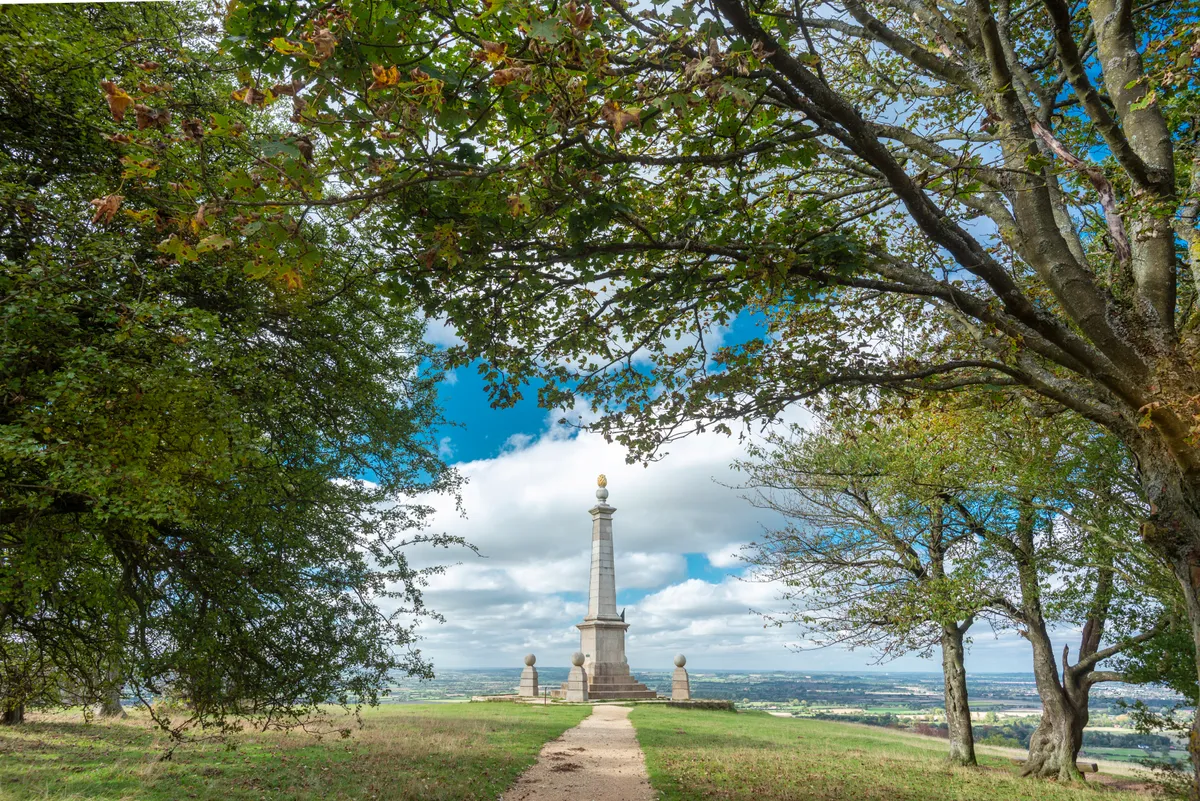
Walking out to the war memorial on the exposed summit of Coombe Hill, the highest point in the Chilterns, is always stirring. You’ve reached the first monument built to commemorate war dead rather than celebrate victory and, coupled with a bracing northerly wind or a mist hanging over the Vale of Aylesbury below, it can’t fail to bring out goosebumps.
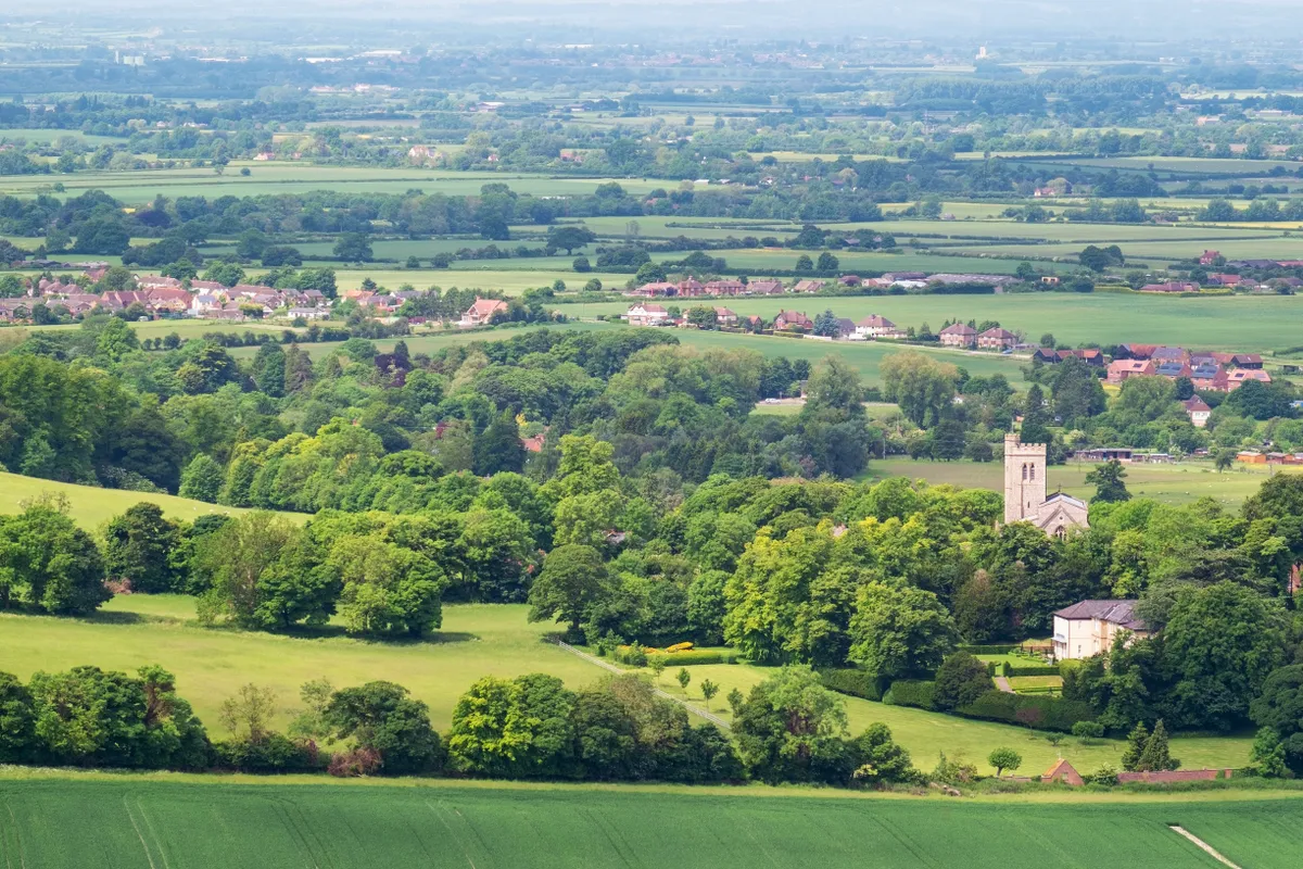
Beyond the monument, the Ridgeway National Trail heads along the top of the wildlife-rich chalk escarpment, enjoying far-reaching views over the Buckinghamshire countryside before we head into ancient woodland.
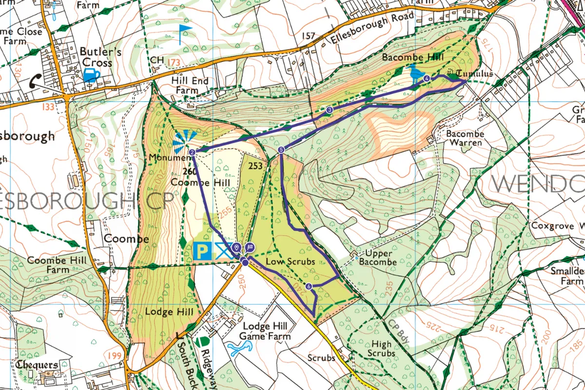
Start from the Trust’s car park, three miles west of Wendover. It has a picnic area and infor-mation panels, including a map, but no toilets.
Looking for more fabulous days out? Check out our guides to the best woodlands, river walks and lakeside strolls in the UK.
Coombe Hill walk
2.8 miles/4.5km | 83m | 2.5 hours | easy
1. Monumental views
A wheelchair-friendly path leads north from the gate on the western side of the car park en-trance as far as the monument. As well as distant views, the Prime Minister’s country home, Chequers, is spotted in the valley below.
2. Along the Ridgeway
No longer suitable for wheelchairs, the main route heads east-north-east along the hilltop, fol-lowing Ridgeway National Trail signs and entering woodland. Fork right soon after a panel with details of the wildlife that thrives on these chalk hills. Watch for flocks of fieldfares and redwings stripping the last of the berries from trees and shrubs.
3. Grassland ants
A kissing-gate provides access to airy grassland sporting the pimply anthills of the yellow meadow ant. Bear right at two faint forks. The path then dips.
4. Into trees
Just before it climbs again, turn sharp right along the signposted ‘Aylesbury Outer Ring’. De-scending through trees, keep left at the next waymarker.
Turn right along a broad, beech-flanked track for 0.6 miles.
Looking for more walking inspiration?
5. Ancient tracks
Take the bridleway on the left to enter Low Scrubs, majestic woodland where, for centuries, local people were allowed to collect wood for fuel. Keep straight on at an iron fence embedded in a tree, following one of the ancient routeways criss-crossing the area. Turn right at a T-junction and, in 300 yards, right again.
6. Back to the start
Go left at the bottom of the slope and then bear right at a signpost. Go right again at a T-junction and, when this path ends, turn left to re-enter the car park.
Coombe Hill map
Coombe Hill walking route and map
Coombe Hill car park
National Trust parking (free to NT members) is available at Coombe Hill. The car park includes an information board and picnic area. Find out more at national-trust.org.uk/chilterns-countryside/features/coombe-hill