Genteel Guildford might not seem a location for much wilderness, but St Martha’s Hill offers a chance to feel at one with one of the most spectacular wild landscapes of Britain – the High Weald.
Once a dense and dangerous forest with difficult terrain and treacherous roads, the High Weald was best avoided, which is why pilgrims took the high and dry roadway along the North Downs.
Today the Pilgrim’s Way and North Downs Way coincide for only short stretches, and the climb to St Martha’s Hill is one of the best. The tracks are well maintained, so you should avoid a quagmire even on a soggy November day.
Looking for more walks in the area? Check out our best walks in Surrey, the South Downs and the New Forest.
St Martha's Hill walk
4.6 miles/7.4km | 3 hours | moderate
1. Shalford Road car park
A small car park just off the A281 Shalford Road is a good starting point. Follow the North Downs waymarkers past the white-painted Chantry Cottage and through Chantries Wood. Here are immediate clues as to the sacred nature of the area. Although there are no visible remains of any chantries now, the area is redolent with mystical ancient power, and there are Bronze Age tumuli to the north.
Discover more of Britain's countryside

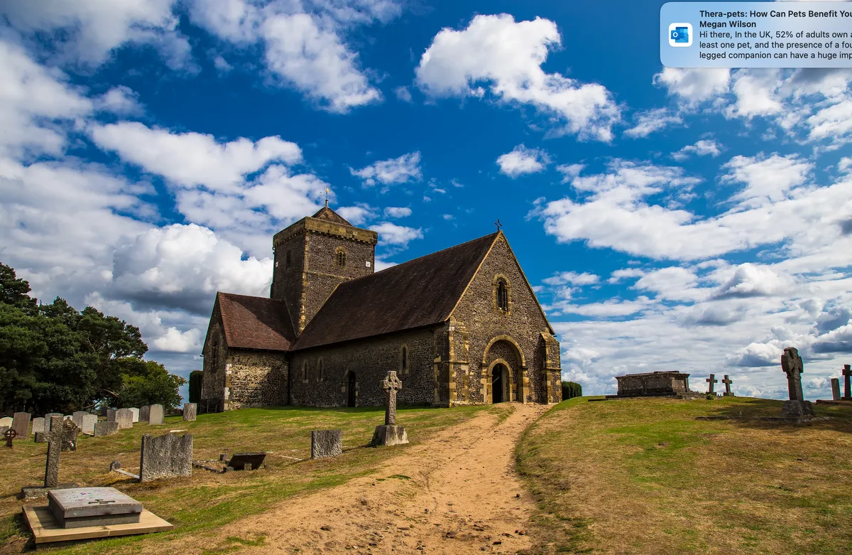
2. St Martha’s Priory
Continue on, descending the hill and zigzagging across Halfpenny Lane before rising again. St Martha’s Priory (another ecclesiastical clue) was derelict for many years but has now been converted into a prestigious house. The bridleway climbs to the church on the hill’s summit (175m).
3. St Martha summit
St Martha’s is now supposedly the only church still remaining on the entire Pilgrim’s Way, and it is only accessible on foot. A religious building has stood here for at least 900 years, and the nearby manors of Chilworth and Tyting are mentioned in the Domesday Book. The Saxon church is gone, but some of the original Norman arches were incorporated into the existing structure when it was rebuilt in 1848–1850. Reconstruction was necessary after an enormous explosion at a gunpowder mill in the valley in 1745 wrecked the tower, leaving the building looking ragged for over a century.
Although the Pilgrim’s Way passes behind the church, you will need to detour in front to see the panoramic views out across the Surrey Hills. Reputedly, you are able to see five other English counties from the vista (seven in some claims), although those to the north are now obscured by trees. Continue past the church for 200m, turn right and descend steeply on the Downs Link Way.
Discover more magical churches
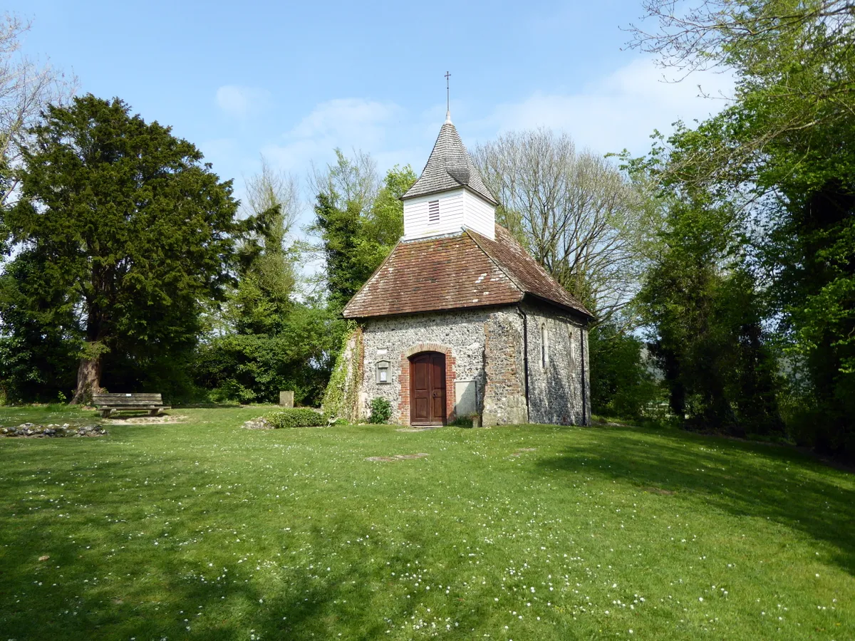
Britain's peaceful rural churches are steeped in holy history and can be fascinating places to visit. Our guide to the UK's best countryside churches delves into their history and design, as well as local walks that incorporate these historic buildings.
4. Chilworth Gunpowder Mills Trail
Rather than continue on to Shoreham-by-Sea, turn on to the Chilworth Gunpowder Mills Trail beside the Tilling Bourne. The mills used to be thick along this stretch of water; they all closed in the 1920s, but left tangible industrial echoes in the now-quiet rural countryside.
5. Chantries Wood
Turn right up Blacksmith Lane and either head back along arable field edges to complete the circuit, or take Halfpenny Lane to the junction with the Pilgrim’s Way and return, a weary pilgrim, through Chantries Wood, back to the start.
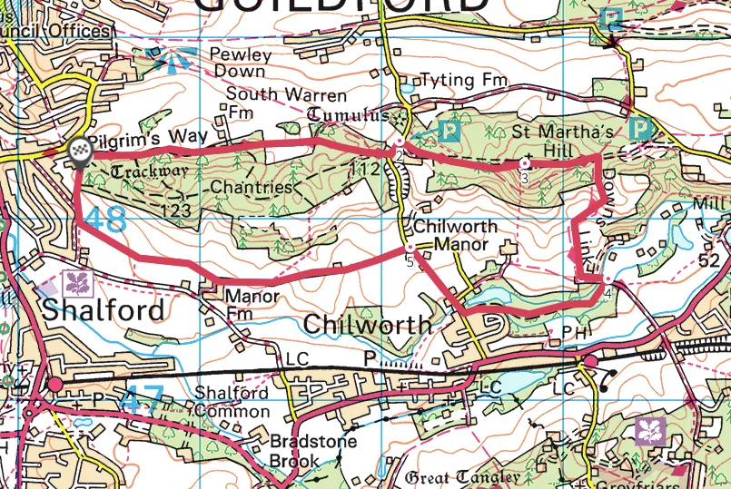
St Martha's Hill map
St Martha's Hill walking route and map