We've lived in an old stone farmhouse perched above the Wye Valley and the ruins of Tintern Abbey longer than anywhere else since I left home at 18. This is my 10th year here, so to celebrate I decided to go for a walk.
The Wye Valley Walk runs 136 miles between Hafren Forest in Mid Wales to Chepstow, on the English border. Most people choose to walk from Chepstow and my guidebook describes the walk from this direction, but I wanted to do it the other way around and walk from the source to home.
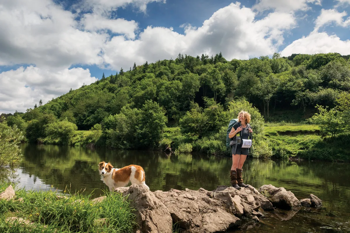
Mid Wales is often overlooked. It doesn’t have the dramatic scenery of Snowdonia or the beauty of the Pembrokeshire coast, but I love this rural part of Wales with its rolling hills, small farms and gruff hospitality. So together with my Welsh sheepdog Teg and a rucksack full of socks and dog food, I travelled to Llangurig, the little village nearest the start of the Wye.
In the village pub I joined a group of men at the bar. They were local farmers, wearing checked shirts and holding pint glasses in gnarled, hard-working hands. There was lots of banter and teasing. “What are you doing here?” they asked and when I told them, one man offered to give me a lift to Rhayader, a day and half’s walk away.
“I can’t do that! That’s cheating!”
“Well then, you’ll be needing more of this,” replied another, pulling me a pint of cider. A third man, Dai, told me that he owned the source of the Wye. “It rises on a hill on my farm, so you’ll be walking across my land tomorrow. How long will it take you to get back to Tintern?”
“I’m planning to do it in nine days,” I said. “Although my navigation skills aren’t brilliant. My husband said he’d be surprised if I was home within a month…”
Starting at the river's source
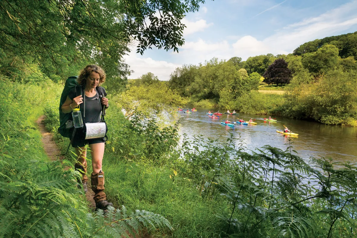
The next morning, as Teg and I got out of the taxi at the start of the route, I stood listening to the sound of the retreating engine and suddenly felt a bit apprehensive. Rain was falling, cloud hung low, we were completely alone and my phone had no signal.
Teg, on the other hand, had no such qualms, and raced off down a path marked ‘walks this way’. So I buckled up my rucksack and followed.
An hour or so later, going through a gate on to an open hillside, I heard the sound of a quad bike. “You made it this far without getting lost!” It’s Dai, the man who owns the land where the Wye rises. “Just thought I’d check to see if you are doing OK. Sorry the weather’s not great. You’ll see a path a bit further along this track that takes you to where you can get a view of the source of the Wye, but you won’t see a thing today. Good luck!” And with that he was gone, swallowed up by the cloud.
That small act of kindness made my apprehension disappear. I was reassured that if anything did happen to us – if we got lost, for instance – there would be someone who would help, because that’s just what people do around here.
We took a short detour across Dai’s hillside to find the Wye’s source. There were any number of boggy patches and little riverlets that could have been it, but if there was any sort of sign marking the spot, it was obscured by the mist.
We returned to the main route, easily navigable here, but not in any way beautiful. It followed a gravel road (which is used by a local rally driving centre) through a rather barren and sodden landscape. At this point, the River Wye was just a narrow stream trickling along below me. But after a couple of hours we crossed a main road and followed the waymark over a bridge and into the woods where my spirits were lifted.
Exploring Mid Wales
For three days we walked the paths, lanes and hills of Mid Wales. And as my husband predicted, we got lost. Or rather we lost the path – numerous times – although never disastrously.
The Wye Valley Walk isn’t a national trail, like Offa’s Dyke or the Pennine Way. It developed as a collaboration between three local authorities and the Wye Valley AONB (a feat in itself) and there isn’t the funding to keep the route regularly maintained. Some waymarks are missing; others are so faded that they’re unreadable or have been swallowed up by the undergrowth. Paths, particularly in the early summer, are often overgrown. But the odd wrong turn and bramble scratch is a small price to pay for some truly lovely and varied walking.
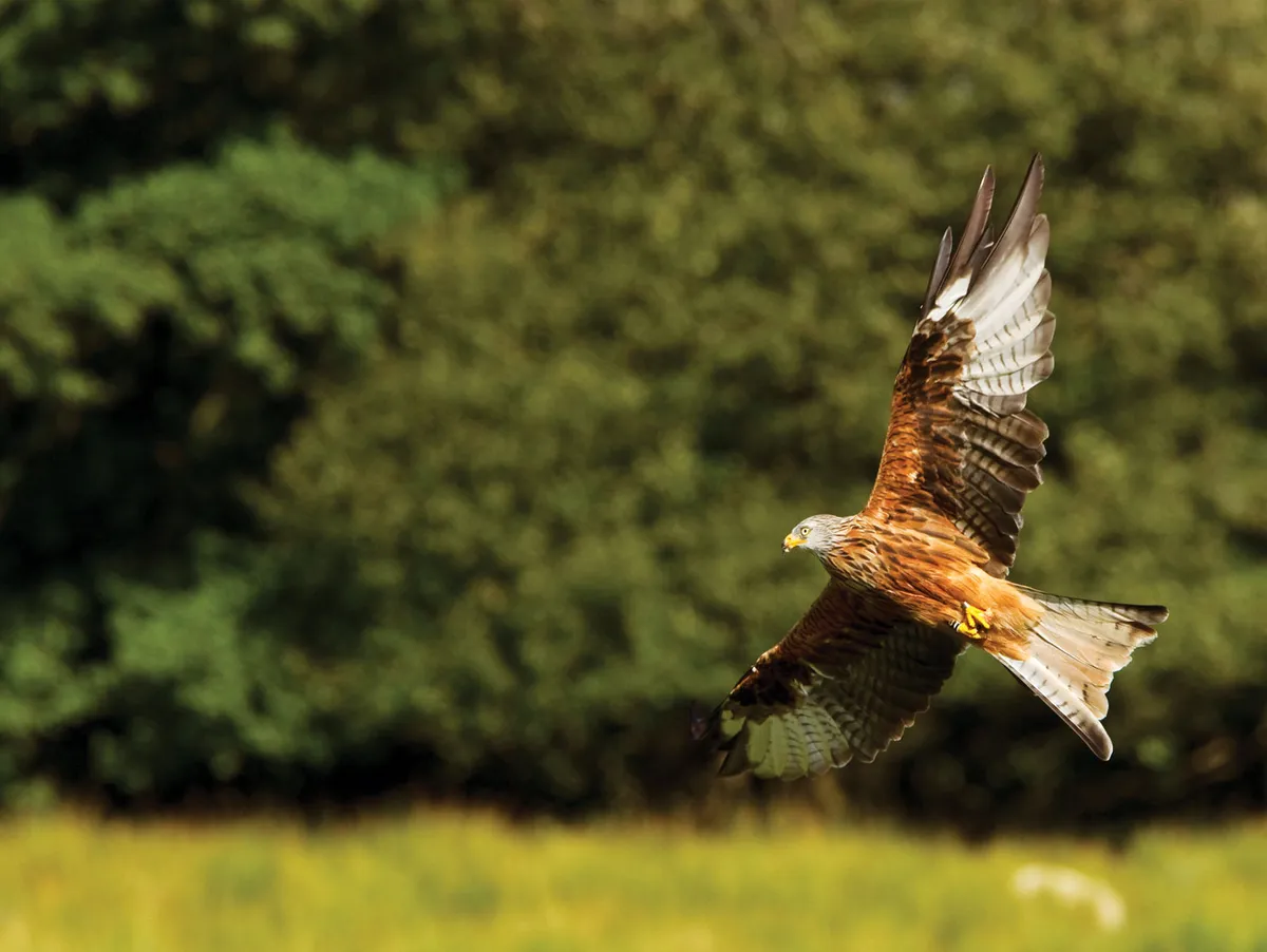
The route doesn’t stick beside the river, but often climbs away from it, providing a different perspective on the unfolding landscapes that are frequently, and sometimes literally, breathtaking. The birdlife was, too – red kites, the bird synonymous with this part of Wales, wheeled above us; chiffchaffs called from the woods; newly fledged swallows skimmed low over the river in formation like tiny fighter jets; and the hedgerows were full of wrens and redstarts.
The first day we walked over 18 miles and camped in a field, after getting permission from the kind farmer who owned it. It was next to a stream and the only sounds were the evening birdsong and water babbling over stones, lulling us to sleep.
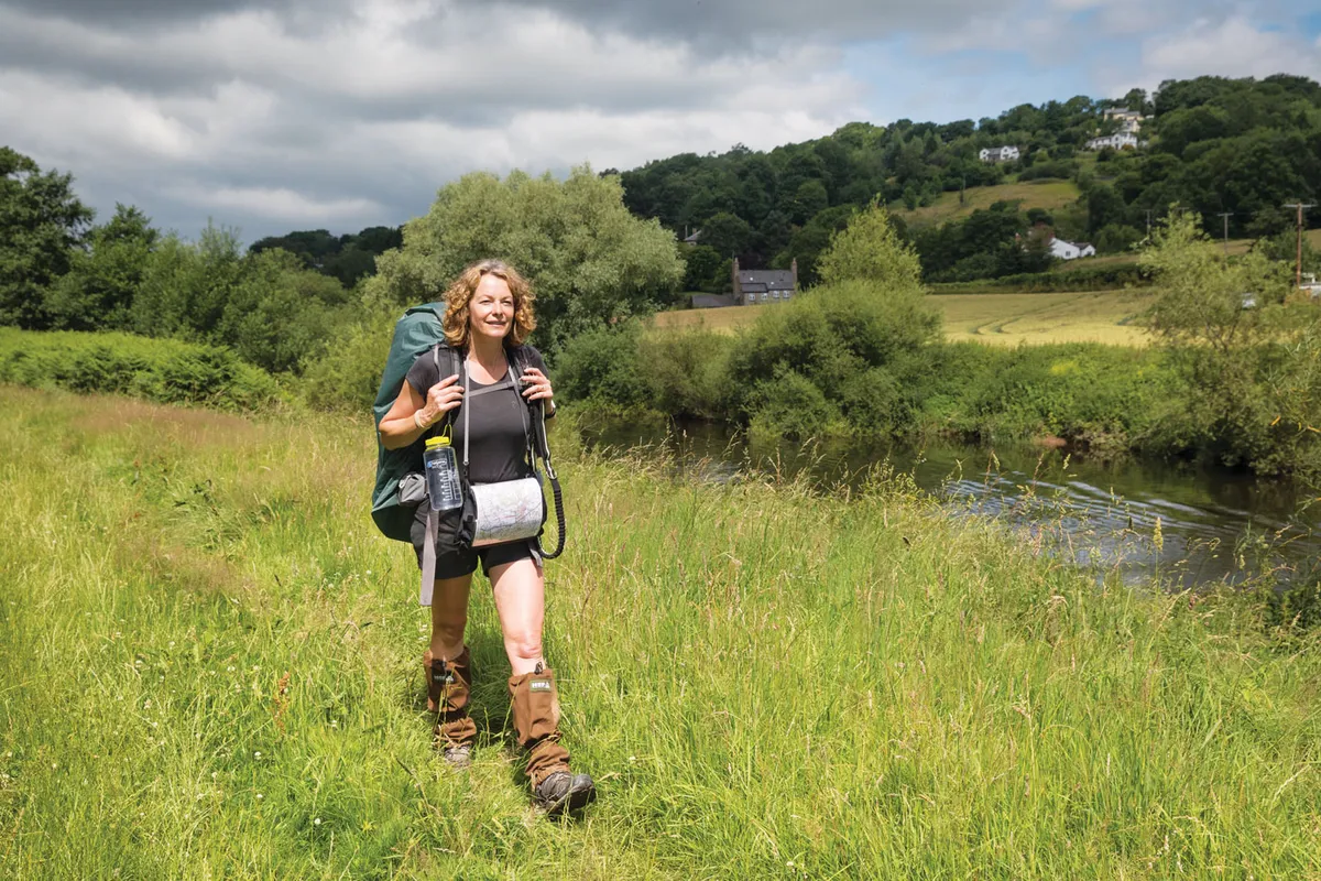
The next day, we reached Rhayader, the first of several small towns en route – so there’s no need to carry huge amounts of supplies or water (my pack weighed a very manageable 14kg).
On day three we reached Builth Wells. The damp drizzle of the first two days had lifted, the sun was out and we came down from the hills to rejoin the river for one of the loveliest sections of the walk so far. Gaggles of Canada geese and pairs of swans with their cygnets floated serenely on the sun-dappled water and further downstream, where the river starts to rush and tumble over stones, we were accompanied by dippers and grey wagtails.
Great views of the Black Mountains - and wet shoes
After a late breakfast in a café in Builth we pressed on, up and away from the river, where our efforts were rewarded with expansive, glorious views of the Black Mountains. We dropped down again to cross the river at Erwood and it was here that I realised all was not well.
The wet conditions of the first couple of days had meant my boots, and therefore my socks, had been sodden pretty much from the outset. The climbs and descents, along with the added weight of the pack, had taken their toll on my feet – I had developed severe blisters. The last couple of miles from Erwood to our campsite were agony.
Despite draining them and covering them with blister plasters, the next day’s short walk to Hay-on-Wye was torturous; it felt as though someone had filled my boots with ground glass. Even the sight of a perky little kingfisher and a song thrush singing its heart out as I limped over the bridge into Hay couldn’t diminish the awful realisation that I simply couldn’t go on.
I woke the next day at 6am. I’d spent the night in a B&B and Teg had rather enjoyed the unfamiliar luxury of sleeping indoors. I hobbled to the bathroom and although I’d resigned myself to the fact that I wouldn’t be carrying on, Teg still needed to go out.
My friend Polly, who had come to join me for a day’s walking, had spent the previous night buying almost every blister plaster available in Hay. My husband had also driven up with dry boots and the B&B’s owner had given me a pan of hot water and salt to soak my sorry feet in. As for my part, I’d bought three pairs of padded socks in the hope of alleviating the pain.
It took a couple of tentative steps for me to realise that in my new socks and dry boots my freshly plastered feet didn’t hurt. I did an experimental bounce. No pain... and so a jump for sheer joy. Teg wagged her great plume of a tail. We were back on the road.
Ross-on-Wye
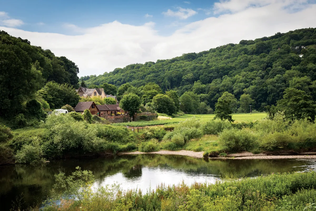
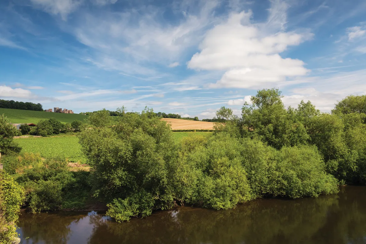
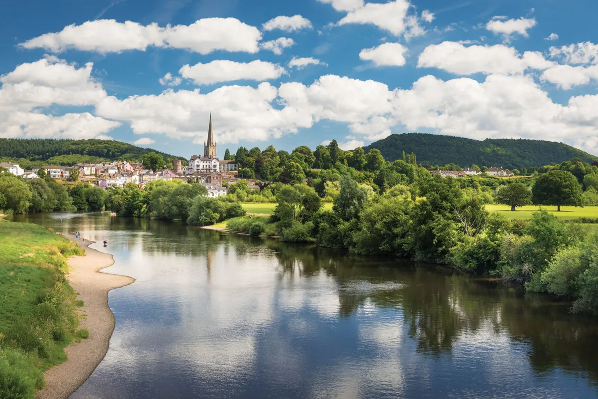
We were now in Herefordshire, walking through fields of barley and potatoes, beautifully regimented apple orchards, views of Lord Hereford’s Knob, May Hill and the Forest of Dean, over which buzzards soared. On day six we followed the river with the spire of the church in Ross-on-Wye as our goal. There were fishermen on the bank, excited children in canoes and mallards with their ducklings.
From Ross we climbed away from the river before descending at Kerne Bridge. On a day of sunshine and uninterrupted blue skies, the ruins of Goodrich Castle looked magnificent and, later, the towering Symonds Yat rock proved, should anyone doubt it, that Mother Nature can do magnificent, too.
Return to Monmouthshire
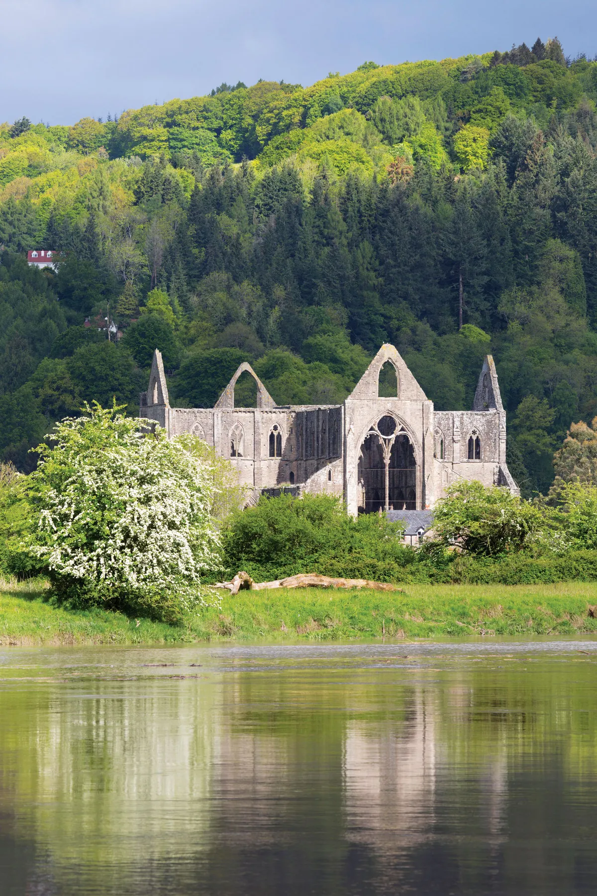
Our final day began in Monmouth, on home turf. Friends joined us and we meandered, enjoying the sunshine, paddling in the river and then stopping for a pint. At the majestic remains of Tintern Abbey, Teg and I turned away from the river and climbed a familiar path through the woods into a neighbour’s field, and then through the gate into our field. Our sheep looked up briefly, baa-ed a greeting and went back to their grazing as Teg and I sat side-by-side on the grass, looking out at the view that greets me everyday, over the beautiful valley that I’m lucky enough to call home.
Kate's Hike Hacks
The Wye Valley walk passes through some beautiful countryside, but is never far from small towns or villages, making it easy to pick up supplies or restock along the way.
My walking essentials are string, plasters (blister and normal), safety pins and a penknife. And, in my opinion, you can never have too many pairs of socks.
I downloaded podcasts to listen to in the evenings: Desert Island Discs, News Quiz Extra and the second series of Serial were my choices on this trip.
Don’t rush the walk. It is tempting, once you’ve loaded up your gear and put your pack on, to march all the way through to your next rest stop. But this is a beautiful part of the world and you’ll pass through some very varied landscapes. Remember to stop once in a while to have a look around and take in your surroundings. And the natives are friendly. Greet the people you meet along the way and any help or advice you may need will be happily given
Kate Humble is a BBC presenter and author. Her book Friend For Life: the Extraordinary Partnership Between Humans and Dogs (Headline, £16.99), is available now.

