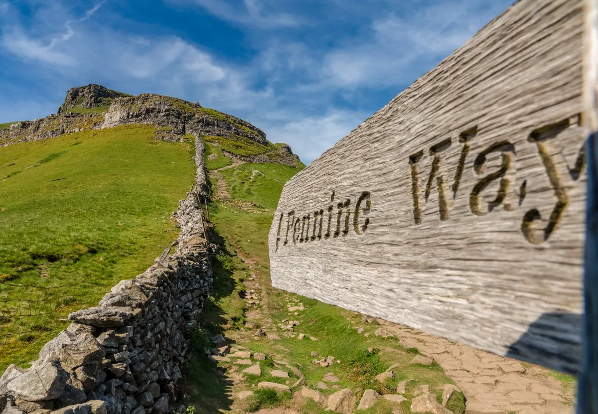
Quite simply, the Pennine Way is Britain’s most iconic National Trail – a 268-mile trek along the spine of England, traversing three National Parks and the North Pennines Area of Outstanding Natural Beauty.
Over 15–20 days, Pennine Way walkers will clock up the equivalent of 1.3 ascents of Everest, gained by scaling a succession of lofty summits and elevated plateaus across Northern England’s most spectacular upland terrain.
It is the original designated National Trail and, to the tens of thousands of folk who have walked it, still the best – right up there with the world’s greatest hikes, such as the Appalachian Trail and El Camino de Santiago.
Walking it in instalments is a practical way to complete the trail, but the best way to understand the Pennine Way’s unique character is to go the full distance in one epic hike – a serious undertaking for even the keenest hikers.
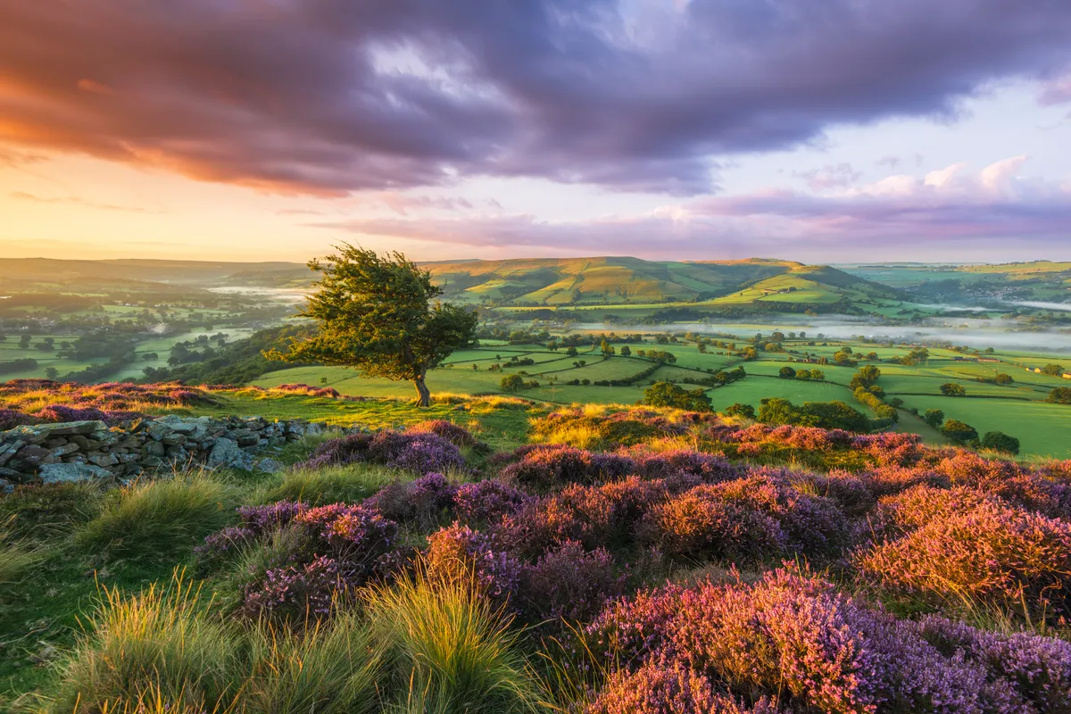
While the Pennine Way visits some of the natural wonders of England – Malham Cove, High Cup and the Cheviot – these are separated by long tracts of remote upland. In these vast, elemental landscapes, the true nature of the trail is revealed, transcending modern noise and creating a deeper, more primal connection between those who walk it and the very soul of the nation.

Find out everything you need to know about this famous walk – including how long it is, the route, trail stages and planning advice – with BBC Countryfile Magazine's ultimate guide to the Pennine Way.
Looking for more walks in the area? Read our guides to the best walks in the Peak District, Yorkshire Dales and the North York Moors.
Pennine Way map
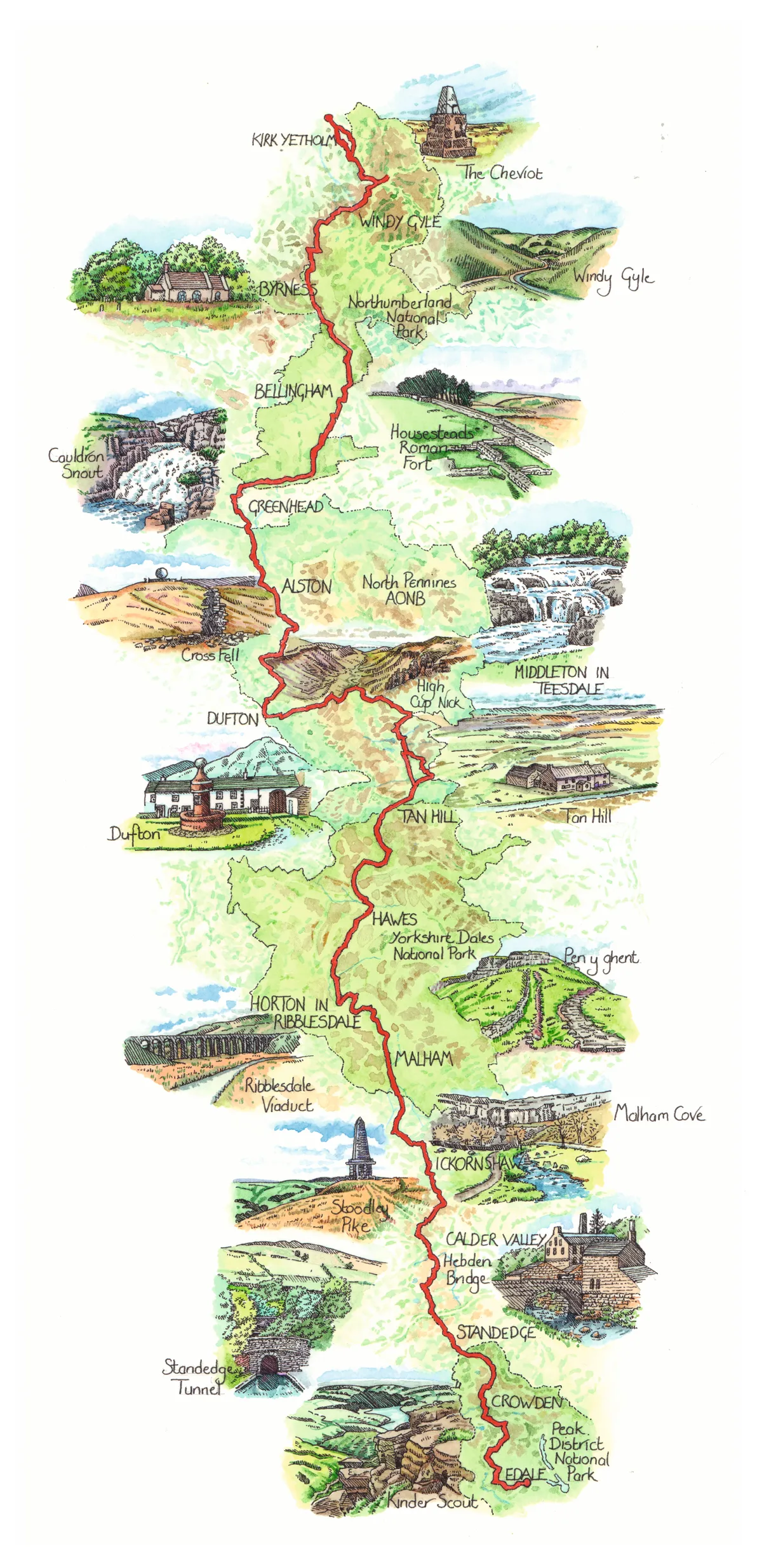
Pennine Way route
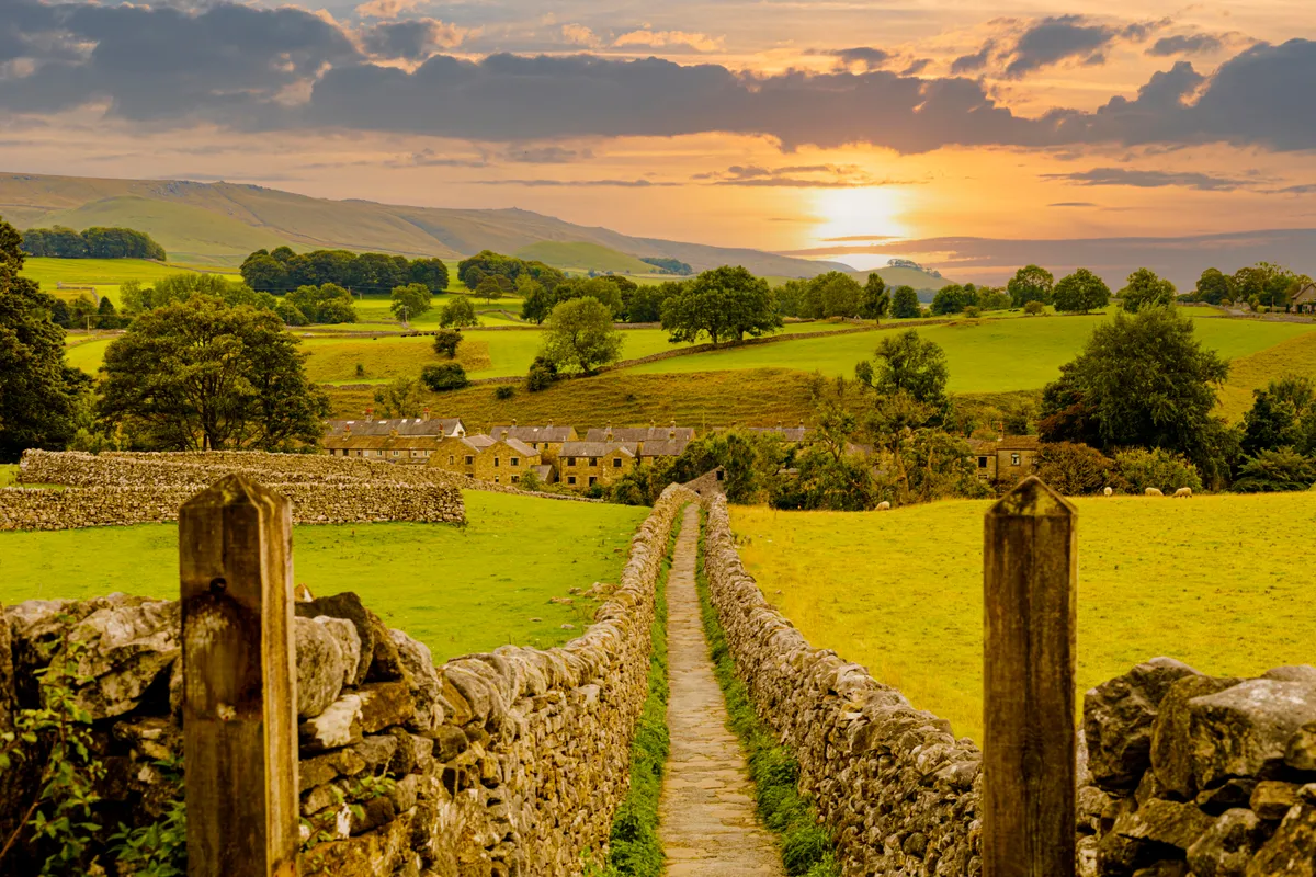
The Pennine Way starts – appropriately enough – at Edale in the shadow of Kinder Scout in the Peak District National Park. This was the backdrop for a series of mass trespasses in the 1930s.
From Kinder, the route meanders for more than 250 miles through the northern uplands, traversing increasingly wild and remote terrain to reach the Scottish Border at the hamlet of Kirk Yetholm.
Peak District guide
Discover the best things to do in the Peak District, gorgeous country walks and beautiful cottages and hotels to stay in with our visitor's guide to the national park
How long is the Pennine Way?
The Pennine Way is 268 miles long, or 431km. It isn’t the longest National Trail in the UK – that would be the 630-mile South West Coast Path, immortalised in Raynor Winn’s bestseller, The Salt Path. And it isn’t the toughest long-distance hike; that is widely acknowledged to be the Cape Wrath Trail – a 230-mile odyssey through some of the most remote wilderness in the Scottish Highlands.

What are the best times of year to walk the Pennine Way?
The route is open all year, although the North Pennine sections can be impassable after heavy snow and covering up to 22 miles is challenging in eight hours of mid-winter daylight, even for the fittest of walkers. The best times of year are May and June, before the searing heat of summer, or September, when the boggier sections are at their driest.

How many days does it take to walk the Pennine Way?
Most Pennine Way walkers split the route up into between 15 and 20 sections – although ultra-runners John Kelly and Damian Hall recently completed the entire distance in just two-and-a-half days of non-stop running. Many hikers complete the walk in ‘instalments’ of a few days or a week at a time. A growing ecosystem of tour operators now offer visiting walkers five, seven and 16-day package trips, which include pre-booked accommodation, luggage transfers and even professional guides if required.

Which way to walk – from north or south?
It’s traditionally walked south to north, keeping the prevailing winds and weather at your back, but don’t forget to cast regular glances over your shoulder as some of the best views may be behind you.
Daily distances vary from a mundane 11-mile schlepp over the moors above the mill towns of West Yorkshire to the challenging 22-mile trek from Greenhead to Bellingham via Hadrian’s Wall.

Pennine Way stages
Day 1: Edale to Crowden
16 miles (26 km)
Catch the train from Manchester or Sheffield to Edale and let the adventure begin! Forget any notion of easing your way into the trail; the first day is a tough climb up on to the Kinder Plateau, characterised by peat hags and eroded edges of millstone grit.
Day 2: Crowden to Standedge
11 miles (18 km)
Today’s section is easier on aching legs, traversing lonely moorland punctuated with sparkling Pennine reservoirs. Footpath improvements mean the horrors experienced by Alfred Wainwright, who almost disappeared into one of the notorious peatbogs while walking this section in the 1960s, are unlikely to be encountered.
Best days walks on the Pennine Way
The Pennine Way weaves through some of northern England's most stunning uplands. Discover some of the best bits our round up of Pennine Way days hikes along the way.
Day 3: Standedge to Calder Valley
11 miles (18 km)
Today’s section cleaves closer to civilisation, with plenty of tempting diversions to sample local food and the vibrant culture of the Calder Valley. The distinctive pinnacle atop Stoodley Pike is a constant companion and the relatively modest distance allows plenty of time to explore the cafés and restaurants of Hebden Bridge.
Day 4: Calder Valley to Ickornshaw
16 miles (26 km)
A longer hike today through the literary landscapes of Brontë Country, through Heptonstall Moor before dropping into the little village of Ickornshaw. There’s a wider range of accommodation and eateries in nearby Haworth – plus the added appeal of the Brontë Parsonage.
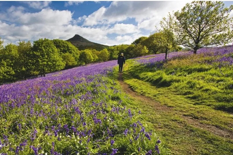
Yorkshire Dales walks
The valleys, moors, hills and caverns of the Yorkshire Dales National Park are etched with miles of rolling footpaths – explore this atmospheric limestone landscape with our guide to the Yorkshire Dales' best walks.
Day 5: Ickornshaw to Malham
17 miles (27 km)
Today’s lengthy leg passes through the low-lying Aire Gap and, while there are plenty of options to buy provisions in the many towns and villages along the route, this makes navigation a little fiddly. This rather nondescript section marks the transition from industrial West Yorkshire to the stunning scenery of the Yorkshire Dales and the contrast is stark.
Day 6: Malham to Horton-in-Ribblesdale
14.5 miles (23 km)
The first of the ‘classic’ days on the Pennine Way climbs on to the limestone pavements of the Dales to cross Malham Moor and tackle the gnarly scramble up Pen-y-ghent before a long, scenic descent to Horton-in-Ribblesdale.

Day 7: Horton-in-Ribblesdale to Hawes
14 miles (23 km)
After the crowds at Malham, today is one of those lonely treks across vast landscapes that characterise the northern sections of the Pennine Way. There’s plenty of classic Dales scenery to enjoy along the route, with good views of the iconic Ribblehead Viaduct from Cam Fell before dropping into the delightful little town of Hawes.
Day 8: Hawes to Tan Hill
16.5 miles (27 km)
Another absolute classic day on the trail, with spectacular cascades, a big climb to Great Shunner Fell, one of the highest points on the route, before striding through a patchwork of wildflower meadows and drystone walls and winding up at the legendary Tan Hill Inn – the highest pub in Britain at 527 metres above sea level.

Day 9: Tan Hill to Middleton-in-Teesdale
17 miles (27 km)
After the delights of Swaledale and Tan Hill, today’s trek offers an opportunity to reflect on progress to date while striding purposefully towards the halfway point on the trail. This section offers a foretaste of the wilder landscapes that lie ahead. Taking the Bowes Loop off the main route offers more accommodation options.
Day 10: Middleton-in-Teesdale to Dufton
21 miles (34 km)
Get ready for the best day on the trail. This epic traverse of the Pennine ridgeline has it all – spectacular waterfalls, massive moorland views, a lot of climbing, some challenging navigation and the jaw-dropping scenic wonder of High Cup, as you – quite literally – enter Eden (the valley, that is).

Day 11: Dufton to Alston
20 miles (32 km)
After the exhilaration of yesterday, today’s trek is an altogether more sobering experience. On a perfect day, the hike across the 914m massif of Cross Fell and its various subsidiary summits feels dramatic, but it’s a very long schlepp with sometimes tricky navigation, so plan your journey with care.
Day 12: Alston to Greenhead
16.5 miles (26 km)
Following the excitement of criss-crossing the backbone of Britain, today’s walk is very much a transition trek, linking the North Pennines to Hadrian’s Wall country. The terrain is unremarkable – save for its unrelenting squelchiness – and navigation can be tricky. Worry not, things can only get better.

Day 13: Greenhead to Bellingham
22 miles (35 km)
Another classic day on the trail, walking alongside Hadrian’s Wall for eight miles before heading north into Wark Forest. It’s a long day with lots of ups and downs and it’s worth considering a detour to overnight at Once Brewed to explore the nearby Roman Fort of Housesteads before continuing your journey.
Day 14: Bellingham to Byrness
15 miles (24 km)
Stock up on provisions for another wild section with nowhere to stop for lunch – and precious little to discover when you reach your destination. This is a walk of two halves: moorland then dense forest. At just 15 miles, it’s an easy day ahead of the epic final legs.

Day 15: Byrness to Windy Gyle
14 miles (22 km)
The Cheviots are England’s least-visited range of hills and today’s challenging stretch is a glorious hike through the remote southern reaches of this wonderfully wild landscape, dotted with Roman remains and echoes of the Border Reivers as you skirt the border with Scotland.
Day 16: Windy Gyle to Kirk Yetholm
13 miles (21 km)
Prepare for a suitably epic finale to the greatest walk in England. Your legs may be aching and feet battered, but adrenaline alone should power you through this exhilarating last day. In good weather, the detour to the summit of the Cheviot is a must for the views to Scotland and to the Farne Islands in the east. Savour the final descent and celebrate in the Border Hotel, where you can collect your finisher’s certificate.
North York Moors walks
The North York Moors landscape comprises more than 1,400 miles of public footpaths – discover the national park's vast moorland and sweeping coastline with our favourite walks in the North York Moors.
Why walk the Pennine Way?
For the thousands of folk who go the full distance, it can be a transformational experience, according to Pennine Way National Trails Partnership Manager Jo McAllister, who walks extended sections of the route every year. “The Pennine Way visits some truly spectacular natural wonders, but for me it’s the lonely stretches away from the ‘honeypot’ destinations where people discover the true nature of the trail,” says Jo.
“It may feel as though you are completely alone, with just the song of the skylark and plaintive call of the curlew for company, but actually you are walking in the footsteps of thousands of other people just like you and it’s only in the quieter places where you make this connection with those whose journey you are sharing.”
Map credit: Liz Pepperell