Guide to hostel walking, including what it is, why you should do it, kit list and the best places to take on the challenge.
With a bit of careful planning, multi-day walking can be enjoyed by almost everyone – and the key is walkers' hostels.

What is hostel walking and why should you do it?
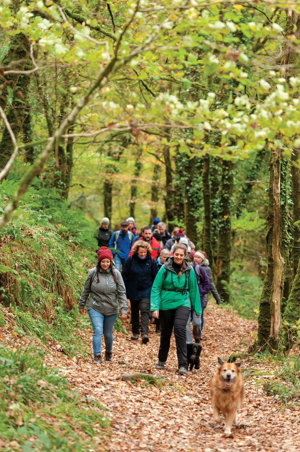
Multi-day walking is often associated with long, hard days in the hills, broken with wet and windy nights in the tent. But long-distance hikes don't need to be as arduous as this – one trick is to incorporate walkers' hostels into your journey.
Hostel walking is the practice of hiking from one hostel to the next, usually through rural areas. Affordable and comfortable, hostels soften the hardships of the path – the heavy camping gear, the uncomfortable packs and the need to cook your own food.

Instead, your steps can be slow and unencumbered, allowing you to focus solely on the joys of the trail – those gurgling streams, those deep green vales and those labyrinthine crags beneath the heights.
What are youth hostels?
Way back in the early 20th century, a German teacher called Richard Schirrmann, disgruntled at the lack of cheap places to stay on a school trip, introduced the idea of the youth hostel: inexpensive accommodation for young people. It took more than 20 years for the notion to reach the UK, at which point the Youth Hostels Association (YHA) was formed. Since its inception, the number of hostels has risen and fallen, and its standards shifted from the very basic to today’s modern and well-equipped inn. All the while, the YHA’s core values have remained “to inspire all, especially young people, to broaden their horizons, gaining knowledge and independence through new experiences of adventure and discovery”.

Today, these rural (and urban) refuges offer everything from food and bedding to toiletries, towels and private lodgings. Their rooms are often clad with old maps, sun-bleached paintings and shelves of muddled books, but they also possess something more ethereal, a sense of journeys passed and those to come.
Make the most of the YHA
There are more than 150 YHA hostels and 45 campsites in England and Wales, all affordable, comfortable and set within some of our most beautiful landscapes. A night in a single-gender dorm room starts at about £15 per adult per night, a four-bed private room is about £49 and camping from £5, though discounts for children, young adults, groups and winter stays apply. Regular hostel goers might consider becoming a YHA member (£15 per year), receiving 10% off every stay.

Hostel-walking kit list
Most hostels provide bedding, food, water, towels and toiletries, meaning you can reduce your pack weight to a comfortable level – aim for 10kg of less, including food and water.

Kit list
- Waterproof jacket and trousers
- Fleece
- Sun hat
- Sun cream
- Woolly hat
- Gloves
- Map, compass and waterproof map case
- First aid kit, including blister plasters
- Torch and spare batteries
- Mobile phone and charger
- Dry bag and warm change of clothes for the evening (including change of footwear)
- Water bladder/refillable water bottle(s) – two litres
- Pack lunch box (and lunch)
- Snacks – trail mix, cereal bars, fruit
- Small wash kit
- Money
- Whistle
- Survival bag
- Antibacterial hand wash
Extras
- Rubbish bag for collecting litter
- Trowel
- Loo roll in a waterproof bag
- Notebook and pencil
- Camera
- Gaiters
- Book
- Penknife
- Water purification tablets
- Walking poles
- Sunglasses
- GPS device
- Binoculars
- Glasses and case
- Travel towel
- Travel wash – for walks more than three or four days
Hostel-walking itineraries
Lake District loop
Three days / 38.7km (24 miles) / 1,597m ascent / moderate

A 40km hostel-to-hostel walk, first rising through Buttermere Valley and Honster Pass. The next day, head south-west across moors, tors and beside lonely tarns to one of the most remote hostels in the UK, Black Sail, before returning through the wild forests of Ennerdale Valley, up and over Whiteoak Moss and back to Buttermere. Route and map.
Itinerary
- Buttermere to Honister Hause – 11.9km/7.4 miles – 760m ascent
- Honister Hause to Black Sail – 5.3km/3.3 miles – 388.8m ascent
- Black Sail to Buttermere – 21.9km/13.6 miles – 418m ascent
- Ravenstor - Castleton Losehill Hall – 15.4km/9.5 miles – 429m ascent
Loch Lomond linear
Three days / 35.8km (22.2 miles) / 1,338m ascent / easy-moderate

This middle portion of the West Highland Way runs from Balmaha in the south to Inveranan in the north. The route is extremely well waymarked and includes a variety of places to stay, including glamping pods, a hostel, a bunkhouse and a hotel. Map
Itinerary
- Balmaha bunkhouse to Rowardennan Lodge Youth Hostel – 13.2km (8.2 miles) – 426m ascent
- Rowardennan Lodge Youth Hostel to Inversnaid Hotel – 11.3km (7 miles) – 523m ascent
- Inversanid Hotel to Beinglas Farm – 10.3 miles (6.4 miles) – 389m ascent
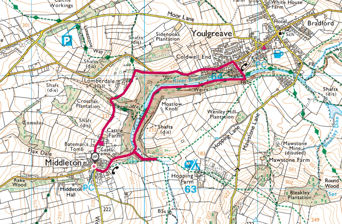
Peak District YHA loop
Four days / 49.3km (30.6 miles) / 1,261m ascent / moderate

Deep dales, rambling rivers and quaint villages define this moderate-level trek through north-west Derbyshire. The first two days are short and gentle, allowing you time to hone your fitness for the tougher second-half of the trip. Map
Itinerary
- Castleton Losehill Hall to Hathersage – 9.6km/6 miles – 160m ascent
- Hathersage to Eyam – 10.4km/6.5 miles – 258m ascent
- Eyam to Ravenstor – 13.85/8.6 miles – 418m ascent
- Ravenstor - Castleton Losehill Hall – 15.4km/9.5 miles – 429m ascent
Snowdonia YHA loop
Four days / 35km (22 miles) / 2,542m ascent / moderate-difficult
Walkers make their way up to the summit of Snowdon, Gwynedd ©Alamy
This Welsh ramble explores the Snowdon massif, from its lowland rivers and waterfalls to its highland peaks. The days vary in length, from 6–15km, and include some sections of tough mountain terrain. Map
Itinerary
- Llanberis to Snowdon Ranger – 6km/3.7 miles – 315m ascent
- Snowdon Ranger to Snowdon Bryn Gwynant – 14.7km/9.1 miles – 774m ascent
- Snowdon Bryn Gwynant to Pen y Pass – 6.2km/3.8 miles – 460m ascent
- Pen y Pass to Llanberis – 16km/9.9 miles – 993m ascent
Using OS
Whether you’re hiking or enjoying a leisurely family walk, OS Maps puts Great Britain’s most detailed leisure mapping at your fingertips.