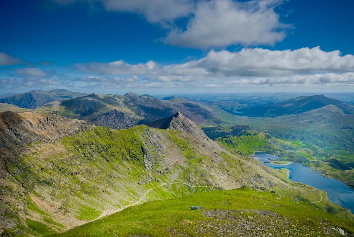
Yr Wyddfa (Snowdon) is the highest mountain in Wales and England. It is also one of the most visited landmarks in Eryri (Snowdonia), not only for its mountain status but so too for its spectacular views of Anglesey, the Llyn Peninsular and the neighbouring Eryri peaks.
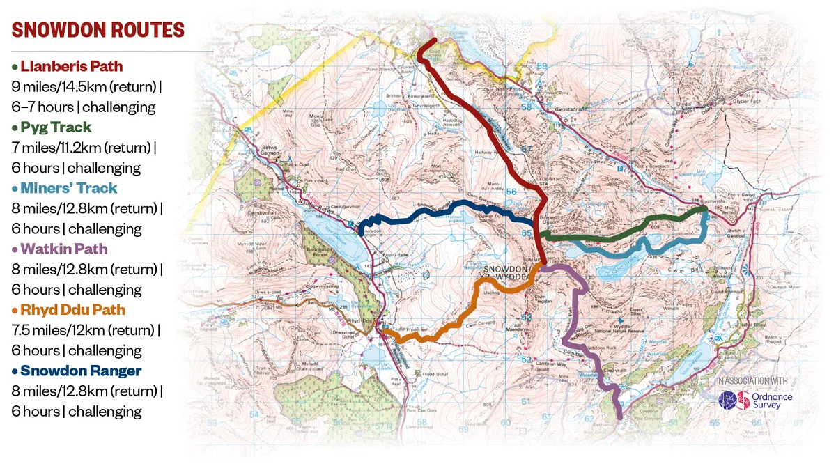
There are six paths that lead to the 1,085-metre summit of Yr Wyddfa, each with its own special character, from the gentle yet still arduous Llanberis Path to the more taxing and exciting Pyg Track, Miners’ Track, Watkin Path, Rhyd-Ddu Path and Snowdon Ranger Path.
In this guide, we take a closer look at what it takes to reach the top of Yr Wyddfa. What kind of weather might you encounter? Can beginners climb Yr Wyddfa? How long does it take and how difficult is it to climb? What should you take with you? And where are the best places to stay in the area?
Find out more about Eryri
Experience the landscapes, best walks and beautiful cosy villages of Snowdonia with our national park guide.
Where is Yr Wyddfa (Snowdon)?
Yr Wyddfa is a mountain in the north-west corner of Eryri (Snowdonia) National Park in north-west Wales. The peak is the highest summit in the Yr Wyddfa Massif, which also includes Y Lliwedd, Garnedd Ugain and Crib Goch.
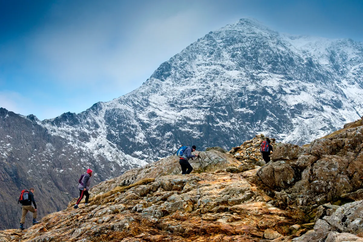
Yr Wyddfa (Snowdon) weather
Yr Wyddfa summers are generally cool and cloudy and the winters are cold, wet and windy, often with snow lying on the upper slopes of the mountain. Temperatures typically range from 1°C to 17°C, though they can fall below freezing or above 20°C.
An annual average rainfall of more than 5,100mm (200in) a year makes Yr Wyddfa one of the wettest places in Britain.
July to late August typically offer the fairest weather for walkers, though it is in these periods that the mountain receives its highest footfall, so don't expect to have the summit to yourself.
Yr Wyddfa (Snowdon) height
Yr Wyddfa has an elevation of 1,085 metres (3,560 ft) above sea level, making it the highest mountain in Wales and England. It is a few hundred metres shorter than Britain's highest mountain, Ben Nevis, which rises 1,345m above sea level.
More on mountains
From Yr Wyddfa in Wales and Ben Nevis in Scotland to the towering heights of the Lake District Fells, here is our guide to the UK's most amazing mountains, including a brief look at the history of British mountain climbing, facts and the best peaks to climb.
Yr Wyddfa (Snowdon) walking routes
There are six routes up Yr Wyddfa, varying in distance, duration and terrain. The most popular is the gradual – yet still tough – ascent on the Llanberis Path. For more of a mountain walking experience, try one of the other routes. All are served by Snowdon Sherpa buses.
Llanberis Path
9 miles/14.5km (return) | 6–7 hours | challenging
The gradual Llanberis Path is shared with cyclists and horses and follows the Mountain Railway.
Pyg Track
7 miles/11.2km (return) | 6 hours | challenging
The shortest route starts high at Pen-y-Pass but is rugged and scrambly along the foothills of Crib Goch.
Miners’ Track
8 miles/12.8km (return) | 6 hours | challenging
From Pen-y-pass, this track traverses the shores of Llyn Teyrn, Llyn Llydaw and Llyn Glaslyn then climbs steeply over loose scree.
Snowdon Ranger Path
8 miles/12.8km (return) | 6 hours | challenging
This less busy route from Llyn Cwellyn ascends the rounded slopes on the west of the mountain with a steep finish.
Rhyd Ddu Path
7.5 miles/12km (return) | 6 hours | challenging
Starting at Llyn y Gader the quietest route on the western side has a difficult section over Llechog Ridge.
Watkin Path
8 miles/12.8km (return) | 6 hours | challenging
Hands are needed on the steep loose section of the trickiest very steep path – for more experienced walkers. Starts at Bethania.
How long does it take to walk up Yr Wyddfa (Snowdon)?
Most of the routes up Yr Wyddfa take at least 6 hours to walk (return), but as always with mountain walking it is best to give yourself as much time as possible. The Llanberis Path take between 6–7 hours.
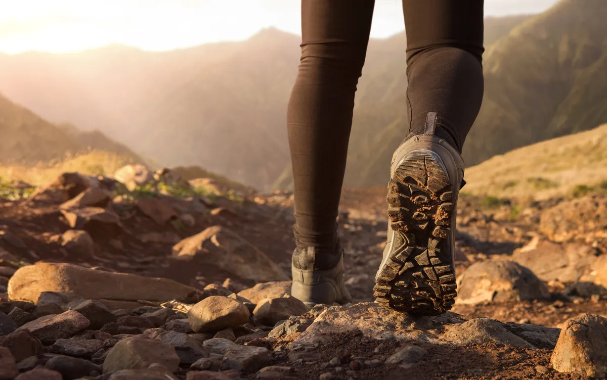
Yr Wyddfa (Snowdon) checklist
Walkers wishing to climb Yr Wyddfa should be well prepared. Here is a checklist of the things you will need:
· Hillwalking experience
· Good level of fitness
· Navigation skills
· Map and compass
· Warm, waterproof clothing
· Sun protection
· Water and food
· Torch and whistle
· Good walking boots
Places to stay near Yr Wyddfa (Snowdon)
One of the advantages of having so many different ascents to the summit of Yr Wyddfa is that you have six starting points to choose from – and this means plenty of options when it comes to accommodation.
YHA Pen y Pass offers affordable accommodation and food and is a great place to stay for anyone wishing to hike the Miners' Track or Pyg Track.
Additional places to stay can be found in Llanberis (Llanberis Path), Rhyd Ddu (Rhyd Ddu Path and Snowdon Ranger Path) and Beddgelert (Watkin Path).
Yr Wyddfa (Snowdon) map