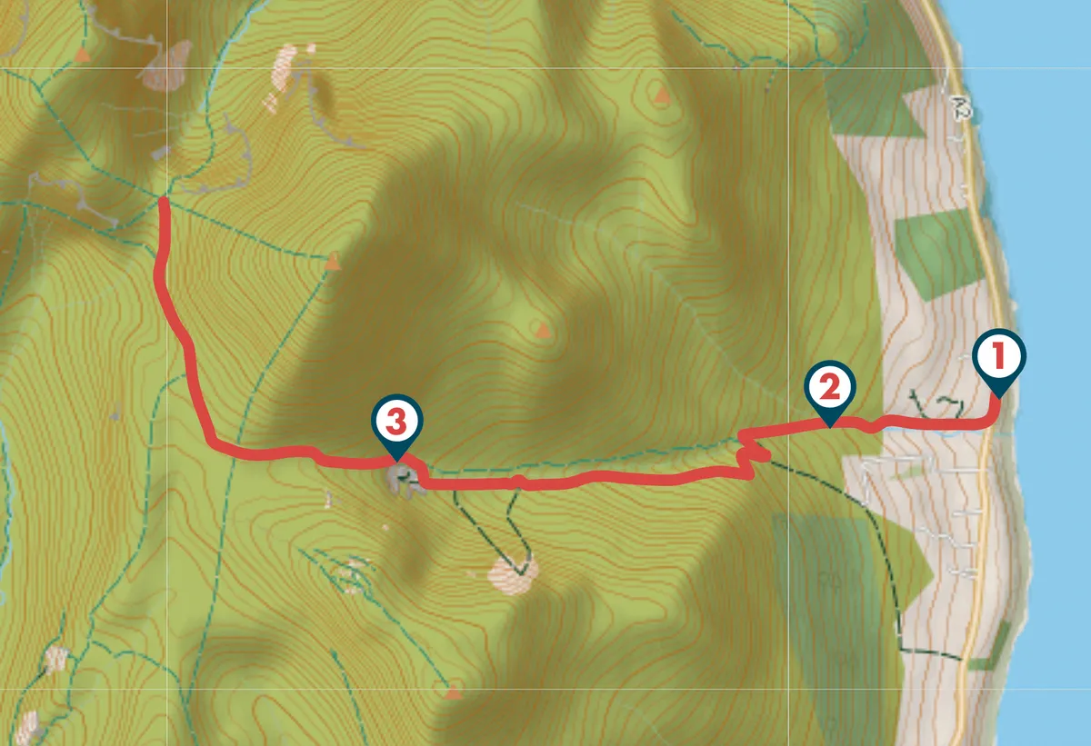
This 6.2-mile return walk begins at Bloody Bridge car park, 3 miles south of the attractive seaside town of Newcastle. The location was immortalised by Percy French, whose song The Mountains of Mourne refers to “where the mountains of Mourne sweep down to the sea”.
For those looking for a slightly shorter route, Crannage Quarry makes a good turn-around point (4 miles return), but if you have the energy it’s worth continuing on to the col beneath Slieve Donnard for spectacular views of the Annalong Valley.
Bloody Bridge River walk
6.2 miles/10km | 4 hours | moderate-challenging
1. Smugglers route
Leave the car park – which has public toilets – from its southern exit and cross the road. Go through the pedestrian gate and narrow squeeze stile and follow the track down the hill, before starting to climb.
The track is the start of a route used in the 18th century by smugglers who brought brandy, wine, spices, tobacco and other contraband to the Mourne coast from the Isle of Man. So skilled were the smugglers that, by 1835, half of the houses in nearby Hilltown were pubs.
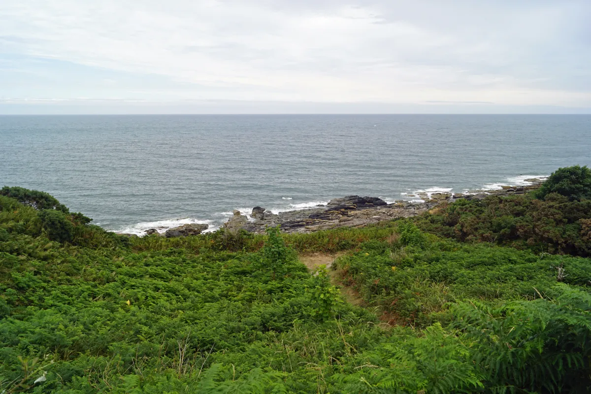
If you look back, you can see Bloody Bridge, originally a ford and the site of a notorious massacre during the 1641 rebellion by Catholic noblemen.
A group of Protestants were being taken by their Catholic captors for exchange in Downpatrick. However, when their captors learned that the Downpatrick prisoners had been killed, the unfortunate Protestant men were “hacked, slashed and cut to pieces” by the Irish commander George Russell. The bodies of nine Protestants and their minister were thrown over the bridge and their blood turned the river water red, giving it the name Bloody Bridge River. These days, a beautiful view of Dundrum Bay and the surrounding County Down countryside is a welcome antidote to this gruesome tale.
2. Mountain life
The path continues to climb the lower slopes of the mountain. Enjoy the sight of the heathers, which form a luxurious, springy carpet around you. Wet springs and flushes are home to rare invertebrates, such as the keeled skimmer dragonfly, and the area is also a haven for several butterfly species, such as the green hairstreak and the dark green fritillary, as well as peregrine falcons, red grouse, ravens, and Irish hares.
Follow the path over the river – take care – and continue west until you reach a stile, marking the end of the National Trust part of the trail.
At a point slightly lower down, cross the river and join a rough quarry track that lies to the left. Continue to climb. Just over a mile of steady ascent brings you to an old, spectacular former quarry.
3. Quarry to col
Leave the quarry on a grassy track to the right and climb a broad col. Eventually you will come across the Mourne Wall with magical views westwards towards the Annalong Valley. Absorb the scene then follow your footsteps back to the car park.
Bloody Bridge map
Words: Margaret Canning

