The county of Somerset in south-west England is a varied landscape of towering coastal cliffs, crashing waterfalls and high moorland, among which lies a fine selection of villages and towns.
It's a historic landscape, too, where ancient ruins, fabled castles and breathtaking country houses can be found in their hundreds.
Discover this diverse landscape with our guide to the best walks in the Somerset.
Looking for more walks nearby? Check out our pick of the best walking routes in Cornwall, Devon and Dorset.
Somerset walks
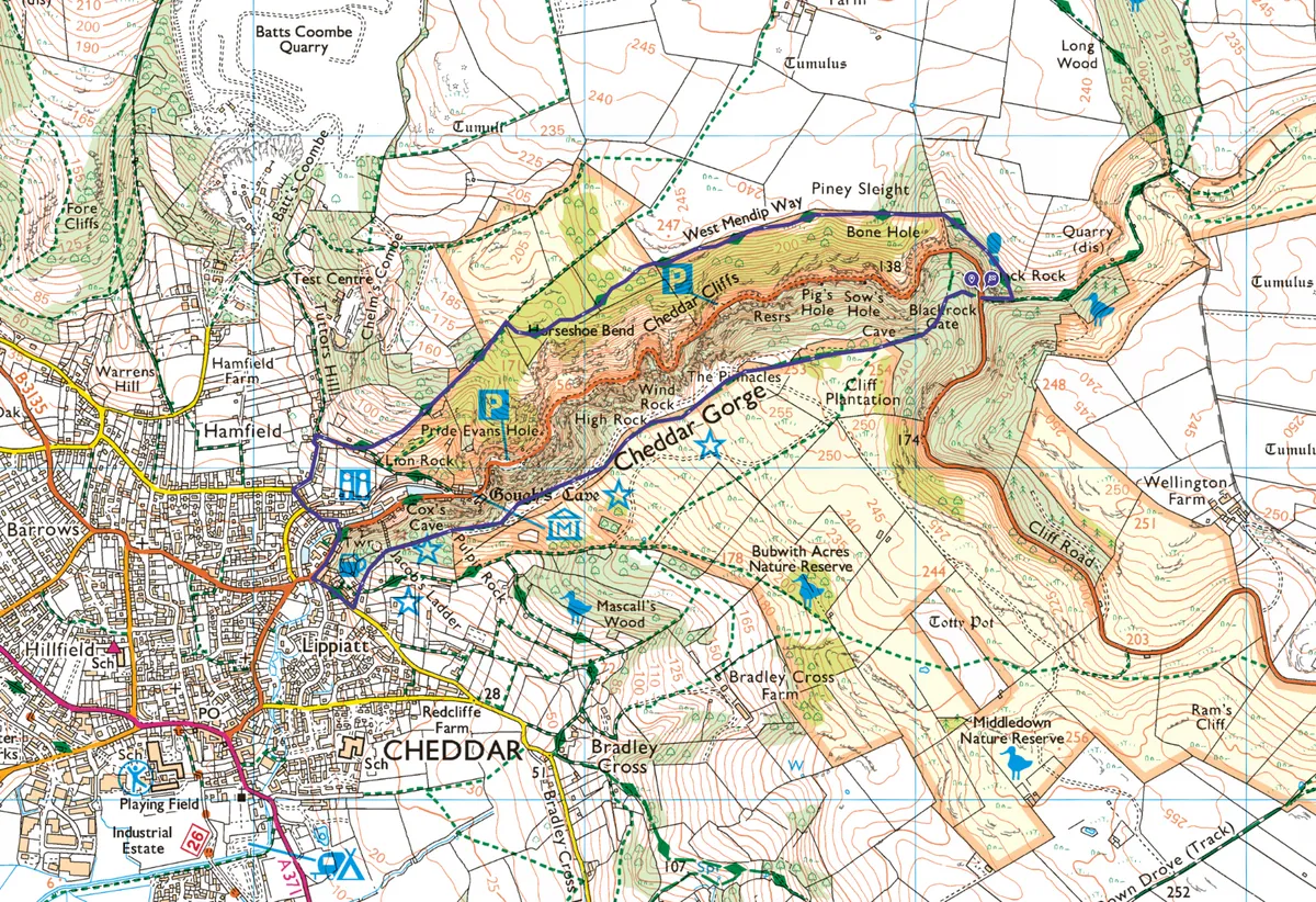
Cheddar Gorge
3.5 miles/5.6km | 2 hours | moderate
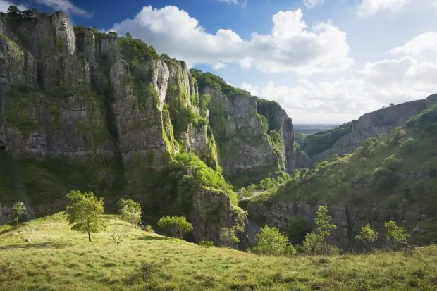
Stunning show caves, rare plantlife and a street of tempting sweet shops and ice cream parlours make this 3.5-mile walk through Britain’s largest gorge irresistible.
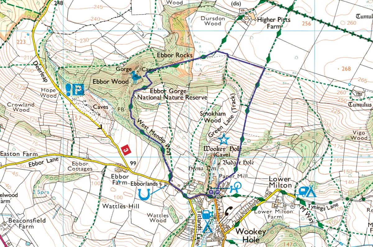
Ebbor Gorge
2.3 miles/3.7km | 1.5 hours | moderate
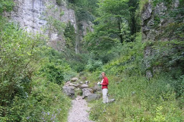
Just down the road from Cheddar Gorge is a quiet yet equally impressive wooded valley, Ebbor Gorge. Starting at Wookey Hole, this route climbs high above the Somerset Levels before dropping through the gorge's lush woodland.
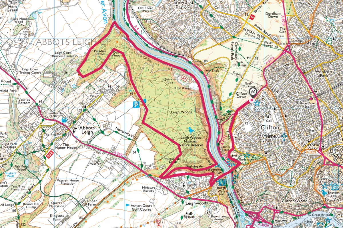
Leigh Woods
8 miles/12.8km | 5 hours | moderate

Visit several iconic Bristol sights – Clifton Suspension Bridge, the Camera Obscura, Leigh Woods and Avon Gorge – on this 8-mile circular walk.
Dunkery Beacon
8 miles/12.8km | 5.5 hours | moderate
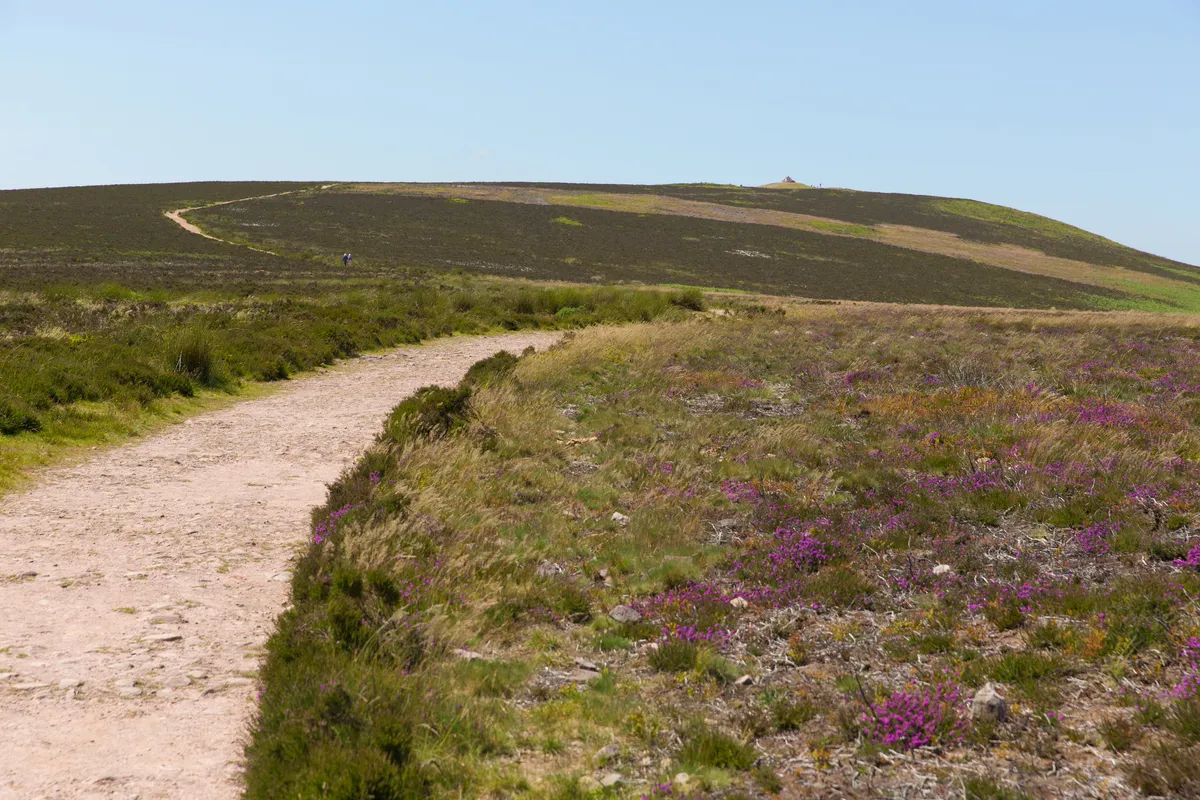
Conquer Somerset’s highest peak for far-reaching vistas and the chance to spot a breed of ponies that has grazed these hills for millennia.
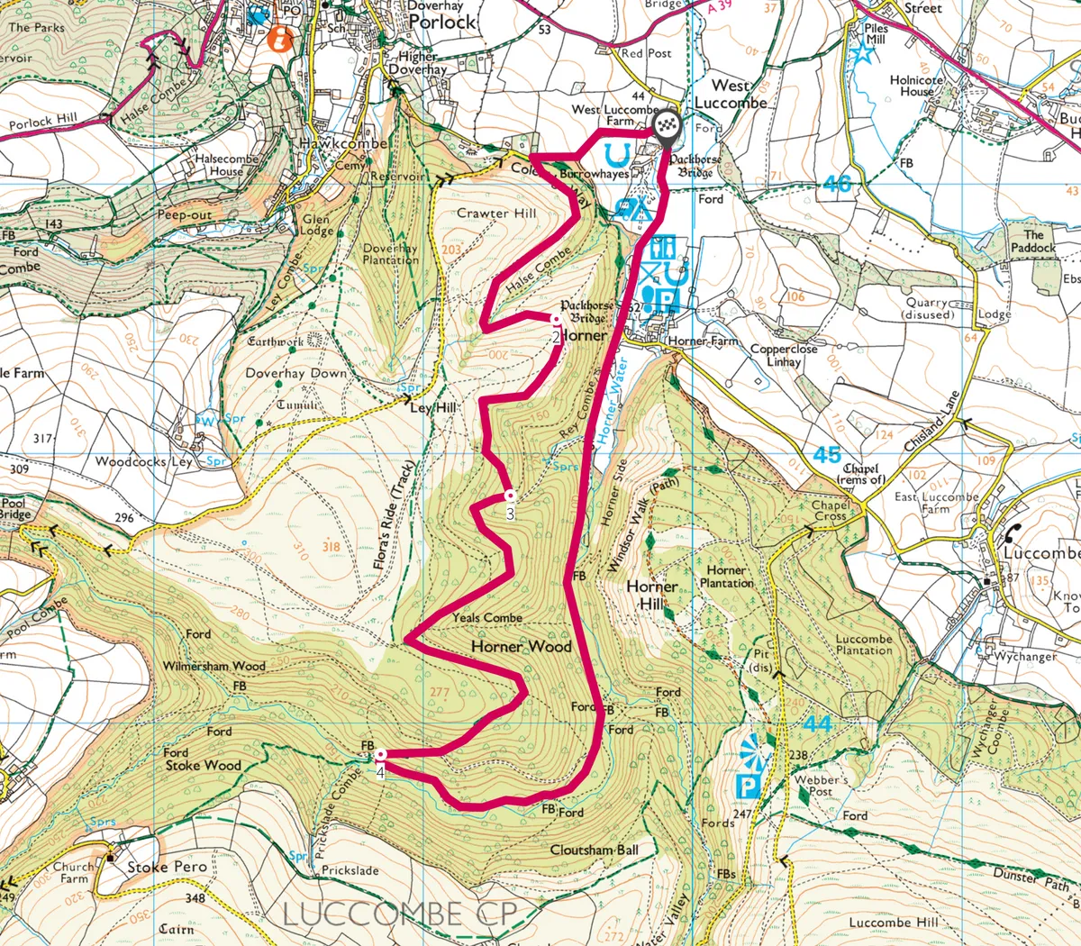
Horner Valley
3.9 miles / 6.4km | 2.5 hours | easy-moderate
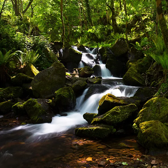
The Horner Valley and its surroundings, including the Vale of Porlock and Exmoor’s highest point Dunkery Beacon, lies within the National Trust’s Holnicote Estate. This wonderful 3.9-mile bridle trail explores the estate's ancient oak woodlands – the perfect walk for wildlife-spotting.
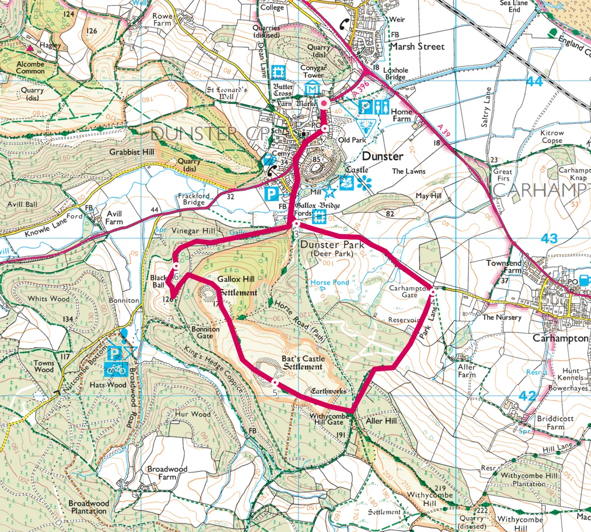
Dunster
3.9 miles / 6.4km | 2.5 hours | easy-moderate
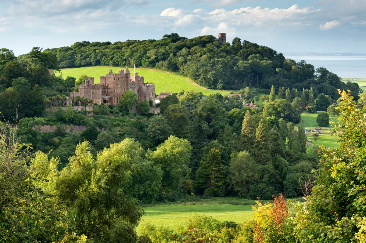
High on a hill in north-east Exmoor, medieval Dunster Castle looks down upon historic Dunster and its bustling gift shops. It’s a magical scene best enjoyed after a circular walk through the surrounding countryside.
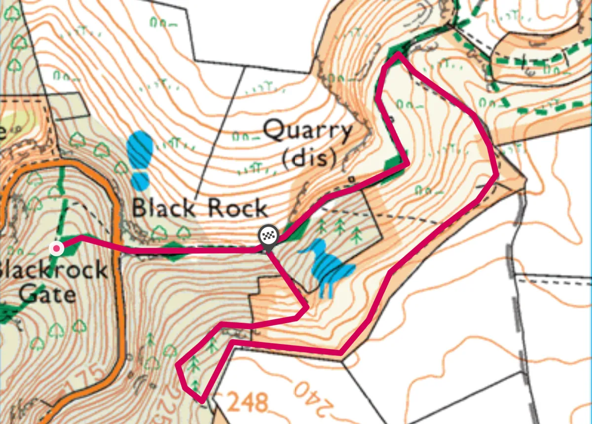
Black Rock Nature Reserve
1.4 miles/2.3km | 1 hour | easy–moderate
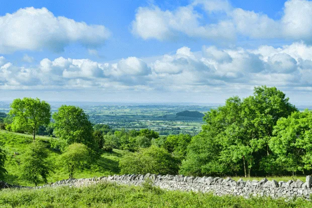
Explore the verdant slopes and rocky outcrops of Black Rock Nature Reserve in Cheddar Gorge, experiencing its unique plantlife, wildlife and geological offerings.
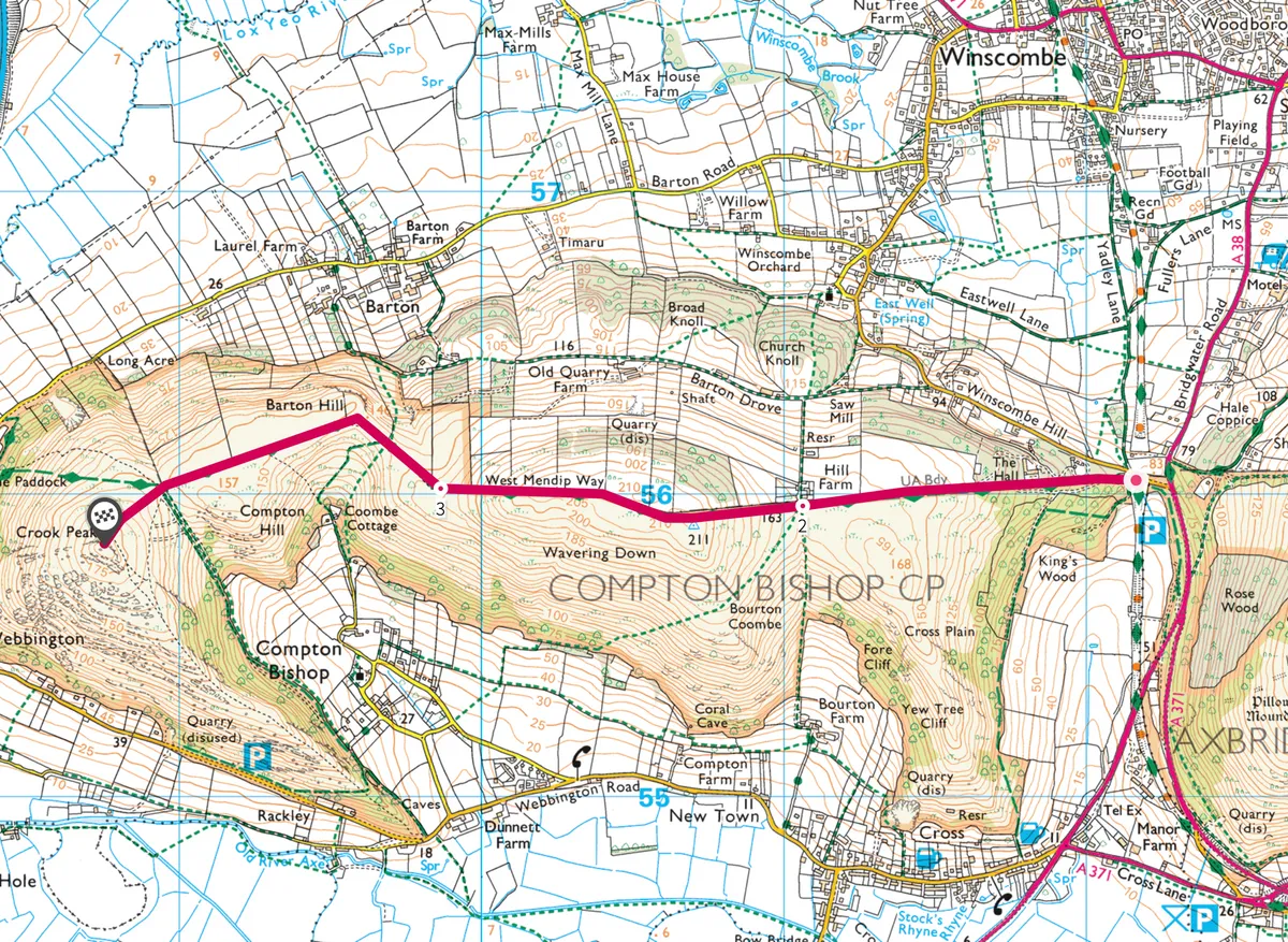
Crook Peak
4.5 miles/7.2km | 3 hours | moderate
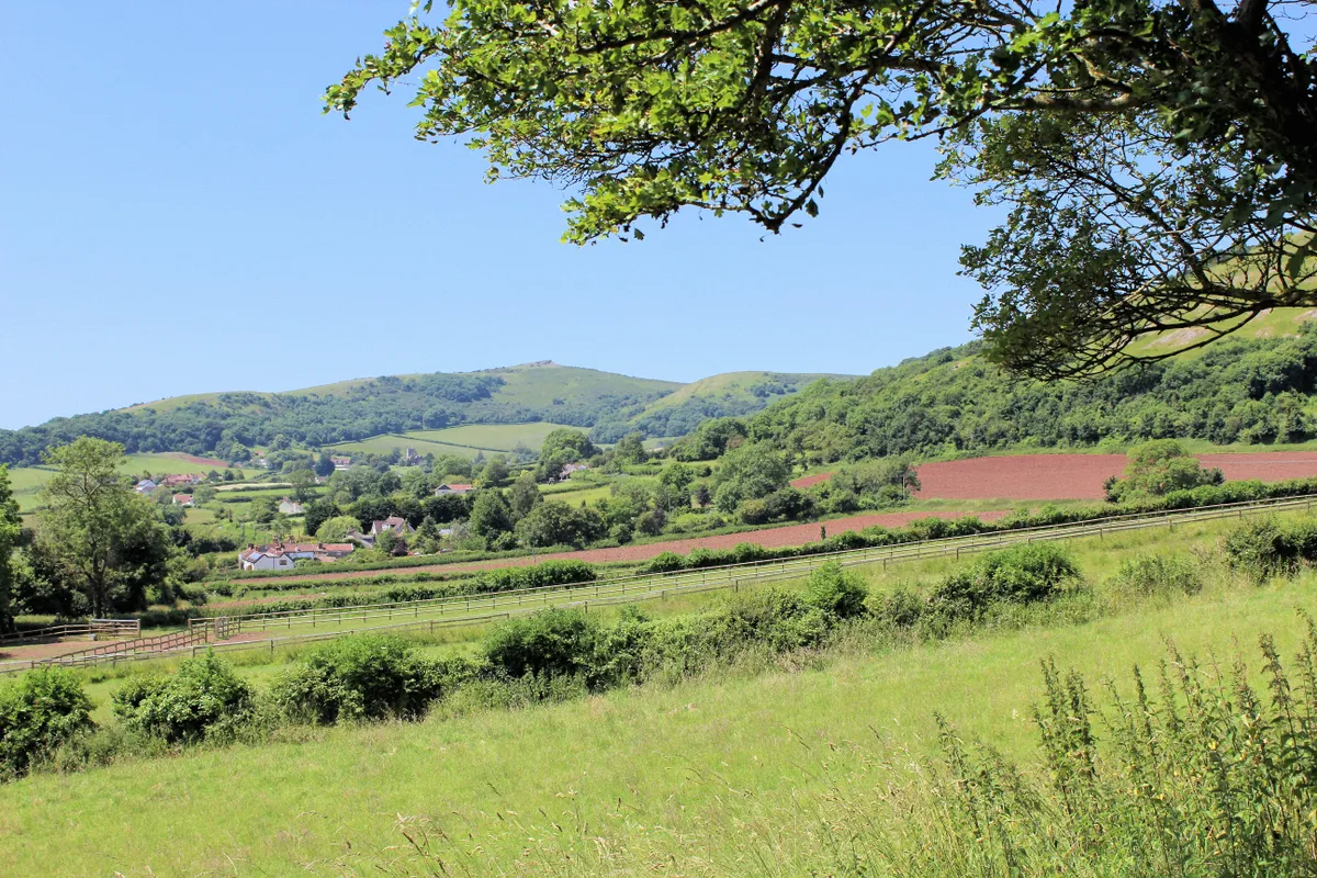
Take a high-ridge ramble along the stunning western edge of the Mendip hills to Somerset’s shapeliest summit.
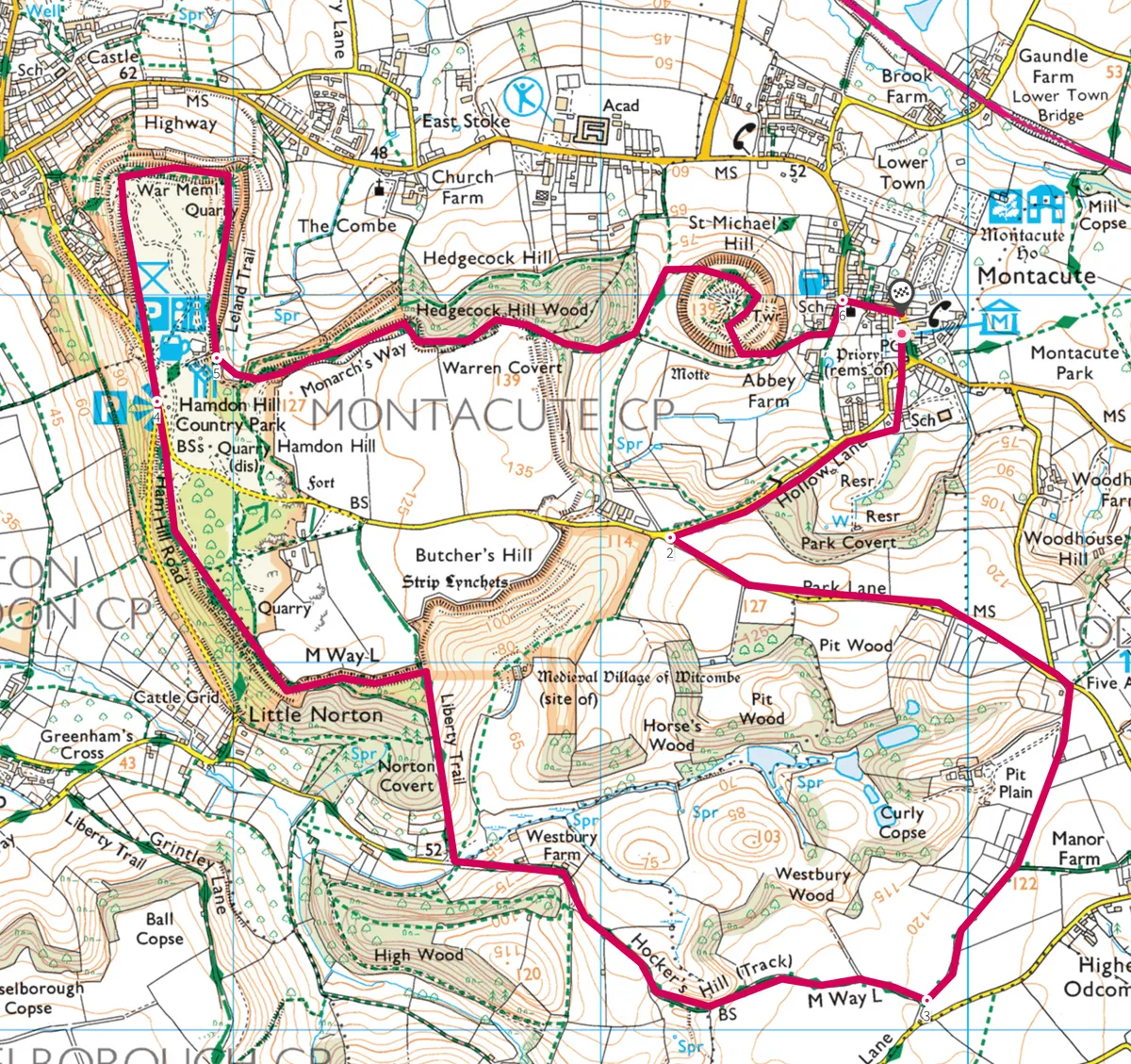
Montacute House
6.3 miles/10.2km | 4 hours | moderate
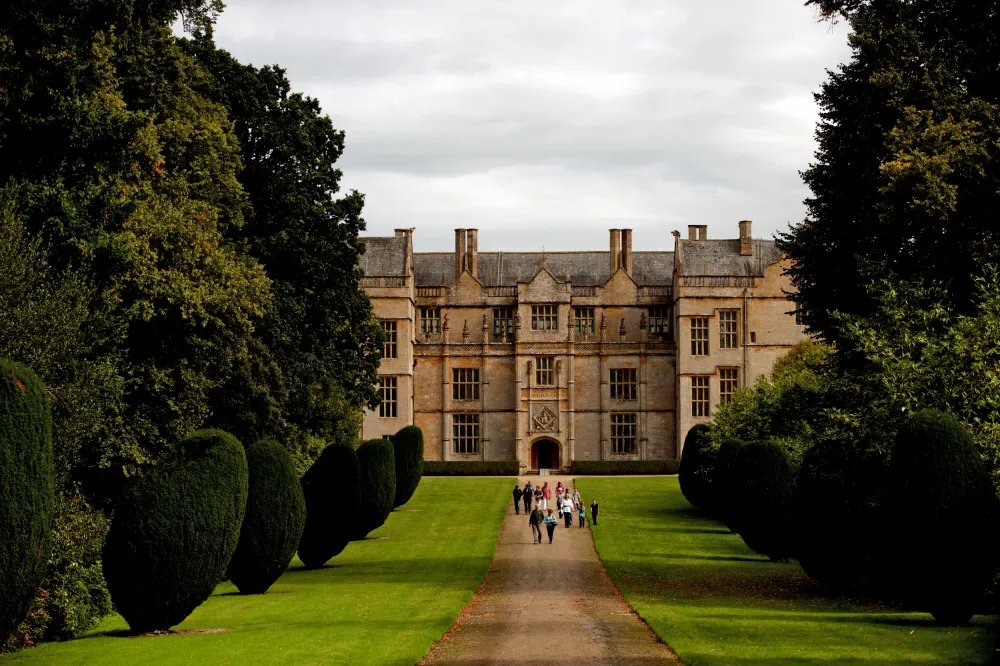
The towering walls, glorious gables, Tudor artwork and fragrant gardens of Montacute House provide the perfect starting point for a 6-mile walk through south Somerset’s ancient countryside.
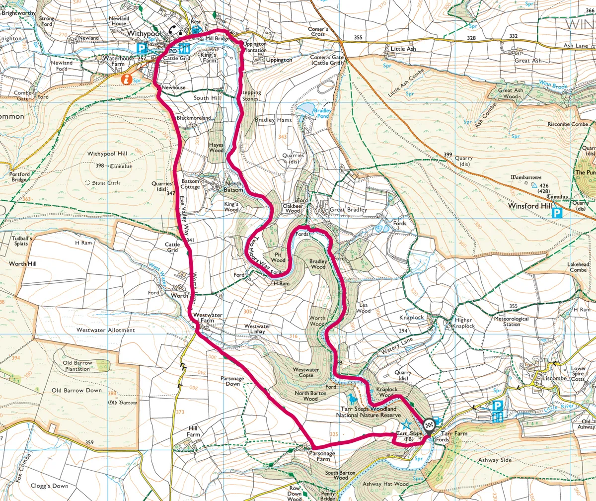
Tarr Steps
7.3 miles / 11.7km | 4 hours | moderate
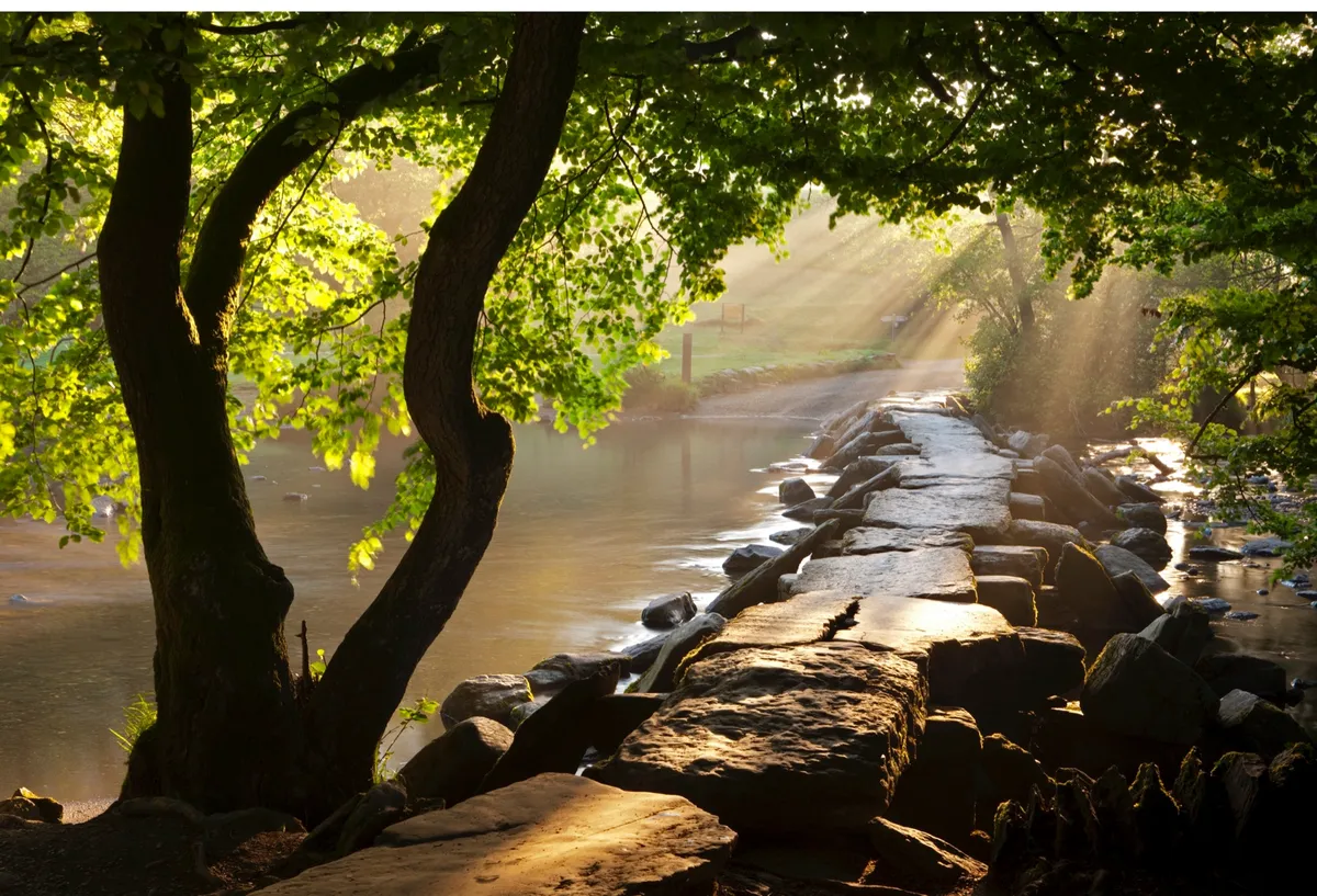
Tarr Steps is one of Exmoor’s true hidden treasures and a firm favourite with visitors – once you’ve discovered it you’ll find yourself drawn back time and time. This gentle 7-mile ramble meanders alongside the river before looping through Withypool and climbing for gorgeous views over Exmoor.
Porlock Bay
10.3 miles/16km | 6 hours | moderate-challenging
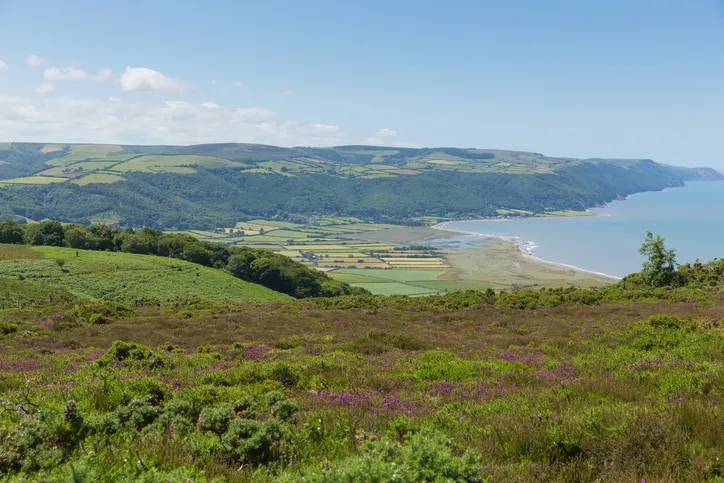
Enjoy a 9-mile coastal walk along the pebbled storm berms, coastal cliffs and saltmarshes of Porlock Bay in Exmoor National Park.

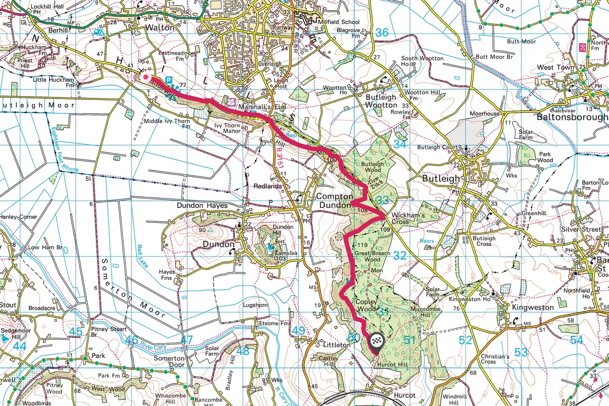
Polden Hills
11.2 miles / 14km (return) | 6 hours | moderate
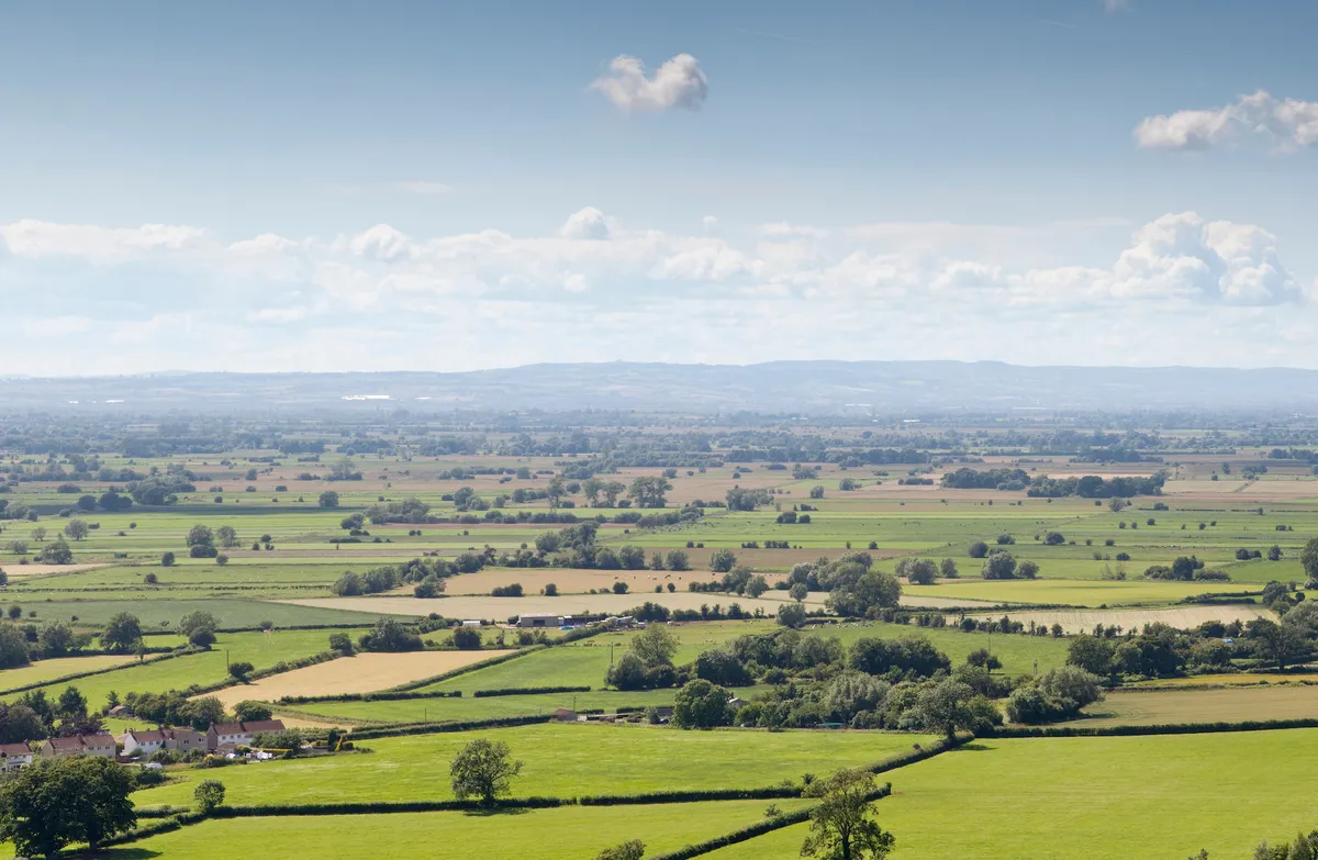
Between the Mendip and Quantock Hills, the Somerset countryside is famously flat. But, running parallel with these well-walked ranges is a lesser-known ridge quietly crossing the otherwise-level landscape. Enjoy this 12-mile hike along the hills' main ridge through beautiful woodland and grassland.
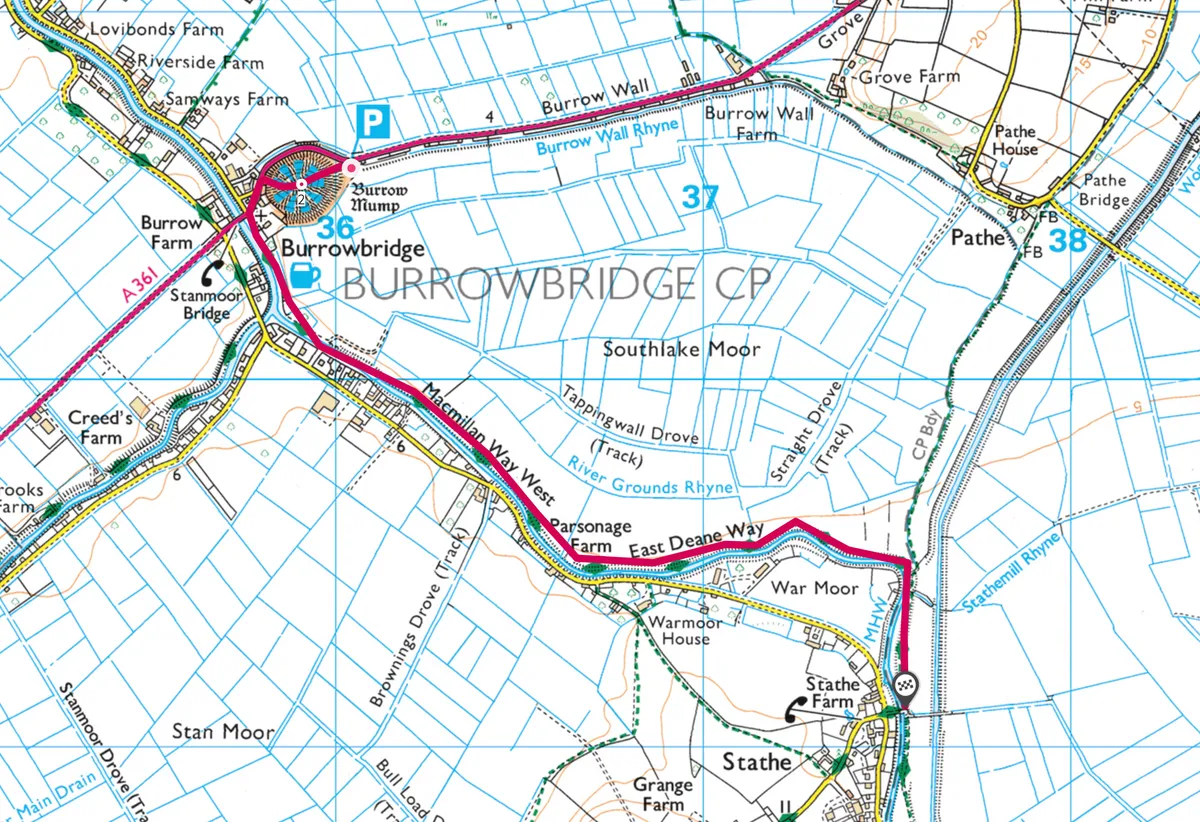
Burrow Mump
4 miles/6km | 2.5 hours | moderate
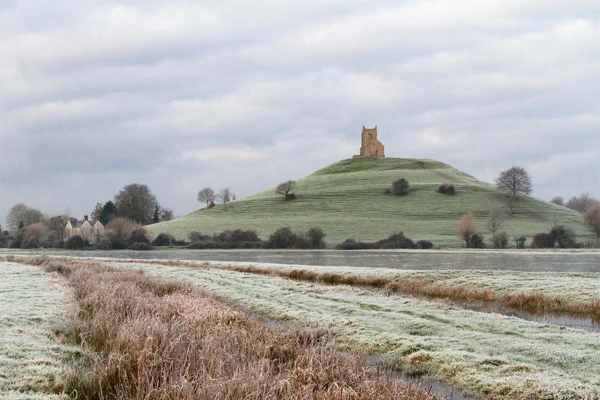
Rising from the expansive wetlands, Burrow Mump not only takes you by surprise – it transports you back in time. This 4-mile walk leads you to the summit of Burrow Mump and along the River Parrot to Stathe.