Britain is well known for its picturesque countryside and rural walking trails, meaning we often overlook our towns and cities when it comes to choosing a walking route. But if you know where to go, our urban areas offer numerous opportunities when it comes to footpaths, which are often easy to access and close to your home.
Restrictions surrounding the coronavirus pandemic have made town and city walks even more important, offering residents a chance to be among nature. Often passing through local parks, gardens, churchyards and nature reserves, urban walks offer us a chance to experience urban wildlife, as well as get a taste of the history of the town or city.
We've picked some of the very best city walks in the UK, some remaining within city limits and others starting in cites before striding out into the countryside. Each walk includes route directions and a map.
UK's best walks in towns and cities
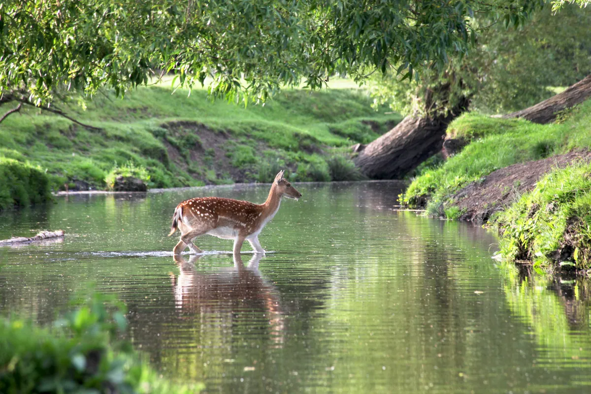
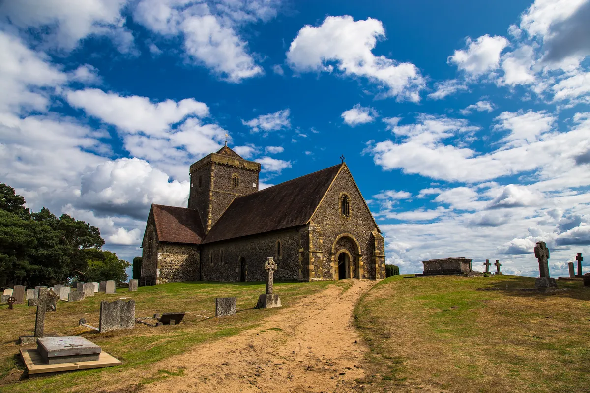
Kew Gardens and Richmond Park, London
7.8 miles/12.6km | 4.5 hours | moderate

Beginning at Mortlake, itself noted in the Doomsday Book, this is a walk through the pages of history. Taking in fascinating Kew Palace, majestic Richmond Park and a veritable procession of kings and queens, if you can ignore the constant Heathrow traffic, you might almost expect to hear a royal hunting party galloping by.
Kew Gardens and Richmond Park walking route and map
Jesmond Dene, Newcastle
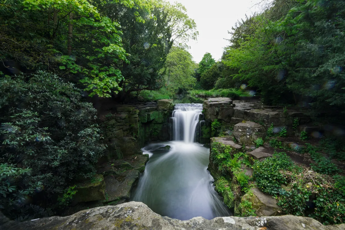
Tumbling down from the north of Newcastle, the Ouseburn river rises most magnificently as it passes through Jesmond Dene on its six-mile journey from Callerton to the city centre.
The Ouseburn is a glacial stream that cut south to the Tyne as the last ice age melted away (‘dene’ is a regional term for a ravine). Here, there is an astonishingly rural, peaceful rhythm for somewhere so close to the city. Microclimates sprout up here and there; dense, mature rhododendrons and rhubarb-like gunnera transform damp groves into an experience of walking through a gloomy jungle. Meanwhile, mosses and ferns take advantage of every crack and cranny.
Jesmond Dene walking route and map
Cathedral Square and The Necropolis, Glasgow

Glasgow’s Cathedral Square packs a lot into its compact boundaries; magnificent buildings, a fascinating history, 3,500 tombs and plenty of unexpected wildlife. Cathedral Square dates back to the seventh century when St Mungo, Glasgow’s patron saint, established a church here.
Overlooking Cathedral Square is The Necropolis, the second-largest greenspace in the centre of Glasgow. The Merchants of Glasgow developed this hilltop location in 1831 as Glasgow’s version of Paris’s Père Lachaise Cemetery. Since then over 50,000 people have been buried here.
This peaceful place is home to roe deer, finches, kestrels, sparrowhawks and many species of butterfly. It holds some of the finest views across Glasgow and is a great spot to retreat from the city’s hustle and bustle, especially with a picnic.
Cathedral Square and The Necropolis
Ecclesall Woods, Sheffield
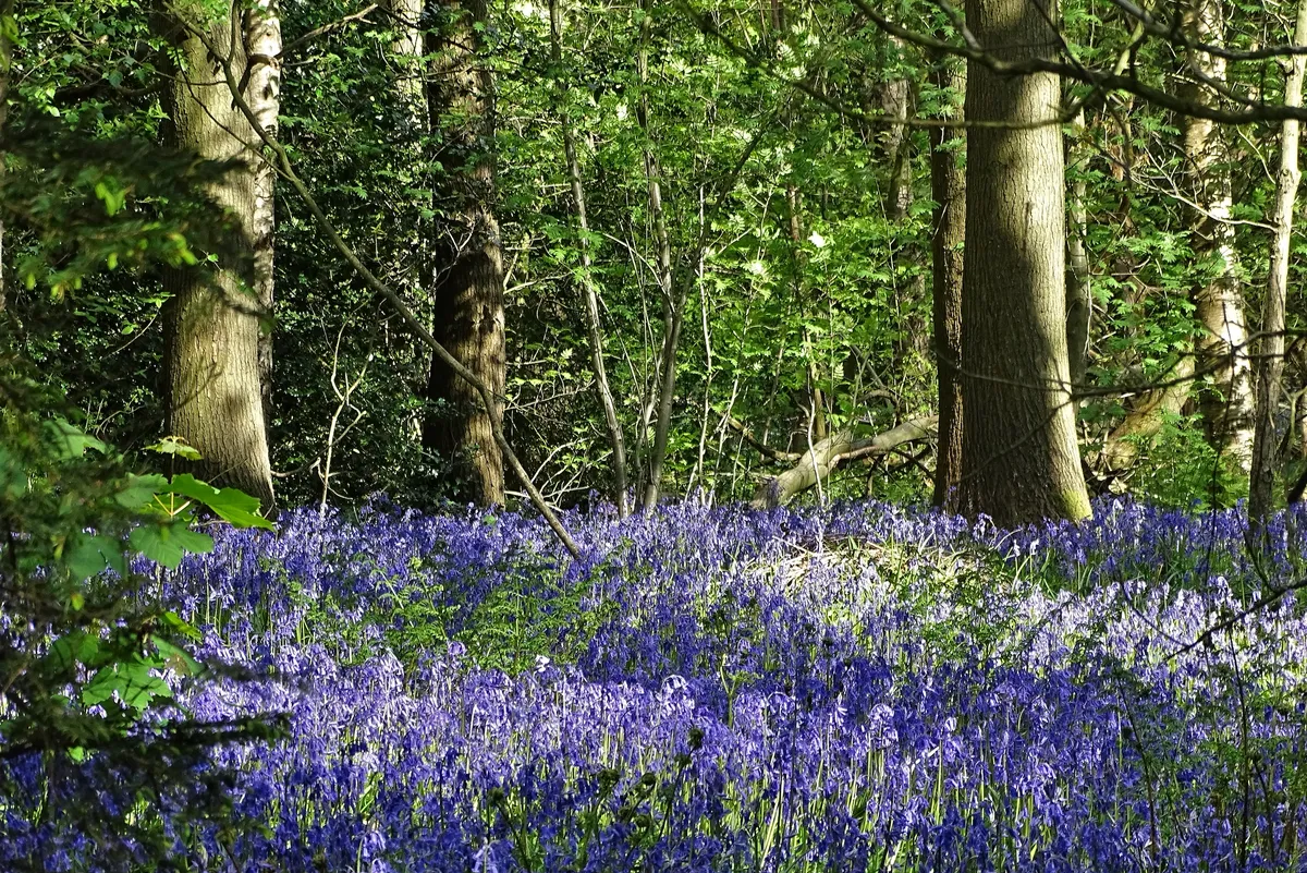
Set within the southern limits of Sheffield, not far from the border of the Peak District National Park, is an arboreal oasis known as Ecclesall Woods. Comprised mostly of oak – as well as naturally occurring alder, rowan, elm, field maple, hawthorn and hazel – these woods are considered ancient, having existed since before 1600.
Since the 1920s, when the woods became publicly owned, Ecclesall has been an important refuge for Sheffield residents, offering the chance to escape the humdrum of the city and to connect with nature. In spring, bluebells cover the woodland floor, songbirds fill the canopies and newts and frogs can be found in the ponds. A staggering 421 flowering plants have been recorded in the woods, along with 171 fungi species.
Friends of Ecclesall Woods have created three walks of varying lengths, ranging from 30 minutes to two hours. Each route starts and ends at the Woodland Discovery Centre, where events are held throughout the year.
Ecclesall Woods walking routes and map
Lincoln Cathedral and Arboretum, Lincoln

Enjoy a walk in the park on Lincoln's south-facing slopes, with impressive views and a touch of Victorian splendour.
Lincoln Arboretum was originally designed between 1870 and 1872 by the celebrated Victorian gardener Edward Milner. Today, it is Grade II-listed, with its beautiful gardens, lakes and bridges, children’s maze, two fountain features, Victorian bandstand and tea room/café.
When built, Lincoln's gothic cathedral was the highest building in medieval Europe and is now the seat of the bishop of Lincoln.
Lincoln Cathedral and Arboretum walking route and map
Thanet coast, Ramsgate to Margate

Ramsgate is, literally, the gateway to Thanet, the outcrop of upper chalk where the North Downs finally meet the North Sea.
It has slightly fewer rams roaming the streets than yesteryear and is now dominated by its 19th-century architecture (check out the Granville Hotel, St Augustine’s Church and others by Pugin) and its continuing fishing industry. You can walk between Ramsgate and its maritime neighbour, Margate, where art and seaside snacks await.
Ramsgate to margate walking route and map
Sutton Park, Birmingham
1.7 miles/2.7km | 1 hour | easy

Sutton Park is a miraculous survival – 2,400 acres of wild country in the northern limits of the UK’s Second City, Birmingham – and spring is a lovely time to explore it.
The ancient oak and birch woodlands are alive with the song of nesting birds, and in the vast holly understory, one of the park’s great specialities, the delicate little azure-winged holly blue butterfly, takes to the wing. On the largest of the seven lakes, great crested grebes, goldeneyes and tufted ducks are setting up home, and on the extensive areas of heather heathland that make up about half the park, small heath and meadow brown butterflies are also emerging from their winter chrysalises.
Sutton Park walking route and map
Leigh Woods, Bristol
8 miles/12.8km | 5 hours | moderate
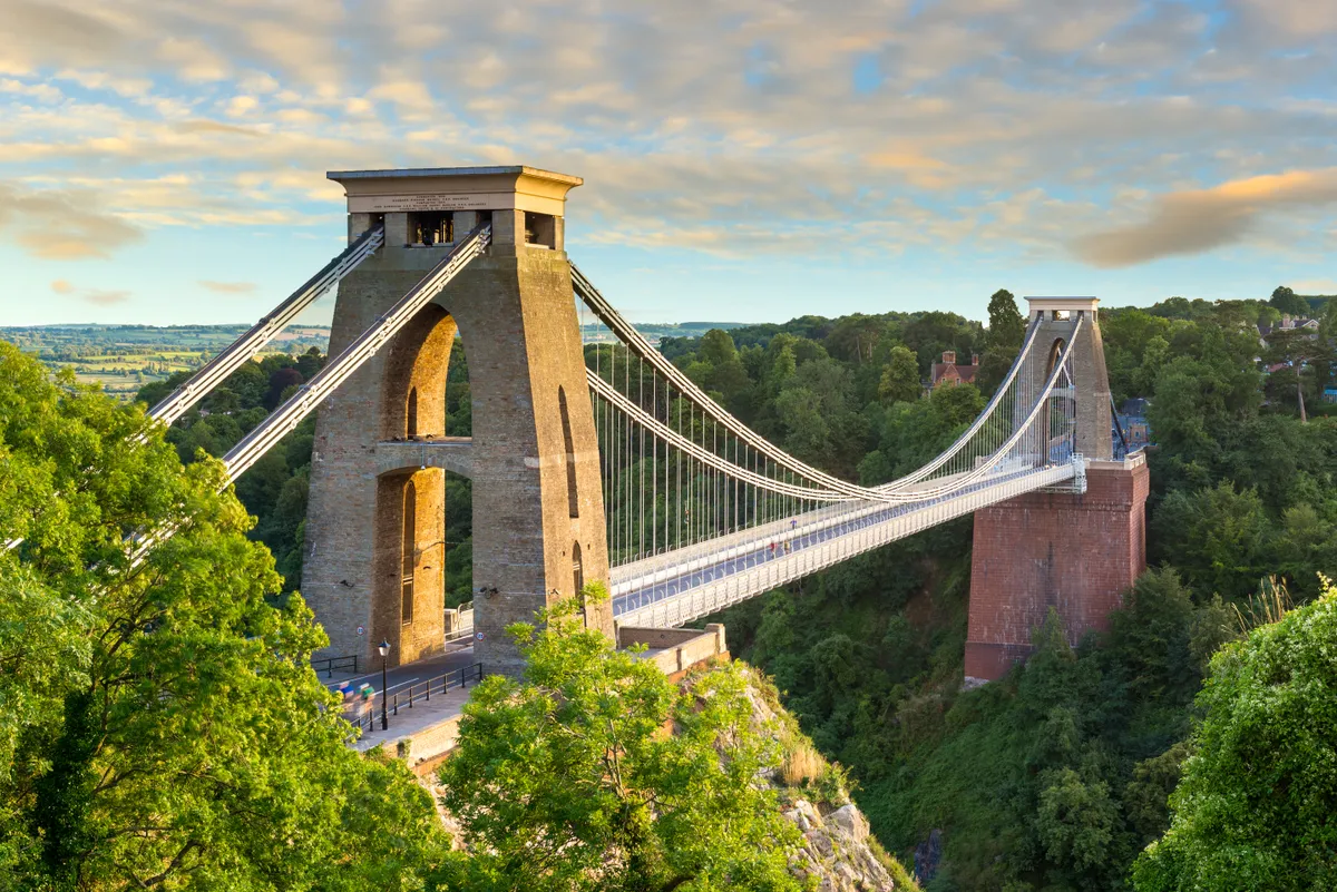
These woods were once part of Bristol's Ashton Court and signs of the pomp and splendour of this grand estate still remain in gnarled, ancient and veteran oaks, limes and yews. These trees also provide a home for fungi, with more than 300 species growing in the woods, including edibles, such as beefsteak and oyster mushrooms. The nooks, crannies, hollows and deadwood created by fungi on these venerable old trees provide valuable niches for wildlife, including birds, bats and invertebrates.
Visit Leigh Woods on a circular walk from Bristol's historic quarter, Clifton, with views of the stunning Avon Gorge and Clifton Suspension Bridge.
Leigh Woods walking route and map
Centenary Walk, Cardiff
2.3 miles/3.6km | 1.5 hours | easy
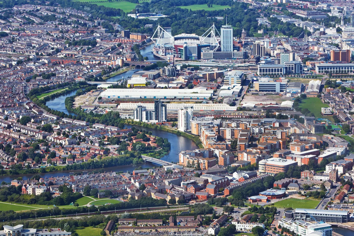
Cardiff's Centenary Walk includes some of the capital city's most celebrated and historic landmarks. For both tourists and local residents, this short loop walk through the city will reveal some of Cardiff's best-kept secrets, as well as some of the more obvious must-see sights.
The route has been designed to be accessible for both wheelchair and pushchair users.
Portobello, Edinburgh
2.7 miles/4.3km | 1.5 hours | easy
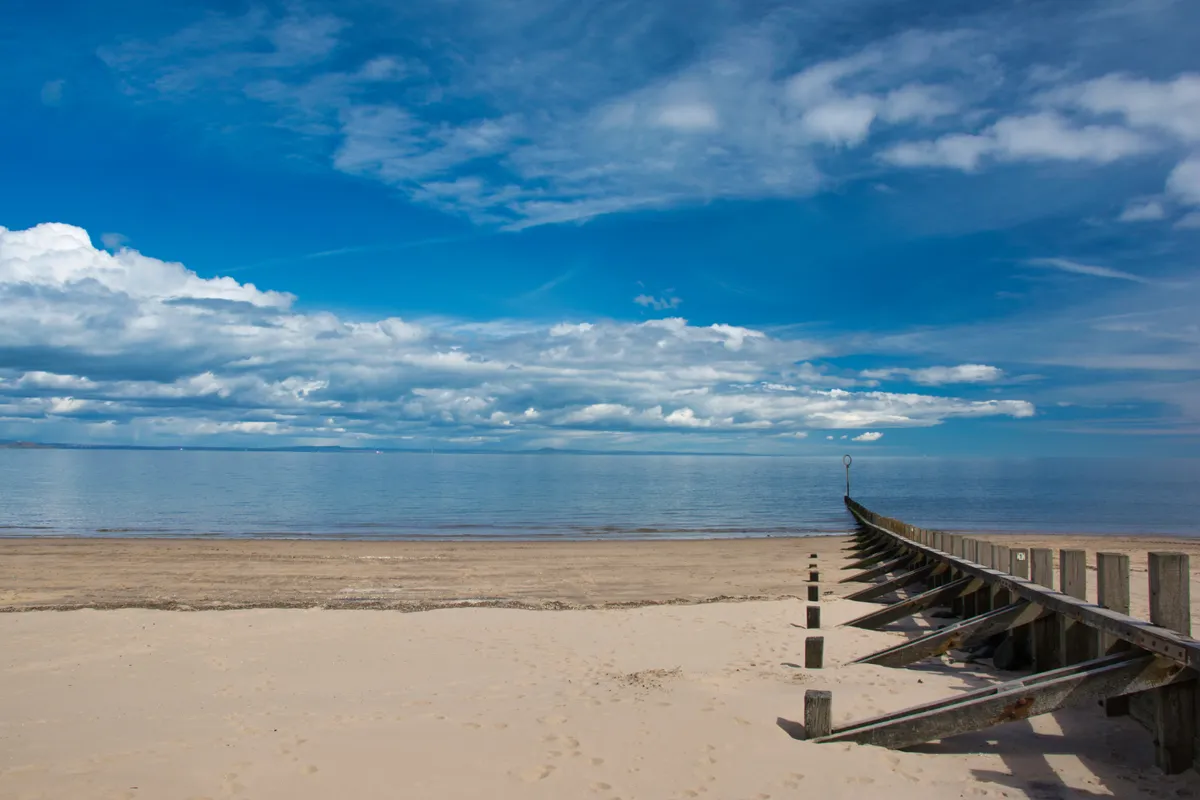
Sitting on the outskirts of Edinburgh, Portobello’s beautiful beach is the focal point of a short, simple walk around this vibrant town.
Having been a popular haunt for many centuries with seamen and smugglers, Portobello reinvented itself in the early 1800s as a fashionable spa town, after a number of mineral wells were discovered. This led to the town becoming the preferred location of Edinburgh’s wealthy middle classes, who spent their weekends and holidays here, taking advantage of the beautiful beach, relaxing spas and water baths.
Portobello continued to grow in reputation with the arrival of the railway and, although only 3½ miles from Edinburgh’s centre, Portobello was (and still is) a million miles from the busy, compact streets of Scotland’s capital. Several elegant Georgian streets and crescents were built (Portobello has since been designated an outstanding conservation area) when visitors realised that it was an attractive and healthy place to live all year round.
Portobello walking route and map
Walks from towns and cities
Mount Edgecumbe and Rame Head, Plymouth
6.8 miles (one way) | 4 hours | moderate
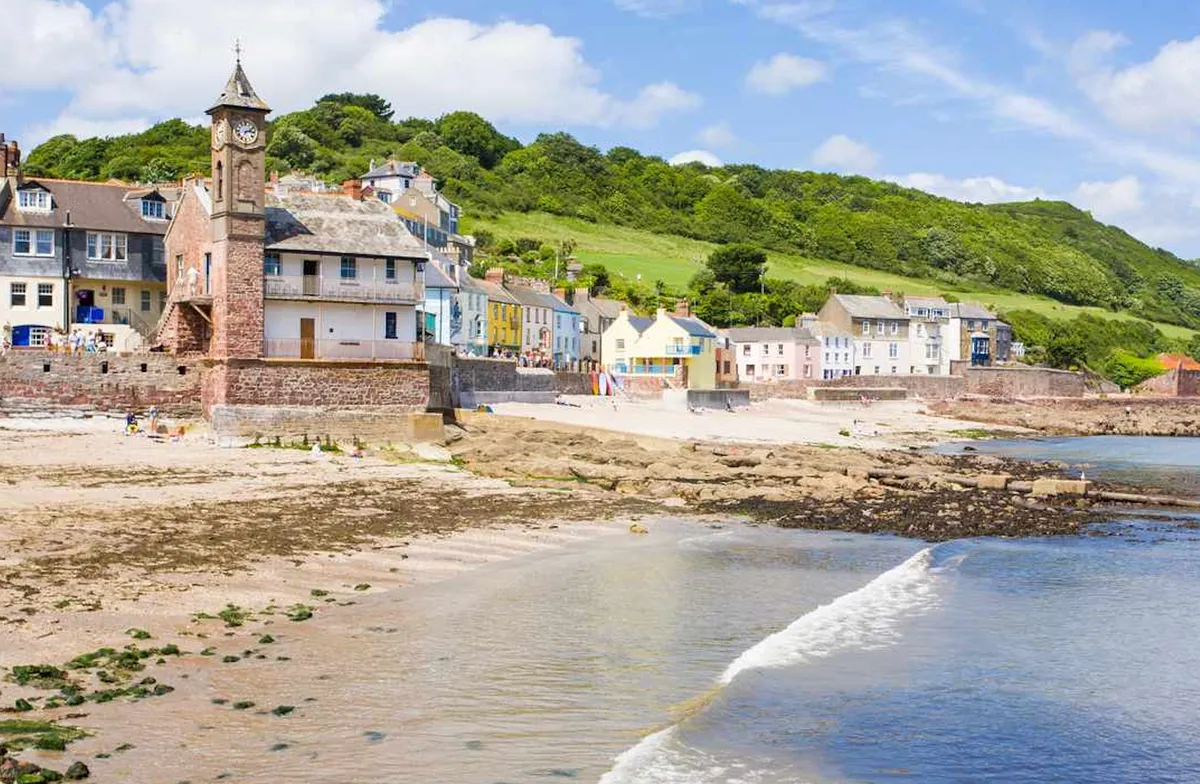
This stunning section of the South West Coast Path leaves Plymouth for the wilds of Rame Peninsula AONB. Stroll through woodlands budding with wildflowers and along sandy bays to historic Kingsand and Cawsand, before reaching spectacular Rame Head.
Ferry to cornwall Park at the Strand Street Car Park, just a stone’s throw from Plymouth’s Barbican and city centre, and take the Cremyll Ferry to Rame Peninsula – Cornwall’s forgotten corner. The boat service, which dates back to at least the 11th century, costs £2 per foot passenger. Look out for lively cormorants diving as you cross.
Plymouth to Rame Head walking route and map
Cave Hill, Belfast
4.5 miles/7.2 km | 3.5 hours | challenging
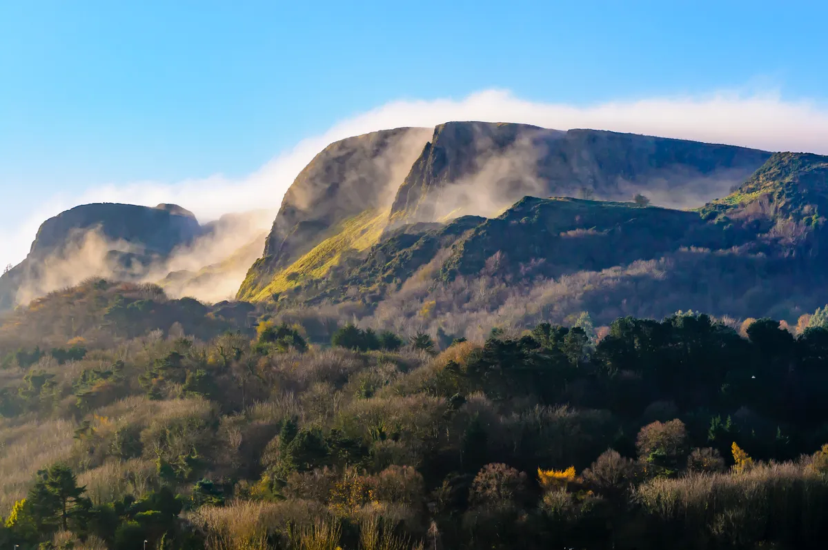
Cape Town has Table Mountain, Edinburgh has Arthur’s Seat, and Belfast has Cave Hill. It’s one of those mandatory excursions and no visitor or local should spend long in the city without making the trip to the top.
Rising to 368m, the eastern slopes of Cave Hill are cut into a series of plunging cliffs. Some 3,000 years ago, the loftiest promontory was home to McArt’s Fort, a prehistoric ceremonial ring fort. Today it’s popularly known as Nelson’s Nose, a reference to its distinctive, face-like profile when viewed from the south.
Bluebells carpet the hillside in spring, with wild orchids blooming later in the summer.
Cave Hill walking route and map
St Martha's Hill, Guildford
4.6 miles/7.4km | 3 hours | moderate
Genteel Guildford might not seem a location for much wilderness, but St Martha’s Hill offers a chance to feel at one with one of the most spectacular wild landscapes of Britain – the High Weald.
Once a dense and dangerous forest with difficult terrain and treacherous roads, the High Weald was best avoided, which is why pilgrims took the high and dry roadway along the North Downs. Today the Pilgrim’s Way and North Downs Way coincide for only short stretches, and the climb to St Martha’s Hill is one of the best. The tracks are well maintained, so you should avoid a quagmire even on a soggy day.
Guildford to St Martha's Hill walking route and map
Brandon Reach Nature Reserve, Coventry

Forty years after developing the glorious Brandon Marsh Nature Reserve just minutes outside Coventry’s city centre, Warwickshire Wildlife Trust had an opportunity to double its wilderness, and acquired Brandon Reach. Now larger than London’s Hyde Park, the two reserves physically reach out towards the town, to connect local communities with a rich oasis of nature.
With a history of mixed land use, the grassland, scrub and ancient woodland at Brandon Reach offer a sense of escapism and peace rarely felt so close to major urban infrastructure
Coventry to Brandon Reach Nature Reserve walking route and map

