In 1951, the Peak District – comprising most of Derbyshire and parts of Cheshire, Greater Manchester, Yorkshire and Staffordshire – became Britain's first national park.
The park is made up of two contrasting regions. To the north is Dark Peak, a wild and open landscape of heather and bog and black granite outcrops. While to the south lies White Peak, where picturesque mill towns sit among lush valleys and limestone caves.
Discover the national park – from the valleys of Dovedale and Lathkill Dale to the heights of Kinder Scout – with our pick of the the best walking routes in the Peak District. We've also got a comprehensive Peak District travel guide which looks at the best places to visit, great places to eat and stay.
Looking for more walks in Britain’s national parks? Check out our favourite routes in the Lake District, Yorkshire Dales and North York Moors.
Peak District walks
Derwent Reservoir and Howden Reservoir, Derbyshire
10.5 miles/16.9km | 6–7 hours | moderate
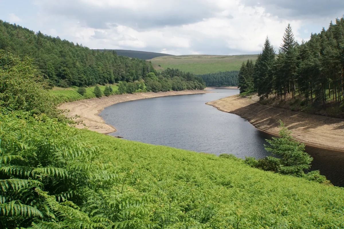
A 10.5-mile circular walk around the majestic reservoirs and through the mixed woodland of the glorious Uppzer Derwent Valley in the Peak District.

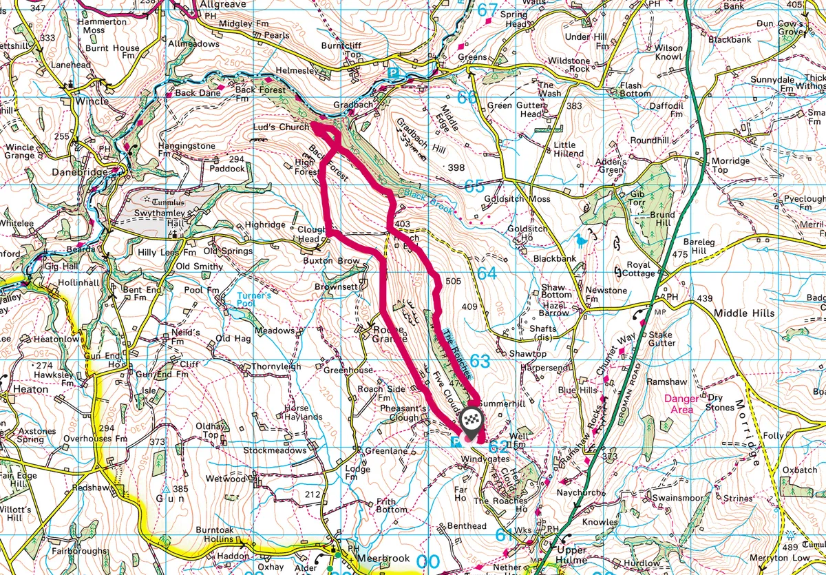
The Roaches, Staffordshire
5.8 miles/9.3km | 4 hours | moderate
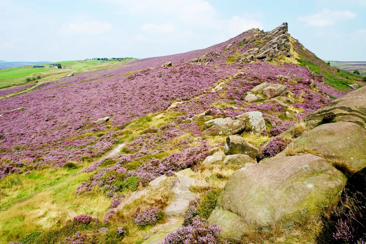
Look out for wallabies while enjoying folklore and oatcakes amid striking Staffordshire gritstone outcrops with this 9.3km walk in the Peak District National Park. Late summer is a wonderful time of year to walk The Roaches ridgeline as it flushes purple with flowering heather.
Chrome Hill, Derbyshire
6.2 miles/10km | 4 hours | moderate
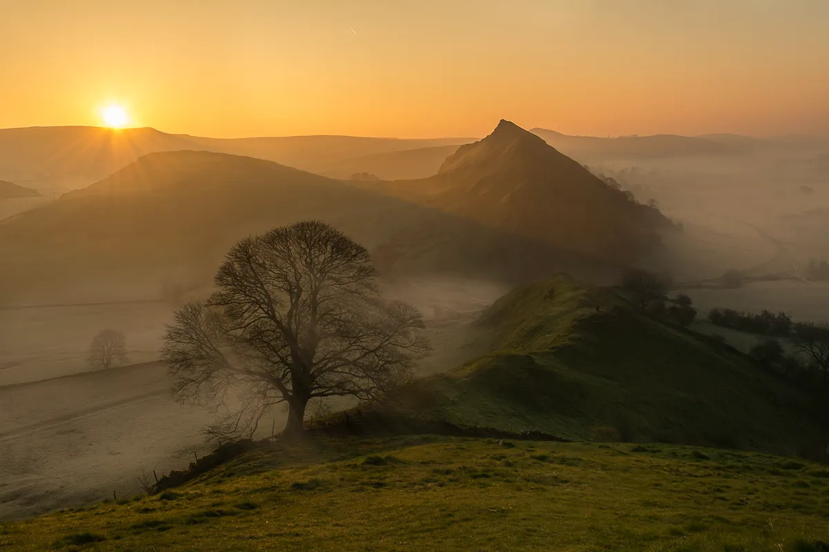
The Dragon’s Back range are often cited as the only true peaks in the Peak District; a line of pinnacles said to resemble the ‘plates’ along the spine of a stegosaurus dinosaur. This exhilarating 10km walk includes seven short, steep climbs to each summit.

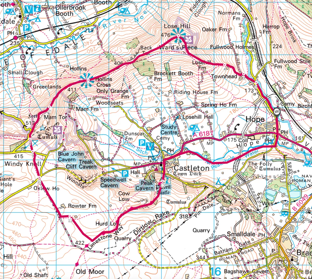
Mam Tor, Derbyshire
8.7 miles/14km | 5 hours | moderate-challenging
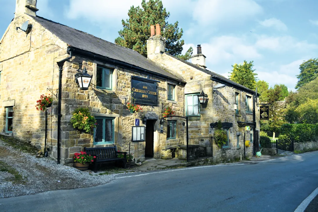
Traditionally, the sign of a Cheshire cheese swinging in front of a pub was used to show it offered a warm welcome, and that a roaring fire, hearty meal and tankard of ale awaited within. This is certainly true of the Cheshire Cheese which lies nestled in the village of Hope in the Peak District. This is the sort of cosy pub you long to stumble across after an invigorating day in the hills.
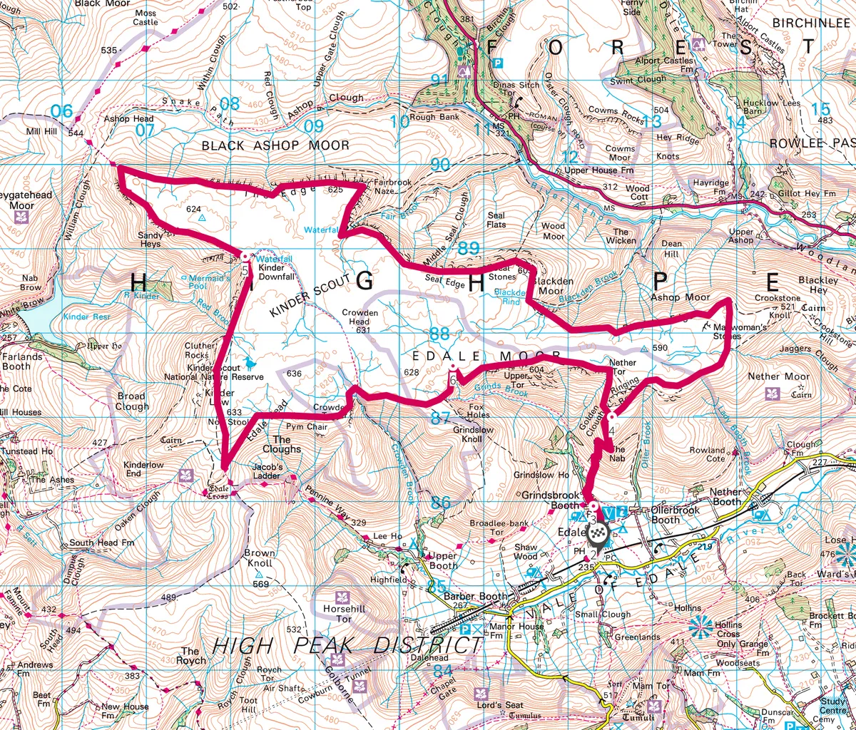
Kinder Scout, Derbyshire
16.3 miles/26.3km | 9 hours | challenging
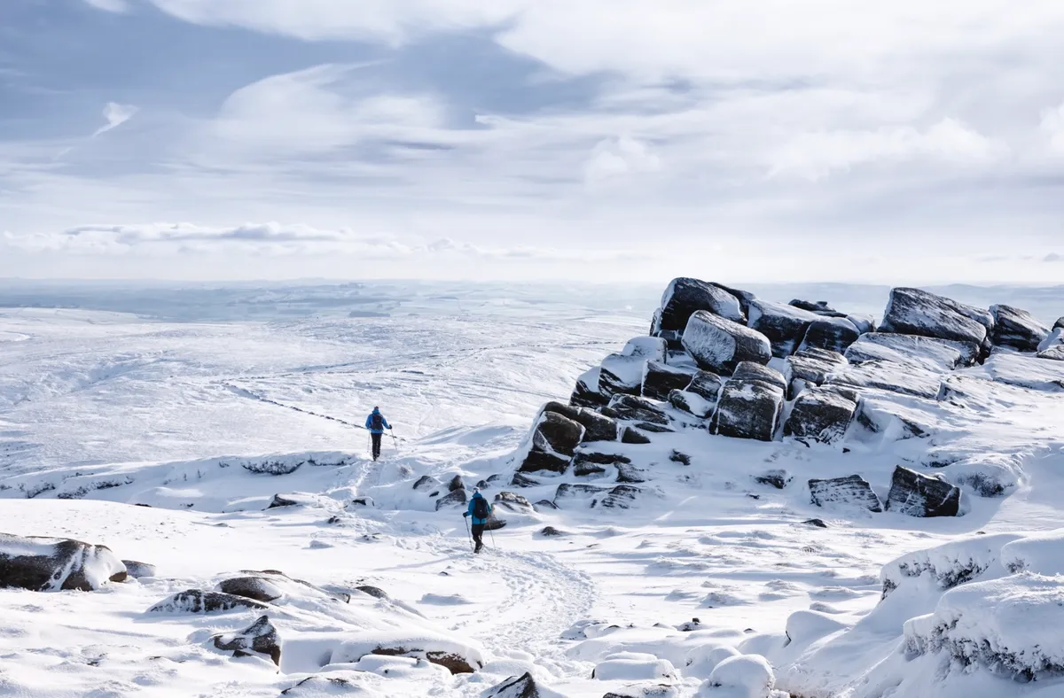
Sandwiched between Manchester and Sheffield in Derbyshire, the bleak but beautiful upland plateau of Kinder Scout is a landscape of wind-swept waterfalls and rocky crags, perfect for hikers and scramblers alike.
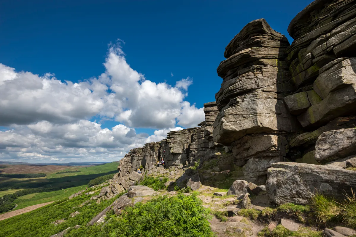
Curbar Edge
4.2 miles / 6.7km | 3 hours | moderate

At Curbar Gap the land drops dizzily to the Derwent Valley floor, the uplands on the other side stretching out in front of you: Longstone Moor, Hucklow Edge, Sir William Hill, Win Hill, Howden and Derwent Edge and Kinder Scout.
These views accompany on your walk, rock piles on Curbar Edge adding drama to the scene. This is prime walking and climbing terrain.

Padley Gorge, Derbyshire
2.3 miles/3.7km | 1.5 hours | easy–moderate
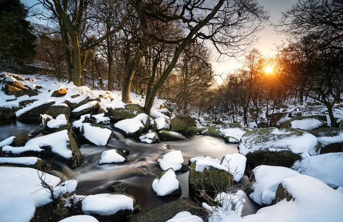
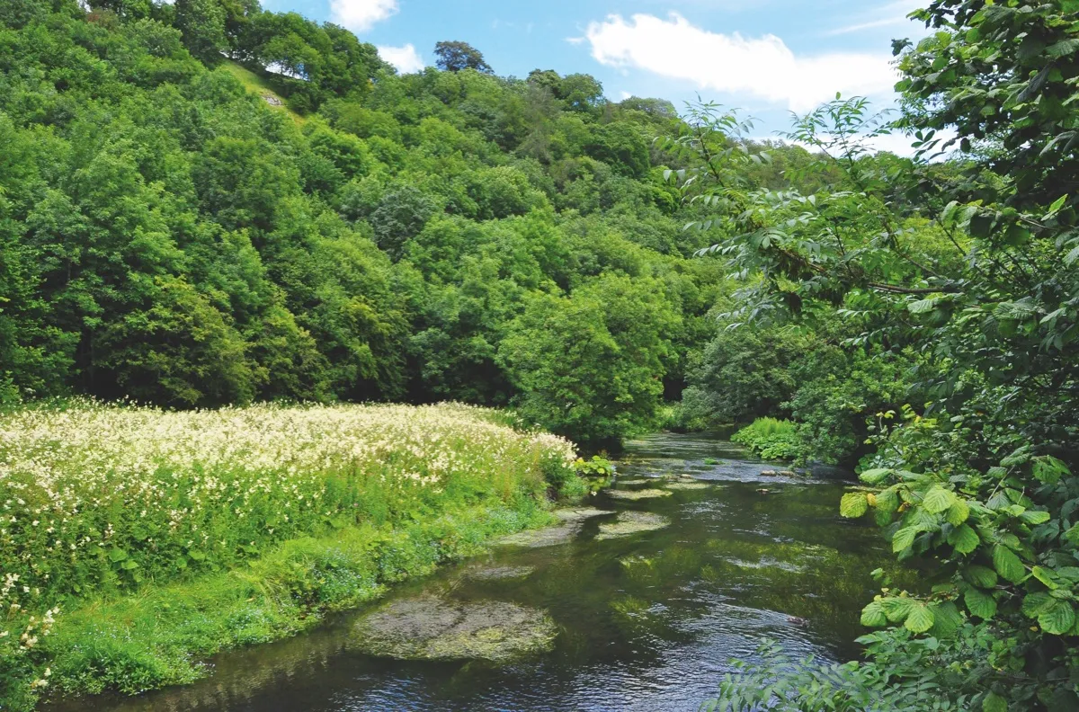
The river Derwent arcs through the eastern Peak District in a wooded vale with looming moorland shoulders. Tributaries tumble from the tops, foaming amid wizened woodlands little-changed in centuries.
Padley Gorge has the best of these, draining Burbage Moor to the Derwent at Grindleford. An enchanting stroll explores this chasm, pausing midway along to route at a cosy inn, before looping up through woodland-shrouded industrial heritage.

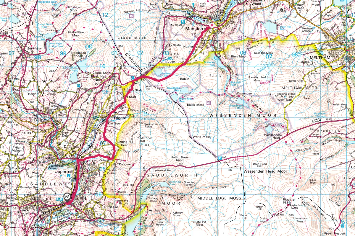
Saddleworth Moor, West Yorkshire
7.3 miles/11.7km | 4 hours | moderate
Enjoy this inspiring 12km walk across England’s great watershed, the Pennine Divide, linking the villages of Marsden and Uppermill via boat-horse trails.
This walk links the Colne and Tame valleys, typical South Pennine countryside with distinctive architecture and robust history. Local trains make this linear walk between white and red rose camps a real pleasure.
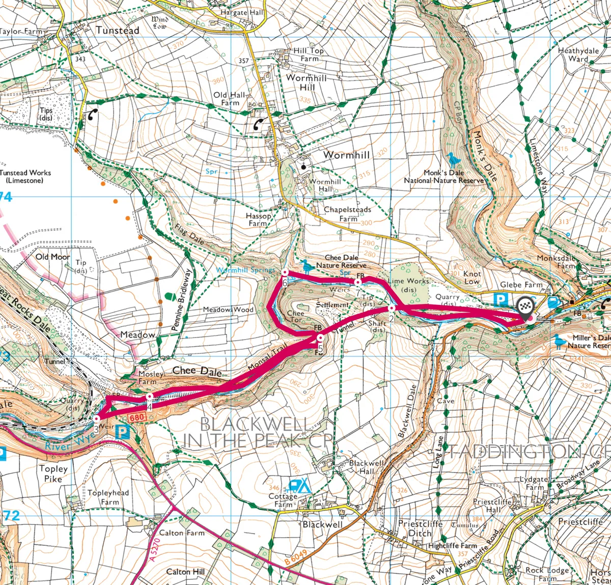
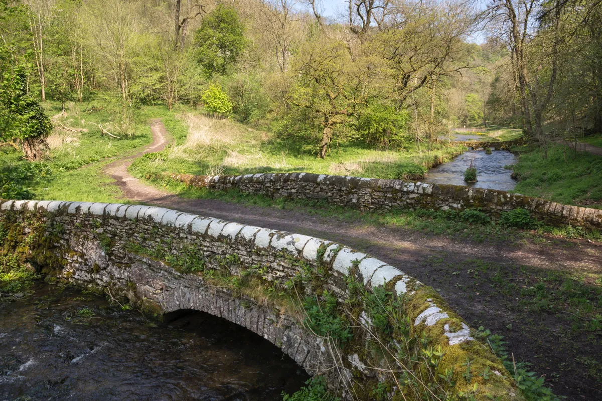
Chee Dale, Miller's Dale and Wye Dale, Derbyshire
4.2 miles/6.8km | 3 hours | moderate
Deep in the White Peak east of Buxton is a captivating area of countryside; a union of natural bounty and majestic engineering that together create a truly astounding landscape.
Although it may have its challenges, this 6.8km loop walk is readily accessible to all with a measure of agility and a sense of adventure.
Bakewell to Chatsworth, Derbyshire
7.3 miles/11.8km | 4 hours | moderate
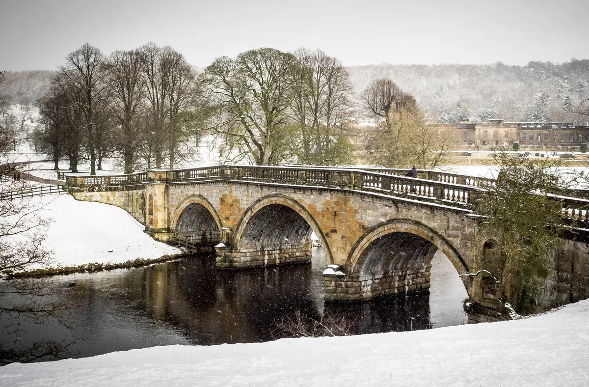
One of our favourite mid-winter rambles is this easy 12km circular walk from the home of the delicious Bakewell pudding and across Calton Pastures to visit the Duke of Devonshire's home and parklands.
Winter is one of the loveliest times to take this walk, because you’ll often have the frosty meadows to yourself, and have a better chance of seeing wildlife, such as the herds of deer that graze in the mature Capability Brown-designed grounds.

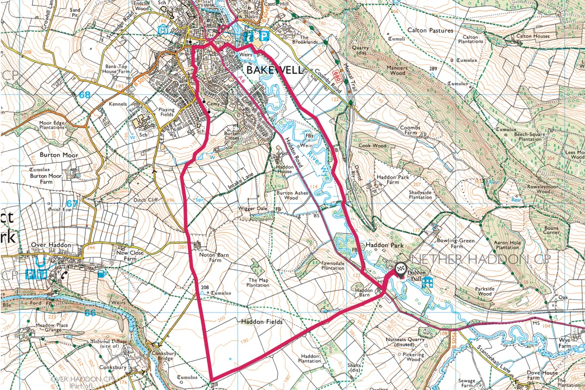
Haddon Hall, Derbyshire
5.5 miles/8.9km | 3 hours | moderate

Roaring fires, glimmering lights and verdant garlands transform the austere atmosphere of this ancient manor house and its stern fortifications into a place of warmth and cheerful celebration.
Leaving the manor house behind, you can follow the meandering River Wye to Bakewell for more delights at All Saints Church and Vernon Chapel.
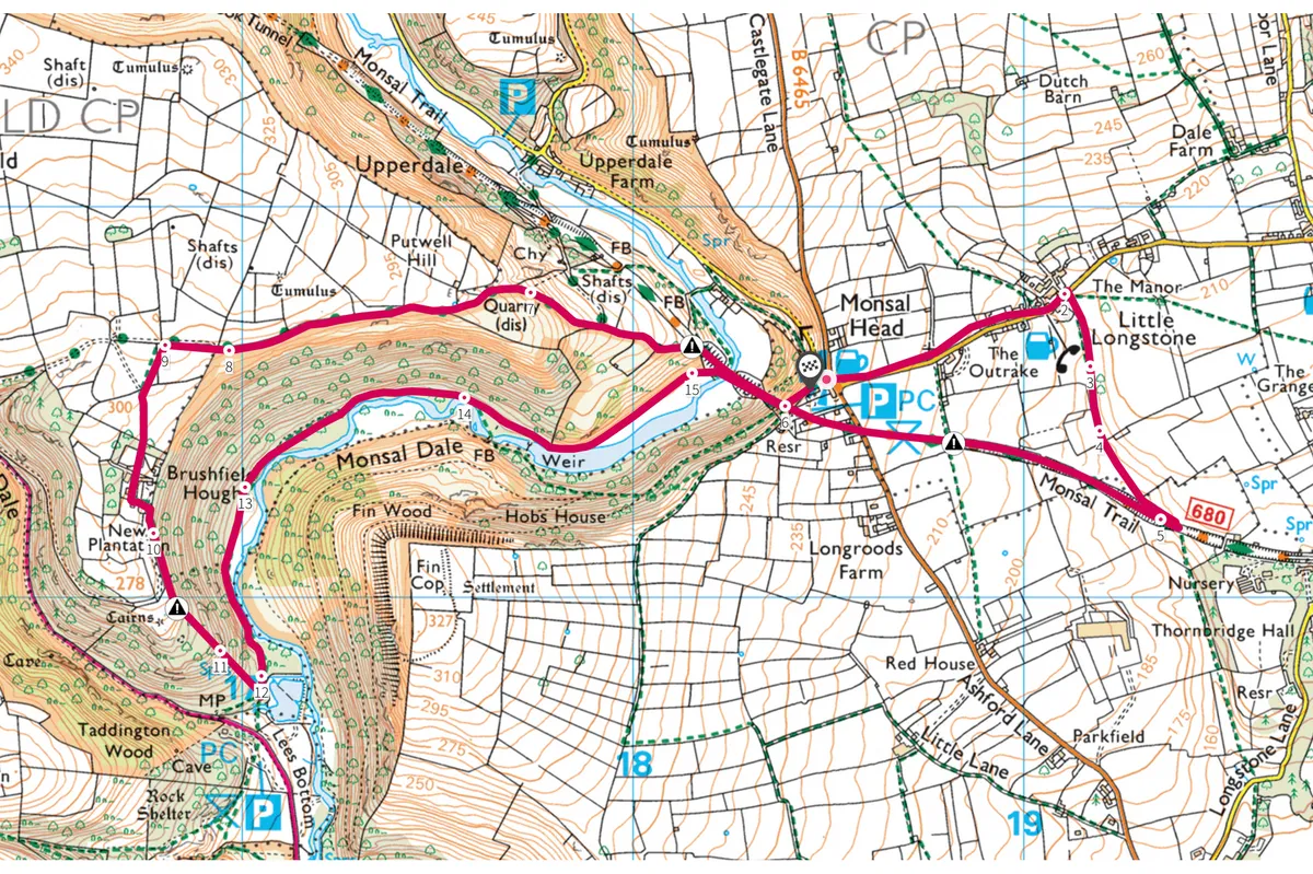
Monsal Dale, Derbyshire
4.6 miles/7.4km | 3 hours | moderate
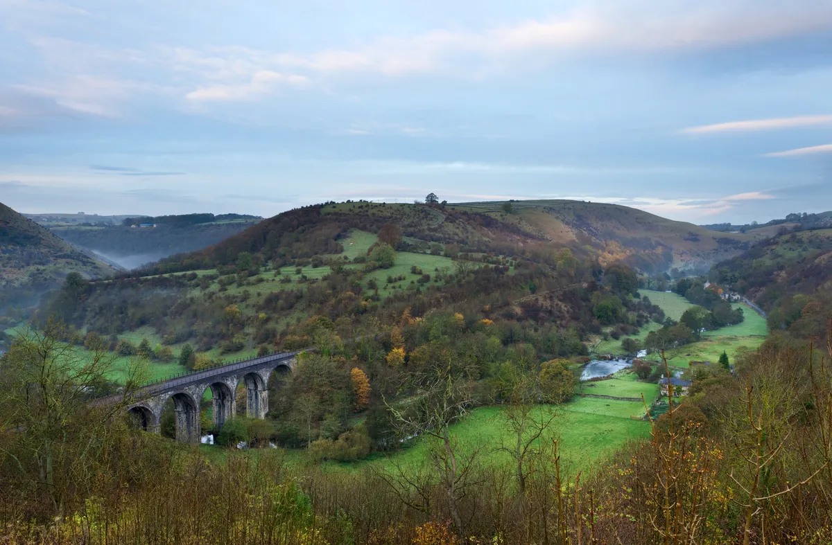
Ramble the high tracks and waterside paths of Monsal Dale in the Peak District National Park to revel in an explosion of seasonal colour, especially in autumn.
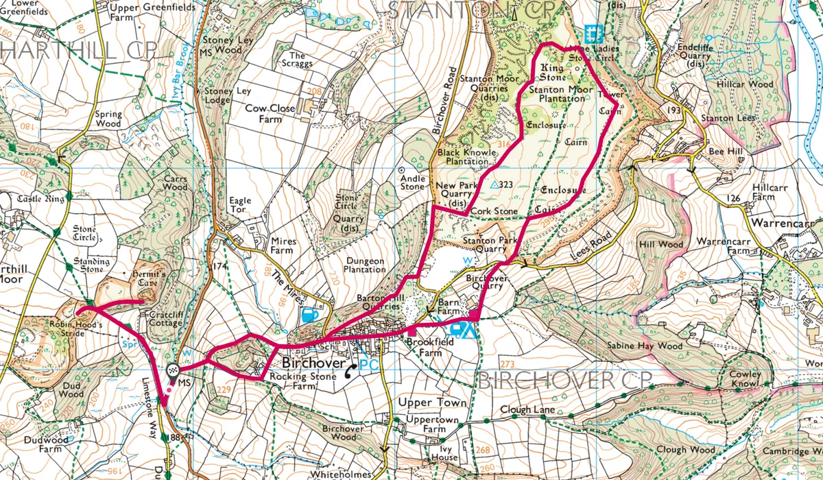
Birchover, Derbyshire
5.3 miles/8.6km | 3 hours | moderate
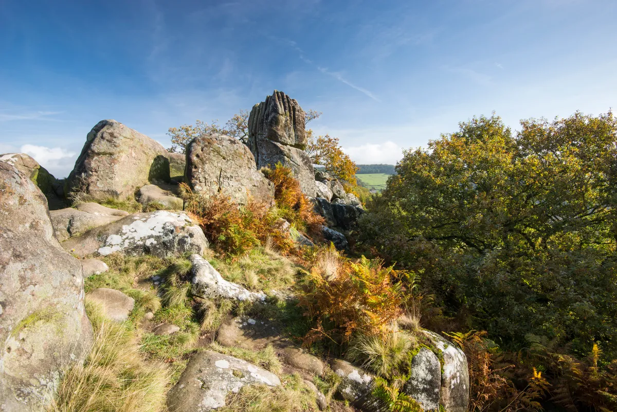
Surrounding the Peak District village of Birchover is a haunting landscape of gritstone bluffs, standing stones, burial mounds and Bronze-Age stone circles, hidden in inky woodland or exposed on windswept upland.
The paths here are littered with the history and mythology of the south-east Peak, from the hermit of Cratcliffe Tor who led travellers to safety off the ancient Portway trail, to the notorious outlaw who leapt across the soaring pillars that straddled Robin Hood’s Stride. Explore this prehistoric landscape on a 8.6km walk.
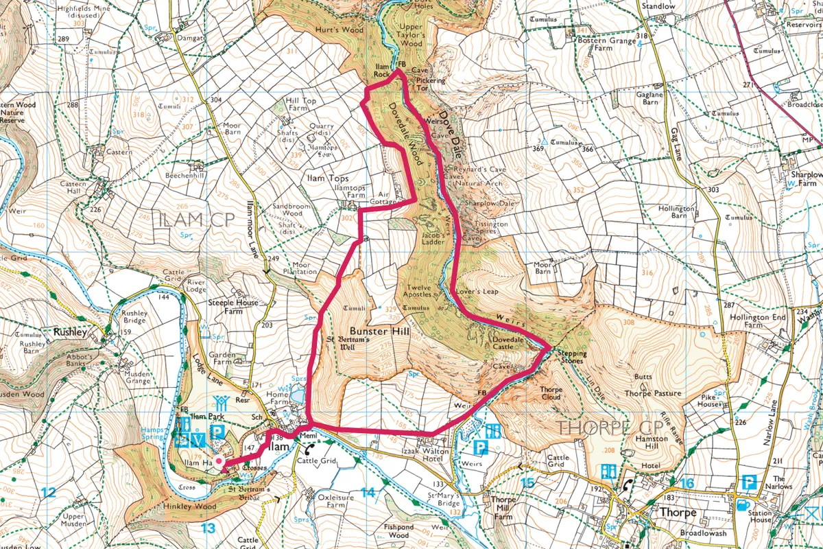
Ilam and Dove Dale, Staffordshire and Derbyshire
5 miles/8.2km | 3 hours | moderate
Explore Dove Dale and its surrounding countryside with a three-hour walk, starting at the pretty village of Ilam. Along the way you will discover the Church of the Holy Cross, beautiful Peak District meadows and stepping stones across a the River Dove.
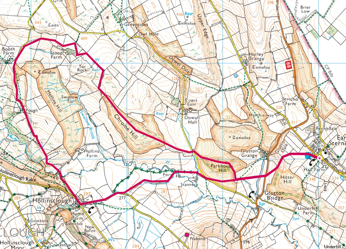
Earl Sterndale to Hollinsclough, Derbyshire
A 8.7km hike through the Peak District, starting at Earl Sterndale then climbing over Parkhouse and Chrome hills towards the village of Hollinsclough. The route starts at the Quiet Woman pub in Earl Sterndale, a 400-year-old inn with hand-painted signs of a decapitated barmaid.
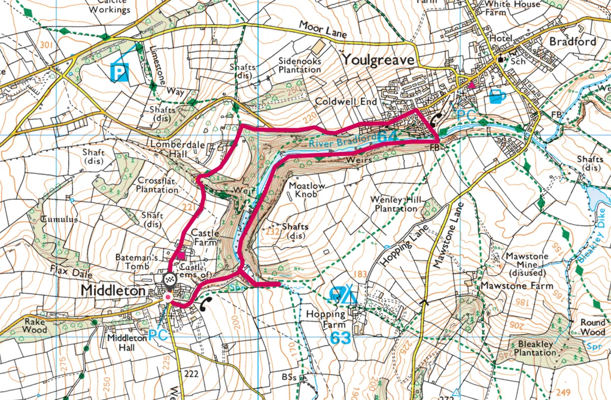
Middleton to Youlgreave, Derbyshire
2.6 miles/4.3km | 1.5 hours | easy
Enjoy a 4.5km poetry walk from Middleton to Youlgreave, a literary treasure hunt created as a millennium project by Middleton and Smerrill Parish around its boundary.
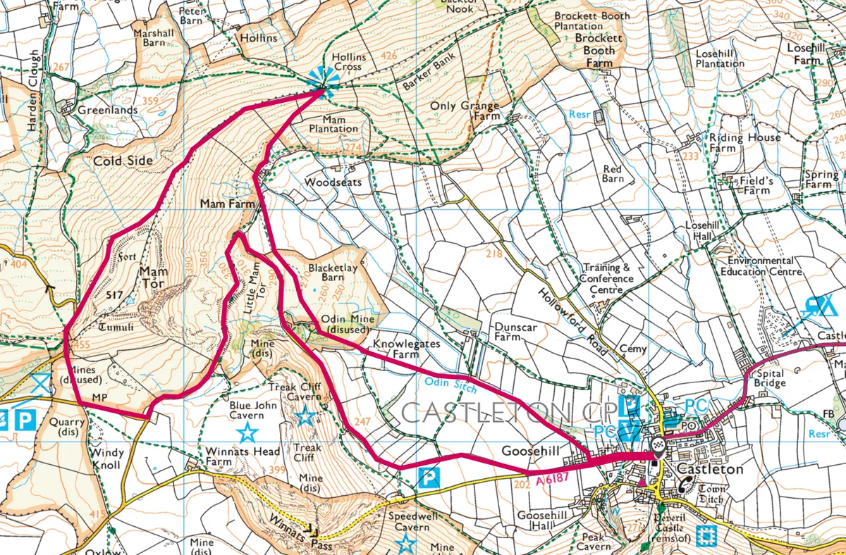
Hollins Cross, Derbyshire
5.2 miles/8.5km | 3.5 hours | moderate
An 8.5km hike from one of the Peak District's most beautiful villages to the top of Hollins Cross and Mam Tor. The route begins by crossing pastures alongside the Odin Sitch stream to meet the ‘Coffin Road’.
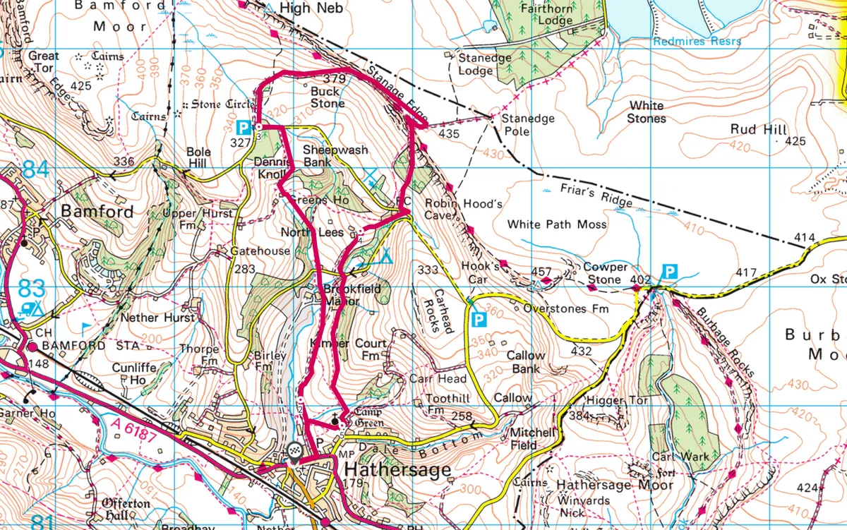
Hathersage and Stanage Edge, Derbyshire
5.8 miles/9.4km | 3.5 hours | moderate
Follow in the footsteps of the Bronte sisters with a 9.5km walk from Hathersage to Stranage Edge in the Peak District National Park. In spring and summer the sweet song of a skylark fills the air.