
There are just over three million people living in Wales, offering plenty of opportunities to discover your own quiet corner of the countryside.
Running the entire length of the country's coastline is an 870-mile footpath, while several more long-distance trails allow you to explore the hills, mountains and riverbanks further inland.
We've gathered 30 of our favourite walks in Wales, from the sandy beaches and coastal cliffs of Pembrokeshire (Sir Benfro) to the mountains and lakes of Snowdonia (Eryri) and the Brecon Beacons (Bannau Brycheiniog).
It's time to strap on your boots and get walking!
Best walks in Wales
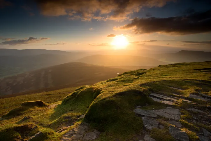
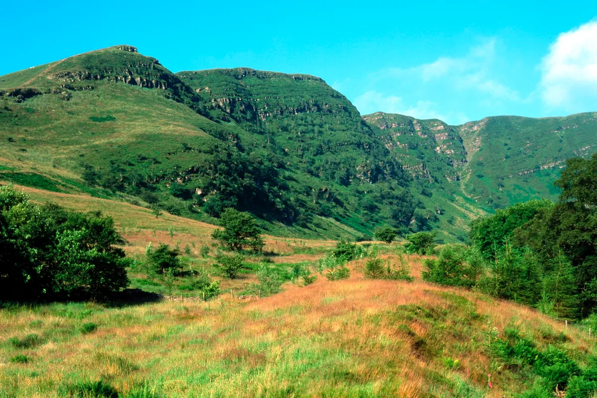
Cribyn, Powys
18.5km/11.5miles | 6 hours | moderate/hard
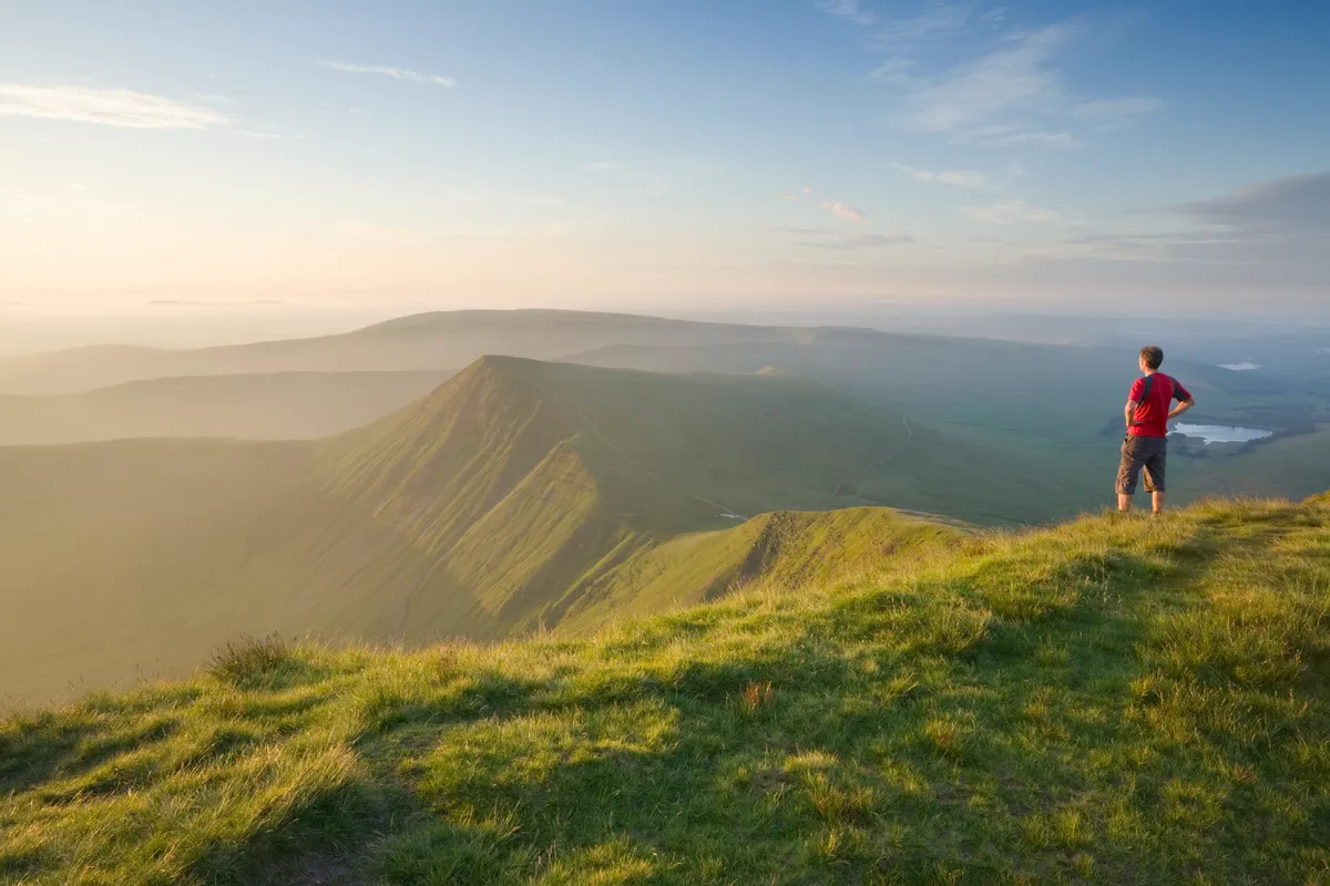
Amid the lumps, bumps and rounded humps that form the ridgelines of the Brecon Beacons, sits Cribyn. It’s the kind of peak a child may draw; pyramidal and stacked with brawn. Yet in spite of its mountain status, its summit is neither as high nor as insurmountable as you may imagine.
Cribyn, at 795m, sits 101m below the tallest peak in southern Britain, Pen y Fan. But far from inferior, the angular mount affords spectacular views over the surrounding countryside, making it well worth the climb.
Snowdon, Gwynedd
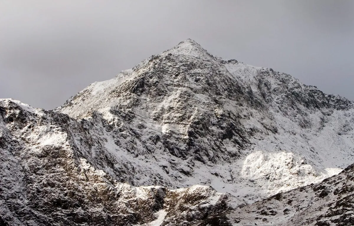
Snowdon (Yr Wyddfa in Welsh) is the highest mountain in England and Wales at 1,085m (3,560ft). The Snowdon range covers 16 square miles and gave birth to Welsh rock climbing in the 19th century. Today the tracks are bustling all year round and there are plenty of varied routes to the top.
This circular route, taking in the Miners’ Track and the Pyg Track, offers panoramic views and a varied terrain to and from the summit.
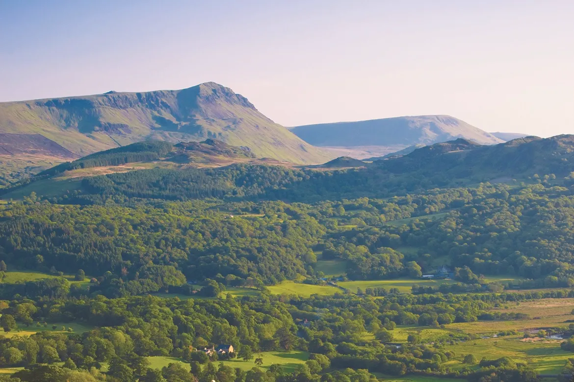
Pen y Fan, Powys
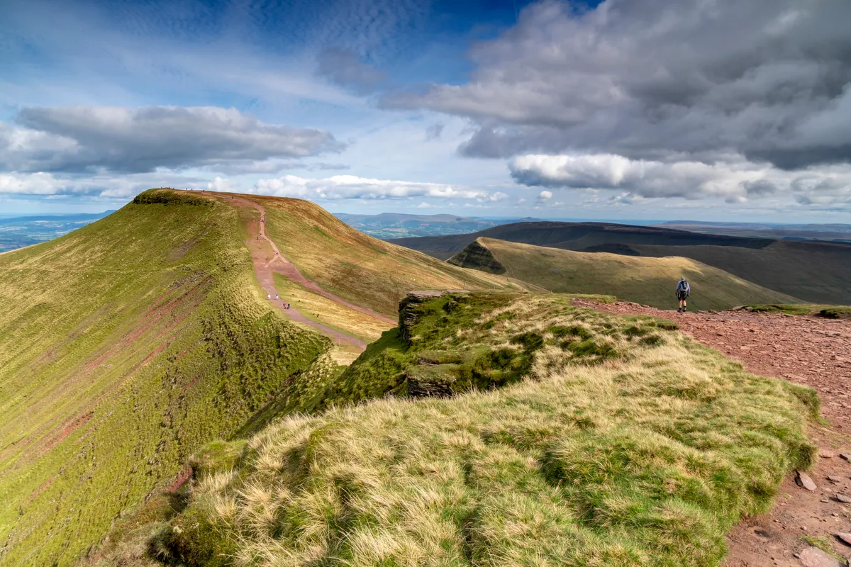
Pen y Fan is one of the most popular peaks in the Brecon Beacons National Park. Most visitors hike to the mountain top from the Storey Arms – but for a quieter and more rewarding route, take the path up from Taf Fechan Forest past Neuadd Reservoir.
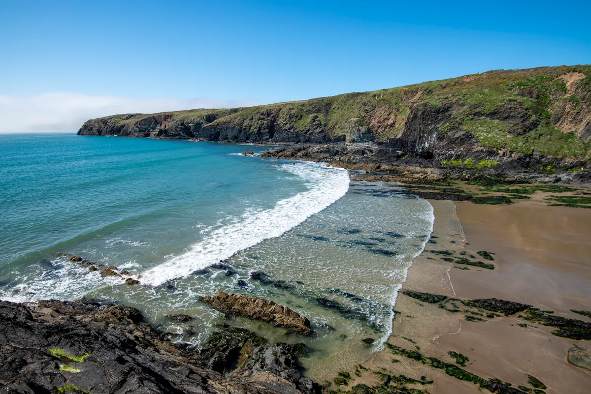
Three Cliffs Bay, Gower, Swansea
6 miles/4km | 3 hours | moderate
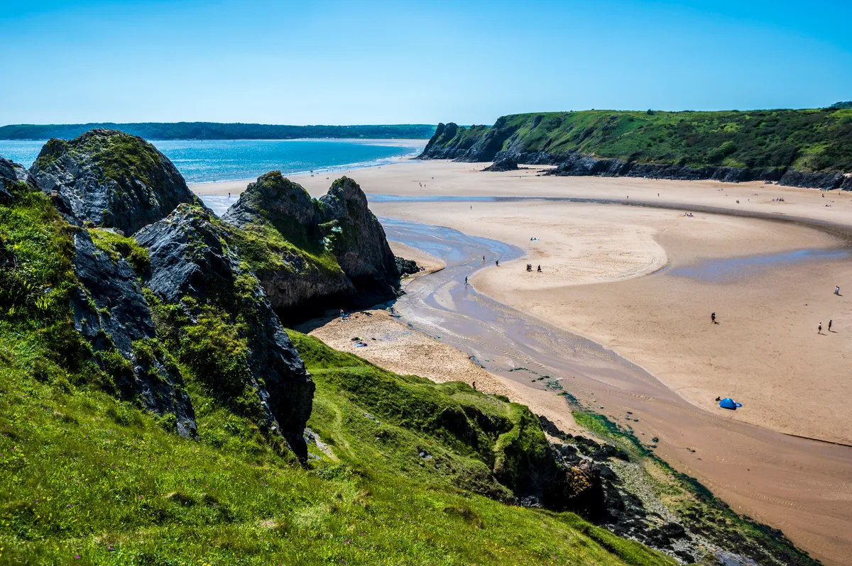
The cliffs of this bay are triangles of a single promontory, swimming out like a dragon to guard a beach brightly ringed by Pennard Pill river, which has squirmed through the saltmarsh to reach it.
At high tide, Great Tor in the west grants seclusion. But at the tide’s ebb, Three Cliffs Bay merges with Tor Bay, Oxwich Bay and Pobbles Bay – with its dramatic cliffs and caves – to create one vast dazzling magnitude of sand.
Follow a footpath past bone-filled caves, a romantic ruin and a winding river, down to a beach bathed in low winter light on this moderate-level, six-mile hike along Three Cliffs Bay.
Aber Falls, Gwynedd
6.7km/4.1 miles | 2 hours | moderate
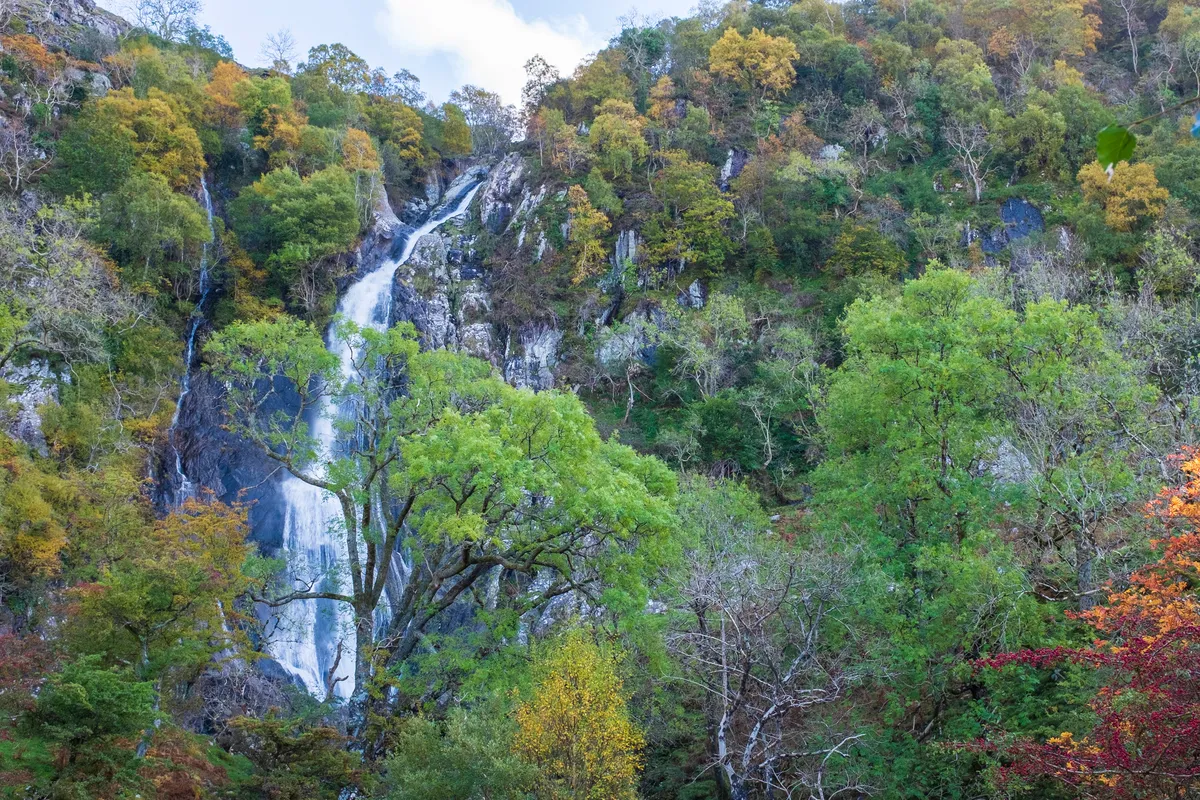
Admire Aber Falls and discover the surrounding history and wildlife on this dramatic valley walk through the north-west fringes of Snowdonia National Park.
This 4-mile circular walk starts from Bont Newydd car park near the village of Abergwyngregyn on the north coast of Wales, then follows a quiet country lane before crossing the Afon Rhaeadr Fawr river. Take a track alongside some beautiful ancient oak woodland up a verdant valley to the spectacular Aber Falls (Rhaeadr Fawr).
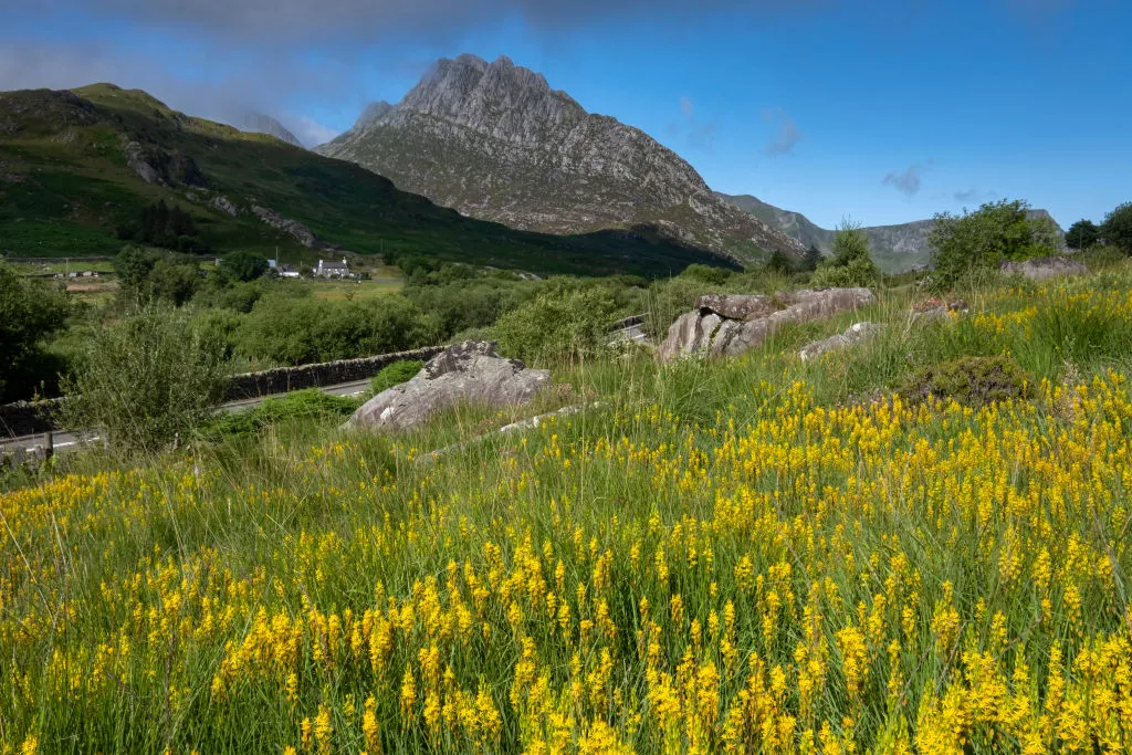
Cnicht, Snowdonia
Soaring in poetic isolation among Snowdonia’s famed mountains – Tryfan, Glyder Fawr and Carnedd Gwenllian – is Cnicht. Venture into the Moelwynion mountain range and climb through this prehistoric landscape to the pyramidal zenith of mighty mountain.
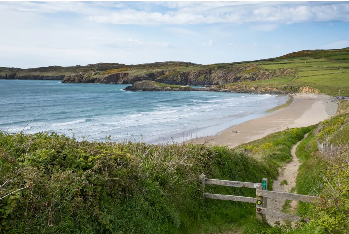
Marloes Peninsula, Pembrokeshire
8.8km/5.4 miles | 3 hours | moderate
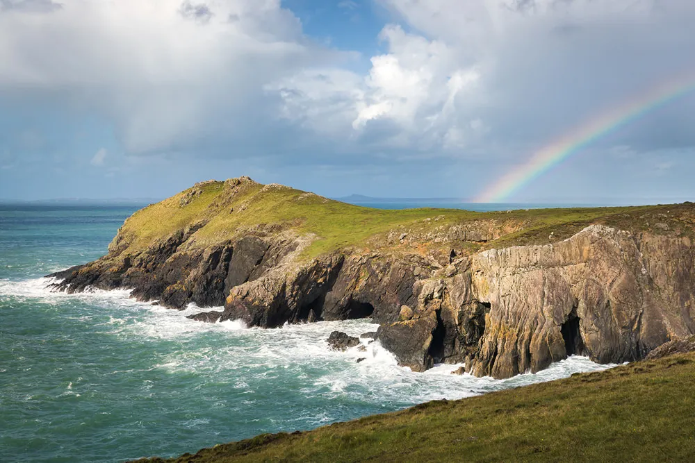
One of the finest stretches on the Pembrokeshire coastline, the Marloes Peninsula takes in a long sandy beach, dramatic rock formations and clifftops of wildflowers. Charismatic choughs whirl through the air, kestrels hover and, out at sea, grey seals and porpoises play alongside diving gannets.
Carreg Cennen Castle, Carmarthenshire
6.6 miles/10.7km | 4 hours | moderate
Journey on foot through chestnut valleys and gilded woods to a dramatic castle ruin in Wales. Once inside, the north-east tower gives spectacular views to Black Mountain on a clear day – a natural monolith framed by arrow slits.
Skomer Island, Pembrokeshire
5.7km/3.5 miles | 1.5 hours | easy/moderate
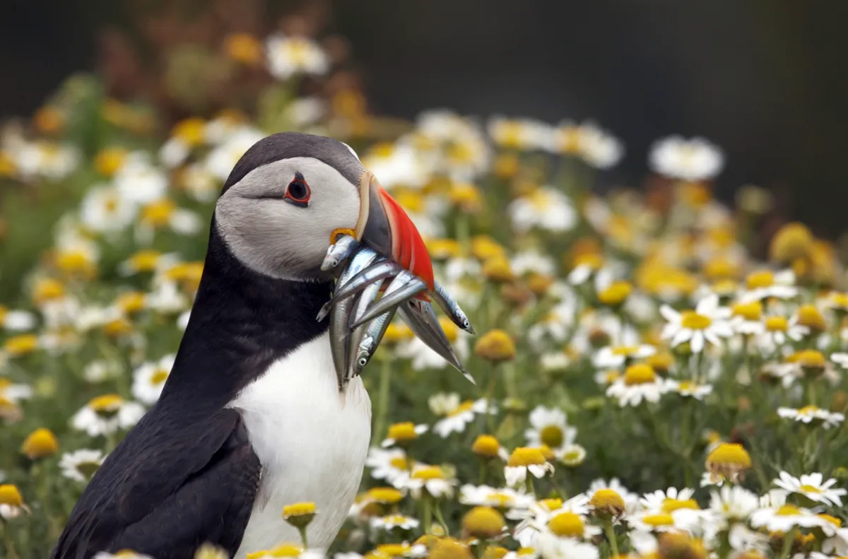
A protected National Nature Reserve since 1959, Skomer Island is one of the most important wildlife sites in Europe. In one day you can see puffins, grey seals, rare wild flowers, stunning views and much more.
St David's Peninsula, Pembrokeshire
15.1km/9.4 miles | 5 hours | moderate
This superb coastal walk follows the trails of some of the Dark Age saints, for whom the St Davids Peninsula was a place of pilgrimage, and passes beside the wild waters of Ramsey Sound. The area is home to a wealth of wildlife, from dolphins and porpoise to peregrines and chough.
Llanthony and Hatterall Ridge, Monmouthshire
8km/5 miles | 3 hours | moderate
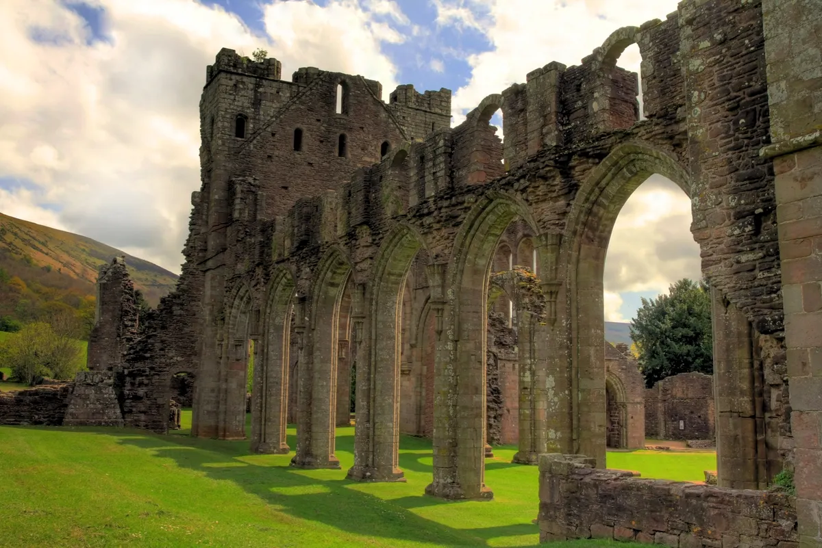
This energetic circular walk meanders in and out of the Brecon Beacons National Park, negotiating the scenic Hatterall Ridge that separates England from Wales. Lying in the Vale of Ewyas, the evocative ruins of Llanthony Priory, a 12th-century Augustinian abbey, can also be enjoyed. Get your heart racing with a 4.5-mile circular walk.
Blorenge, Monmouthshire
The rounded hilltop of Blorenge in the Brecon Beacons National Park was once dominated by industry. The landscape bears scars from all this activity; coal mining has left black furrows in the hillside, evidence of limestone and ironstone quarries litter the landscape and bell pits pockmark the ground behind the car park. Now, wildlife flourishes among vast swathes of heather moorland.
Llyn y Fan Fach, Camarthenshire
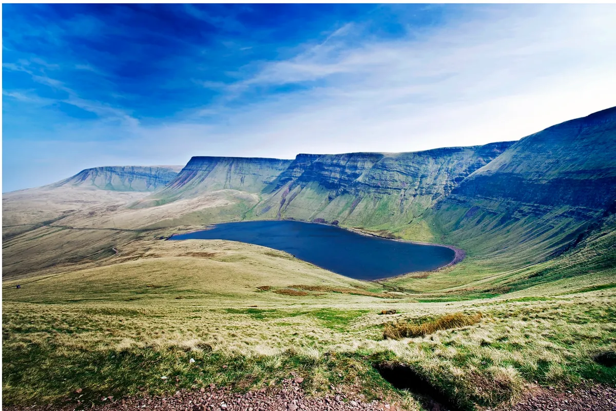
Parking up in the small, gravel car park, you’ll already be aware of the solitude of this part of the Brecon Beacons – it’s the quiet understudy to the neighbouring central peaks of Pen y Fan, Corn Du and Cribyn, yet certainly no less spectacular.
Follow this easy four-mile walk in the west of the Brecon Beacons National Park along a bustling river, a lonely llyn and a wild mountain ridge.
Sugar Loaf mountain, Monmouthshire
In its relatively modest 596m, the summit of Sugar Loaf in the Brecon Beacons National Park encompasses much that is magical about mountains, hills and woodland – explore this wonderful Welsh peak with a five-mile circular walk.
Moel Tryfan and Moel Smytho, Gwynedd
13.3km/8.3 miles | 4.5 hours | hard
Kate Roberts spent her childhood on the slopes of Moel Tryfan and Moel Smytho, which is the setting for her early novels including Feet in Chains and Tea in the HeatherEnjoy. This 8.3-mile mountain walk through open hills and slate quarries explores the area that inspired her.
Yr Eifl, Llyn Peninsula, Gwynedd
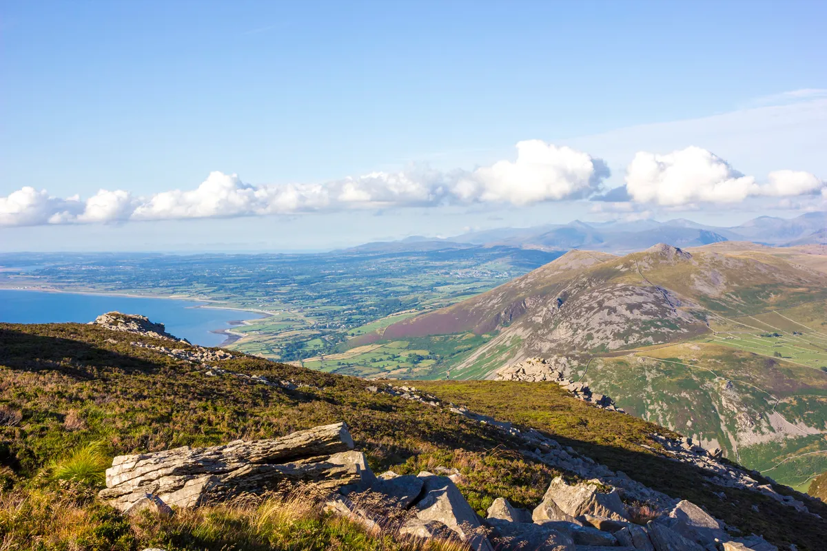
Mountainous in spirit if not in height, Yr Eifl is a hill of vertiginous vistas and igneous granite intrusions. Its craggy summits have various names but are referred to here as Garn For, Garn Ganol, and Tre’r Ceiri, and this walk scales all three with views of the Menai Strait.
Mawddach Estuary, Gwynedd

The former railway track between Morfa Mawddach and Dolgellau is used for walking and cycling. Savour the beautiful scenery on this 9.5-mile route to the stunning Cregennen Lakes in the foothills of Cader Idris in Snowdonia National Park.
Llanbedr Woods, Gwynedd
Now a Conservation Area, the oak woods hugging the hillsides above Afon Artro form a fine example of temperate forest that once covered most of Wales. Pass through this ancient woodland teeming with wildlife in north-west Wales with this 6.5-miles walk, especially glorious in late summer and autumn when the woods are filled with colour and foraging creatures.
Cemaes to Porth Wen, Anglesey
5.9 miles/9.5km | 4 hours | moderate–challenging
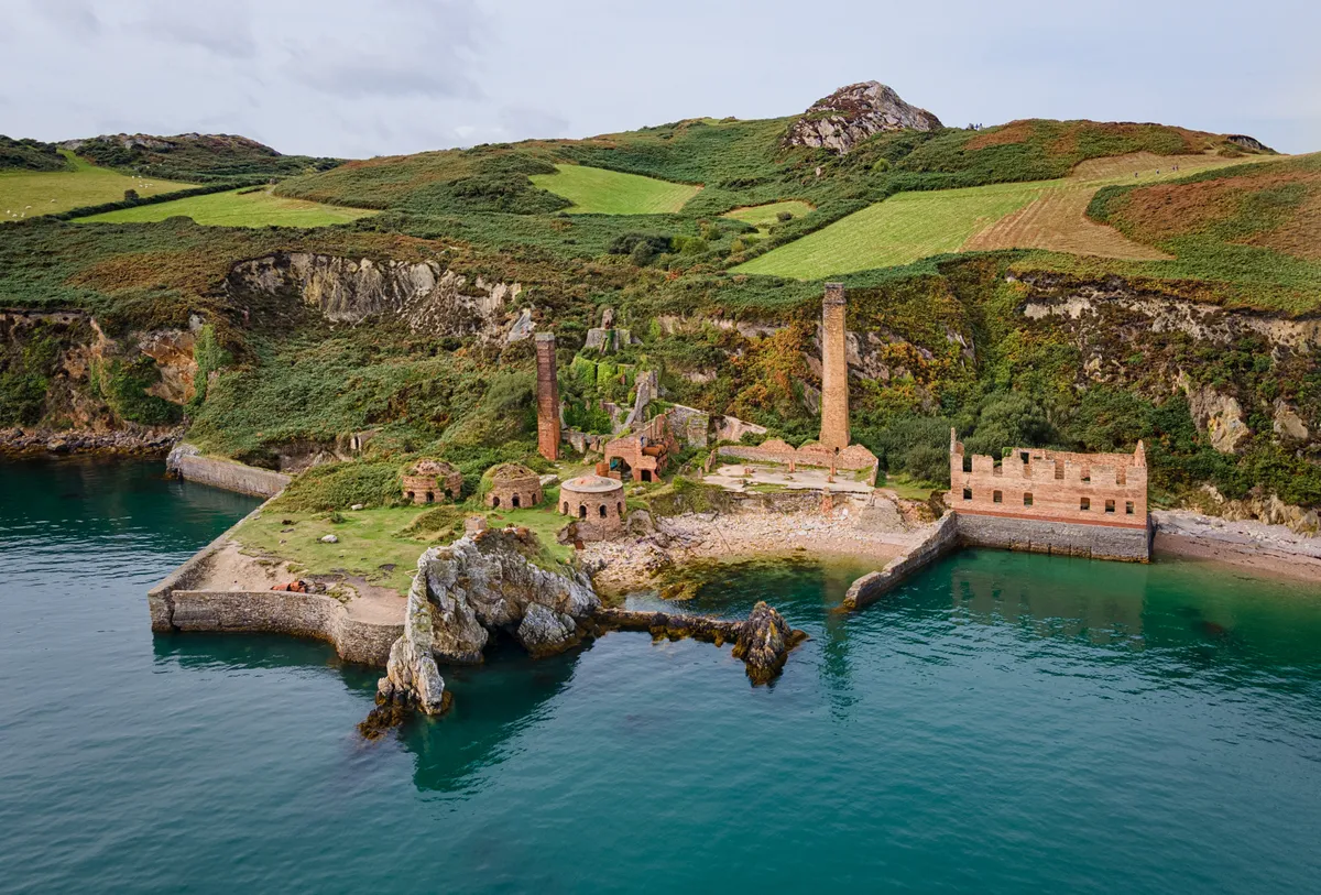
Coastal marvels come in many forms, and nowhere is this more palpable than on the northern shores of Anglesey, where twinkling seas, sandy bays and mighty cliffs offer a canvas for some of Wales’ most striking historic relics.
Llyn Tegid, Gwynedd
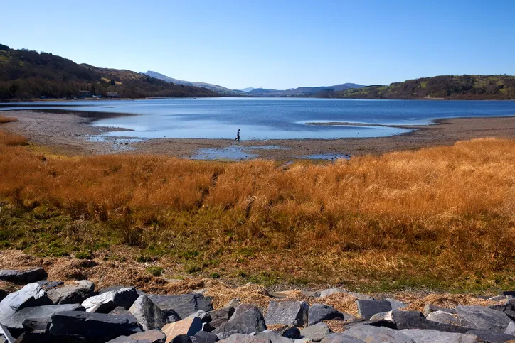
Glaciers come to mind when you see the cool gleam of Llyn Tegid from the mountain ranges surrounding it; the Arenigs, the Berwyns and the Arans. Known in English as Lake Bala, Llyn Tegid is the largest natural lake in Wales – explore its banks and surrounding forests in the east of Snowdonia National Park with this 8.5-mile hike.
Gwydir Castle, Llanrwst, Conwy
8.5km/5.3 miles | 3 hours | moderate
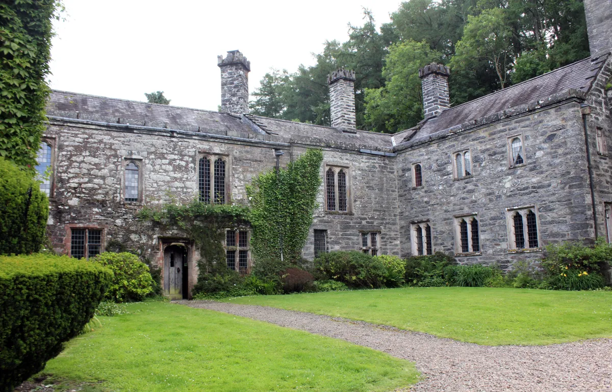
Gwydir Castle stands beside an old road connecting the market town of Llanrwst with the village of Betws-y-Coed in the lush Conwy Valley. It’s a peaceful place – but it hasn’t always been that way. Stroll around this Tudor mansion and its former estate on the edge of the Snowdonia National Park in Wales’ northern region of Conwy.
Llyn y Dywarchen, Gwynedd
11.3km/7 miles | 3.5 hours | moderate
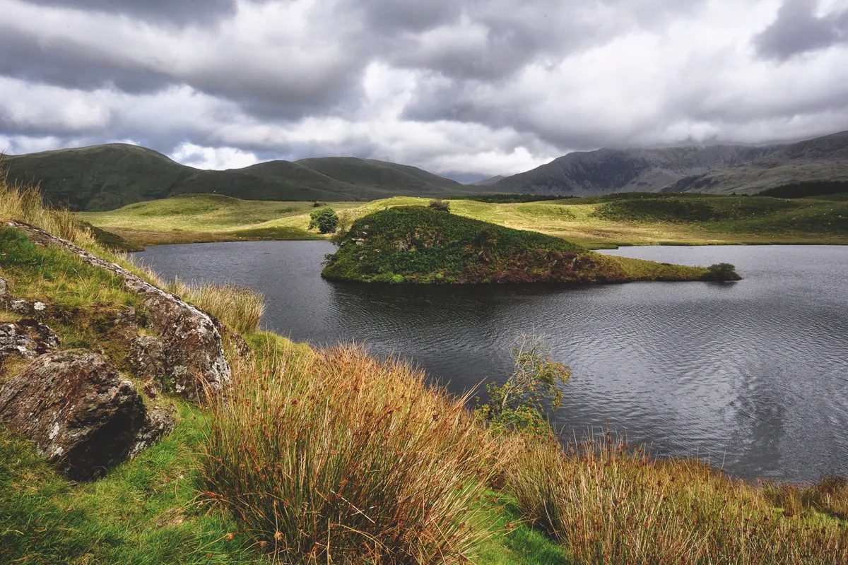
Deep in Snowdonia lies a lake across which an island once floated. In folklore, this is not unusual. St Brendan’s Isles drifted around the globe for centuries, and seven of Britain’s canonised saints apparently floated to our shores on a sod.
But in this case, the island was real, and unusual enough for Edmund Halley the astronomer to swim out and see for himself in 1698. He described a piece of turf broken loose from the bank and buoyed up by the lightness of “broad-spreading fungous roots on its sides
Hike through deep valleys, along meandering forest paths and beside an old mountain railway to this mysterious lake.
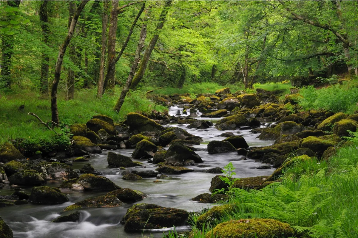
Coed y Brenin, Gwynedd
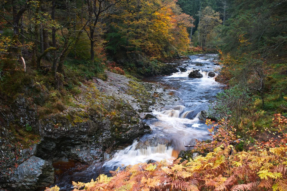
Coed y Brenin Forest Park covers 9,000 acres of woodland and river valleys. Its 500-million-year-old rocks with their deposits of copper and gold once made it a centre for mining. Now it’s managed for timber and recreation, with well-marked mountain-bike, walking and running trails. This refreshing 3.5-mile route through the forest, thick with greenery, mist and roaring torrents, is the perfect family walk.
Harlech to Llandecwyn, Gwynedd
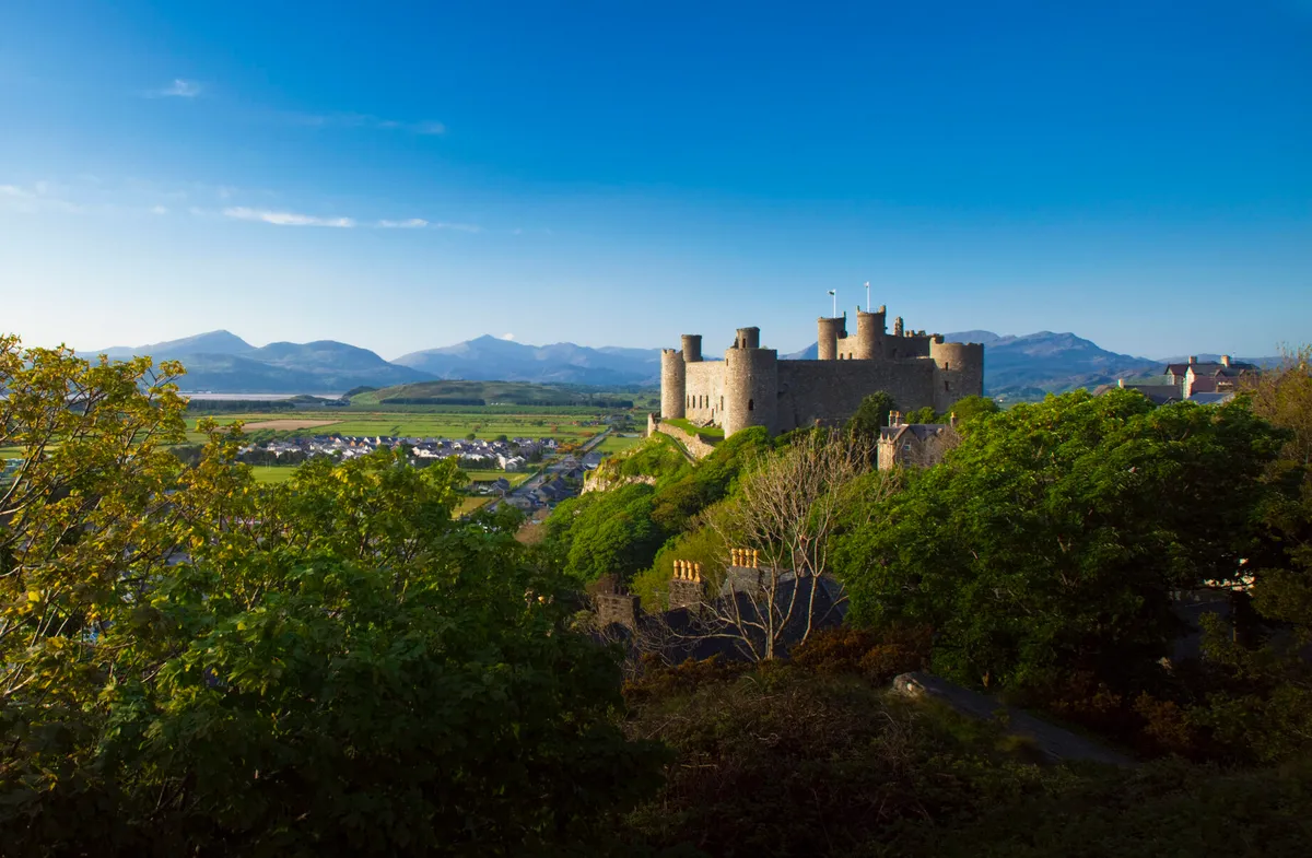
Located in the ancient district of Ardudwy, between the stunning estuaries of the Mawddach and Glaslyn, is the town of Harlech, famed for its dramatically positioned castle on a rock.
High above the castle and town, a Bronze Age trackway runs through a magical landscape, disturbed only by the mewing of buzzards and the song of the skylark. Choose a fine, clear day during a dry spell and follow this peaceful, linear walk towards Bryn Cader Faner, a striking Bronze Age cairn set in the wild foothills of the Rhinog mountains.
Dyffryn Fernant Garden, Pembrokeshire
11.6km/7.2 miles | 4.5 hours | moderate/hard
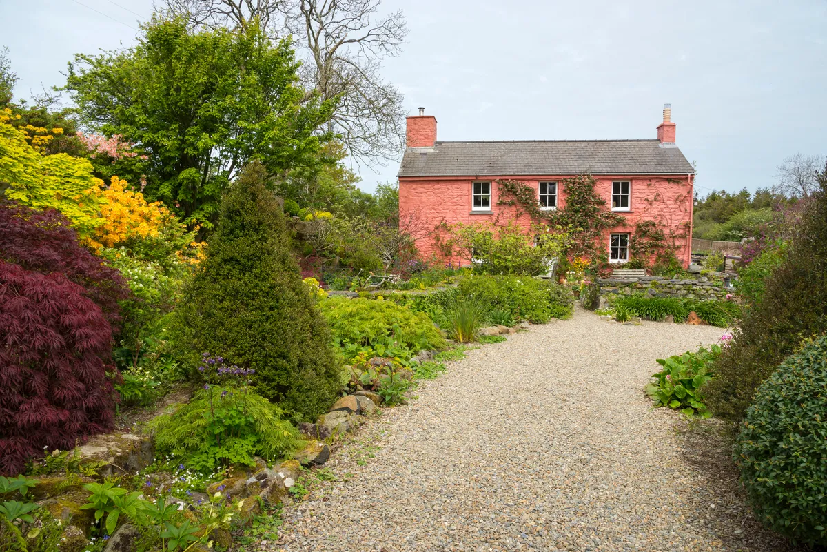
Few places talk to the landscape quite like Dyffryn – explore these pretty gardens in Pembrokeshire National Park then step into the hills for a seven-mile loop walk to Garn Fawr, the largest rocky outcrop on the Mynydd Dinas summit.
Caldey Island, Pembrokeshire
5.6km/3.4km | 1.5 hours | easy/moderate
Caldey Island lies a few miles off the magnificent Pembrokeshire coast of west Wales. It is one of Britain’s Holy Islands and, today, the Cistercian order continues to observe traditions begun in the 6th century by Celtic monks. Explore this historic Welsh island, where woodlands resound with birdsong and path verges blush pink in spring with clumps of thrift.
Tenby, Pembrokeshire
12km/7.5 miles | 4 hours | moderate
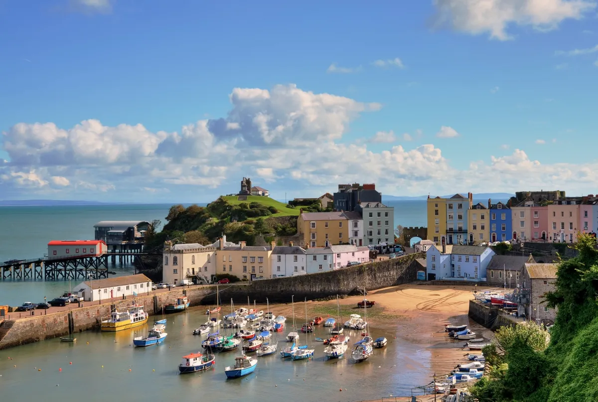
Perched on the western fringes of Carmarthen Bay, the charming seaside towns of Tenby and Saundersfoot are designated conservation areas that offer superb Blue Flag beaches and picturesque harbours. Explore the beaches and seaside towns of south Pembrokeshire's sandy coast with a seven-mile circular walk.
Ramsey Island, Pembrokeshire
4.2km/2.6 hours | 1.5 hours | easy/moderate

St. Justinian the hermit sought sanctuary on Ramsey Island in the 6th Century and, if it’s peaceful solitude you’re searching for, then this secluded outcrop is still the perfect place for a day’s retreat. Escape to this isolated Welsh island and ramble over a rugged landscape teeming with wildlife.
Craig-Cerrig-gleisiad, Powys
Climb any of the Brecon Beacons and you’ll find a stirring view. But the best of them all is the glowering peak of Craig-Cerrig-gleisiad.
This raven-haunted buttress is studded with steep crags that have prevented sheep from grazing rare sub-Alpine plants such as the delightful purple saxifrage. It means that the flora here is richer and more interesting than elsewhere in the national park. And so are the birds.
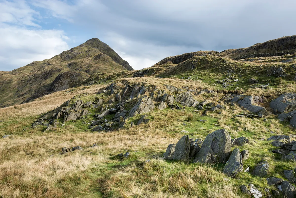
Carn Pica, Powys
This mountain in the east of the Brecon Beacons National Park rises more than 750m above sea level. You can approach it from the long, sprawling mass of Bryn and the boggy uplands of Waun Rydd, or from the west and the Central Peaks of Pen y Fan and Cribyn. Perhaps the most exhilirating way to reach the summit, however, is from the east and Talybont Reservoir. It’s a steep route to the top, but a quiet one, perfect for those seeking a little solitude in the hills.
Llyn Cynwch and the Precipice Walk, Gwynedd
5.5km/3.4 miles | 2 hours | easy/moderate
Llyn Cynwch is a conversation between the elements, an expression of light, an intervention of rain, a murmur of breeze. The undersides of overhanging leaves reflect light from its surface. Tree trunks stripe its bed with shadows, interrupted by ripples. Wander the snaking shores of this Welsh fishing lake, bound by pendulous trees, sky-striving mountains and a Victorian cliff-top walk.
Porthmelgan, Pembrokeshire
5.4km/3.4 miles | 2 hours | moderate
A small valley dotted with signs of ancient habitation runs through the moorland of St David’s Head. The vale ends at Porthmelgan cove, where its stream flows into the rolling sapphire waters of Whitesands Bay.
The cove is carved into soft shale, flanked with harder rock that makes up the protective promontories that form the bay. When the tide is out, the sandy beach invites exploration of rock pools and a cave.

