For most of us, the National Trust and National Trust for Scotland are synonymous with beautiful buildings, manicured gardens and delicious cream teas, but it’s sometimes easy to forget both charities are also the custodians of many of our most treasured outdoor spaces.
From precious upland landscapes and ancient woodlands, to exceptional coastlines, the National Trust and National Trust for Scotland care for, and make accessible, over 3,000 hectares of countryside and hundreds of miles of coastline.
National Trust-managed landscapes enable us to walk mountain ridges, follow meandering rivers and wander along lonely beaches, unlocking the history of our landscapes, and understanding their conservation as we go.
Both the National Trust and the National Trust for Scotland have put a lot of thought and experience into making landscapes accessible to everyone, even in inclement weather, and their well-maintained, waymarked paths, accessible trails and information boards can make the difference between a plodding ramble and an exciting exploration.
And as for their cafes? Well, there’s nothing like a bowl of soup, or hot chocolate and cake, to put a smile back on the face of even the most tired of walkers.
Whether you love striding out on long-distance walks, ambling around landscaped gardens, or enjoying something in-between, our National Trusts sites have a walk to suit you.
With so many wonderful walks to choose from, picking one can prove a difficult task. Never fear, BBC Countryfile Magazine are here to help with our round-up favourite National Trust walks.
Looking for more great days out?
22 of the best National Trust walks
Studland Bay and Old Harry Rocks, Dorset
5.6 miles/9.1km | 3.5 hours | moderate
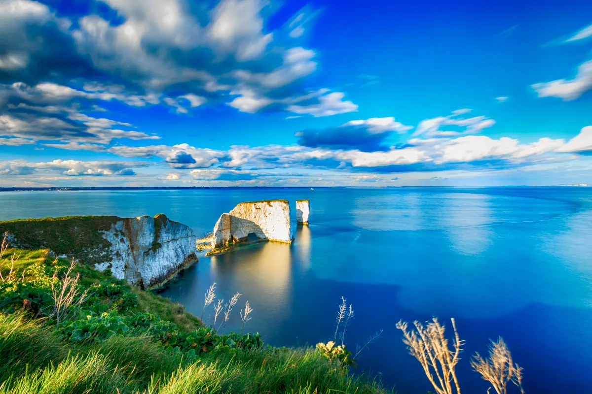
It’s small wonder that Studland Bay is visited by millions each year. This sandy peninsula is perfect for walks, watersports and sea swimming, and has space for everyone, including the naturists. The grassy headland of Ballard Down rises high above the southern end of Poole Bay, and is punctuated by the chalk stacks of the iconic Old Harry Rocks. Formed over millions of years but now in a state of constant sea erosion, this chalk ridge is a wonderful place to be whatever the season.
On a clear day, the views from Ballard Down can be breathtaking. Don’t be put off though if the weather is wet; this close to the sea, you’ll be able to taste the salt in every misty droplet. After your walk, rest and refuel at the National Trust’s wonderful Knoll Beach Café.
This 5.6-mile circular walk takes in the Studland shoreline, Old Harry Rocks and Ballard Down. It includes hills and unfenced clifftop areas. Your starting point is the National Trust Knoll Beach car park. Parking is free for National Trust members.
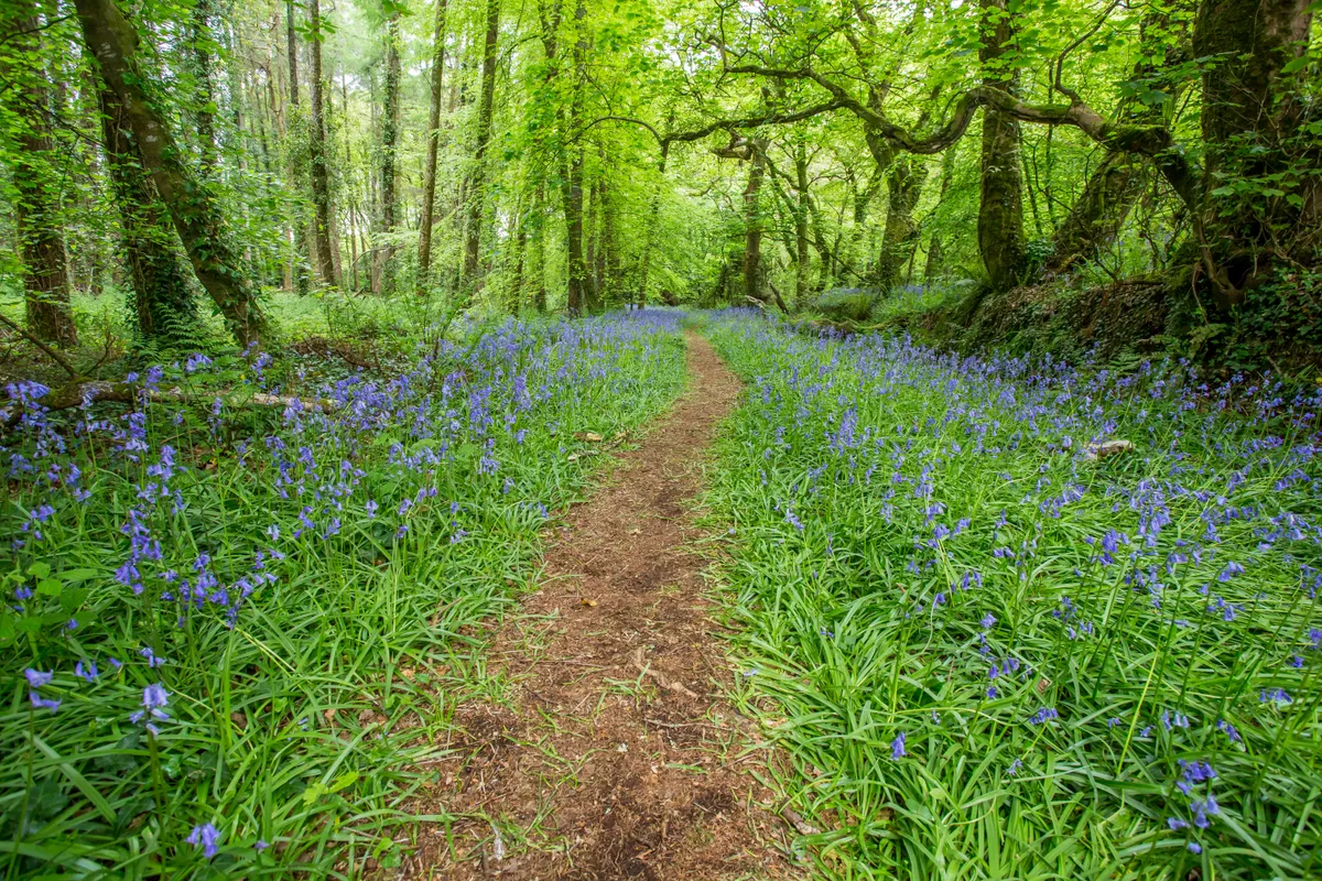
Tarn Hows, Cumbria
1.8 miles/2.9km | 1.5 hours | easy
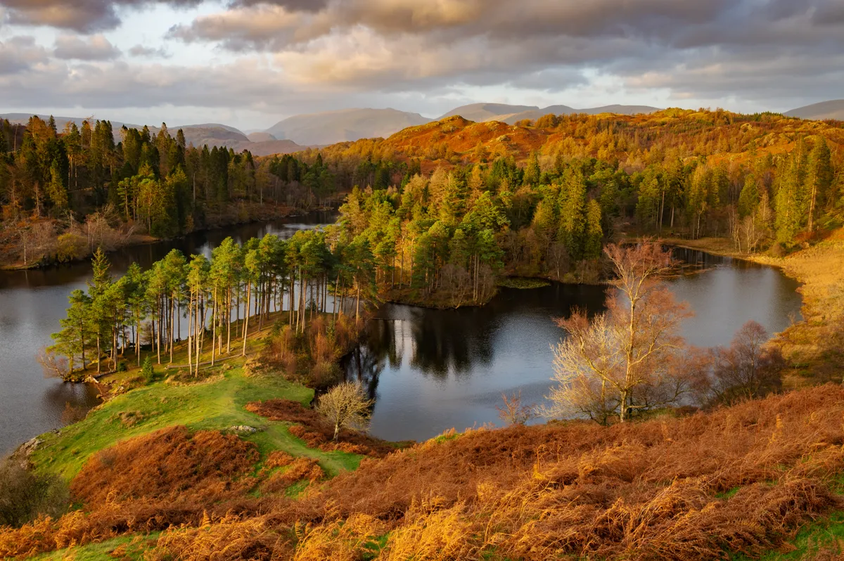
The circuit of Tarn Hows may be short, but you’ll need to allow lots of time for all the occasions on which yet another entrancing scene will suddenly stop you in your tracks.
This dark, mirror-like body of water is surrounded by atmospheric woodland, with snatched glimpses of dramatic mountain scenery, often snow-covered in winter, constantly appearing and disappearing.
If it all sounds too good to be true that’s because, in some ways, it is – Tarn Hows is actually a Victorian construct. It started life as three small pools, but the landowner, James Garth Marshall, dammed one of them in 1865 to create the single tarn that exists today. With ideas based on Romantic notions of the ‘picturesque’, he also planted trees, intending both to frame and reveal views of his creation.
The National Trust has owned the popular beauty spot since Beatrix Potter sold it to them in 1930.
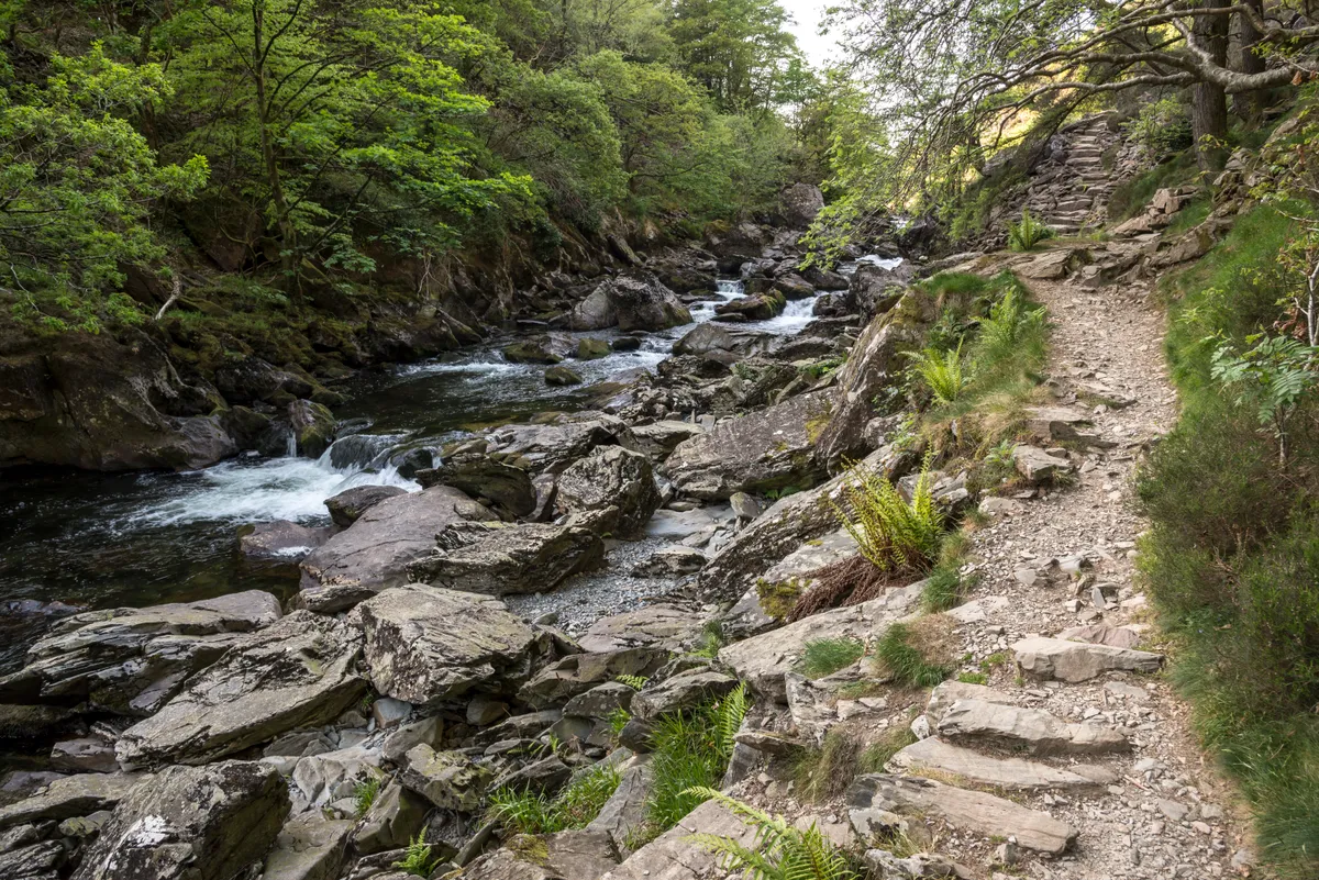
Cwm Idwal, Gwynedd
2.5 miles/4km | 1.5 hours | easy-moderate
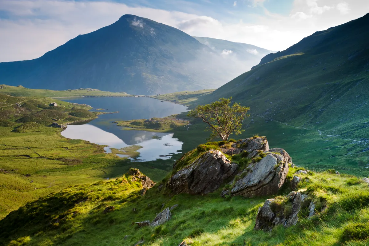
The jagged peaks that soar over Cwm Idwal dwarf the Arctic-alpine plants that grow on the slopes around its waters. To appreciate them fully, you have to crouch down or dangle over them to see their colourful petals hunkered on ledges or in crevices – it’s here that they thrive, feeding on minerals that leach through the rock.
These miniature Ice Age relics have outlived the mammoths, surviving in an environment that is neither far enough north to be considered Arctic nor high enough to be alpine. Accustomed elsewhere to cold snowy winters, here the climate is unpredictable and predominantly wet, with ill-defined seasons.
This easy circular walk around Llyn Idwal gives you the chance to spot these hardy little plants, along with a host of other wild delights.
Bateman’s, East Sussex
Three walks, various lengths
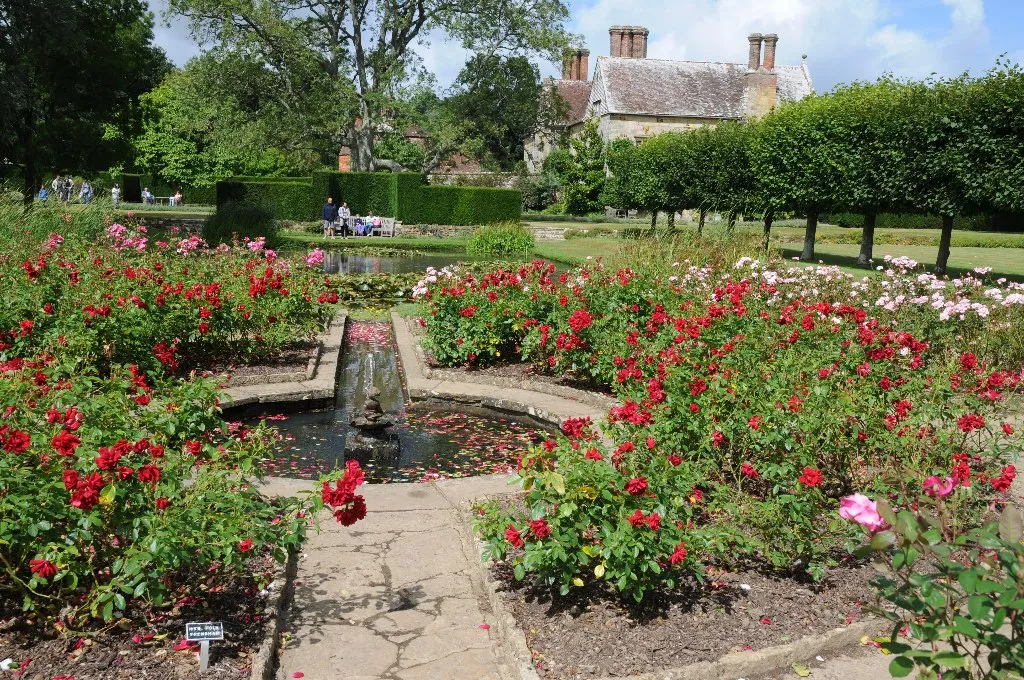
Tucked away amongst the hills of the Sussex Weald countryside lies the home of the English novelist, poet and journalist Rudyard Kipling.
Unlike some National Trust houses, Bateman’s remains open during winter, albeit with restricted hours, but the best part about this estate is the grounds. In spring and summer, there’s dragonflies and newts in the large pond, whilst bumblebees and butterflies enjoy the flowers on offer.
Yew hedge planting divides the garden into sections, look out for goldcrests flitting along the edges in search of tiny insects and invertebrates to feast upon. Upon leaving the formal part of the gardens, you can follow a path up to the Mill Pond, which has been recently restored. Look out for small birds and thrushes foraging amongst the grasses and trees. If you’re visiting over December or January, you might spot the snowdrops starting to emerge, and a sunny winter day holds the chance of sleepy butterflies emerging early from hibernation.
There’s more to Bateman’s than initially meets the eye. Spreading beyond the gardens, there are 300 more acres to enjoy, and the National Trust website has a map of three recommended routes.
Corfe Common, Dorset
2.5 miles/4km | 1.5 hours | easy
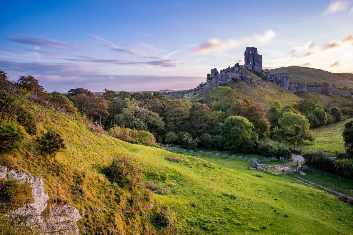
Take a 4 km circular walk around Corfe Castle Village and Common. Walk a smugglers’ route, spot Bronze Age burial mounds, and work out how Duck Street earned its name. National Trust car parking, toilets and a café are all available at Castle View. This walk is mostly level with a few slopes, gates and boardwalks.
Murlough National Nature Reserve, County Down
4.75 miles/7.6km | 2.5 hours | easy
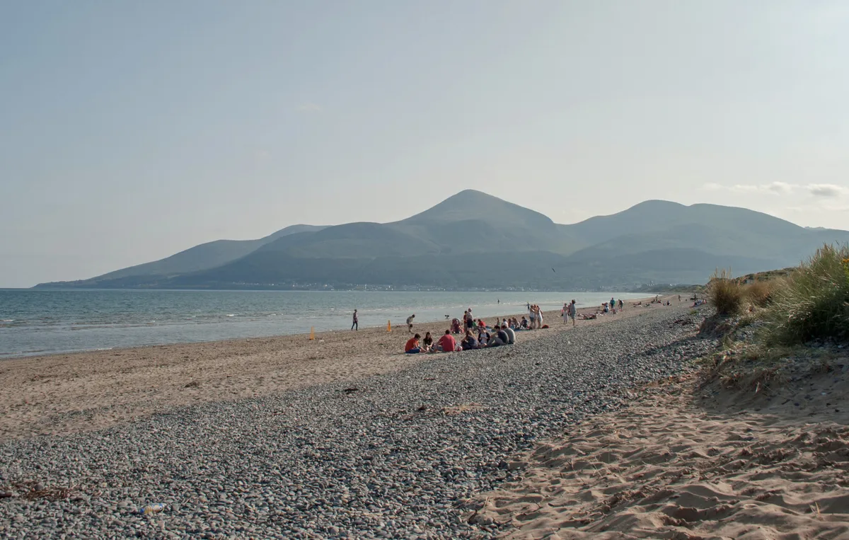
Situated 3.5 miles north-east of the coastal town of Newcastle in County Down, Murlough National Nature Reserve is a wildlife-watchers’ dream.
Its range of habitats play host to a vast diversity of flora and fauna, and the long, sandy beach is the focal point of a fantastic walk, overlooked by the iconic Mourne Mountains.
Learn all about Murlough National Nature Reserve in County Down, including wildlife, history and where to walk.
Beddgelert, Llyn Dinas and Aberglaslyn Pass, Gwynedd
5.5 miles/8.8km | 3.5 hours | moderate-challenging
This route traverses the low terrain of central Eryri (Snowdonia). It weaves through or alongside National Trust Cymru land, from Beddgelert at the confluence of the Glaslyn and Colwyn rivers, to glassy Llyn Dinas, the remnants of Sygun Copperworks, Bwlch y Sygun, Cwm Bychan and the path clutching Afon Glaslyn.
You could begin (and end) this walk at the National Trust car park at Nantmor. But for a more pleasing day out it's best to start at Beddgelert – where there are pubs, cafes, a pleasing legend about a dog, and crucially, buses to and from Porthmadog and Caernarfon.
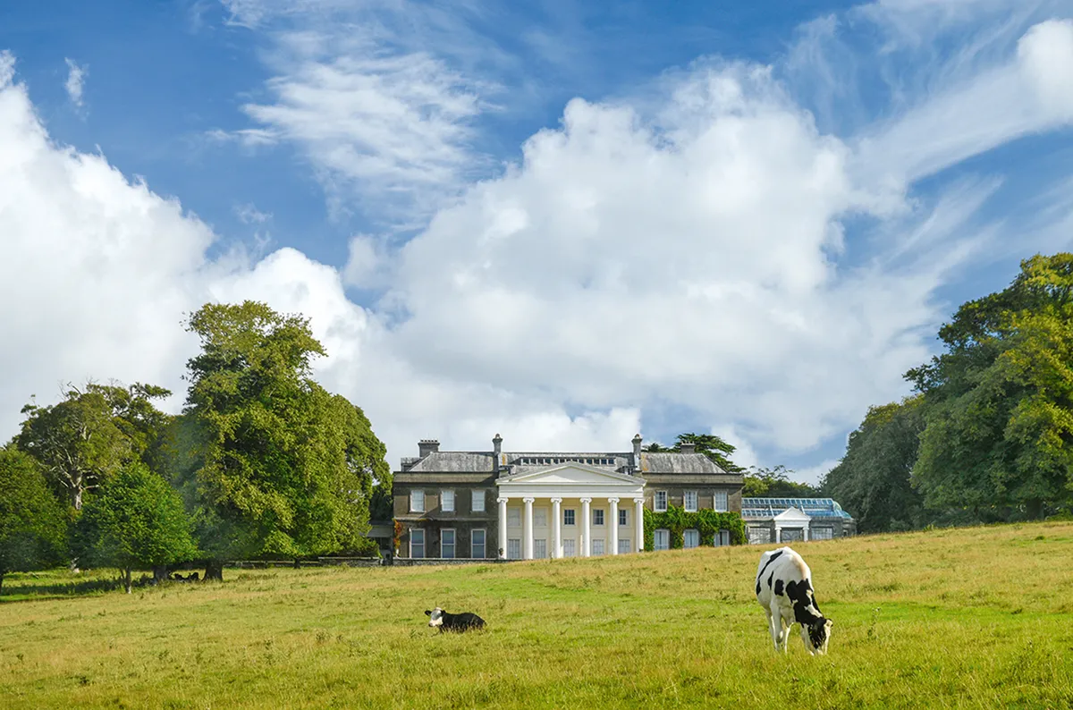
Mount Stewart, County Down
Three walks, various lengths
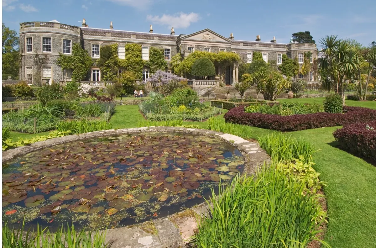
Perched on the edge of the largest sea inlet in the UK is Mount Stewart, a gorgeous Neo-classical house surrounded by woodland, orchards and farmland just waiting to be explored, says Helen Fairbairn
The shores of Strangford Lough, County Down, harbour a host of precious habitats. Prime amongst them is the family-friendly National Trust estate of Mount Stewart, on the lough's north-eastern edge. Reduced winter foliage makes it easy to spot the demesne's red squirrels and woodland birds, while seasonal flocks of gadwall supplement resident water birds on the lake.
To discover this rich landscape, start from the front of the 19th-century mansion. Begin by following the Lake Walk, a wide gravel path that meanders left, past the lake. Look out for evergreen tree species like monkey puzzle and Californian redwood, and later for the famous white stag statue.
Cross a little stone bridge to meet Lady's Walk; turn right here for a circuit 0.6 miles long. Alternatively, continue onto woodland paths for a two-mile loop around Rhododendron Hill. Berries and snowdrops provide winter colour before you descend back to the main house. Finish your outing with a hot drink in the cosy café.
Godrevy to Hell’s Mouth (and back), Cornwall
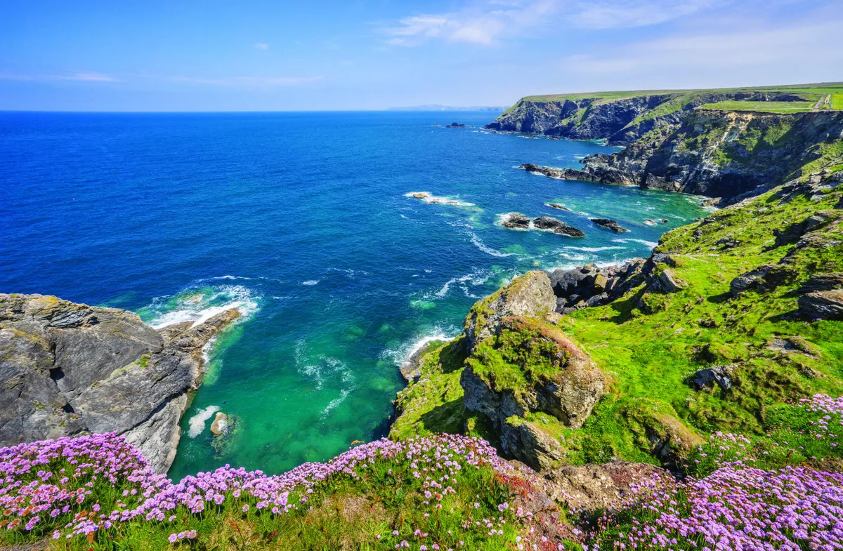
A stirring yomp along the South West Coast Path that offers a gloriously elemental experience of Cornwall’s wild, rugged north Atlantic Coast.
Starting at Godrevy National Trust car park, the path first leads to Godrevy Point, taking in views of the lighthouse that inspired Virginia Wolfe’s 1927 novel. It then passes through the Knavocks, an area of important, wildlife-rich heathland, before merging with a stretch of road to Hell’s Mouth.
From your vantage point nearly 100m up, you can gaze down as sheer cliffs give way to this craggy, ominously-named little cove, where waves churn and seabirds soar. Before re-tracing your steps, refuel at Hell’s Mouth Coffee House (hellsmouth.co.uk).
Coombe Hill, Buckinghamshire
2.8 miles/4.5km | 2.5 hours | easy
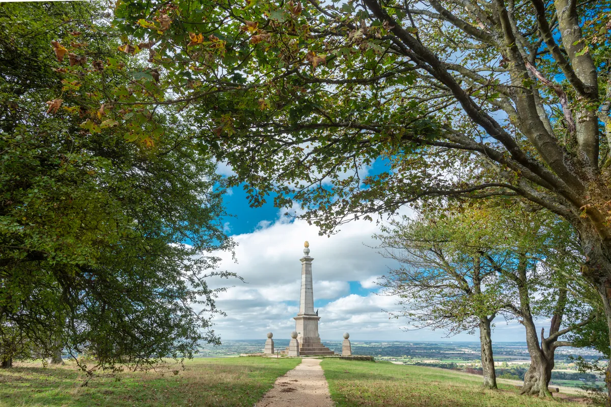
Walking out to the war memorial on the exposed summit of Coombe Hill, the highest point in the Chilterns, is always stirring. You’ve reached the first monument built to commemorate war dead rather than celebrate victory and, coupled with a bracing northerly wind or a mist hanging over the Vale of Aylesbury below, it can’t fail to bring out goosebumps.
Beyond the monument, the Ridgeway National Trail heads along the top of the wildlife-rich chalk escarpment, enjoying far-reaching views over the Buckinghamshire countryside before we head into ancient woodland.
Start from the Trust’s car park, three miles west of Wendover. It has a picnic area and infor-mation panels, including a map, but no toilets.
Looking for more fabulous days out? Check out our guides to the best woodlands, river walks and lakeside strolls in the UK.
Corrieshalloch Gorge, Highland
1.2 miles/1.9km | 1 hour | easy-moderate
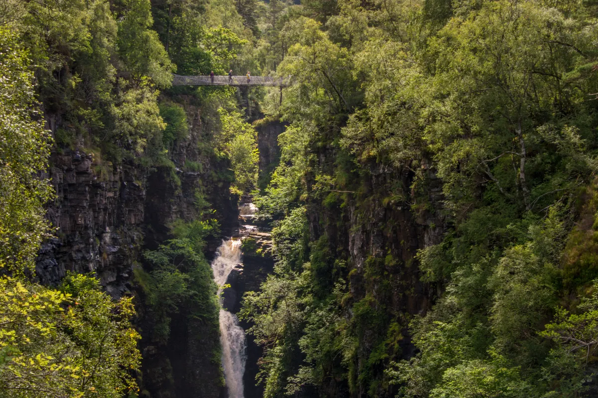
You are guaranteed to be awestruck with your first sight of the vertigo-inducing Corrieshalloch Gorge and the Falls of Measach.
One of the most spectacular of its type in Britain, Corrieshalloch provides striking evidence of how glacial meltwater can create deep gorges. A Victorian-era suspension bridge spans the gap above the 200-foot-deep chasm, where you can gaze at the long, crashing waterfall.
The National Trust for Scotland manages this national nature reserve, designated for its upland birch wood and geomorphological features, and the charity carries out a range of conservation work to protect the diverse habitats, including the eradication of rhododendron.
Botallack and Levant Mines, Cornwall
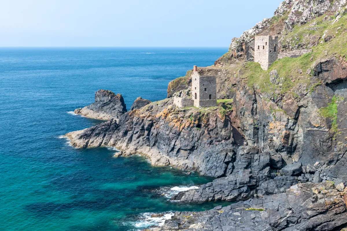
Celebrate Cornwall’s mining heritage by exploring the Tin Coast, which stretches for nearly 12km from Pendeen Lighthouse to Cape Cornwall. Starting at The Count House (once the mine office, now an information centre), first explore the atmospheric ruins of Botallack Mine, including The Crowns – two engine houses built into the base of the rugged cliffs.
You could then follow the coast path as far as Levant Mine and Beam Engine (a 3.5km round trip), enjoying a host of other mining relics along the way.
Kingston Lacy, Dorset
2.8 miles/4.6km | 2 hours | easy
Follow this 4.6 km gravel track and wooden boardwalk through the winter treescapes of Kingston Lacy’s deciduous native woodland. It’s suitable for bikes, pushchairs and wheelchairs. Don’t forget to stop for halfway fun at the Woodland Play Area. Find toilets and refreshments at the Stables Café at the start and end of this walk.
Clent Hills, Worcestershire
3.8 miles/6.1km | 2.5 hours | moderate
Smoke-filled skies. Soot-saturated streams. Sporadic birdsong. The industrial revolution of the 19th-century spelt squalor for those in its heartlands. As a philanthropic response the National Trust was born in London. In a colloquial response the area to the north-west of Birmingham took the name Black Country. For some, temporary relief was the green lungs of the Clent Hills.
Still used as an escape from urbanisation, the National Trust has owned the partially wooded Clent Hill and Walton Hill since 1959. The two peaks rise either side of St Kenelm’s Pass. Gaps between the trees seem only to enhance the fantastic views.
Access to the Client Hills can be gained via a number of car parks. This route begins at Nimmings Wood Car Park, which contains a well-priced and friendly open-air café dispensing hot drinks and snacks throughout the year.
Looking for more walking inspiration? Check out our favourite walks in England, Scotland, Northern Ireland and Wales.
Fountains Abbey and Studley Royal Water Garden, North Yorkshire
5 miles/8.1km | 3 hours | moderate
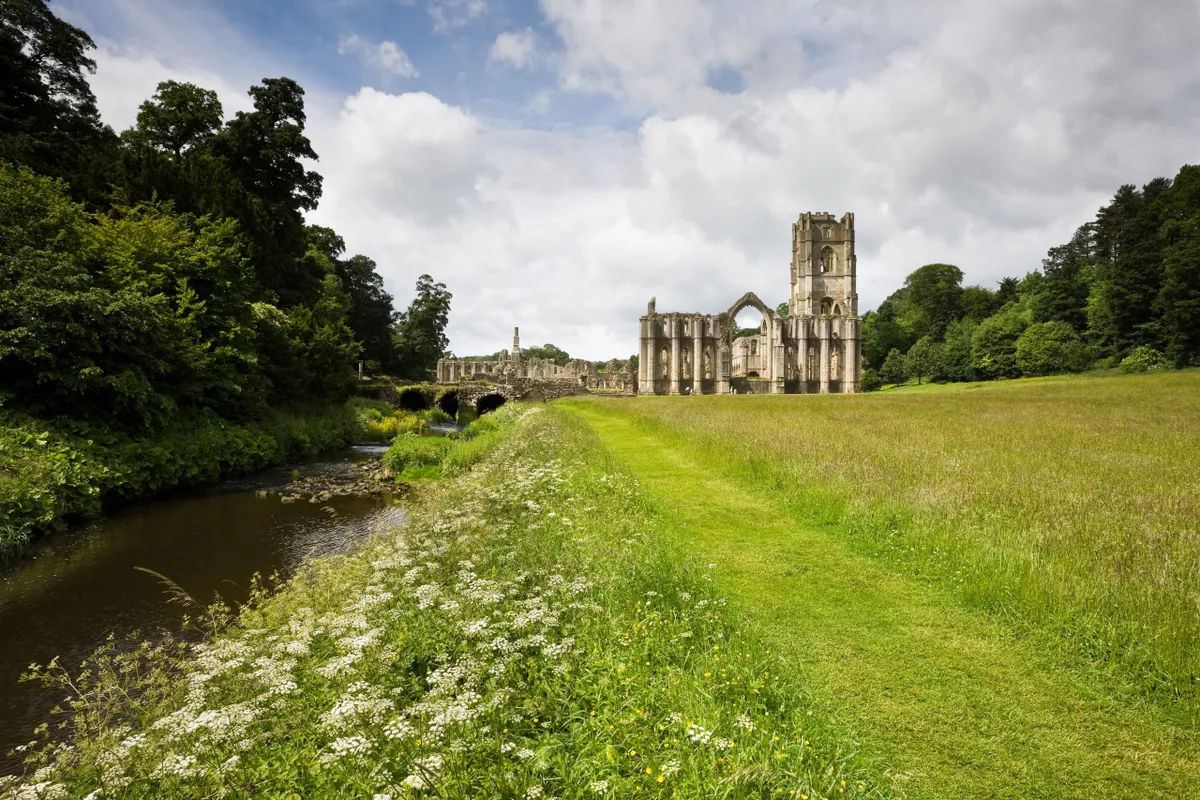
The twin National Trust properties of Fountains Abbey and Studley Royal Water Garden near Ripon provide an outstanding walk for all seasons of the year.
Using the clear, well-surfaced paths, explore the steps, follies, bridges, grottos, arches, tunnel and striking ruins of the 12th-century Cistercian abbey and 17th-century water garden. There's also a restaurant and café at either end of this walk.
Use your imagination to give names to shapes in the trees and fallen trunks that dot the deer park, the third element of the estate. Allow a full day for your visit as there's masses to see and lots of places you'll want to linger.
Looking for more walking routes in the area? Check out our favourite walks in North Yorkshire.
Brownsea Island, Dorset
Three routes, various lengths
Keep your eyes open for Sika deer and red squirrels as you explore Brownsea Island. Choose from three way-marked routes or join them together to discover cliff views, a natural play area and a beach covered in old pottery.
Catch a ferry from Poole Quay and enjoy drinks and light meals at the café. Toilets are available at locations across the island. Assistance dogs only.
Cotehele, Cornwall
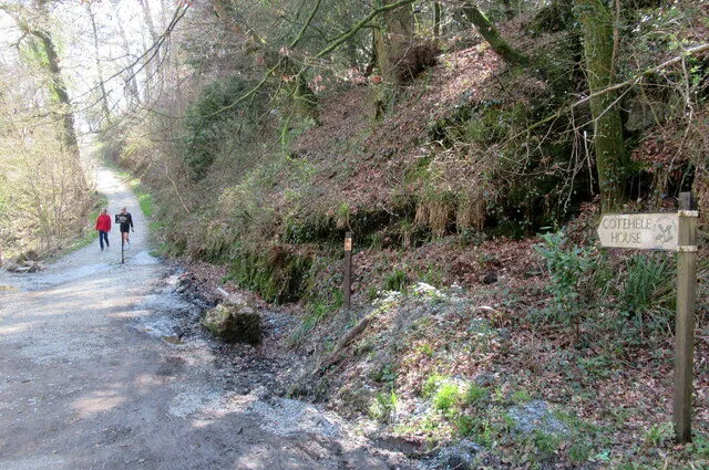
Spanning 1,300 acres on the Cornish side of the winding River Tamar, this vast and varied estate offers riverside woodland, a water mill and a historic quay. Follow the easy trail beside Morden Stream to the mill and back, then amble along the bank of the Tamar, where valuable inter-tidal habitat is being restored for wildlife.
Along the way, discover a tiny hidden chapel and take in the striking views of Calstock Viaduct. After a short, steep climb up through the gardens, pop into the Tudor Hall to admire the traditional winter garland, made from thousands of dried flowers grown in Cotehele’s Cut Flower Garden.
Grey Mare’s Tail, Dumfries and Galloway
2.7 miles/4.3km | 2 hours | moderate
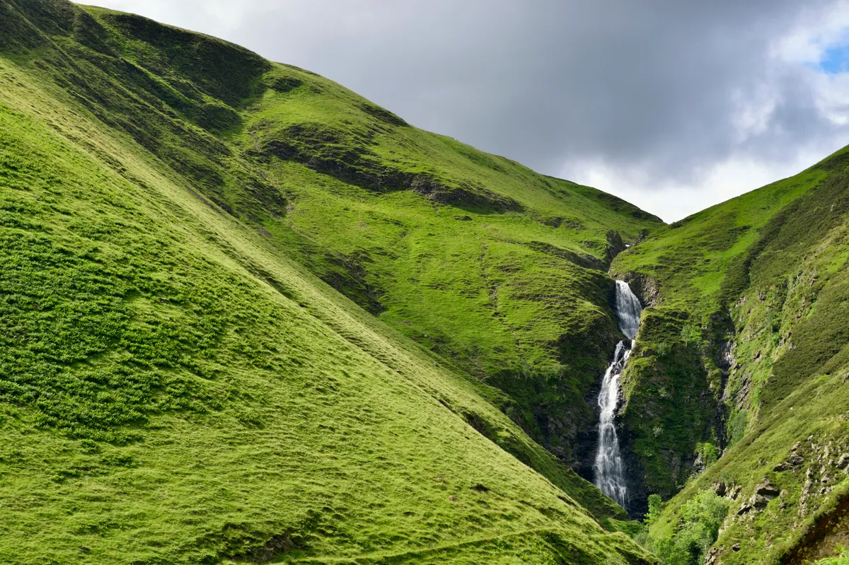
The Grey Mare’s Tail Nature Reserve lies on the eastern edge of Dumfries and Galloway, near the boundary with the Scottish Borders. Nearby Moffat, 10 miles to the west, was the first ‘Walkers are Welcome’ town in Scotland and makes the perfect base for year-round exploration of the peaks and valleys of the Southern Uplands.
This easy-to-follow path from the car park 200m up the side of the Grey Mare’s Tail waterfall to Loch Skeen at 500m is an excellent introduction to the Moffat Hills, especially in the colder months when the chances are you might have it all to yourself.
Godolphin, Cornwall
2 miles/3.2km | 1 hour | easy
An evocative, 17th-century manor house within 550 acres of woodland and farmland, lying in the shadow of Godolphin Hill.
An hour’s ramble to the summit will reward with a spectacular winter coast-to-coast panorama of the Cornish countryside, stretching from St Michael’s Mount in the south to St Ives Bay in the north. For those less fond of heights, there’s also a picturesque, one-mile circular trail along the River Hayle; part of this is suitable for wheelchairs.
Trelissick, Cornwall
4 miles/6.4km | 2 hours | easy–moderate
Sitting on its very own peninsula, this impressive property enjoys a commanding position over the Fal Estuary. Stroll down through parkland to Trelissick Beach and look out over the water, then lose yourself in the maze of woodland paths, taking in the view of the house from Tregothnan View.
Along the way, catch glimpses of the Fal through the leafless trees and listen out for the drumming of great spotted woodpeckers.
Boscastle and the Valency Valley, Cornwall

Beginning in the scenic fishing harbour of Boscastle, this walk sweeps you south west around the headland before turning inland, passing through the village and up and around Minster Wood, along the banks of the Valency River.
Tucked away in the woods is Minster Church, whose origins go back to the 6th century, and there’s the option of a fun short cut via stepping stones across the water. At low tide, look out for the blowhole at the base of the cliffs near the harbour entrance, which periodically hurls spouts of white water high into the air.
St Anthony’s Head, Roseland Peninsula, Cornwall
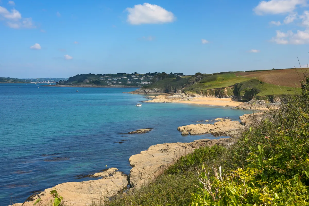
History and wildlife combine in this interesting little ramble around the southernmost tip of Cornwall’s famous Roseland Peninsula. From St Anthony’s Head National Trust car park, the route zig-zags towards and away from St Anthony’s lighthouse and up to the headland, taking in a bird hide and military outposts.
Watch the comings and goings across the water into Falmouth Harbour and look out for grey seals hauling out on the rocks below. There’s also the option to divert off the path for some winter games on the sand at Little Molunan beach.