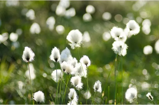
During the long, balmy days of summer, options for walking are seemingly endless. Step out of your door and stroll to your local park or reserve; amble through cool, shady woodlands; follow riverside trails and canal towpaths; relish the seaside charm of a coastal path; head for the high hills or climb mountains.
With so many options, choosing a summer walk can be tricky. To help you out, we've put together a selection of our favourite summer hikes. Each summer walk includes route directions and a map, as well as wildlife highlights, amenities, distances and difficulty.
Looking to make the most of your summer walk? Check out our guides to the 'best walking shoes to buy this summer', 'picnic essentials' and 'eco-friendly gear for walkers'.
So, without further ado, from long coastal walks and mountain climbs to riverside rambles and wildflower strolls, here is our guide to Britain's best summer walks.
Best summer walks in Britain
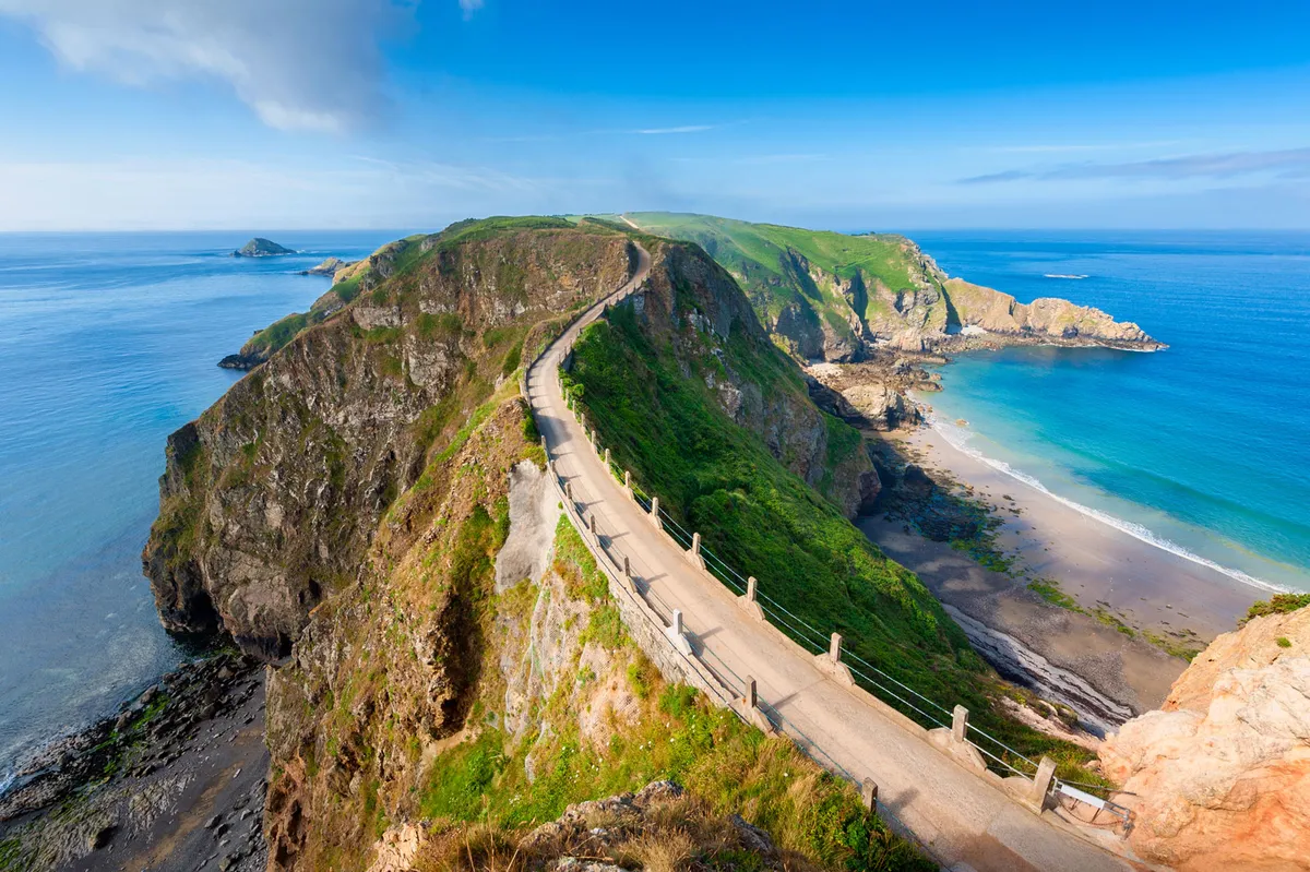
Valley of Rocks, Devon
Distance: 3 miles | Duration: 1.5 hours
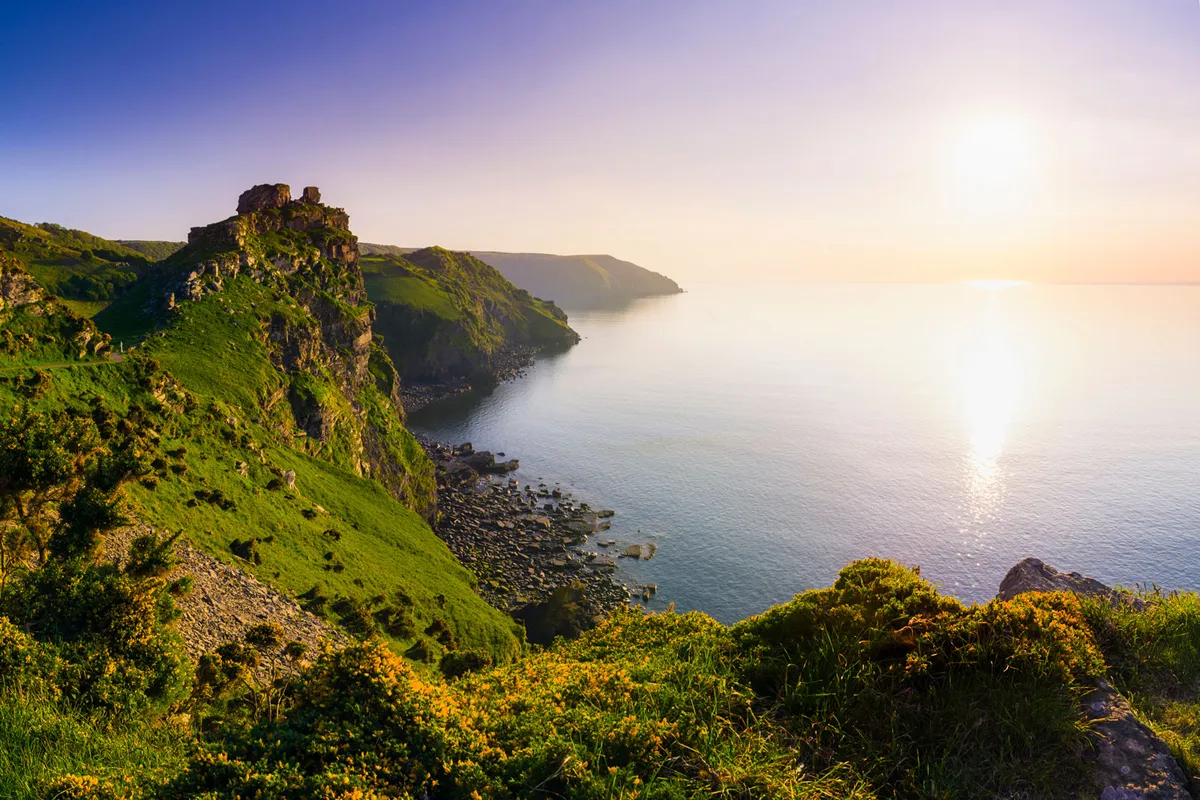
Exult in towering sea cliffs where feral goats clamber skilfully between Devonian crags on our short circular walk around the Valley of Rocks in Exmoor National Park.
Valley of the Rocks walking route and map
More related content
Nant Bochlwyd and Llyn Bochlwyd, Conwy
Distance: 2 mile | Duration: 1.5 hours
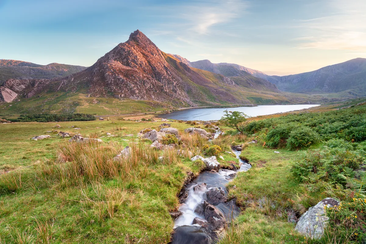
Almost 200m above the magical Llyn Idwal National Nature Reserve are the mercury waters of Llyn Bochlwyd. For many, this small, isolated lake offers a welcome stopping point en route to the vertiginous heights of Tryfan – one of Snowdonia’s most prized summits.
But the pool has another secret: an unruly cascade that spills from its outflow between two huge rocky buttresses that conjure visions of Tolkien’s Gates of Argonath, or The Pillars of Kings.
Nant Bochlwyd and Llyn Bochlwyd walking route and map
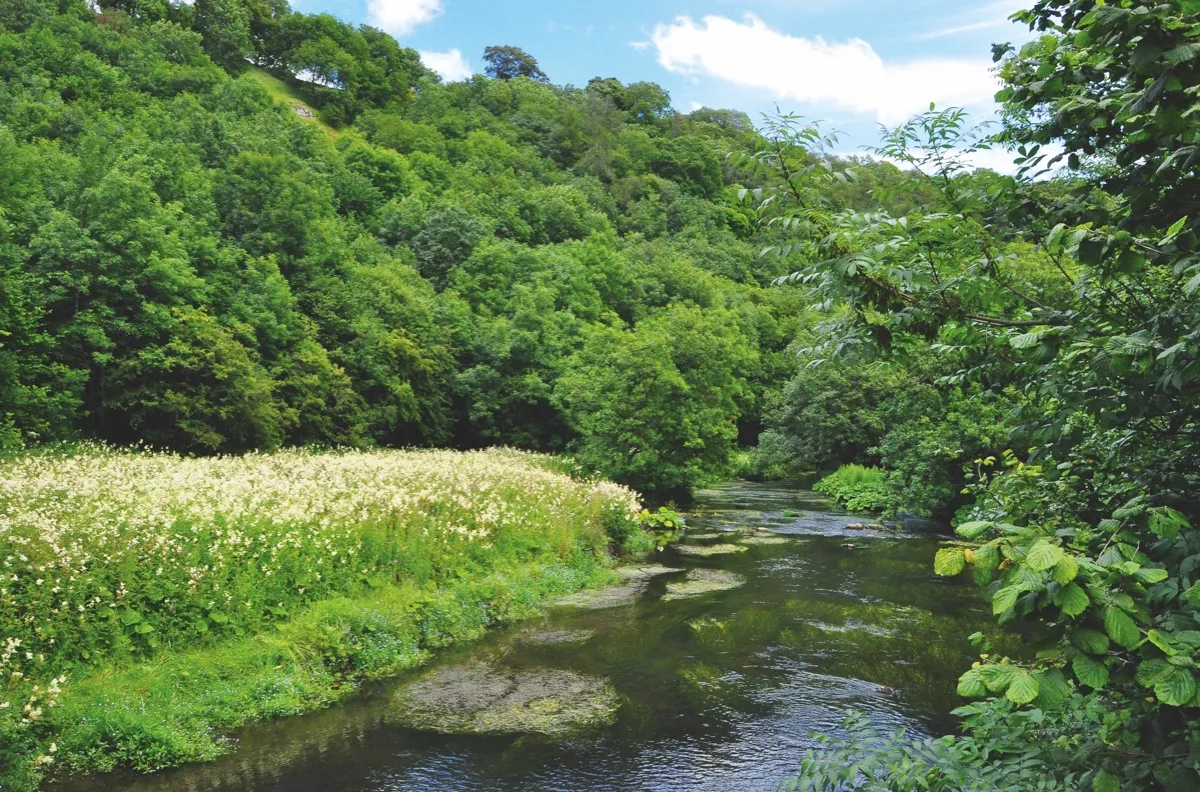
River Stour, Suffolk
Distance: 3 miles | Duration: 1.5 hours
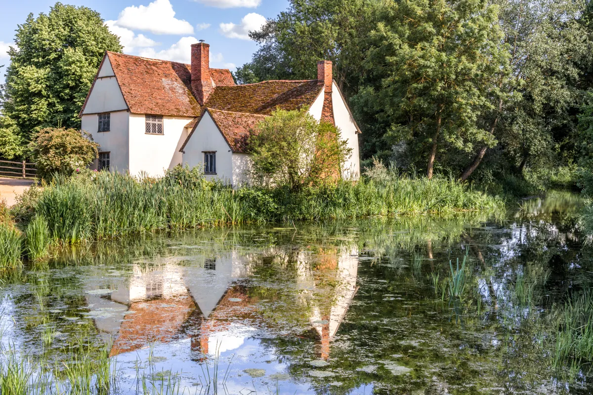
A short walk along the marshy banks of the River Stour, running from the Suffolk town of Dedham to Flatford Mill – once home to painter John Constable – and back again.
River Stour walking route and map
Crail to Anstruther, Fife
Distance: 3.8 miles | Duration: 2 hours
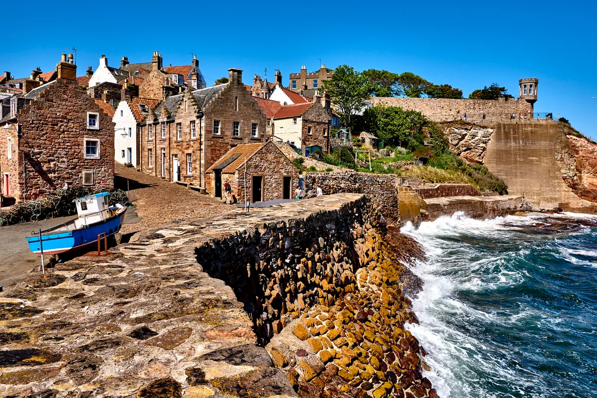
From the latter half of the 19th century, the fishing industry developed in earnest. Fishing still runs deep and working harbours remain along the Fife coast. A walk along the gentle coastline in the invigorating sea air is the best way to discover the area and its heritage. It’s also straightforward thanks to the waymarked Fife Coastal Path.
Crail to Anstruther walking route and map
Murlough National Nature Reserve, County Down
Distance: 4.7 miles (7.6 km) | Duration: 2.5 hours
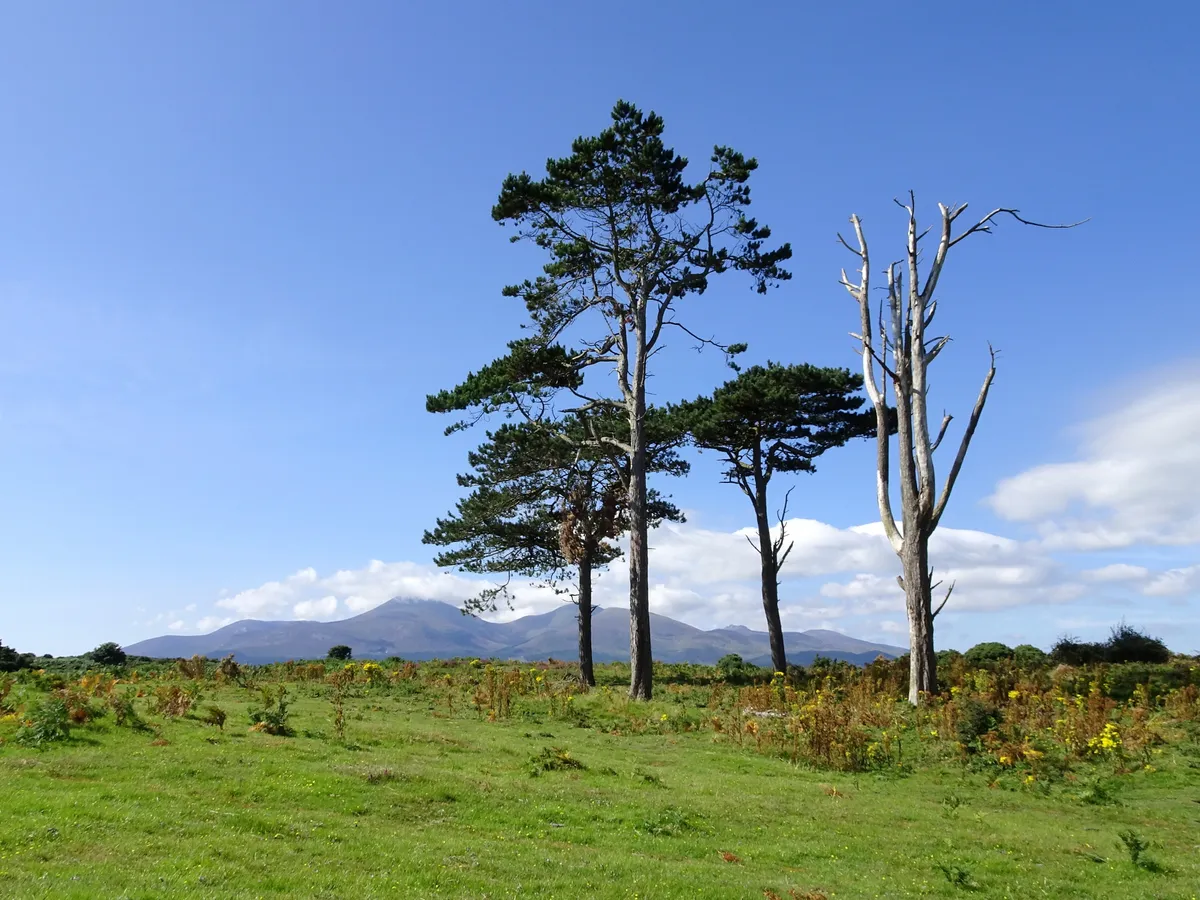
Situated 3.5 miles north-east of the coastal town of Newcastle in County Down, Murlough National Nature Reserve is a wildlife-watchers’ dream. Its range of habitats play host to a vast diversity of flora and fauna, and the long, sandy beach is the focal point of a fantastic walk, overlooked by the iconic Mourne Mountains.
Murlough National Nature Reserve walking route and map
Greenlee Lough, Northumberland
Distance: 3 miles | Duration: 2.5 hours
Lying to the north of the Great Whin Sill, and easily visible from Hadrian’s Wall, Greenlee Lough is the largest natural lake in Northumberland.
Greenlee Lough walking route and map
Caer Caradoc Hill, Shropshire
Distance: 4.5 miles | Duration: 3 hours
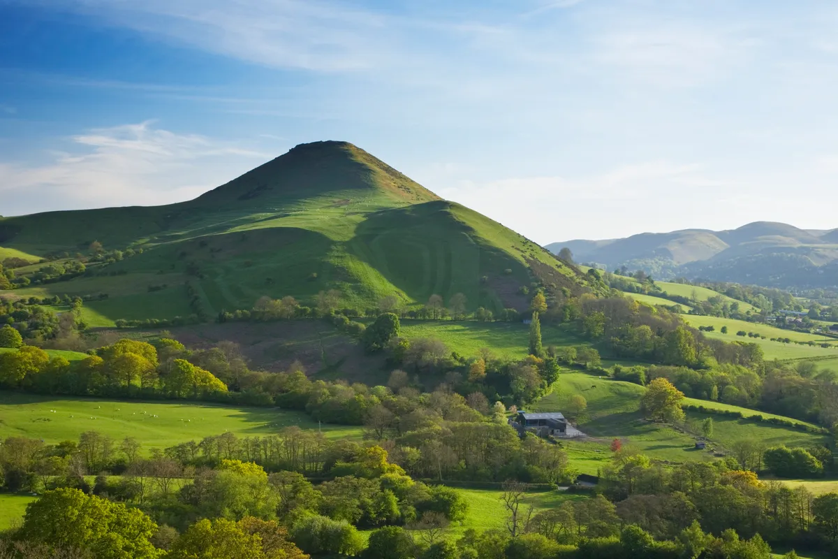
This moderate-level ramble takes you from the train station to the summit of Caer Caradoc and its ancient hill fort – thought to date from either the Iron Age or Late Bronze Age. It’s a stiff climb to the top, but one worth the effort for the spectacular views.
Caer Caradoc walking route and map
Sutton Bank, North Yorkshire
Distance: 8 miles (13km) | Duration: 5 hours
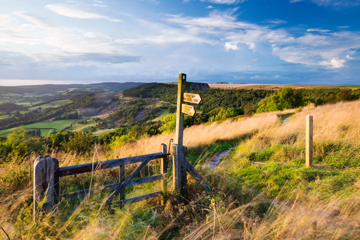
This route to Sutton Bank provides walkers with one of the finest views in the Yorkshire Dales and a chance to see the national park’s varied scenery from up high on the escarpment edge.
Sutton Bank walking route and map
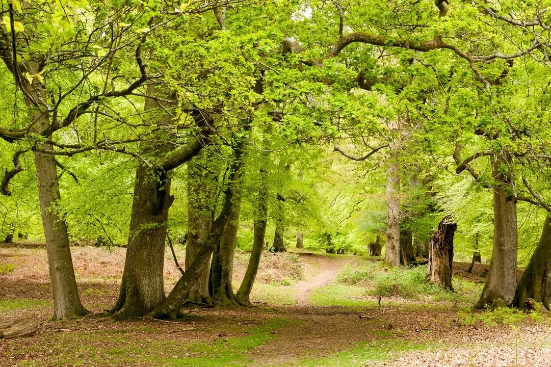
Coille Mhor, Highland
Distance: 5 miles (8km) | Duration: 3 hours
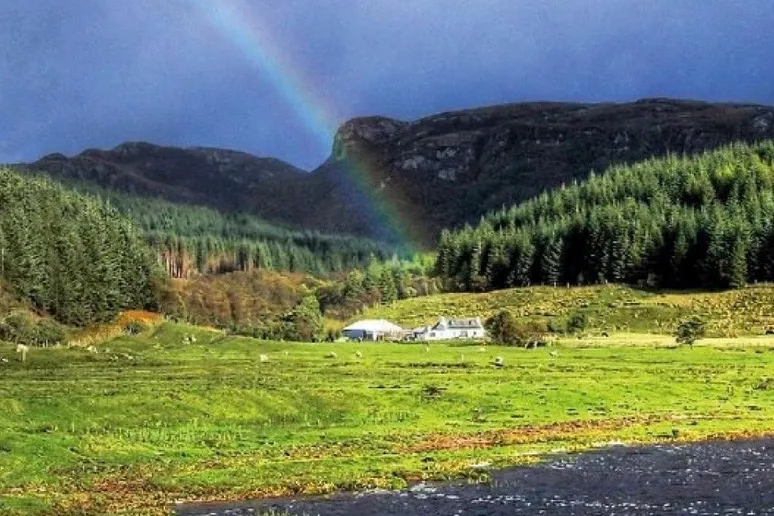
The zing of spring and summer is powerful here. Pure air provides ideal conditions for an impressive range of lichens that grow en masse upon the old oaks of Coille Mhòr’s lower slopes. Higher up, birch, rowan, alder and ash thrive, and the forest is also home to mammals including badgers, pine martens and visiting otters.
Coille Mhòr walking route and map
Meon Valley, Hampshire
Distance: 12¾ miles (20 km) | Duration: 5-6 hours

Discover a landscape shaped by man and nature over 6,000 years on a walk that enters the heart of the South Downs National Park in Hampshire. This walk offers a perfect blend of impressive natural wonders and interesting historical sites.
Meon Valley walking route and map
Cwm Idwal, Gwynedd
Distance: 3 miles (4.8km) | Duration: 2 hours
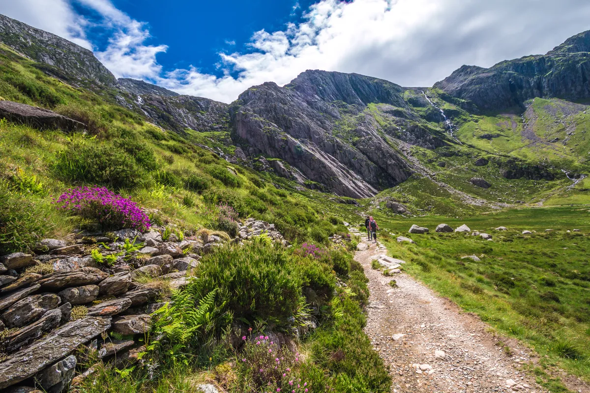
The jagged peaks that soar over Cwm Idwal dwarf the Arctic-alpine plants that grow on the slopes around its waters. To appreciate them fully, you have to crouch down or dangle over them to see their colourful petals hunkered on ledges or in crevices – it’s here that they thrive, feeding on minerals that leach through the rock.
Cwm Idwal walking route and map
Chee Dale, Miller’s Dale and Wye Dale, Derbyshire
Distance: 4 miles | Duration: 2.5 hours
Deep in the White Peak east of Buxton is a captivating area of countryside; a union of natural bounty and majestic engineering that together create a truly astounding landscape. Although it may have its challenges, this walk is readily accessible to all with a measure of agility and a sense of adventure.
Cheedale walking route and map
Seven Sisters, East Sussex
Distance: 4 miles (6.4km) | Duration: 2 hours

At the National Trust hamlet of Birling Gap, the sea’s aroma sits strong in the air. From the top of the steps above the beach and its numerous rockpools, the views of the Seven Sisters and Seaford Head are excellent. For many, these huge chalk cliffs are even more picturesque than the famous White Cliffs of Dover up the coast.
Seven Sisters walking route and map
Ennerdale and Haystacks, Cumbria
Distance: 14.2 miles (22.8km) | Duration: 7 hours
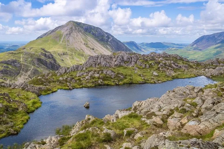
Ennerdale – the Lake District’s least populated valley – is into its second of a long-term plan to re-wild Lakeland’s westernmost dale. Management of the valley was delegated to Mother Nature back in 2006, but the Wild Ennerdale project isn’t about conserving or restoring a landscape to some long-lost idyll – it’s about getting out of the way to let nature take its course.
Ennerdale walking route and map
What is a national park?
In the UK, national parks are protected areas set aside for their beautiful countryside, wildlife and cultural heritage.
Our guide explores all 15 of Britain’s breathtaking national parks, each with its own unique landscape, wildlife, history and communities.
Abbotsbury, Dorset
Distance: 8 miles (12.8km) | Duration: 4.5 hours
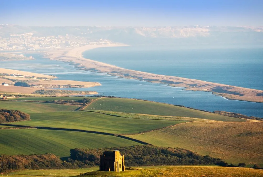
Take a walk through the Dorset countryside to a chapel overlooking the spectacular Jurassic Coast. The Jurassic Coast spans over 90 miles of Dorset's shoreline. You’ll scarcely find a coastline with more places to stretch your legs and explore the local landscape. And at the heart of it all is the village of Abbotsbury.
Abbotsbury walking route and map
Isle of Eigg, Inner Hebrides
Distance: 4 miles (6.4km) | Duration: 3.5 hours

Home to prehistoric inhabitants, Vikings, clashing clans and crofters, this mini Scottish isle has a dynamic history written deep into the land. Of all the Small Isles, Eigg – pronounced egg – is undoubtedly the most distinctive. The dramatic rocky remains of an old lava flow – An Sgurr – stand proud above the surrounding flatter land, like a whale breaching the ocean.
Lindisfarne, Northumberland
Distance: 4 miles (6.4km) | Duration: 2 hours
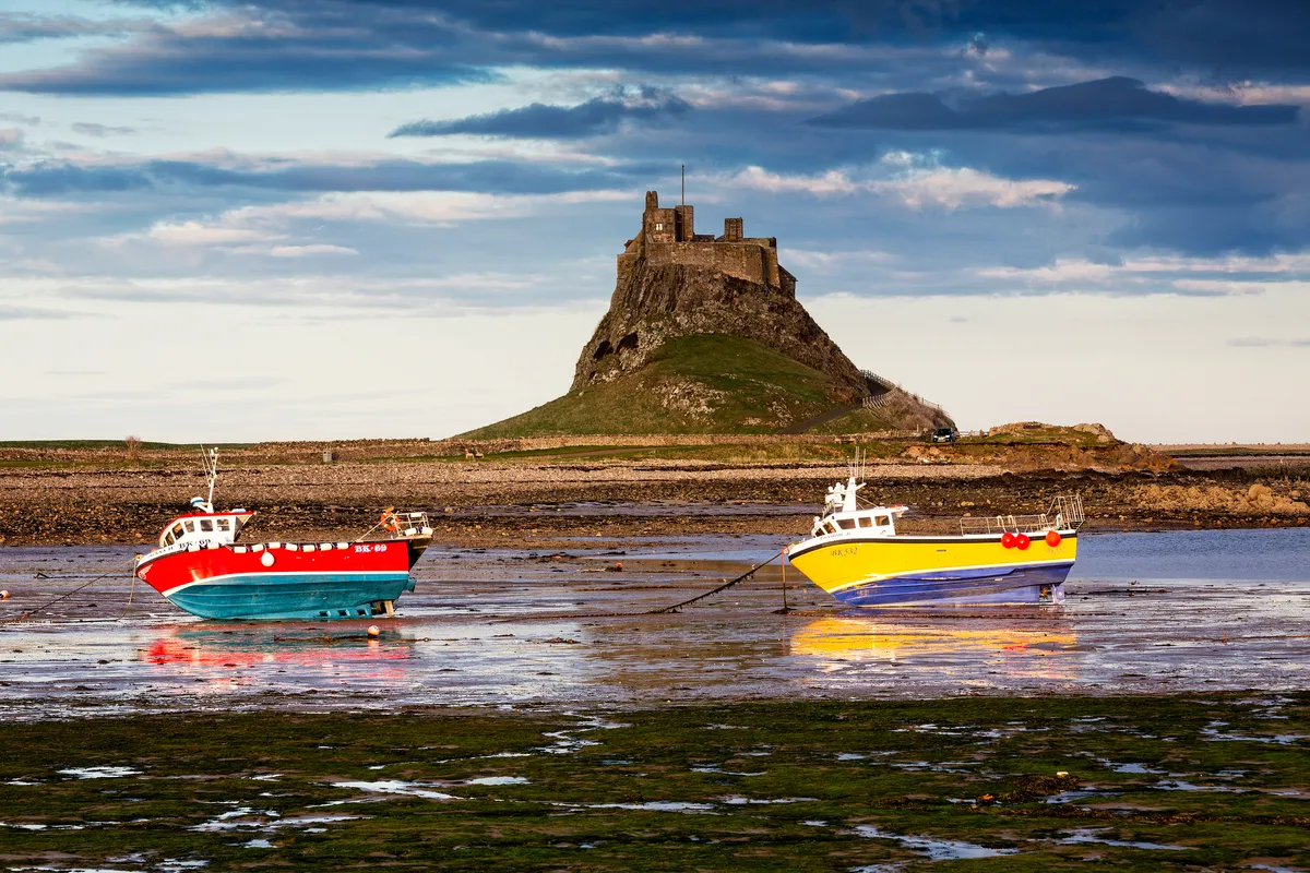
In 635 AD, King Oswald of Northumbria invited St Aidan from the monastic settlement on Iona to found a monastery on Lindisfarne. Aidan’s death, 16 years later, coincided with the vocation of local shepherd boy Cuthbert, who became bishop of Lindisfarne. The island is also an mportant national nature reserve and wintering site for migrating birds, including whooper swans and brent geese.
Lindisfarne walking route and map
St Davids Peninsula, Pembrokeshire
Distance: 9.5 miles (15km) | Duration: 5 hours
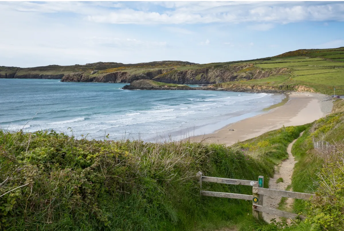
This superb coastal walk follows the trails of some of the Dark Age saints, for whom the St Davids Peninsula was a place of pilgrimage, and passes beside the wild waters of Ramsey Sound. The area is home to a wealth of wildlife, from dolphins and porpoise to peregrines and chough.
St David's Peninsula walking route and map
Upper Wharfedale, North Yorkshire
Distance: 7 miles (11km) | Duration: 4 hours
Upper Wharfedale is a charming little valley off the beaten track where the roads are too narrow for trucks and busses to navigate. It's a bit of a bind to get to, but once you've found the dale, you'll never forget it. The limestone and peat uplands hereabouts are riven with steep-sided valleys and ghylls where water teems off the fells and tumbles over a series of waterfalls through the heart of the picturesque villages of Cray, Yockenthwaiteand Hubberholme.
Upper Wharfedale walking route and map
Glen Sligachan, Isle of Skye
Distance: 11 miles (17.7km) | Duration: 5 hours
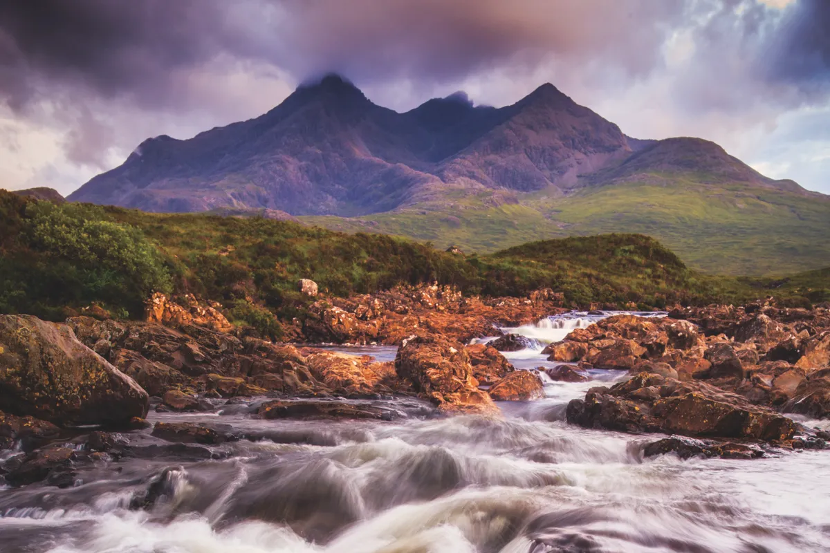
Winding through true wilderness country, you’ll feel a real sense of progression as you ford several rivers, moving from one loch to the next, past herds of red deer and the dramatically located Camasunary Bay, before arriving at the houses of Kirkibost. Save it for a fine late-summer day after a spell of dry weather – the midges will be fewer, the burns lower – and you will have a memory to last a lifetime.
Glen Sligachan walking route and map
Sark, Channel Islands
Distance: 9 miles | Duration: A leisurely 5 hours
This nine-mile walking route takes in the whole island, although there are options to shorten the way or split it into two or three days of walking. Three miles in length and half that across, Sark’s small size encourages visitors to slow down. There are plenty of trails, but no official coast path, so after visiting viewing points, you will need to retrace your steps inland at times.
Sandwood Bay, Sutherland
Distance: 13 miles | Duration: 7 hours
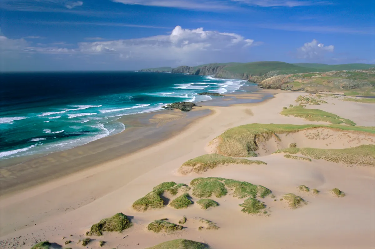
Sandwood Bay is one of Britain’s most remote and beautiful beaches. Flanked by grassy dunes and buffeted by the rolling breakers of the Atlantic, the swath of white sand is a wild and wonderful place. The only way in is on foot and the car park at Blairmore, on the narrow road between Kinlochbervie and Sheigra, is the perfect place to start.
Sandwood Bay walking route and map
East Lyn River, Devon
Distance: 6 miles | Duration: 4 hours

This beautiful six-mile walk begins at Lynmouth in the Exmoor National Park and follows the East Lyn River upstream to Rockford before heading back to the coast.
East Lyn River walking route and map
Malvern Hills, Worcestershire and Herefordshire
Distance: 5.3 miles | Duration: 3.5 hours

Hike along the Malvern ridge from British Camp, a magnificent Iron Age hill fort, before descending into the picturesque town of Great Malvern for a well-earned pub meal.