The Bannau Brycheiniog (Brecon Beacons) National Park was designated as a national park in 1957, later achieving International Dark Sky Reserve status in February 2013. The park covers an area of 519 square miles and comprises four regions: the Brecon Beacons, Black Mountains, Fforest Fawr and Black Mountain (Y Mynydd Du) each with its own bounty of beautiful walking routes.
Head to Waterfall Country in the south and take a hike along a gushing river to a series of impressive cascades, or visit the verdant valleys and ridgelines of the Black Mountains in the east. Many people seek the highest mountain, Pen y Fan, but there are plenty of other, quieter mountains with equally exciting walking routes.
Our guide explores some of the best hiking routes in the Bannau Brycheiniog, each with its own walking map and set of directions.
Bannau Brycheiniog: learn more about the renaming of the Brecon Beacons
The Brecon Beacons recently adopted its ancient Welsh name, Bannau Brycheiniog, or Bannau for short. Pronounced ban-aye bruck-ay-nee-og, the name translates in English to “the peaks of Brychan’s kingdom”, referencing the lands of King Brychan, whose 5th-century borders historically covered those of the South Wales national park.
Bannau Brycheiniog (Brecon Beacons) walks
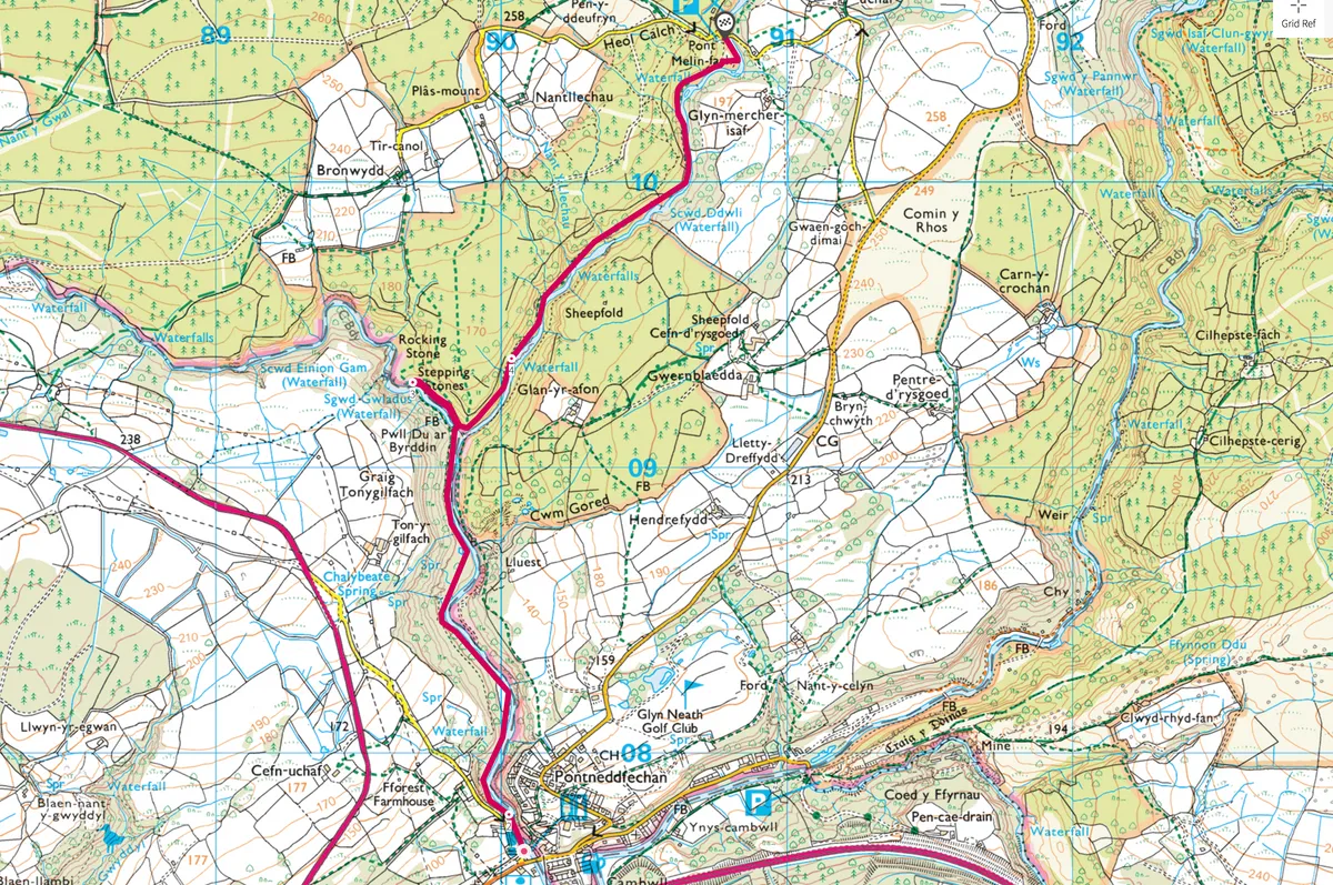
Waterfall Country, Powys
2.5 miles/4km | 2 hours | moderate
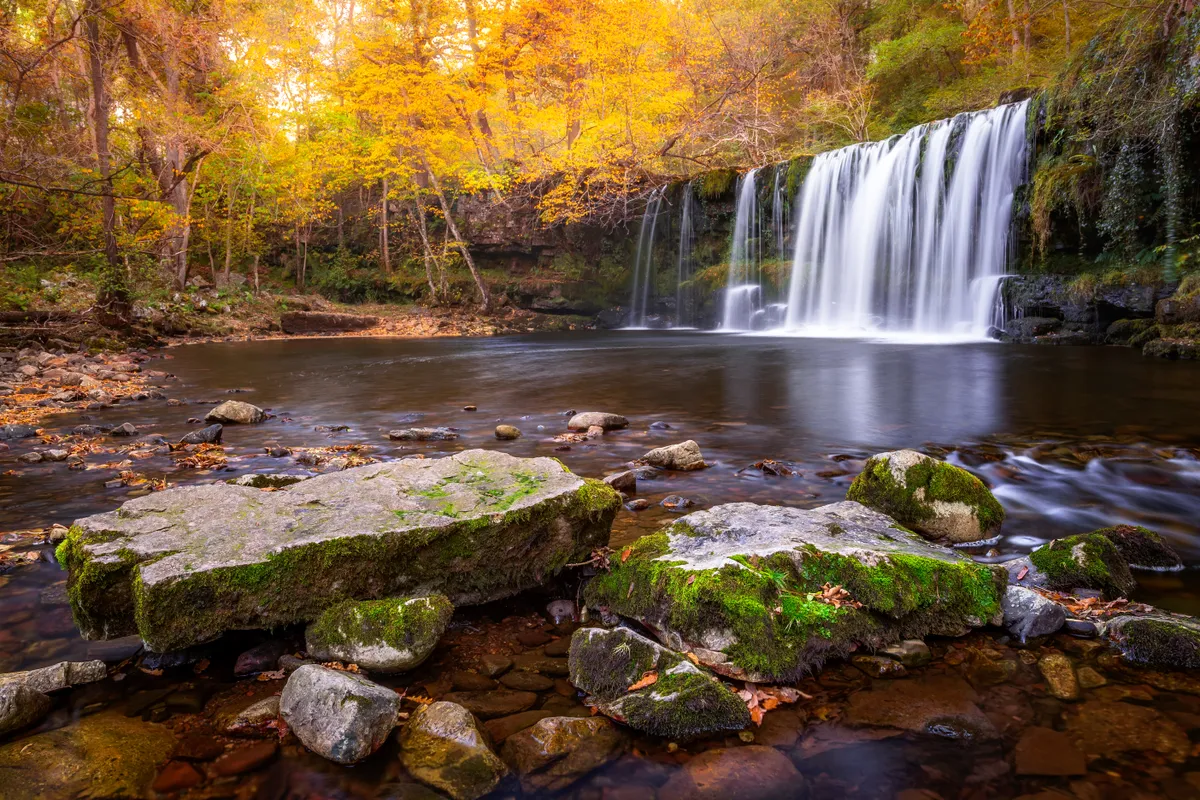
“I cannot call to mind a single valley that… comprises so much beautiful and picturesque scenery and so many interesting and special features.”
With these words, Victorian naturalist Alfred Russel Wallace was describing neither the Amazon nor the Far East that he explored on his intrepid travels, but somewhere much closer to home: the Vale of Neath on the southern slopes of the Brecon Beacons.
Spilling water, mossy riverbeds and tree-shrouded caverns, Waterfall Country is a ramblers dream – find out for yourself with this 2.5-mile walk.
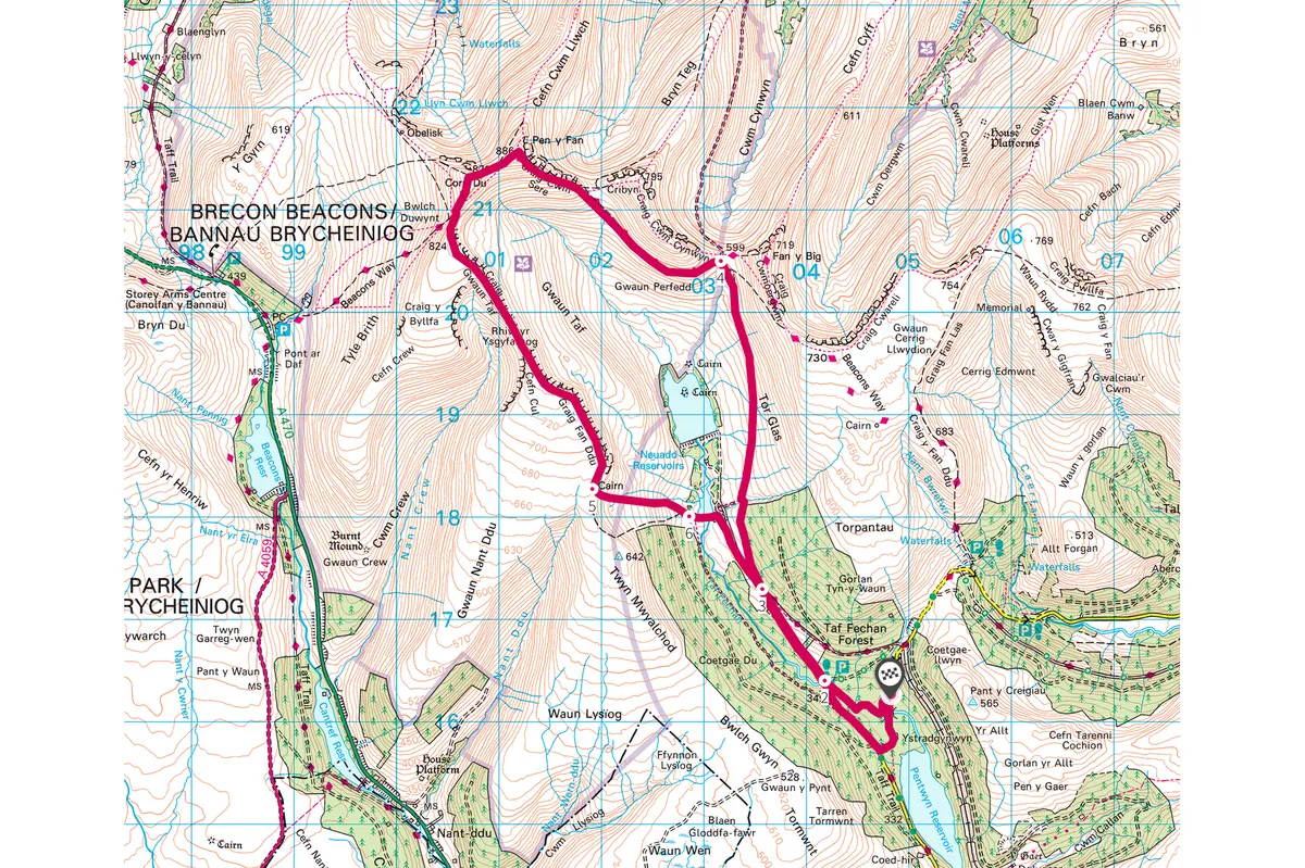
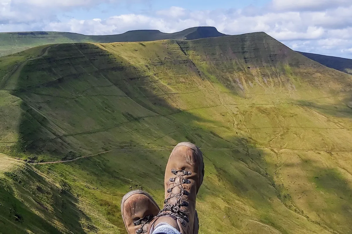
Pen y Fan, Powys
10.3 miles/16.7km | 6 hours | challenging
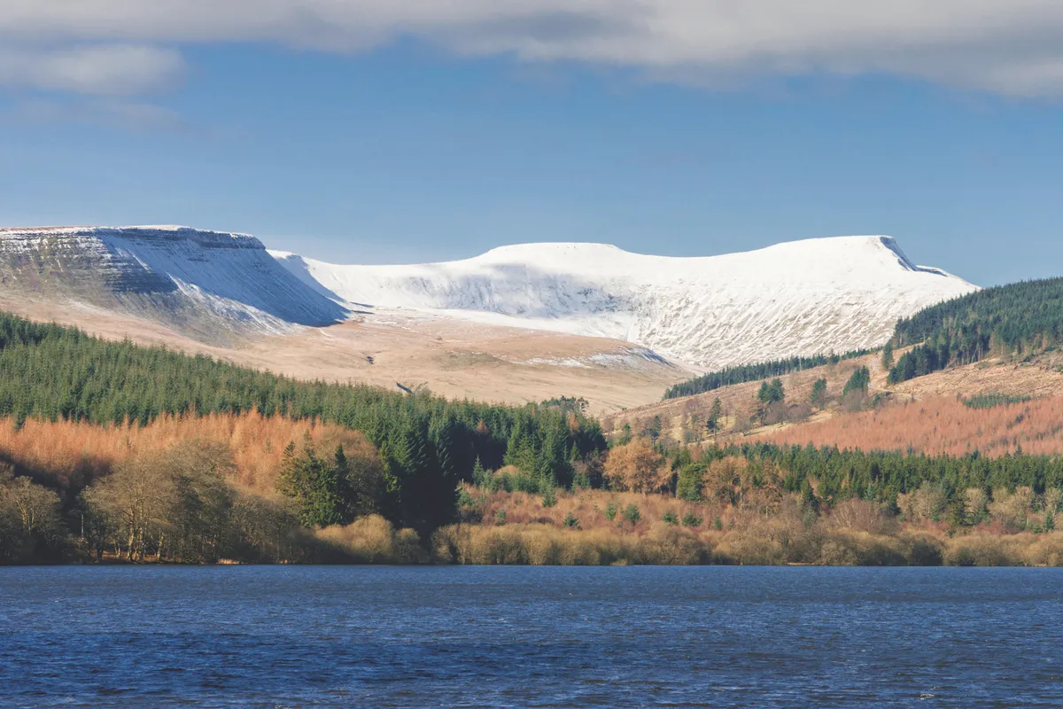
This quiet accent of Pen y Fan begins at the enchanting Taf Fechan Forest, rising beyond the now-empty Upper Neuadd Reservoir to meet the summit from the south. It’s a long day, but a highly rewarding one.
For anyone who doesn’t fancy to entire 10.5-mile hike, stop at the reservoir and appreciate the peak from the valley. A string of trees runs alongside Neuadd, offering shade in the warmer months and shelter in the cold.
Looking for more walks in Wales?
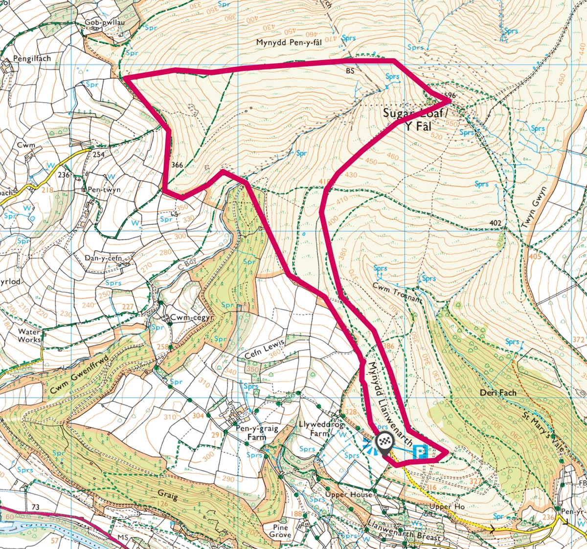
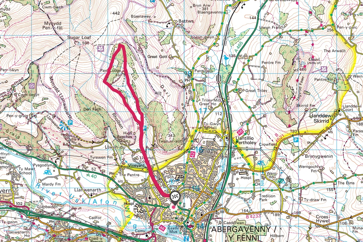
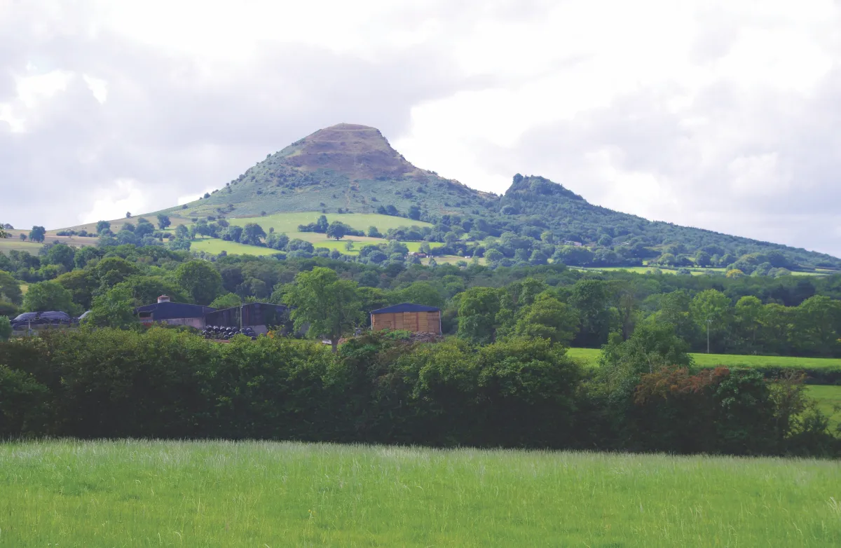
Sugar Loaf, Monmouthshire
5.2 miles/8.4km | 3 hours | moderate
In its relatively modest 596m, the summit of Sugar Loaf in the Bannau Brycheiniog National Park encompasses much that is magical about mountains, hills and woodland – explore this wonderful Welsh peak with a five-mile circular walk.
Cribyn, Powys
11.5 miles/18.8km | 6 hours | moderate-challenging
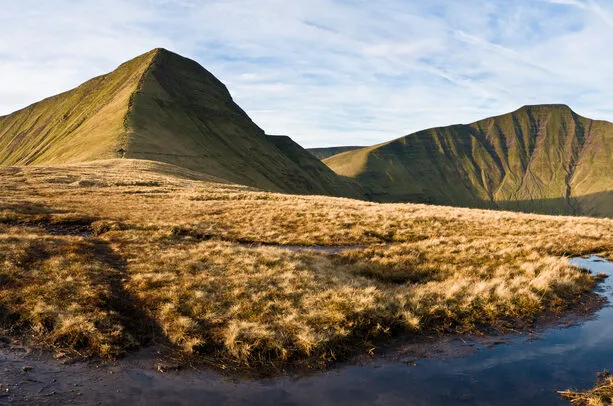
Often overshadowed by its towering neighbour, Pen y Fan, this verdant mountain in the heart of the Bannau Brycheiniog National Park in Wales is one of Britain's most understated peaks. Cribyn is the kind of mountain a child may draw; pyramidal and stacked with brawn.
Yet in spite of its mountain status, its summit is neither as high nor as insurmountable as you may imagine, making it well worth the climb.
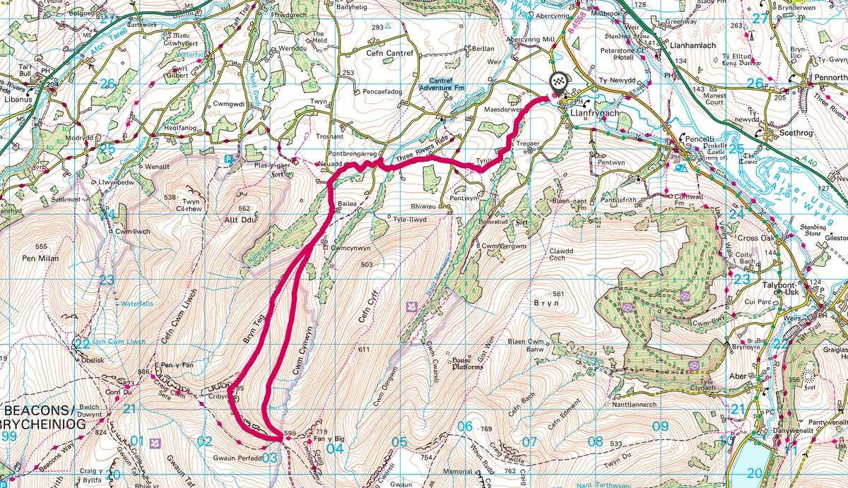
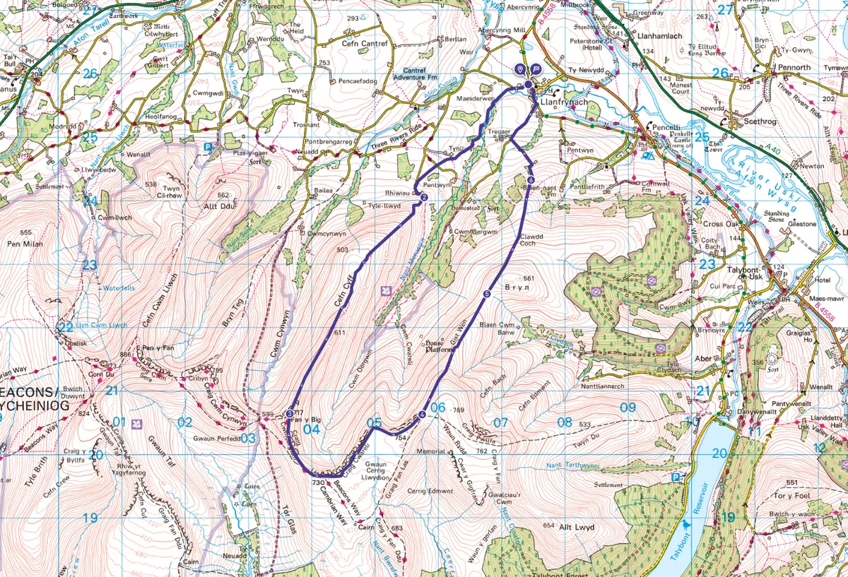
Fan y Big, Powys
10.2 miles / 16.4km | 6–7 hours | challenging
The Old Red Sandstone peaks of the Bannau Brycheiniog form an impressive backdrop to the village of Llanfrynach. Nant Menasgin, a river running through the village, originates from streams beneath the peaks Waun Rydd and Fan y Big.
This walk follows ridges via Fan y Big and includes views across the other Beacons, north to the Black Mountains and south to The Valleys and Wales.
Abergavenny and Avon Cibi, Monmouthshire
6.1 miles/9.8km | 4 hours | moderate
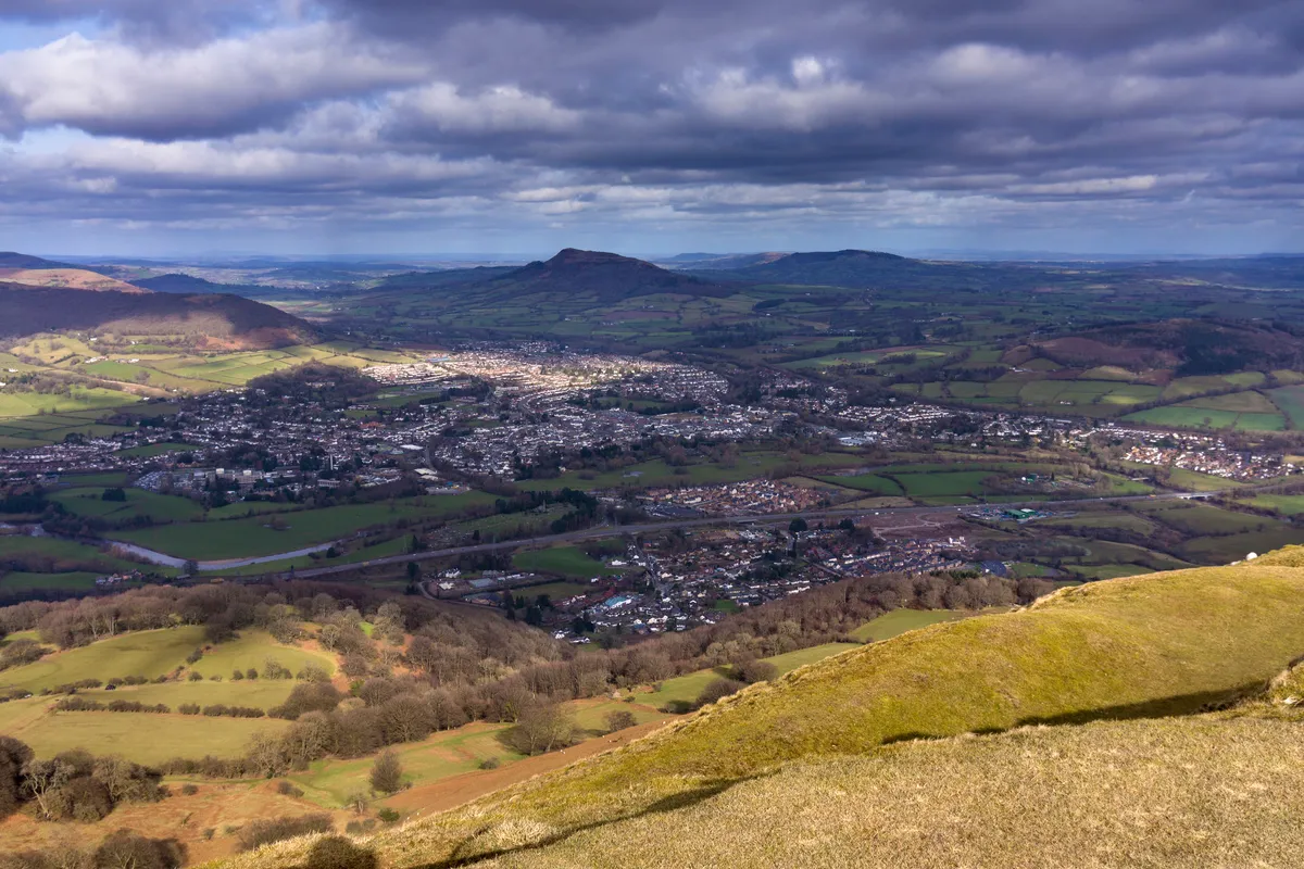
Take your time exploring the newly pedestrianised town centre, gather your treats, then set off on a lovely four-hour walk, taking in some beautiful countryside on the Sugar Loaf mountain just north of Aber.
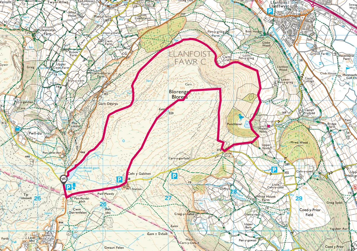
Blorenge, Monmouthshire
6.5 miles/10.6km | 3.5 hours | moderate
Step out of your car at Keeper’s Pond and look out over the Black Mountains. The instantly recognisable flat top of Sugar Loaf mountain rises above Abergavenny and, on a clear day, you can pick out the Brecon Beacons’ highest peaks, Pen y Fan, Corn Du and Cribyn to the west.
The surrounding landscape bears scars from the industrial activity the area is famous for; coal mining has left black furrows in the hillside, evidence of limestone and ironstone quarries litter the landscape and bell pits pockmark the ground behind the car park – the starting point of this 16.6km walk.
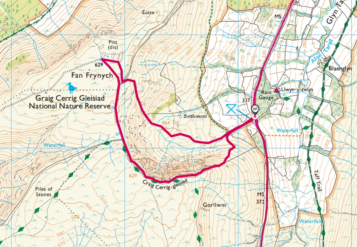
Craig-Cerrig-gleisiad, Powys
2.7 miles/4.4km | 2 hours | moderate–challenging
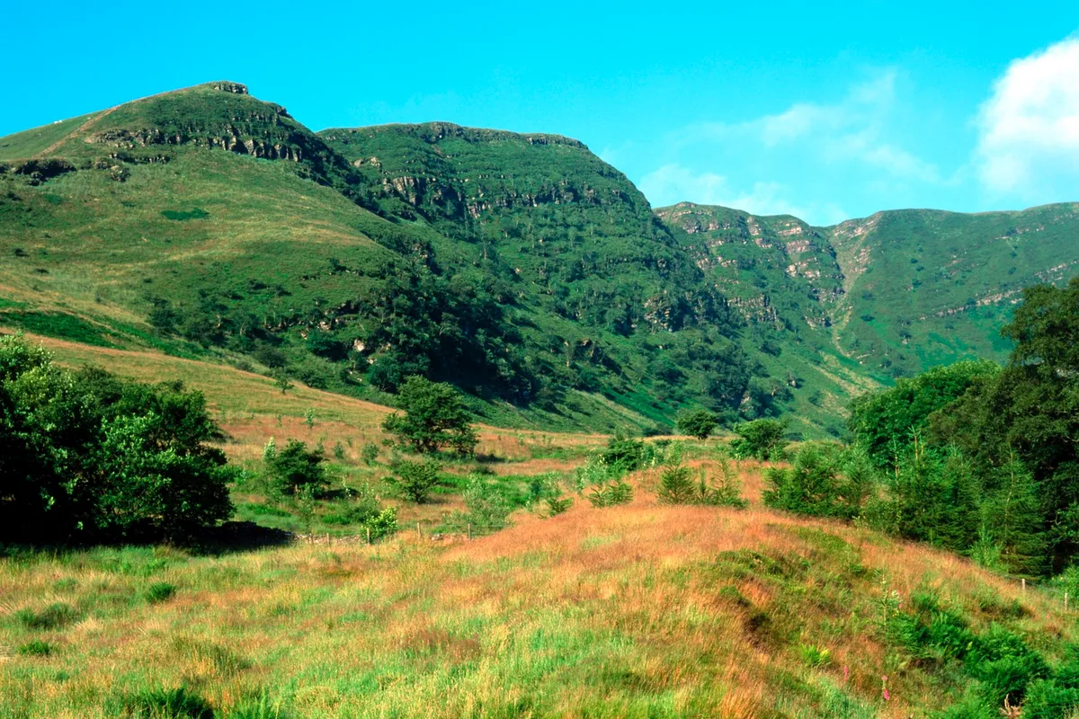
Climb any of the Bannau Brycheiniog and you’ll find a stirring view. But the best of them all is the glowering peak of Craig-Cerrig-gleisiad.
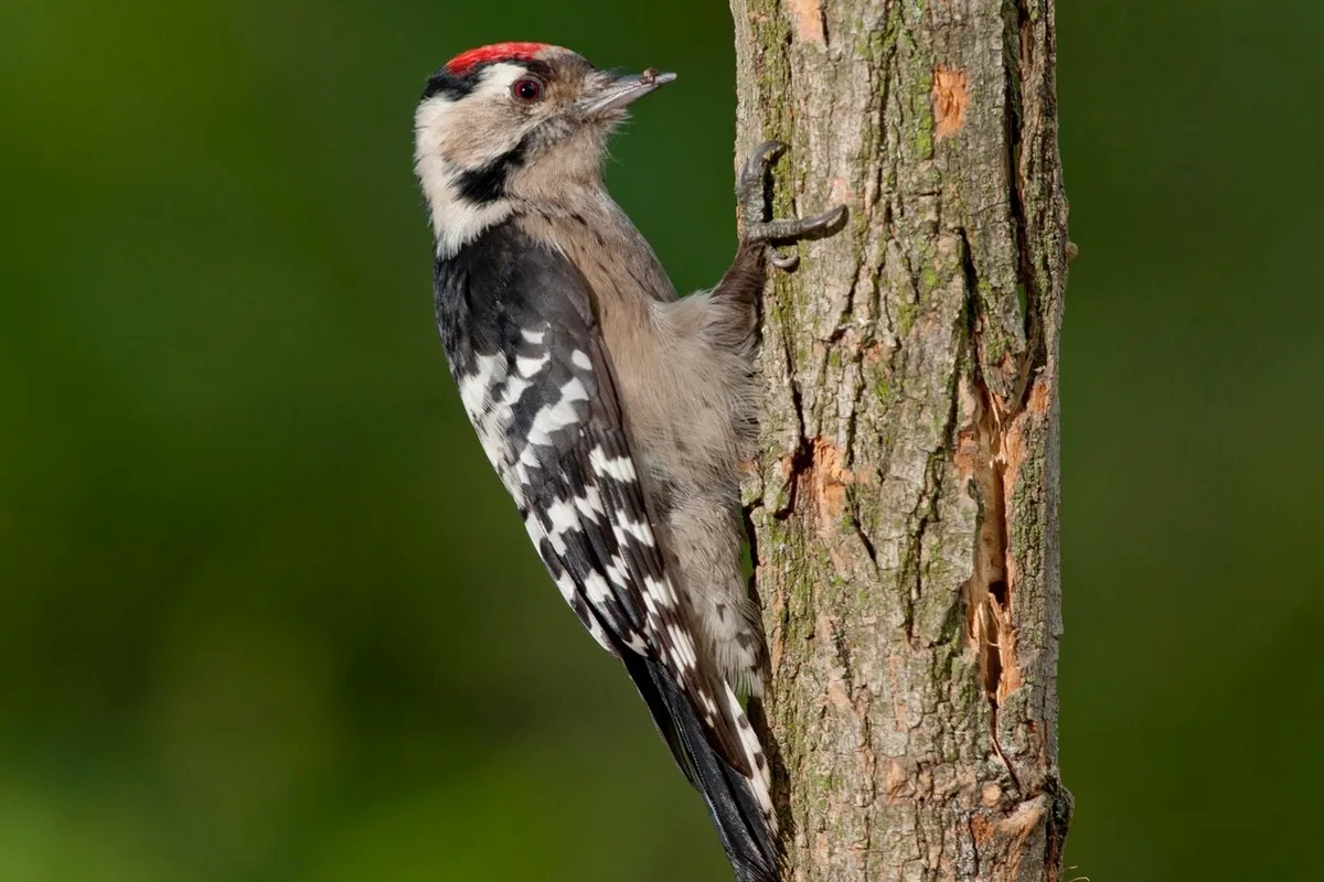
This raven-haunted buttress is studded with steep crags that have prevented sheep from grazing rare sub-Alpine plants such as the delightful purple saxifrage. It means that the flora here is richer and more interesting than elsewhere in the national park. And so are the birds.
At the foot of the cliff you’ll find bluebells in flower now among the hawthorn scrub, from where male redstarts sing. As you climb the steep paths to the top, look out for nesting peregrine falcons and the star of the reserve, the ring ouzel.
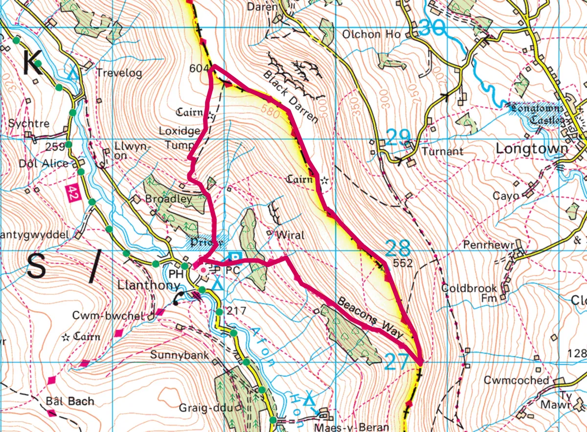
Llanthony and Hatterall Ridge, Monmouthshire
5 miles/8km | 3 hours | moderate
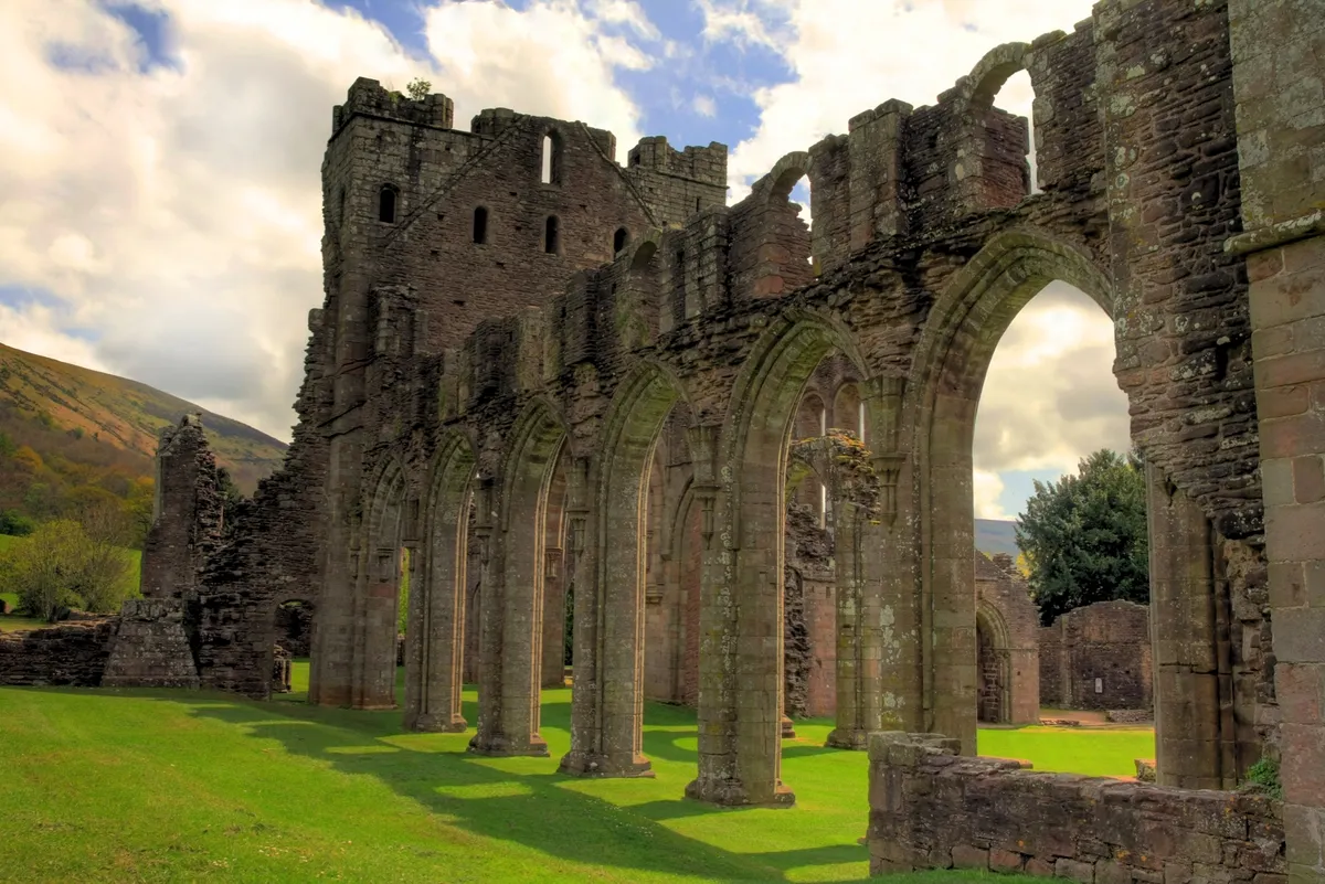
Running along the spine of England and Wales for 177 miles, this ancient path follows the eighth-century fortification built on the order of King Offa in an attempt to divide Mercia from rival kingdoms.
This energetic circular walk meanders in and out of the Bannau Brycheiniog National Park, negotiating the scenic Hatterall Ridge that separates England from Wales. Lying in the Vale of Ewyas, the evocative ruins of Llanthony Priory, a 12th-century Augustinian abbey, can also be enjoyed. However, to appreciate its full splendour, grit your teeth and prepare for a heart-pumping climb…
Here's our guide to one of Britain’s exhilarating national trails, the Offa’s Dyke Path.
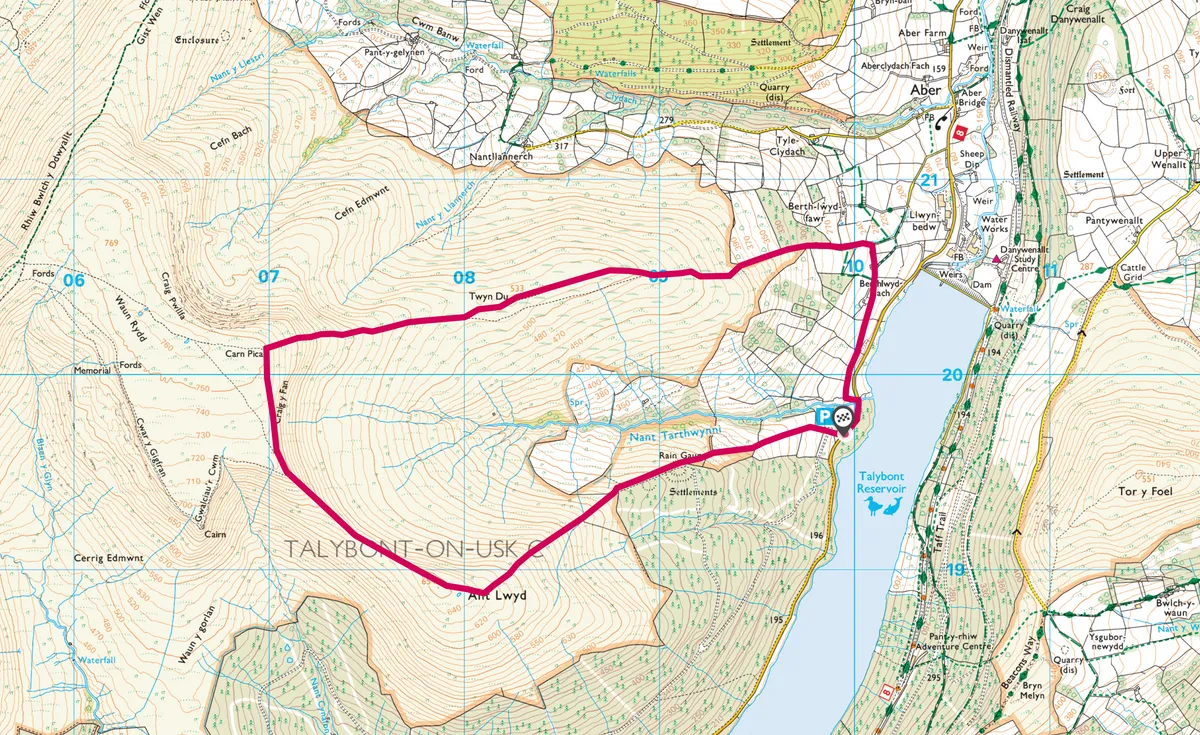
Carn Pica, Powys
5 miles/8km | 3.5 hours | moderate-challenging
The Bannau Brycheiniog National Park comprises many great peaks, each as worthy as the next – one of the most understated of all these is Carn Pica.
There's no easy way to get to the summit of this mountain, which rises more than 750m above sea level. You can approach it from the long, sprawling mass of Bryn and the boggy uplands of Waun Rydd, or from the west and the Central Peaks of Pen y Fan and Cribyn. My favourite way to reach the summit, however, is from the east and Talybont Reservoir. It's a steep route to the top, but a quiet one, perfect for those seeking a little solitude in the hills
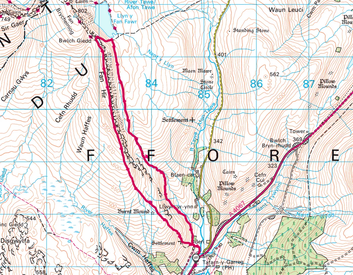
Fan Hir, Powys
6.6 miles/10.6km | 4 hours | moderate-challenging
This seven-mile route across the Black Mountain to Llyn y Fan Fawr in the Bannau Brycheiniog National Park is wild and rugged – take on the path at walking pace, or for a little more excitement, try running the length of the ridge.
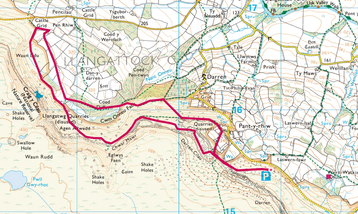
Craig-y-Cilau, Monmouthshire
4.3 miles/7km | 2.5 hours | moderate
Little known and seldom celebrated, these towering rocky crags are within an hour’s drive of Cardiff and Bristol – yet people insist on travelling further in search of such mountainous drama.
This was once a huge quarry in the 18th and 19th centuries. Here, limestone was hewn from the ridge and taken by tram to the Monmouthshire and Brecon Canal in the valley below. It was then burnt in kilns for use as fertilizer, whitewash on cottages, and as a vital part of the iron-making process when the southern Welsh valleys were awash with pits and furnaces.
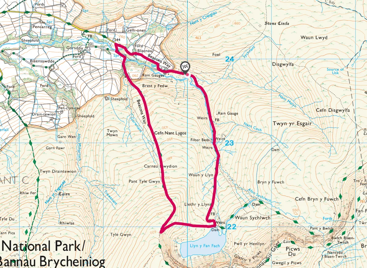
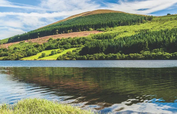
Llyn y Fan Fach, Camarthenshire
4.8 miles/6.2km | 2.5 hours | moderate
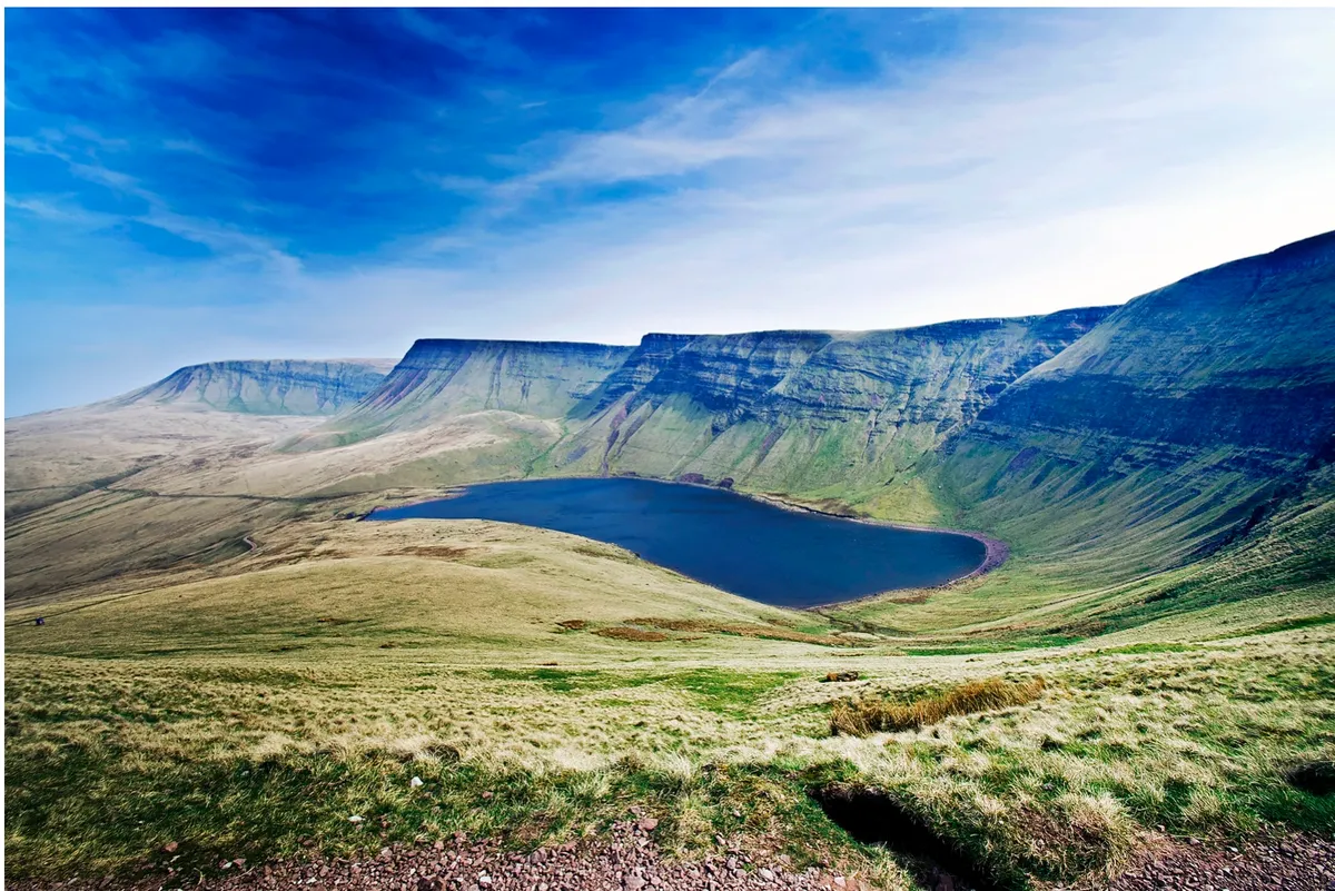
Perhaps the hardest part about this day out is finding the car park; pass the small community of Llanddeusant and you know you’re close.
Parking up in the small, gravel car park, you’ll already be aware of the solitude of this part of the Bannau Brycheiniog – it’s the quiet understudy to the neighbouring central peaks of Pen y Fan, Corn Du and Cribyn, yet certainly no less spectacular.
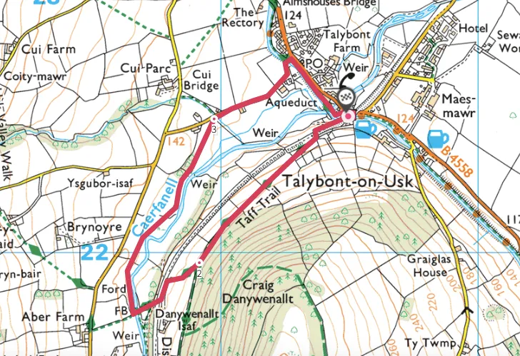
Talybont-on-Usk, Powys
1.7 miles/2.8km | 1 hours | easy
The Brinore Tramroad fell out of use more than 150 years ago, yet evidence of the primitive railway still haunts this quiet valley in the heart of the Brecon Beacons.
Explore this old track on a short walk from Talybont-on-Usk along the tramroad and back along the Caerfanell River.
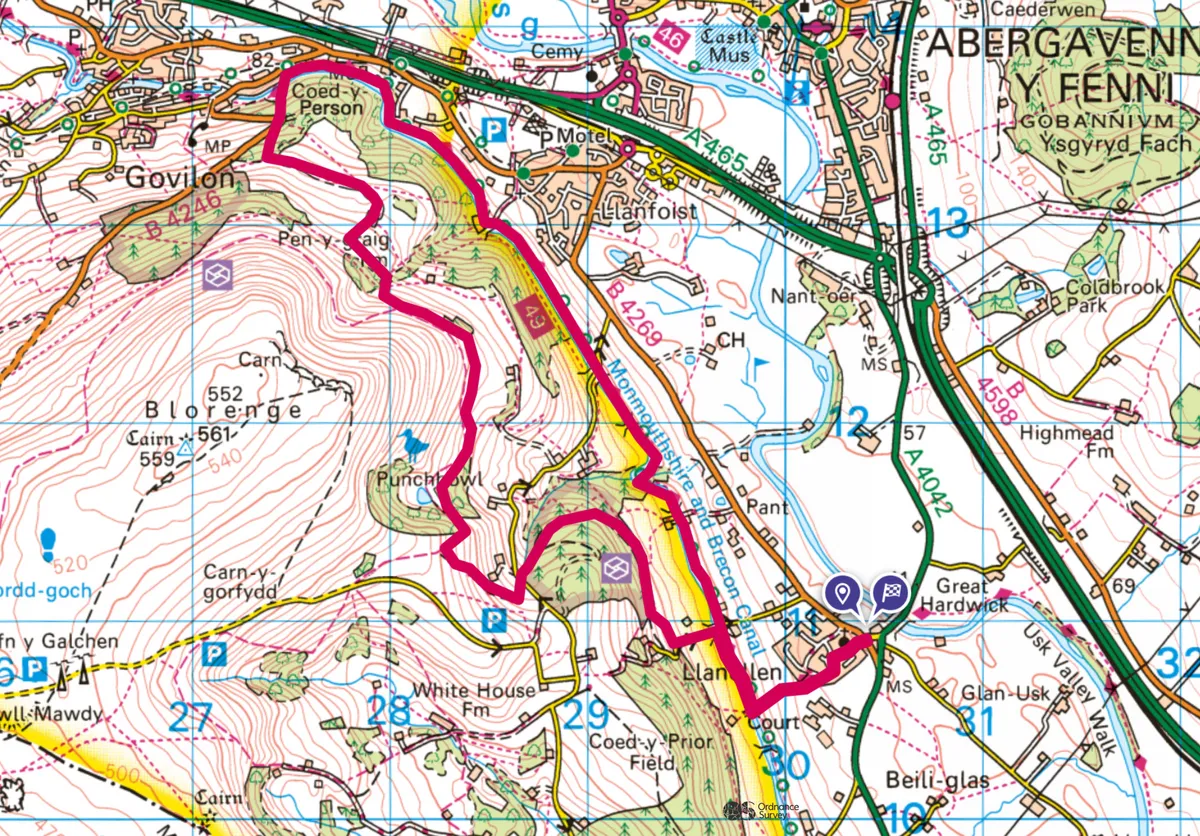
Llanellen to Govilon, Monmouthshire
7.4 miles/11.9km | 5 hours | moderate

Arguably the most beautiful – and peaceful – canal in Britain, the Monmouthshire and Brecon Canal runs only for about 35 miles (55km) between Brecon and Newport. Built in the late 18th century to carry iron and other goods from the Valleys to the River Usk, it appears to defy gravity, clinging to hillsides and giving boat users and towpath walkers extraordinary views.
This walk takes in one of the loveliest stretches – and offers a more challenging route back to the start following a tram road over the mountain.
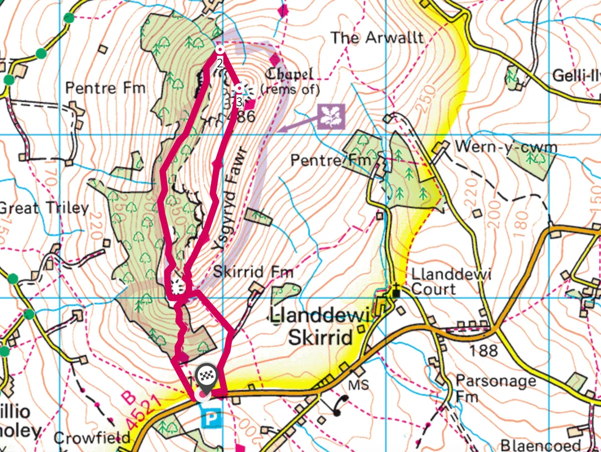
The Skirrid, Monmouthshire
5.6 miles/5.6km | 2.5 hours | moderate
Holy Mountain, Sacred Hill, Ysgyryd Fawr in Welsh – ‘ysgyryd’ meaning shattered or split – or simply The Skirrid, this mini mount goes by many names, hinting at its extensive and intriguing past.
The land surrounding the hill has long been considered holy and fertile – according to one ancient legend, a powerful landslide hit it the moment Christ was crucified on the cross – and religious pilgrimages have been made to the summit for centuries.
Enjoy a 5km circular walk to the summit of this spooky hill, which offers dramatic views across the surrounding countryside with the Blorenge hill in the distance.